Gaia GPS
  • Explore The Map
  • Get the App
  • Upgrade Today
  • Explore The Map Catalog
  • New Features
    • Gaia GPS

      The Hike Map That Broke Me: How Gaia…

      April 24, 2025

      Gaia GPS

      Introducing the Gaia Hike Map: Your Trail-Ready Adventure…

      March 18, 2025

      Gaia GPS

      Unlock a New Level of Personalization in Gaia…

      December 12, 2024

      Gaia GPS

      Goodbye Clutter, Hello Streamlined Maps: Introducing Sync to…

      November 26, 2024

      Gaia GPS

      Discover Prime Stargazing Locations with Our New Light…

      August 15, 2024

      Gaia GPS

      2023 Mapped: Our Best New Features of the…

      December 27, 2023

      Gaia GPS

      Discover Adventure Easier Than Ever with New Map…

      July 27, 2023

    • New Maps
      • Gaia GPS

        Discover Prime Stargazing Locations with Our New Light…

        August 15, 2024

        Gaia GPS

        Find Prime Viewing for Total Solar Eclipse with…

        March 27, 2024

        Gaia GPS

        See the World More Clearly with New Gaia…

        May 18, 2023

        Gaia GPS

        Gaia Classic: The Only Map You’ll Ever Need?

        May 4, 2023

        Gaia GPS

        Why NatGeo Trails Illustrated are America’s Favorite Maps

        February 9, 2023

        Backcountry Skiing

        Find Backcountry Skiing in Gaia Winter Map

        January 11, 2023

        Gaia GPS

        Our Favorite New Maps and Features

        December 23, 2022

  • Activities
    • Backcountry Skiing
    • Boating
    • Emergency Response
    • Fishing
    • Offroading
  • Adventures
    • User Stories
  • Help
Top Posts
The Hike Map That Broke Me: How Gaia...
A Fond Farewell to National Geographic Maps —...
Introducing the Gaia Hike Map: Your Trail-Ready Adventure...
Download the app and get a free 14-day...
Gaia GPS is Improving Satellite Imagery: Saying Goodbye...
How I Used Gaia GPS to Navigate Italy
Gaia GPS x Toyota: A New Way to...
Download Gaia GPS– iOS & Android App
Unlock a New Level of Personalization in Gaia...
Important Update: Changes to Esri World Imagery Offline...
Gaia GPS
  • Explore The Map
  • Get the App
  • Upgrade Today
  • Explore The Map Catalog
  • New Features
    • Gaia GPS

      The Hike Map That Broke Me: How Gaia…

      April 24, 2025

      Gaia GPS

      Introducing the Gaia Hike Map: Your Trail-Ready Adventure…

      March 18, 2025

      Gaia GPS

      Unlock a New Level of Personalization in Gaia…

      December 12, 2024

      Gaia GPS

      Goodbye Clutter, Hello Streamlined Maps: Introducing Sync to…

      November 26, 2024

      Gaia GPS

      Discover Prime Stargazing Locations with Our New Light…

      August 15, 2024

      Gaia GPS

      2023 Mapped: Our Best New Features of the…

      December 27, 2023

      Gaia GPS

      Discover Adventure Easier Than Ever with New Map…

      July 27, 2023

    • New Maps
      • Gaia GPS

        Discover Prime Stargazing Locations with Our New Light…

        August 15, 2024

        Gaia GPS

        Find Prime Viewing for Total Solar Eclipse with…

        March 27, 2024

        Gaia GPS

        See the World More Clearly with New Gaia…

        May 18, 2023

        Gaia GPS

        Gaia Classic: The Only Map You’ll Ever Need?

        May 4, 2023

        Gaia GPS

        Why NatGeo Trails Illustrated are America’s Favorite Maps

        February 9, 2023

        Backcountry Skiing

        Find Backcountry Skiing in Gaia Winter Map

        January 11, 2023

        Gaia GPS

        Our Favorite New Maps and Features

        December 23, 2022

  • Activities
    • Backcountry Skiing
    • Boating
    • Emergency Response
    • Fishing
    • Offroading
  • Adventures
    • User Stories
  • Help
Tag:

update

Gaia GPS

A Fond Farewell to National Geographic Maps — And a Look at What’s Ahead

by Eric Evans March 26, 2025
written by Eric Evans

Support for National Geographic Trails Illustrated maps in Gaia GPS will officially end on April 14th, 2025.

We know change isn’t always easy, especially when it involves something familiar. National Geographic maps have been a core part of the Gaia GPS experience for many years—admired for their detail, clarity, and iconic style. Like many of you, our team has planned countless adventures with these maps, and we deeply respect the legacy they’ve carried into the digital age.

This wasn’t a decision we made lightly. But it’s one that reflects a broader transformation in how people explore the outdoors—and how Gaia GPS is evolving to support that future.

Looking Ahead: Why Gaia GPS Is Moving Forward

Outdoor adventurers today need more than just maps—they need smart, flexible, and informative tools that adapt to the way they travel through the world. Our mission at Gaia GPS is to build the most capable and trusted navigation platform for outdoor exploration—and that means constantly improving the quality, interactivity, and relevance of the map layers we provide.

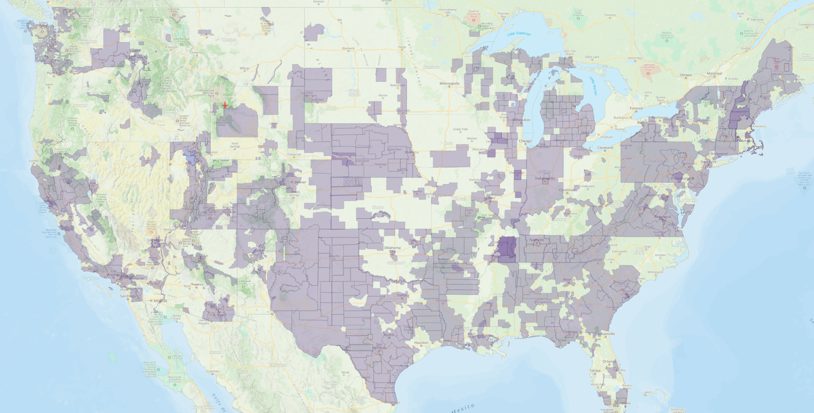
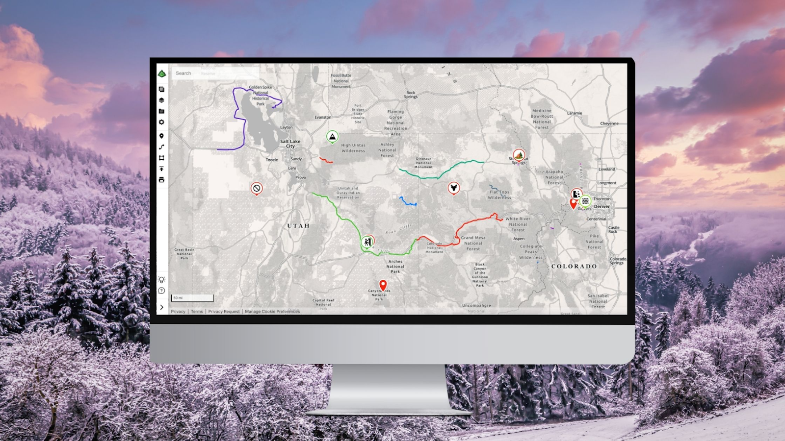
Over the last few years, we’ve invested heavily in building new, modern maps designed for how people explore today. While National Geographic maps offered beautifully detailed cartography, their coverage was limited to select regions—leaving many outdoor destinations without the support our users needed. In contrast, our new map layers offer global reach and go far beyond simply showing trails—they bring them to life with dynamic terrain data, activity-specific highlights, and powerful tools to help you plan, discover, and navigate with more confidence than ever.

Better Maps for Every Kind of Adventurer

As we continue to evolve Gaia GPS, we’re excited to share a new generation of map layers that offer even greater utility, clarity, and coverage—built to support the way you explore today:

🥾 Gaia Hike

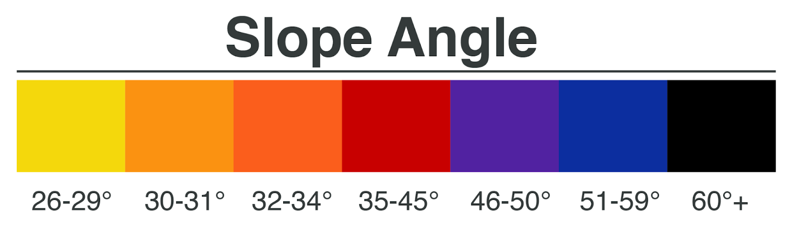
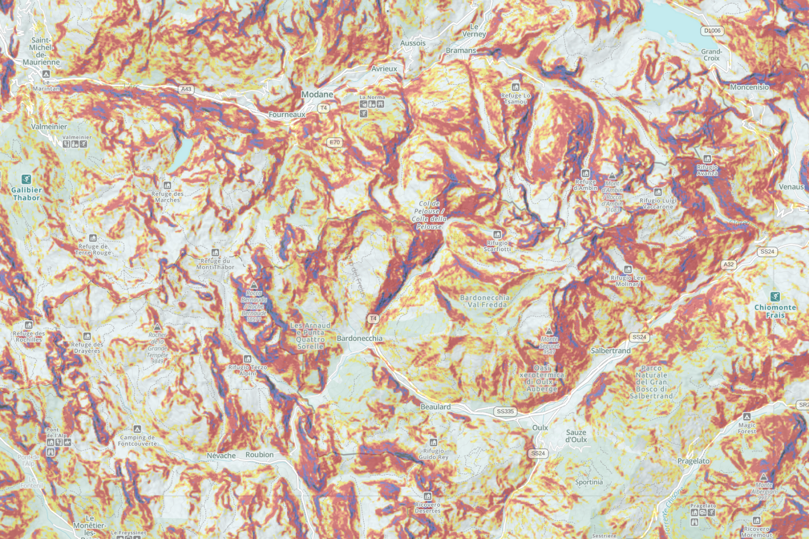
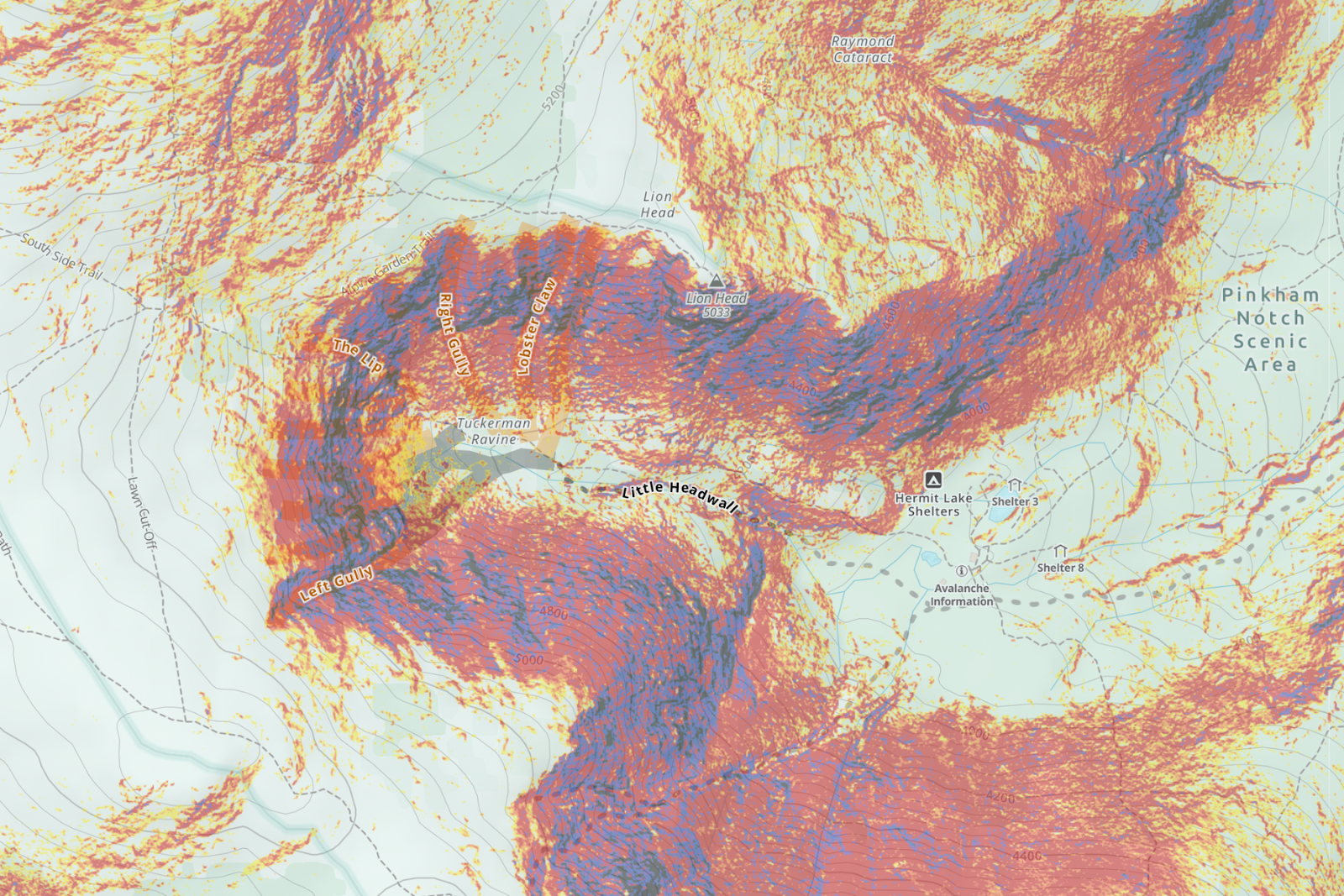
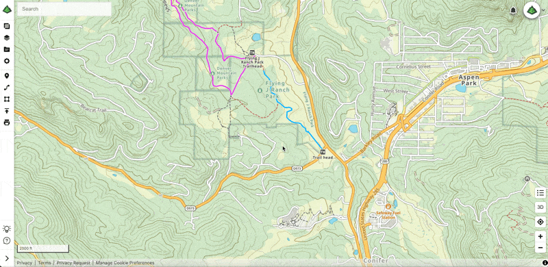
Our newest global hiking map is built specifically for hikers, backpackers, and thru-hikers. It emphasizes trail detail, labels key waypoints, and includes an innovative steepness shading overlay that instantly reveals the grade and difficulty of your route—something you won’t find on any traditional map.

🏞️ NPS Visitor Map

For those heading into U.S. National Parks, this layer delivers the official maps from the National Park Service. You’ll get visitor center locations, trail info, campgrounds, and more—exactly how the rangers want you to see the park.

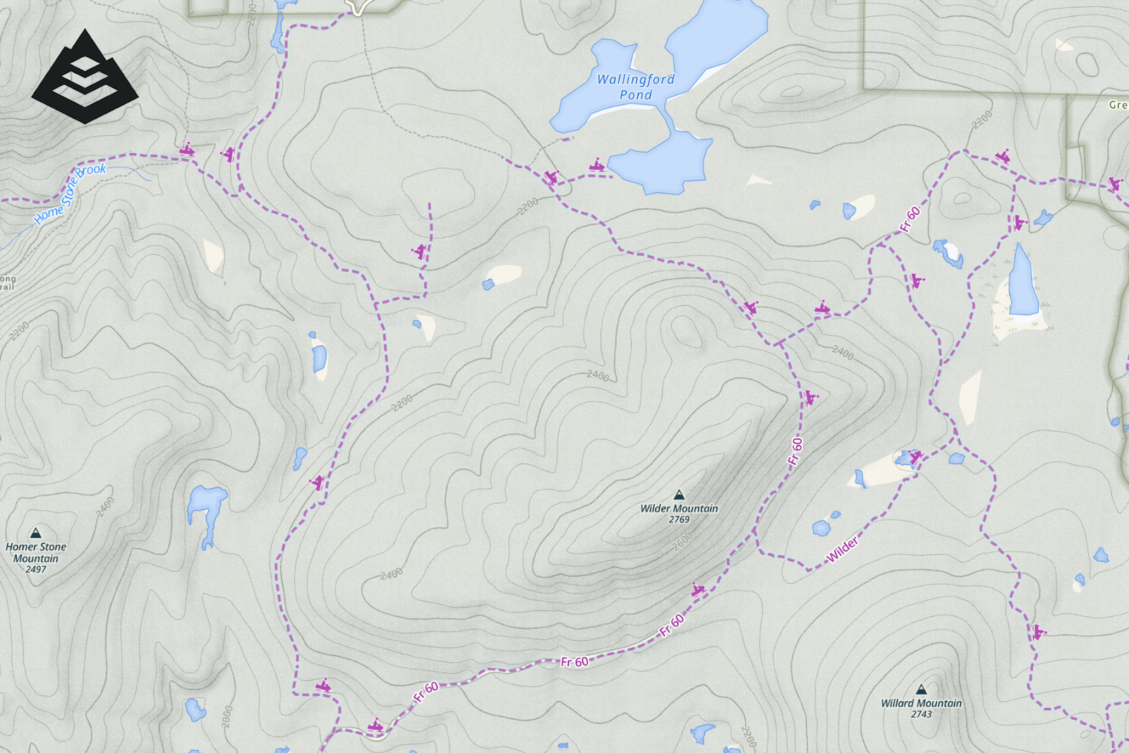
🌲 USFS Roads & Trails

Explore the backcountry with confidence using this detailed layer showing official Forest Service roads and trails—ideal for hikers, hunters, overlanders, and multi-use adventurers alike.

These map layers reflect the future we’re building toward: more personalized, responsive, and powerful maps that work for you—whether you’re walking a familiar trail or blazing a new one.

What to Expect on April 14th

  • The National Geographic Trails Illustrated layer will be removed from Gaia GPS on April 14th, 2025.
  • We recommend switching over to one of the enhanced map layers above, which are fully supported online and offline.

Thank You

To everyone who has used and loved National Geographic maps in Gaia GPS—we’re grateful. These maps helped define our app during its early years and inspired a generation of outdoor explorers to venture farther.

But we’re even more excited about what’s ahead. With every map layer, product update, and partnership, we’re working to make Gaia GPS the most trusted companion for every outdoor journey.

If you have questions or want help transitioning to new layers, our support team is here and happy to help. 

Here’s to the next great adventure,

—The Gaia GPS Team

March 26, 2025
1 FacebookTwitterLinkedinRedditEmail
App UpdatesGaia GPS

Important Update: Changes to Esri World Imagery Offline Maps in Gaia GPS

by Eric Evans December 10, 2024
written by Eric Evans

At Gaia GPS, our priority is to provide reliable mapping tools that empower you to explore the backcountry safely, whether you’re hiking, overlanding, camping, or engaging in any adventure off the grid. That’s why we’re writing to let you know about a recent change to the Esri World Imagery layer and share some great alternatives for those who use this layer offline.

What’s changed?

Recently, Esri, the provider of the World Imagery layer, has made a significant policy change regarding the use of offline map tiles. They now require all apps to automatically delete downloaded map tiles after just 3 days of being stored on a device. While this policy may work for apps in urban or connected environments, it presents serious challenges for backcountry explorers like you, who can have limited or nonexistent access to data or cell service for extended periods.

What are we doing about it?

The reality is that Gaia GPS users often rely on maps stored offline for much longer than 3 days. We believe that staying safe outdoors shouldn’t depend on when or where you can access the internet. We recognize that World Imagery is one of our best satellite sources, but due to circumstances beyond our control, we’ve made the difficult decision to disable the option to download Esri World Imagery maps for offline use in Gaia GPS.

This change ensures that you won’t be left without critical map data when you need it most. However, Esri World Imagery will still be available for online use in the app and on the website. You can view and plan routes with this rich satellite imagery when connected to the internet, but the download limit for offline use will now be set to 0 tiles.

What are your options?

We understand that the Esri World Imagery layer has been an important resource for many of you. While we’re unable to offer it for offline use, Gaia GPS offers a wide range of alternative satellite imagery and topographic map layers that you can continue to download for offline use on your adventures. Another option to consider is Mapbox Satellite which is an excellent satellite imagery layer that can be used both online and offline.

We encourage you to explore this option and download the maps you need well in advance of your next adventure to ensure uninterrupted access in the backcountry.

What happens to my saved ESRI World Imagery maps? 

Q: Are they deleted from my phone? 

A: No. We are only removing the ability to download new Esri World Imagery Tiles. Your existing downloads won’t be affected. 

When is this happening? 

Q: How long do I have to redownload my maps using a different source if I want to?

A: The ability to download Esri offline map tiles will be disabled on January 1, 2025.

Moving Forward Together

We understand that changes like this can be frustrating, but rest assured, our commitment to supporting your outdoor journeys remains stronger than ever. We will continue to improve Gaia GPS and offer the tools you need to safely and confidently explore off the beaten path.

Thank you for your understanding and for being part of the Gaia GPS community. If you have any questions or need assistance finding the right map layers for your trips, don’t hesitate to reach out to our support team.

Stay safe, and happy adventuring!

The Gaia GPS Team

December 10, 2024
0 FacebookTwitterLinkedinRedditEmail
Gaia GPSNew Features

Goodbye Clutter, Hello Streamlined Maps: Introducing Sync to Mobile

by Jules Semotuk November 26, 2024
written by Jules Semotuk

Have you ever found yourself scrolling through your Gaia GPS app, searching for that one piece of data you need, only to get lost in a sea of old adventures you’ve already completed? It’s time to put that behind you! Say goodbye to clutter in the app, and hello to a more streamlined mapping experience. 

Meet Sync to Mobile – a new feature that lets you tailor your sync preferences to decide what data you want on your mobile device, all while keeping all your data viewable on gaiagps.com. This new feature makes managing your data in Gaia GPS easier than ever and ultimately completes the lifecycle of your adventures.

Sync Only What You Need 

As the new year approaches, it’s a great time to declutter, both physically and digitally. If you’ve been using Gaia GPS for a while, you’ve probably noticed an accumulation of old data on your device. Maybe it’s a swarm of waypoints from a long-forgotten trip or a track you recorded years ago. It’s great to have memories of your adventures, but let’s be honest—do you need every old route and track synced to your mobile device when you’re heading out on a new adventure? 

Gone are the days of having to sync all of your data to the app. Now, Sync to Mobile allows you to focus on what you currently need in the app, while still preserving your memories and data on the web. Think of the web platform as hanging a paper map on your wall to plan and remember your life’s adventures, and let the app be focused on data for your current endeavor. Here’s how to use the new Sync to Mobile feature: Organize Your Data with the Sync to Mobile Feature on Gaiagps.com.

From Planning to Reflection

Gaia GPS has always been a powerful tool for both planning and navigating your outdoor excursions. The new Sync to Mobile feature takes it a step further by allowing you to manage your data across devices with greater control. Imagine Gaia GPS as the ultimate command center for your adventures—the web interface is your mission control, where you can plan and organize your trips, while your mobile device is your trusty companion in the field.

Sync to Mobile enables you to select exactly which data (tracks, routes, waypoints, etc.) you need on the app for a particular trip—whether you’re heading out on a multi-day overlanding adventure or just going for a day hike. By utilizing this feature, you not only reduce the clutter on your mobile device, but less data on the app also decreases loading times, ultimately upgrading the Gaia GPS app’s performance and efficiency. 

Once you’ve finished your trip, turn Sync to Mobile off on the data you no longer wish to sync to your device. You’ll still be able to see your saved data on the web—so don’t worry, your past trips will be there for reminiscing. However, by turning off Mobile Sync for completed trips, you can decrease loading times and improve the performance of the Gaia GPS app. A win-win, if you ask me!

A Smarter Way to Archive

With Sync to Mobile, the archiving feature takes on a new role. In the past, archiving was your way of managing what data you didn’t want synced to your device, but this had the side effect of removing that data from the web map as well. Now, you can selectively choose which data you want synced to mobile without the hassle of archiving. This is a game-changer for anyone who likes to keep a record of their adventures without being weighed down by unnecessary data while you’re on the go. Moving forward, you can think of archiving as a soft delete, rather than a sync management tool. Items can still be restored from an archived state (or deleted permanently), similar to how the trash can works on a computer’s operating system.   

How to Get Sync to Mobile

Anyone with a Gaia GPS account can take advantage of this new feature on the web at gaiagps.com. If you also want access to premium maps and features, you can upgrade to a Gaia GPS Premium or an Outside+ membership. 

Gaia GPS Premium or Gaia GPS with Outside+ gives you access to the entire 300+ map catalog. With Premium, you can also download maps for offline use so you can find your way—even without cell service. You can layer maps together to reveal even more terrain, weather, and safety features. And you can print custom maps.

With Outside+, you’ll also receive unlimited access to digital content from Outside and 15 other brands—think recipes, meal plans, and training tips from Backpacker, RUN, and more. Explore new routes with Trailforks Pro, and stream 600+ hours of ski and climbing action, survival challenges, travel documentaries, and more with Outside TV.

So, what are you waiting for? Try Sync to Mobile today for your next adventure with Gaia GPS!

November 26, 2024
0 FacebookTwitterLinkedinRedditEmail
two people look at a phone while pointing to mountains in the distance.
Gaia GPSNew Features

2023 Mapped: Our Best New Features of the Year

by Abby Levene December 27, 2023
written by Abby Levene

As the world opened back up in 2023, the Gaia GPS community adventured further, deeper, and higher than ever. As you climbed new peaks, skied new trails, and camped in new spots, our team back at home worked tirelessly to make Gaia GPS even better for your adventures. 

From shiny new features to the invisible work behind the scenes that keeps Gaia GPS running smoothly and reliably while you’re out in the backcountry, here are the top new features and maps from 2023. Thank you for being part of our community, and cheers to another year outside!

Get the Best Off-Pavement Routes with BDR Integration

Photo: Backcountry Discovery Routes

Sometimes, it’s a relief—even a delight—to follow a trusted off-pavement route you know will go. Especially when you know it will go past breathtaking views, across challenging terrain, and to memorable watering holes. That’s why we partnered with Backcountry Discovery Routes to bring you premier long-distance off-pavement routes with a leading navigation experience.

Thanks to this partnership, you can take any iconic long-distance Backcountry Discovery Route offline in the Gaia GPS app with just one click. We’re also honored to promote BDR’s mission of promoting responsible travel and fostering sustainable adventuring and economic growth.

Spy Points of Interest Easier Than Ever with New Map Spotlight

Our proprietary Gaia Topo, Gaia Overland, and Gaia Winter maps equip backcountry travelers on foot, wheels, and skis with the information they need to adventure safely and confidently From trails color-coded by activity type to lands shaded by ownership, to amenities to points of interest, these maps have a lot of information packed in them. Honestly, it’s a lot to take in. (In the best way.) That’s where the map legend comes in. The map legend cracks the code. And now the map legend is even easier to find, decipher, and use. 

Meet our brand new interactive map spotlight on gaiagps.com. Simply click on a symbol and the map lights up, showing you the trails, amenities, or points of interest you’re looking for. Whether you’re searching for a waterfall, an ice cream shop, or a horseback riding trail, the spotlight puts the world at your fingertips.

Draw Routes in Android

In addition to our gold-standard snap-to-trail route planning, which is available across iOS, Android, and gaiagps.com, this year we unveiled route drawing on the Android version of our app. 

Simply click the finger icon on the bottom of the screen and draw on the map to create your route. This route planning mode is particularly useful when you’re going off-trail, where snap-to-trail route planning isn’t available. iOS users: Don’t worry we’re coming for you too!

See the World More Clearly with Gaia Black and White Map

Move over technicolor, black and white is back in style. Meet Gaia Black and White, our very first all-black-and-white topo map. Whether you’re color vision deficient or want a crystal-clear paper map printout on hand, Gaia Black and White is for you.

Styled in the same manner as our other proprietary topo maps designed in-house, Gaia Black and White brings you industry-leading clarity, accuracy, and file-efficiency. Like our other Gaia Series maps, Gaia Black and White provides world-wide coverage. Download the map to use offline for your entire state so you can always find your way—even without cell service. 

Reap the Rewards of Our Type 2 Engineering™

As our software has increased in complexity, our number of users has grown, and the app is utilized in unexpected ways (we’re looking at you, users who record their flights in the app), the proclivity of systems to fail in remarkable fashion skyrockets. 

Our engineers bushwhacked through the code base in an endeavor they called type 2 engineering. Like type 2 fun, it was hard but rewarding work that we enjoyed…once we were done. Along the way, we squashed bugs, improved our design, and cleaned up shared folders. And the outcome is that moving forward, we’ll be able to bring you new features and improvements faster than ever. 

Adventure Intuitively with Our Redesigned App

We take your feedback seriously over here at Gaia GPS, and that’s why we’ve worked tirelessly to make our iOS and Android apps more intuitive and easier to use. This year, we simplified the top five features in the app so you can spend less time looking at your phone and more time exploring. Waypoints, locating yourself on the map, taking a geotagged photo, recording an activity, and downloading maps for offline use are easier to access than ever.

Think of this update like reorganizing the gear shed. All the tools you know and love are still there. We’ve simply moved them to more convenient locations and gave them a fresh coat of paint. 

December 27, 2023
0 FacebookTwitterLinkedinRedditEmail
Backcountry SkiingGaia GPSNew Maps

Find Backcountry Skiing in Gaia Winter Map

by Abby Levene January 11, 2023
written by Abby Levene

Discover backcountry ski zones, snowmobile trails, and trails for every winter activity with our new and improved Gaia Winter map. Complete with world-wide ski resort maps plus nordic, fatbike, uphill skiing and snowshoe trails, Gaia Winter serves as the go-to map for winter travel. We’ve updated it to make it even more useful for your adventures.

Just like our original Gaia Topo, Gaia Winter comes with industry-leading clarity and download efficiency. Download the map for your entire state so you can always have a map on hand, even when you lose cell service. From backcountry ski zones to snowmobile trails to enhanced tree cover, read on to learn about the improvements and how to get the most of Gaia Winter this season.

Discover Backcountry Skiing

Backcountry skiers planning their next tour have come to the right place. We’ve added popular backcountry ski zones to the map. Areas shaded in blue show where you may find places to tour. Regions shaded in orange illustrate starting points.

Our cartographers created these backcountry start and ski zones based on where users started recording ski tracks and where their tracks took them, respectively. Backcountry ski zones are mostly contained within North America now. And you’ll also find a few zones in Iceland, Norway, and France.

Spy Snowmobile Trails

snowmobile trails in Gaia Winter

Sledders can now discover snowmobile trails right on the map. We’ve added all the snowmobile trails from our Snowmobile Trails map to Gaia Winter for your convenience. Before you go on your next tour, download Gaia Winter for offline use so you have a trail map on hand. That way you can reroute on the fly, find somewhere to refuel, or navigate in a white-out. 

Get even more trail details including grooming status, access dates/restrictions, trail width, difficulty level, trail length, and direction of travel with our interactive Snowmobile Trails map. Pair this trail overlay with Gaia Winter for optimal planning and navigation. 

Understand Landcover and Topography

Say goodbye to the blues. We’ve revamped the color palette to make Gaia Winter brighter, with more detailed landcover. As you’re planning your next ski tour, use Gaia Winter to see if you’ll be skinning over shrubs, through trees, or across tundra. Sledders can see if they’re traveling past prairies or farmlands. 

The winter-themed color palette of the map sets a seasonal tone and enhances its utility. Tour the backcountry with confidence thanks to a stronger emphasis on terrain, tree cover, and contour lines. Mountains pop out of the map, helping you scout the best uphill and ski lines. See exactly where treeline ends so you can find powdery bowls and untracked glades. Hiking, mountain bike, and other three-season trails are deemphasized to make it even easier to see ski, snowshoe, and fat bike trails.

Activate Snow Mode

Gaia Winter’s less diverse color scheme also pairs perfectly with our safety and weather maps. Pair Gaia Winter with our suite of winter safety maps, including Slope Angle shading, Avalanche Forecast, Snow Stations Daily, Snow Depth, and Satellite Imagery to help you plan safer tours. Check out our primer on how to use maps to help avoid avalanches for a refresher.

Trails for alpine skiing, cross country skiing, snowshoeing, fatbiking, uphill skiing, and snowmobiling are indicated by line type. And now you can also distinguish trail activity type thanks to icons right on the trails themselves. 

Gaia Winter is Available with a Premium Membership

Gaia Winter is available on the web and in the Gaia GPS app with a Gaia GPS Premium membership. To access this map, visit the layers menu and search for “Gaia Winter.” Or from the layers menu, select “Topo Maps.” Scroll down and tap “Gaia Winter.” Tap the “Add Layer” button. Learn how to add and manage overlays here.

A Premium Membership also gives you access to Gaia GPS’s entire map catalog, including a suite of avalanche safety maps. These include Slope Angle, Avalanche Forecast, recent satellite imagery, Snow Stations (Daily), Snow Depth, and snow forecast maps. Read up on how to use maps to help avoid avalanche danger.

Plus, with Premium, you can layer maps together. For example, you can place the Slope Angle map on top of Gaia Winter to find the best low-angle terrain. And you can download your maps (including Gaia Winter) for use without cell service, as well as print maps so you always have a backup.

Take winter to the next level. Join Gaia GPS Premium with Outside+ to get one subscription to fuel all your adventures, thanks to access to Trailforks Pro, Outside, SKI, Trail Runner, Outside Watch, and more. 

January 11, 2023
1 FacebookTwitterLinkedinRedditEmail
Gaia GPSNew FeaturesNew Maps

Our Favorite New Maps and Features

by Abby Levene December 23, 2022
written by Abby Levene

As our community dreamed up more routes, downloaded more maps, and covered more miles than ever before, our team remained hard at work making Gaia GPS even better for your adventures. Here’s a look at our favorite maps, features, and updates we launched this year. We’re counting down, 12 days of Christmas style. 

12. Map Packs (Beta): A Totally New Way to Map

To put the best of our 300+ maps in your hands, right now, we’ve totally redesigned our mapping interface. Meet map packs.

Enable this new beta feature available on iOS and get the best map presets curated by the Gaia GPS team. Whether you’re visiting a national park with your family, backpacking a long trail, or skiing in the backcountry, just tap the map pack crafted specifically for your adventure to put the right maps on your screen

Or create your own map pack so you can always have your favorite map combinations at your fingertips. Explore map packs.

11. Gaia Classic: The Map That Never Goes Out of Style

Do you yearn for the classic topo maps of old? You know, the ones not busied up with excessive colors and silliness when all you really need to know is how to plot your path from that alpine lake to that mountain pass and down the other side?

Or maybe you’ve found yourself yelling at our cartographers, “why or why can’t I see the contour lines in this blazing sun!?”

Enter Gaia Classic, the map that just may answer that call of the wild. It’s inspired by a classic aesthetic, from the colors to the fonts to the very textures of the map itself. Maybe it’s totally pointless, or maybe, just maybe it’s the only map you’ll ever need.

Check out our new map, Gaia Classic.

10. Gaia GPS Master Classes: Map Like a Pro

We’re the first to admit there’s a bit of a learning curve to mastering the breadth and depth of gaiagps.com and our app. That’s why we teamed up with Outside Learn to bring you two master classes. Find the best of our 300+ maps for your adventures. Learn how to take your maps offline. Layer maps together to unlock more terrain detail. Reroute on the fly. Share your routes with friends and family. Discover our top hacks. It’s all here. Take these two courses to brush up on your mapping skills and to get the most of the app. 

Take Gaia GPS 101 and Gaia GPS Advanced. 

9. Wildfire Maps: Spot Fires Faster

This update is lit. You can now spot wildfires on the Wildfire map as soon as they appear on InciWeb, the government website that tracks wildfire information for the public. Our cartographers also added wildfire labels right onto wildfires themselves for easy viewing. Plus, we expanded our smoke forecast maps coverage to include Alaska and Canada.

Check out the enhanced Wildfire and Smoke Forecast maps.

8. Snowmobile Trails Map: Discover Global Sledding Trails

Planning snowmobile routes and navigating across the snow has never been easier. Find sledding trails across the US, Canada, Europe, and Australia with our new Snowmobile Trails map. We’ve pulled together trail data from local, state, and federal sources to bring you some of the most comprehensive sledding coverage in the world.

Easily spy trail networks to build routes and find your way in the field. When available, see key details like trail width, grooming status, restricted access areas, and difficulty ratings. Plus, find warming huts, gas stations, and snowmobile shops.

Try out the Snowmobile Trails map.

7. Android Auto: Navigate from the Dash

We’ve revamped Gaia GPS on Android Auto so you can manipulate the map, record tracks, and drop waypoints all from your dashboard. Just connect your phone to your car display and navigate with your favorite Gaia GPS maps like Gaia Overland, MVUMs, hi-res global satellite imagery, and National Geographic Trails Illustrated—all from the luxury of the wide screen.

From expanded map controls to clearer visibility, here are the major updates. And if you’re on iOS, check out Apple CarPlay.

6. Slope Angle: Stay Safer with Highest-Res Map

Scout avalanche terrain easier than ever before. We’ve updated our Slope Angle map with the latest highest resolution 1-meter LIDAR DEM data from the USGS. This data is the gold standard for slope angle shading, rendering our Slope Angle map crisper and clearer for your winter adventures.

Whatever your objective and mode of travel, you can now enjoy the highest resolution slope angle data, wherever it’s available. Check out the updated Slope Angle map.

5. Rec.Gov: Make Campsite Reservations from the Map

Find the perfect campsite in Gaia Topo, and then reserve it right from the map. The ultimate tool for reserving public campsites in the US is now accessible right from our app and gaiagps.com. In addition to reservations, recreation.gov gives you every detail you could possibly want about a campsite. View photos to see if the campsite has the spectacular mountain view. Find out how many cars are allowed, and if pets and campfires are permitted. Even see if there’s a fire ring or a grill.

Learn more about our rec.gov integration. 

4. Trailforks MTB Map: Discover the Best Bike Trails

Trailforks’ coveted mountain bike trail database is now in Gaia GPS! Discover brand new routes, get the beta on trail conditions, and easily spy trails based on type and difficulty level with this new map.

Trailforks, a trail management system, catalogs trail networks around the world. The crowd-sourced database and moderated site provides the most accurate and comprehensive trail data available. And now you can get all 361,392 Trailforks mountain bike trails around the globe right in the Gaia GPS app and on gaiagps.com.   

Check out the Trailforks MTB map.

3. Planning Tools: Easily Dream Up Your Own Routes

Creating your own adventures in Gaia GPS got even easier—and more fun. Meet our new route editing tools, here to let you quickly fix any mistakes or changes of heart, automatically out-and-back any one-way route, send your route back to the start, and reverse your route direction.

You asked, and we listened. We added these route editing tools so that you can explore our maps with even more abandon, knowing you can painlessly erase any route-building mistakes and let our planning tools handle the tedious tasks. Enjoy these tools on Android and on the big screen at gaiagps.com. To put the cherry on top of this route creation cake, we’ve added keyboard shortcuts to the web so you can perform any of these tasks without even touching your mouse, making it even easier to carry on route building with our smart snap-to-trail planning tools.

Explore the new planning tools. 

2. OpenSnow Weather: Localized Forecasts at a Tap

While we can’t supply a crystal ball, we can supply the weather for exactly where you’re going, exactly where you need it—right on the map. We partnered with OpenSnow, the leading resource for backcountry weather, to bring you hyper-localized weather forecasts that you can access at a tap.

Just tap anywhere on the map, anywhere in the world, and get the current weather plus the forecast right in Gaia GPS. Learn more about weather at-a-tap.

1. Gaia Overland Map: World’s Best Offroading Map

Ditch the crowds with Gaia Overland, the best overlanding map you can put right on your vehicle’s dashboard. MVUM, USFS, public land boundaries—it’s all in here. Designed in-house for planning big routes, navigating tricky terrain, and rerouting on the fly, Gaia Overland is the definitive map for all of your overlanding, offroading, and motorized adventures. 

Modeled after our proprietary Gaia Topo map, Gaia Overland comes with the same crystal-clear resolution and download efficiency you know and love from Gaia GPS. But it puts everything for motorized travel first. Whether you’re embarking on a multi-day expedition or just heading to a remote trailhead, use Gaia Overland to get you there efficiently and (relatively) effortlessly.

Check out Gaia Overland.

It Wouldn’t Be the Holidays Without a Few Bonuses

Permitted Rivers Map

This map overlay shows you all the rivers that require a permit to raft or kayak. Tap to learn the river’s name, see permit information, and get the link to a permit application. Check out the Permitted Rivers map here.

Customized Waypoints

You can now change the color of waypoint borders. Use these colors of the rainbow to classify and categorize your waypoints to your heart’s desire. Learn more about all of the ways to use waypoints here. 

Ski Resort Reports Map

From Aspen to Zermatt, get conditions for ski resorts around the globe in Gaia GPS. Ski areas with fresh snow light up on our new Ski Resort Reports map. See snow totals and weather readings. Find out how many trails are open. Even read the resort’s daily report, all right within the app and on gaiagps.com. Explore the Ski Resort Reports map here.

December 23, 2022
0 FacebookTwitterLinkedinRedditEmail
slope angle shading on a 3d map
Gaia GPSNew Maps

Spy Avalanche Terrain with Higher Res Slope Angle Map

by Abby Levene December 14, 2022
written by Abby Levene

Scout avalanche terrain easier than ever before. We’ve updated our Slope Angle map with the latest highest resolution 1-meter LIDAR DEM data from the USGS. This data is the gold standard for slope angle shading, rendering our Slope Angle map crisper and clearer for your winter adventures.

Gaia GPS users primarily use our Slope Angle map in winter to avoid avalanche-prone terrain. But hikers, mountaineers, and bikepackers use it year-round to find the easiest path over mountain passes. Photographers and adventurers turn to this map to find unique rock features and waterfalls. Whatever your objective and mode of travel, you can now enjoy the highest resolution slope angle data, wherever it’s available. 

Meet the Slope Angle Gold Standard: Lidar

Last year, we developed our Slope Angle map in-house and tapped into the US Geological Survey’s 3D Elevation Program and NASA’s Digital Elevation Model. These sources allowed us to expand our coverage globally, integrate high-resolution data, and fine-tune color details.

Now we’ve updated the map even further with the best data available on the planet: LIDAR DEM. Harnessing a laser scanner, Global Positioning System (GPS), and Inertial Navigation System (INS), Light Detection and Ranging (lidar) technology produces high-resolution models of ground elevation within an accuracy of 10 centimeters, or four inches. This means our Slope Angle map contains more accurate data than ever before while also pulling out more of those smaller terrain details that can be easy to miss.

Lidar Coverage Continues to Spread Across the US

The updated Slope Angle map uses the latest lidar data wherever it’s available. Check out the map above for a full view of lidar coverage. As you can see on the map, avalanche-prone regions in the northeast, California, and the Pacific Northwest enjoy excellent lidar coverage. 

We’re still waiting for the USGS to supply full lidar coverage of the mountain west. The USGS hopes to complete its collection of lidar data for all of the U.S. and its territories soon; see the status map. Thanks to its high cloud cover and remoteness, Alaska uses Interferometric Synthetic Aperture Radar (IfSAR) instead.

Graded Color Style Picks up the Details

A continuous color ramp shows terrain changes in a graded fashion, making terrain features a snap to read on the map.

The map emphasizes 30 to 45-degree zones in orange and red colors, recognizing and calling your attention to the fact that these slopes comprise the starting zone for most avalanches. Less steep terrain—in the 20 to 25-degree range—is highlighted in green. Slopes steeper than 45 degrees are shaded in greyscale colors to point out the steepest terrain on the map. The grey shading also helps people with red/green confusion color blindness see the map details.

Identify Avalanche Terrain Worldwide 

While LIDAR DEM does not cover the entire US, our Slope Angle map continues to provide not just country-wide, but also worldwide coverage using the highest quality data available from the US Geological Survey’s 3D Elevation Program and NASA’s Digital Elevation Model. 

Whether you’re backcountry skiing the bowls or snowmobiling deep into the forest, add the Slope Angle layer to your favorite global base map like Gaia Winter or Satellite Imagery to help plan safer winter routes through the backcountry.

Keep in mind that you can tweak the opacity of the Slope Angle overlay to your needs. Turn the opacity down to reveal underlying terrain details, or dial it up to more clearly view slope steepness. 

Warnings and Limitations

Avalanche forecasting uses many tools to analyze avalanche risk in the field. Slope shading is best used for a big-picture overview of terrain. All slope angle maps, including the updated Slope Angle layer, fail to show micro terrain such as small starting zones. Snow features like wind pillows and cornices will not be on the map.

Be prepared to use an inclinometer and other on-the-ground assessments in the field in addition to the slope angle map. Change your plans accordingly if the terrain does not match up to the data depicted on the slope angle layer.

Educate yourself about avalanche and snow safety before traveling in any areas prone to avalanches. For more information on how slope angle maps are made, see Jeff Deems’ presentation about how these map overlays are made from the 2019 Colorado Snow and Avalanche Workshop or the article “Digital Mapping: Do You Know What Your Map Knows?” in September 2020 issue of The Avalanche Review.

How to Get the Slope Angle Map

The Slope Angle layer is available with a Gaia GPS premium membership. To access the layer, visit the layers menu, and select the “Features/Weather Overlays” tab. Scroll down and tap “Slope Angle.” Tap the “Add Layer“ button. Learn how to add and manage overlays here. 

Pair this map with other useful backcountry skiing maps available with a Premium membership on Gaia GPS. Read up on how to use maps, including the slope angle layer, to help avoid avalanche danger. 

December 14, 2022
1 FacebookTwitterLinkedinRedditEmail
A Gaia GPS map shows points of interest, restaurants, and amenities near Tibbetts Valley Park in Issaquah, WA.
App UpdatesGaia GPSNew Features

Find 4×4 Roads and Points of Interest Quicker with Latest Updates to Gaia Topo

by Mary Cochenour July 14, 2020
written by Mary Cochenour

Gaia Topo now displays color-coded points of interest, more 4×4 roads when the map is zoomed out, and larger labels, badges, and contour markers when the map is zoomed in. Whether traveling through a city or on the hunt for a campsite on a rugged dirt road, these new improvements make the map easier to read, helping you find features and services quicker than ever. Plus, seeing more 4×4 roads on a larger viewing field of the map makes planning out the details of your trip a snap.

Color-Coded Points of Interest

Quickly find urban features and attractions with new color-coded amenity labels on Gaia Topo. Hotels and lodging labels now appear in bright blue, museums in purple, hospitals and medical clinics in red, and stores, gas stations, and other town amenities in orange. The colors allow you to scan the map and easily find the services you need.

When rolling into town after a long adventure, you can now pull up Gaia Topo and look for the exact type of business or service offered around you. Simply scan the map for color-coded gas stations to fill up your tank, search for stores for a quick resupply of food, or hit up the museum for a bit of culture before your next outing to nature.

View More 4×4 Roads and Larger Map Labels, Badges, and Contour Markers

The new updates to Gaia Topo make dirt roads visible when you zoom out on the map. That means when you are viewing a large area of the landscape, you’ll see more 4×4 roads without having to zoom into the map to see if those roads exist.

Also, when you zoom further in, the map’s labels, badges, and contour markers get larger. These makers become easier to read as you zero in on a specific spot on the map.

Gaia Topo Improvements Automatically Updated

Completely redesigned in early 2020, the new Gaia Topo combines world-class cartography with industry-leading download speeds and size. Hand-curated and rich with details, Gaia Topo is constantly updated as technology and information from map sources evolve. These latest updates will appear automatically when you open up the map in the Gaia GPS app or on a desktop computer. Any portion of the Gaia Topo map that had been downloaded earlier will need to be downloaded again for the updated changes to appear.

Access to Gaia Topo is available for free on gaiagps.com or in the app on Android or iOS. Purchase a membership to download and take the map offline. A Premium Membership includes all the maps from the Gaia GPS catalog, from USGS Topo to USFS Recreation Maps and hundreds of National Geographic Trails Illustrated titles, as well as satellite imagery and weather layers. With a premium membership, you can download these maps to your device and use them in the field, far away from cell service.

July 14, 2020
4 FacebookTwitterLinkedinRedditEmail
AndroidApp UpdatesGaia GPS

Android 2020.5: Faster Deletion and Smoother Planning

by Julien Friedland May 9, 2020
written by Julien Friedland

The latest Android 2020.5 release includes a number of usability updates, making actions in the app more efficient and visuals more detailed. A refreshed stats bar and a number of fixes, like better deletion, add up to a smoother experience when using your Android device. After listening to your feedback, we’re excited to deliver Android 2020.5.

Update to version 2020.5 in the Play Store. Open the Play Store and check Gaia GPS has updated on your phone.

Save Time with Improved Deletion

After deleting an item, move on to your next task or close out of the app completely while the app works to delete the item. You’ll no longer have to wait for your item to delete or wonder if it deleted. Just tap delete and move on to your next task.

Completely Customize Your Stats Bar

The recently improved Stats Bar gives you the power to completely customize your map home screen. With a cleaner design and more versatility, the stats bar lets you decide exactly what trip details you want to see when you pull up the app. Choose from elevation, current speed, moving speed, average speed, ascent, sunrise/sunset, and more.

Quickly Find Campsites and Trails

Android users now have access to ‘tap to zoom’ so you can quickly zoom in on a recreation area of interest. Tap any group of amenities on Gaia Topo and discover campsites, trails, viewpoints, and other places you don’t want to miss.

View More Details for Your Saved Items and National Parks

Detail pages for saved items and national parks include more information with updated visuals. National parks and forests now display boundary lines so you can easily see where the parks begin and end. The newly designed waypoints and track detail pages provide more detail about the item, including coordinate points, elevation, and a view of your current map layer.

Android display of Yosemite National Park on Gaia GPS

Next Up for Gaia GPS on Android

Coming soon, Android users will be able to draw and measure areas on the map, by creating polygons. The polygon tool allows you to outline and save irregular shaped items on the map, and measure the perimeter. For example, you could trace the park boundaries pictured above and save the map data from just Yosemite National Park.

May 9, 2020
1 FacebookTwitterLinkedinRedditEmail
Cellphone screen operating in Dark Mode with dark colored topographical map and white writing, set against a colorful sunset in backdrop
Gaia GPSHow-ToNewsletter

Navigate at Night with Dark Mode

by Corey Buhay February 5, 2020
written by Corey Buhay

Use Dark Mode in Gaia GPS to plan routes, research hikes, and navigate after sundown without straining your eyes or wasting device battery. Dark Mode inverts the traditional iOS color scheme, showing you light-colored text and icons on a dark background. The result is a beautiful new aesthetic that produces less ambient light.

For an even better viewing experience, enable the Dark Mode responsive Gaia Topo map and your eyes will thank you.

A tablet screen operating in dark mode with topographical maps shown in dark colors and writing shown in light colors.  The tablet screen is set against a dark night sky with stars.

When to Use Dark Mode

Optimal for low-light environments, Dark Mode is easier on your eyes and won’t disturb people around you. It’s perfect for nighttime navigation, reviewing route stats during the ride home, or even just double-checking the weather for your morning hike or run while you wait for the sun to come up. And if you’ve got a dream trip keeping you up at night, you can nerd out over the details without disturbing your sleeping significant other.

Dark Mode also has the potential to extend the battery life of your device since the display requires less light.

A cell phone with the screen displayng a topographical map in Dark Mode, with a dark colored map and light colored writing.  The phone is set against a colorful sunset backdrop.

How to use Dark Mode in Gaia GPS

Dark Mode is a feature available with iOS 13. To turn it on, go to Settings > Display & Brightness > Appearance. Then, tap “Dark” to set the display to Dark Mode. Gaia GPS will automatically adjust its own display settings to match.

To ensure that your screen settings are always suited to your environment, tap “Automatic” under “Display & Brightness” to sync up Dark Mode with sunset and sunrise. You can also set it to adjust according to a schedule of your own choosing.

February 5, 2020
3 FacebookTwitterLinkedinRedditEmail
Load More Posts

Categories

  • Adventures
  • Android
  • App Comparisons
  • App Updates
  • Backcountry Skiing
  • Boating
  • Company News
  • Emergency Response
  • Featured
  • Fishing
  • Gaia GPS
  • Gaia GPS Offroad Podcast
  • GaiaCloud
  • Hikes
  • How-To
  • Hunting
  • iOS
  • New Features
  • New Maps
  • Newsletter
  • Offroading
  • Out and Back Podcast
  • User Profiles

Recent Posts

  • The Hike Map That Broke Me: How Gaia GPS Turned an Overlander Into a Reluctant Hiker
  • A Fond Farewell to National Geographic Maps — And a Look at What’s Ahead
  • Introducing the Gaia Hike Map: Your Trail-Ready Adventure Buddy
  • Download the app and get a free 14-day trial of Gaia GPS Premium
    • Facebook
    • Twitter
    • Instagram
    • Youtube
    • RSS
    • Explore The Map
    • Get the App
    • Upgrade Today
    • Explore The Map Catalog
    • New Features
      • Gaia GPS

        The Hike Map That Broke Me: How Gaia…

        April 24, 2025

        Gaia GPS

        Introducing the Gaia Hike Map: Your Trail-Ready Adventure…

        March 18, 2025

        Gaia GPS

        Unlock a New Level of Personalization in Gaia…

        December 12, 2024

        Gaia GPS

        Goodbye Clutter, Hello Streamlined Maps: Introducing Sync to…

        November 26, 2024

        Gaia GPS

        Discover Prime Stargazing Locations with Our New Light…

        August 15, 2024

        Gaia GPS

        2023 Mapped: Our Best New Features of the…

        December 27, 2023

        Gaia GPS

        Discover Adventure Easier Than Ever with New Map…

        July 27, 2023

      • New Maps
        • Gaia GPS

          Discover Prime Stargazing Locations with Our New Light…

          August 15, 2024

          Gaia GPS

          Find Prime Viewing for Total Solar Eclipse with…

          March 27, 2024

          Gaia GPS

          See the World More Clearly with New Gaia…

          May 18, 2023

          Gaia GPS

          Gaia Classic: The Only Map You’ll Ever Need?

          May 4, 2023

          Gaia GPS

          Why NatGeo Trails Illustrated are America’s Favorite Maps

          February 9, 2023

          Backcountry Skiing

          Find Backcountry Skiing in Gaia Winter Map

          January 11, 2023

          Gaia GPS

          Our Favorite New Maps and Features

          December 23, 2022

    • Activities
      • Backcountry Skiing
      • Boating
      • Emergency Response
      • Fishing
      • Offroading
    • Adventures
      • User Stories
    • Help

    @2024 - All Right Reserved. Gaia GPS


    Back To Top