
Top Posts
Introducing Adventure Modes: The Right Map for Every...
Trip Report: A Rider’s Guide to Bikepacking in...
How to Hike a Colorado 14er: A Step-by-Step...
Trip Report: A Rider’s Guide to link Boulder...
Trip Report: A Rider’s Guide to the South...
Battling the Wind: Setting Your Shocks to Firm...
The Hike Map That Broke Me: How Gaia...
A Fond Farewell to National Geographic Maps —...
Introducing the Gaia Hike Map: Plan Your Hike,...
Download the app and get a free 14-day...
Gaia GPS
  • Explore The Map
  • Get the App
  • Upgrade Today
  • Explore The Map Catalog
  • New Features
  • Activities
    • Backcountry Skiing
    • Boating
    • Emergency Response
    • Fishing
    • Offroading
  • Adventures
    • User Stories
  • Help

Unlock a New Level of Personalization in Gaia GPS with Photo Waypoints

by Jules Semotuk December 12, 2024
written by Jules Semotuk
12.7K

Get ready to elevate your Gaia GPS adventures with the brand-new photo waypoint feature! While emoji icons are fun for marking locations, this exciting update lets you add images to your waypoint icons, taking your map personalization to the next level. With Photo Waypoints, you can make your maps more personal and visually rich, helping you navigate with greater ease and relive your experiences in a whole new way. Whether you’re out exploring, planning your next pursuits, or perhaps revisiting previous journeys, this upgrade transforms your maps into a truly personal and visually stunning experience. 
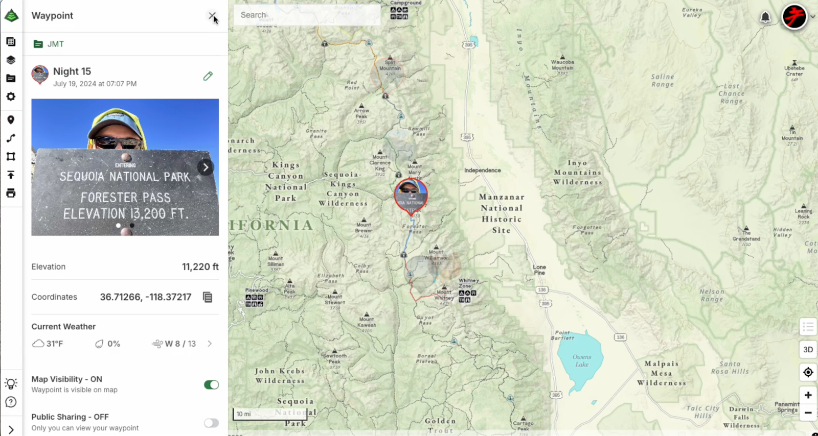
Photo Waypoints Are Available on the Web with Gaia GPS Premium

Photo Waypoints are a premium feature exclusively available on the Web with a Gaia GPS Premium or an Outside+ membership. With a subscription, you’ll unlock Photo Waypoints along with an array of other premium features to enhance your outdoor experience, including our 300-plus map catalog, offline navigation, and more.

How It Works

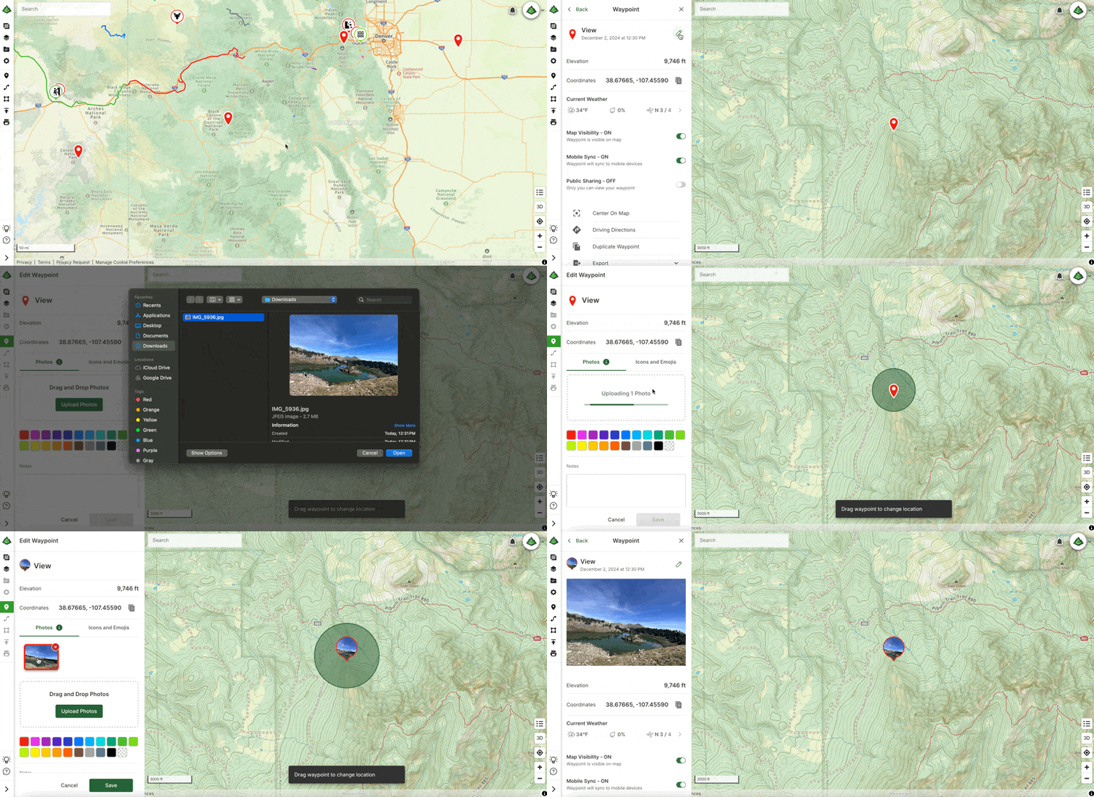
Creating Photo Waypoints on the web as a Gaia GPS Premium user is easy and just takes a few steps. Here’s how: 

  1. Visit gaiagps.com on your desktop. Log in or create an account. 
  2. Select a waypoint you would like to edit from the Saved Items sidebar.
  3. Click the pencil icon to the right of the waypoint title to edit the waypoint.
  4. If not already selected, click the Photos tab and then click ‘Upload Photos.’ 
  5. Once your photo(s) are uploaded, choose a photo to use as the waypoint icon photo, then click save!

That’s it! Now your waypoint has a personalized touch, adding a new layer of meaning to your adventure.
Personalize Your Adventure with Gaia GPS

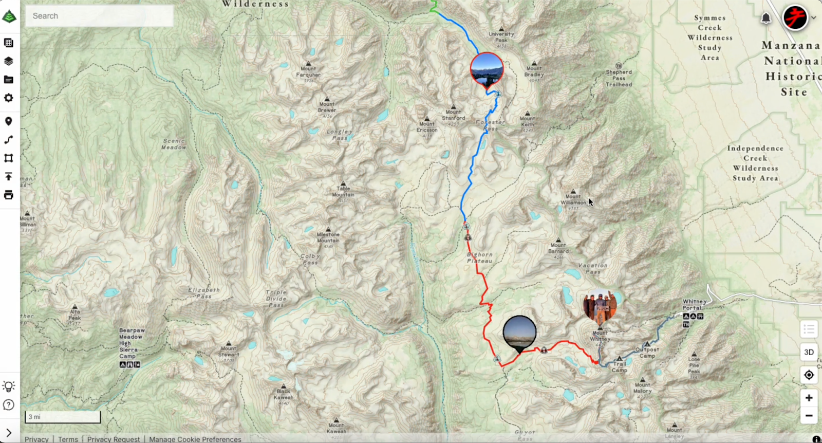
Gaia GPS empowers you to create personalized, detailed, and memorable maps that enhance your preparation and documentation of your outdoor experiences. With the new Photo Waypoint feature, you can use images to capture and recall key locations along your journey. Whether you are an outdoor enthusiast documenting new hikes and viewpoints, a traveler looking to mark destinations and favorite spots on the road, or a photographer creating a photo journal of your outdoor excursions, the Photo Waypoint feature is here to help you transform your maps into visual representations of your unique experiences. 
Begin Customizing Your Maps Today

Ready to make your next adventure even more memorable? Dive into our easy Help Center guide on creating and editing waypoints, and start customizing your maps today! Learn more here: Edit Waypoints on gaiagps.com

previous post
Important Update: Changes to Esri World Imagery Offline Maps in Gaia GPS
next post
Download Gaia GPS– iOS & Android App

You may also like

Introducing Adventure Modes: The Right Map for Every...

August 13, 2026

Trip Report: A Rider’s Guide to Bikepacking in...

November 7, 2025

How to Hike a Colorado 14er: A Step-by-Step...

October 24, 2025

Trip Report: A Rider’s Guide to link Boulder...

September 26, 2025

Trip Report: A Rider’s Guide to the South...

August 27, 2025
Jules Semotuk

Jules is a copywriter and digital marketing enthusiast. Outside of work, you can find her hiking with her dog, Toasty, getting lost in a good book, painting, and riding motorcycles.

Categories

  • Adventures
  • Android
  • App Comparisons
  • App Updates
  • Backcountry Skiing
  • Boating
  • Company News
  • Emergency Response
  • Featured
  • Fishing
  • Gaia GPS
  • Gaia GPS Offroad Podcast
  • GaiaCloud
  • Hikes
  • How-To
  • Hunting
  • iOS
  • New Features
  • New Maps
  • Newsletter
  • Offroading
  • Out and Back Podcast
  • Overlanding
  • User Profiles

Recent Posts

  • Introducing Adventure Modes: The Right Map for Every Adventure in One Tap
  • Trip Report: A Rider’s Guide to Bikepacking in Bears Ears National Monument
  • How to Hike a Colorado 14er: A Step-by-Step Guide with Gaia GPS
  • Trip Report: A Rider’s Guide to link Boulder and Steamboat Springs
    • Facebook
    • Twitter
    • Instagram
    • Youtube
    • Rss
    • Explore The Map
    • Get the App
    • Upgrade Today
    • Explore The Map Catalog
    • New Features
    • Activities
      • Backcountry Skiing
      • Boating
      • Emergency Response
      • Fishing
      • Offroading
    • Adventures
      • User Stories
    • Help

    @2024 - All Right Reserved. Gaia GPS


    Back To Top
    Gaia GPS
    • Explore The Map
    • Get the App
    • Upgrade Today
    • Explore The Map Catalog
    • New Features
    • Activities
      • Backcountry Skiing
      • Boating
      • Emergency Response
      • Fishing
      • Offroading
    • Adventures
      • User Stories
    • Help