Gaia GPS
  • Explore The Map
  • Get the App
  • Upgrade Today
  • Explore The Map Catalog
  • New Features
    • Gaia GPS

      The Hike Map That Broke Me: How Gaia…

      April 24, 2025

      Gaia GPS

      Introducing the Gaia Hike Map

      March 18, 2025

      Gaia GPS

      Unlock a New Level of Personalization in Gaia…

      December 12, 2024

      Gaia GPS

      Goodbye Clutter, Hello Streamlined Maps: Introducing Sync to…

      November 26, 2024

      Gaia GPS

      Discover Prime Stargazing Locations with Our New Light…

      August 15, 2024

      Gaia GPS

      2023 Mapped: Our Best New Features of the…

      December 27, 2023

      Gaia GPS

      Discover Adventure Easier Than Ever with New Map…

      July 27, 2023

    • New Maps
      • Gaia GPS

        Discover Prime Stargazing Locations with Our New Light…

        August 15, 2024

        Gaia GPS

        Find Prime Viewing for Total Solar Eclipse with…

        March 27, 2024

        Gaia GPS

        See the World More Clearly with New Gaia…

        May 18, 2023

        Gaia GPS

        Gaia Classic: The Only Map You’ll Ever Need?

        May 4, 2023

        Gaia GPS

        Why NatGeo Trails Illustrated are America’s Favorite Maps

        February 9, 2023

        Backcountry Skiing

        Find Backcountry Skiing in Gaia Winter Map

        January 11, 2023

        Gaia GPS

        Our Favorite New Maps and Features

        December 23, 2022

  • Activities
    • Backcountry Skiing
    • Boating
    • Emergency Response
    • Fishing
    • Offroading
  • Adventures
    • User Stories
  • Help
Top Posts
The Hike Map That Broke Me: How Gaia...
A Fond Farewell to National Geographic Maps —...
Introducing the Gaia Hike Map
Download the app and get a free 14-day...
Gaia GPS is Improving Satellite Imagery: Saying Goodbye...
How I Used Gaia GPS to Navigate Italy
Gaia GPS x Toyota: A New Way to...
Download Gaia GPS– iOS & Android App
Unlock a New Level of Personalization in Gaia...
Important Update: Changes to Esri World Imagery Offline...
Gaia GPS
  • Explore The Map
  • Get the App
  • Upgrade Today
  • Explore The Map Catalog
  • New Features
    • Gaia GPS

      The Hike Map That Broke Me: How Gaia…

      April 24, 2025

      Gaia GPS

      Introducing the Gaia Hike Map

      March 18, 2025

      Gaia GPS

      Unlock a New Level of Personalization in Gaia…

      December 12, 2024

      Gaia GPS

      Goodbye Clutter, Hello Streamlined Maps: Introducing Sync to…

      November 26, 2024

      Gaia GPS

      Discover Prime Stargazing Locations with Our New Light…

      August 15, 2024

      Gaia GPS

      2023 Mapped: Our Best New Features of the…

      December 27, 2023

      Gaia GPS

      Discover Adventure Easier Than Ever with New Map…

      July 27, 2023

    • New Maps
      • Gaia GPS

        Discover Prime Stargazing Locations with Our New Light…

        August 15, 2024

        Gaia GPS

        Find Prime Viewing for Total Solar Eclipse with…

        March 27, 2024

        Gaia GPS

        See the World More Clearly with New Gaia…

        May 18, 2023

        Gaia GPS

        Gaia Classic: The Only Map You’ll Ever Need?

        May 4, 2023

        Gaia GPS

        Why NatGeo Trails Illustrated are America’s Favorite Maps

        February 9, 2023

        Backcountry Skiing

        Find Backcountry Skiing in Gaia Winter Map

        January 11, 2023

        Gaia GPS

        Our Favorite New Maps and Features

        December 23, 2022

  • Activities
    • Backcountry Skiing
    • Boating
    • Emergency Response
    • Fishing
    • Offroading
  • Adventures
    • User Stories
  • Help
Author

Abby Levene

Abby Levene

Abby Levene is a writer, editor, and podcast producer for Gaia GPS. She's also a professional endurance athlete based in Boulder, Colorado. In her free time you can find her sweating in the mountains by foot, bike, and skis, or at home painting or curled up with a book.

BDR route in Gaia GPS on a phone, mounted to a bike on a trail.
Gaia GPS

Backcountry Discovery Routes Now Integrated with Gaia GPS: Get the Best Off-Pavement Routes with the Leading Navigation Experience

by Abby Levene April 4, 2023
written by Abby Levene

Sometimes, it’s a relief—even a delight—to follow a trusted off-pavement route you know will go. Especially when you know it will go past breathtaking views, across challenging terrain, and to memorable watering holes. That’s why we’ve partnered with Backcountry Discovery Routes to bring you premier long-distance off-pavement routes with a leading navigation experience.

Thanks to this new partnership, you can take any Backcountry Discovery Route (BDR) offline in the Gaia GPS app with just one click. We’re also honored to promote BDR’s mission of promoting responsible travel and fostering sustainable adventuring and economic growth.

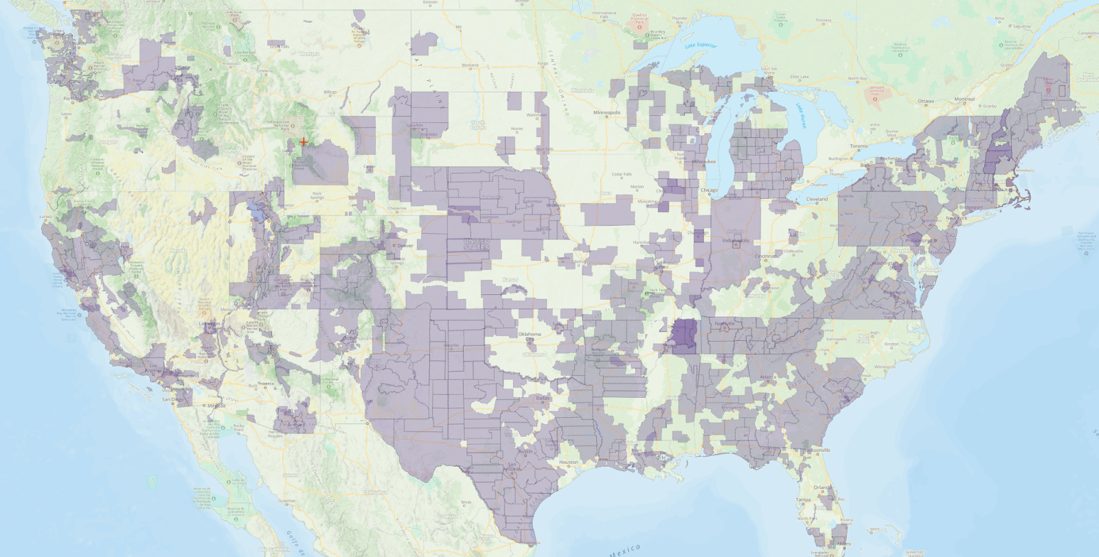
Explore 12 Iconic Long-Distance Routes

BDRs provide a unique opportunity to explore rural America and taste the tracks that shaped early American history. From Gold Rush ghost towns to the battlefields of the American Revolution, explore the country’s iconic public lands on two wheels. Soak up seemingly endless desert solitude, majestic mountainscapes, and wildlife sounds and sights while covering engaging and fun terrain most people will never see.

Every year since 2010, with the exception of 2021 due to the global pandemic, BDR has introduced a new long-distance route for dual-sport and adventure motorcycling. These off-pavement routes come with free GPS tracks, lodging, food, and fuel suggestions, and detailed guidebook notes. Choose from the rocky and rugged terrain of the northeast to the canyons and sandy washes of southern California. Soak in the hot springs of New Mexico, or climb jaw-dropping passes over 12,000 feet high in Colorado.

This year’s newly unveiled route traverses the lush coniferous forests and winds past the volcanic mountains of Oregon. Gaia GPS played a pivotal role in the creation of this route, from finding new roads and trails to navigating in the field. Go inside the Oregon Backcountrry Discovery Route and whet your thirst for adventure by watching the new ORBDR feature-length film. Find a showing near you.

The Best Backcountry Navigation App Meets the Best Long-Distance Adventure Motorcycle Trails

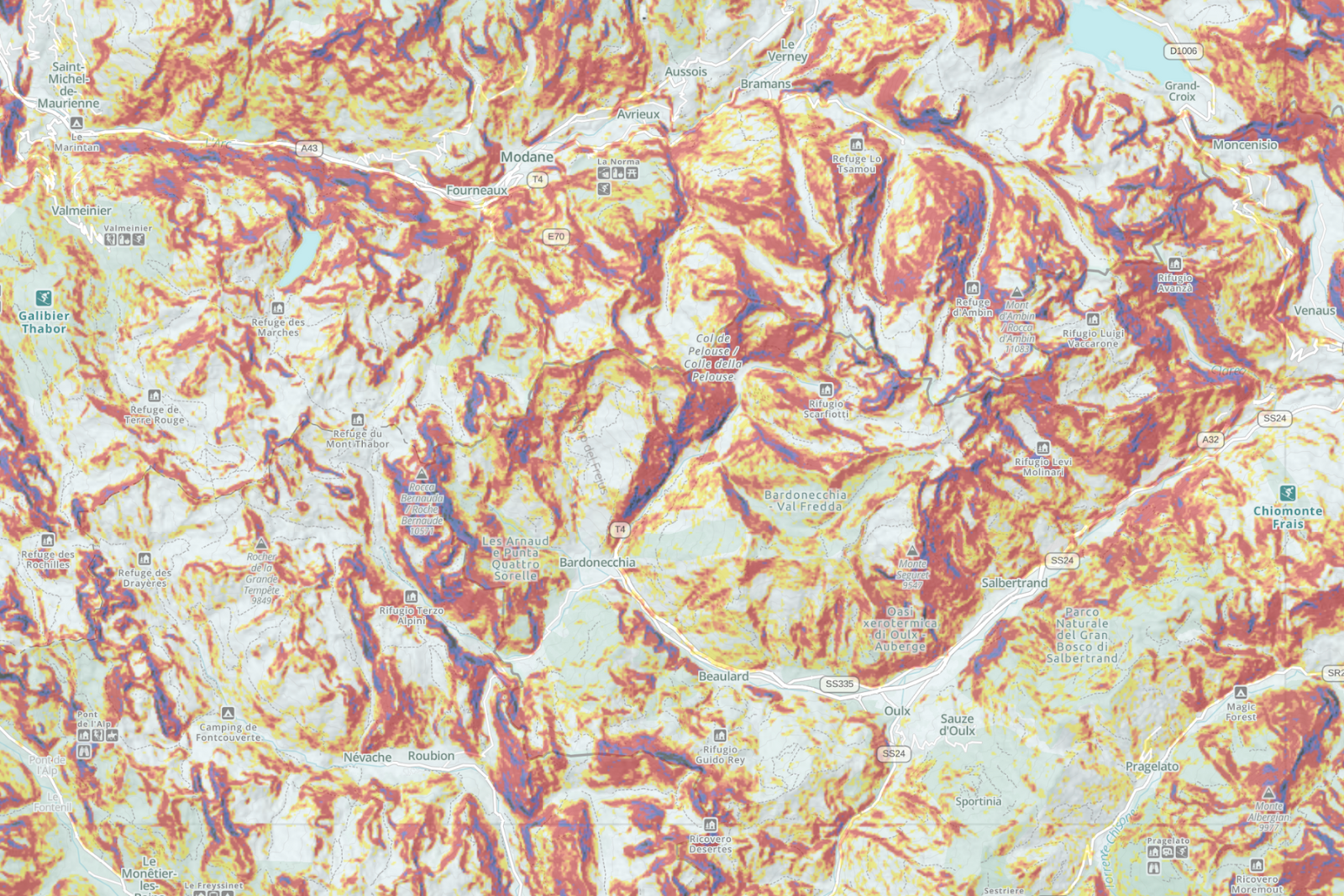
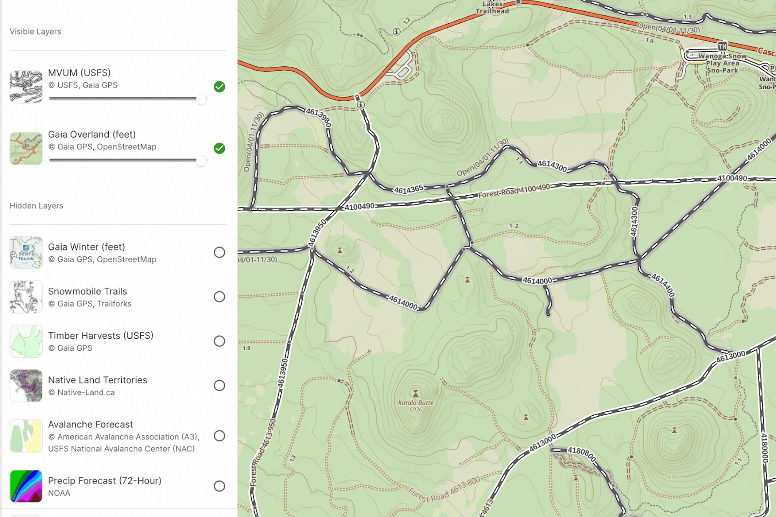
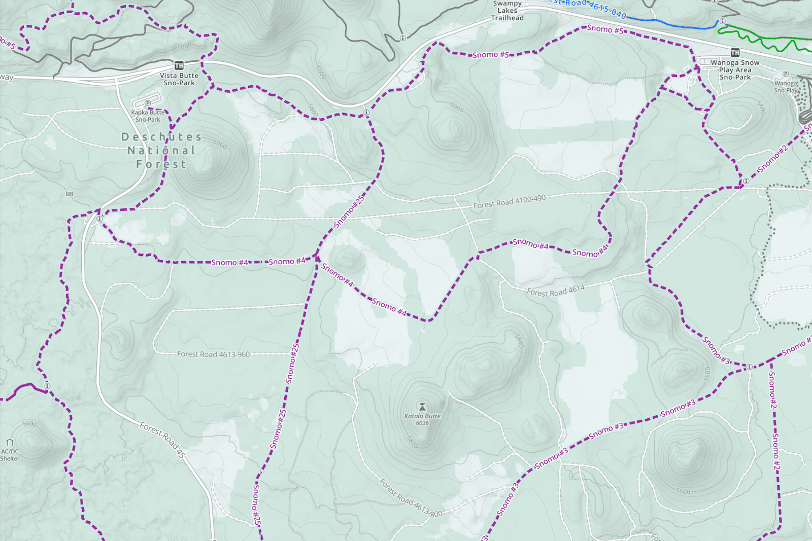
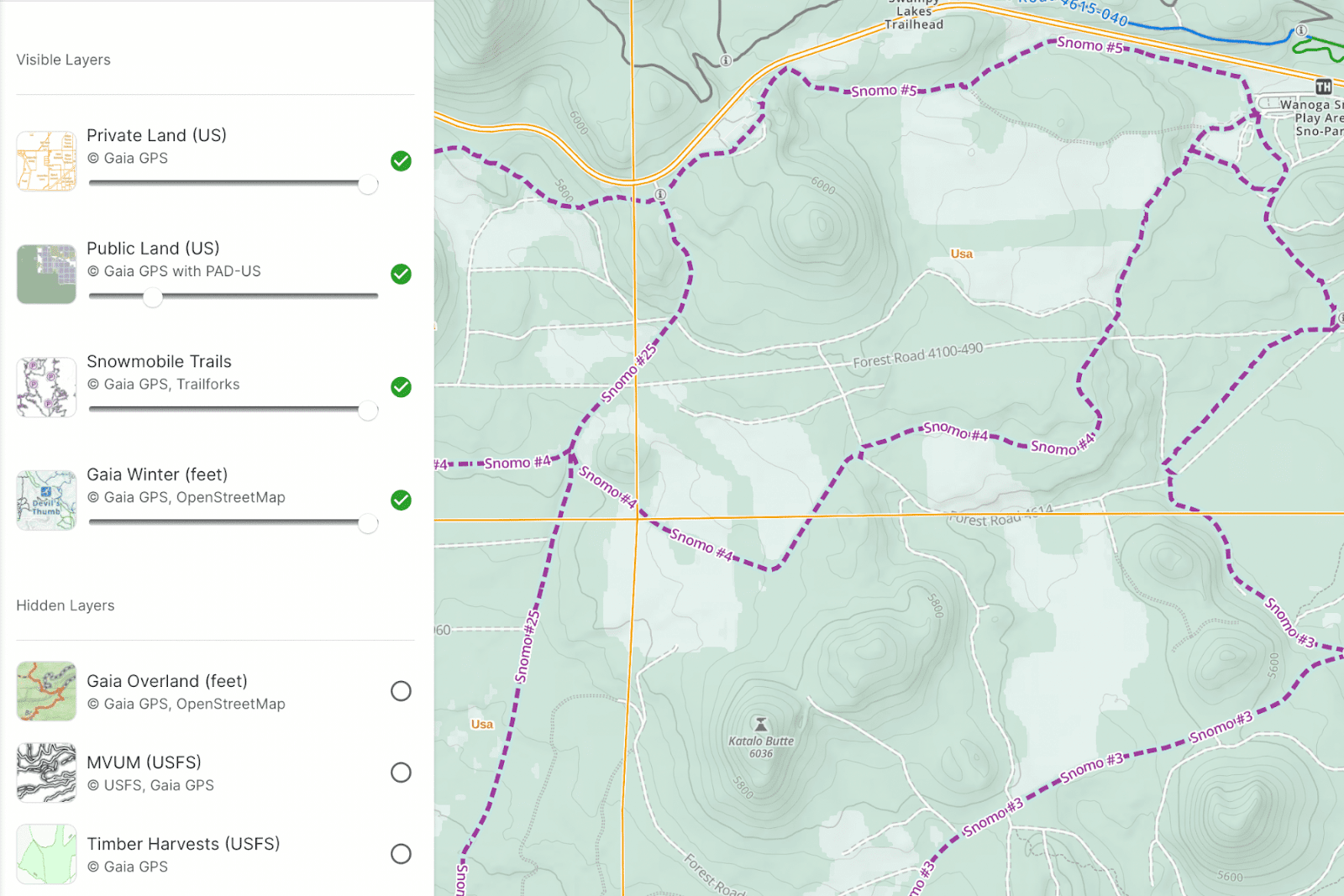
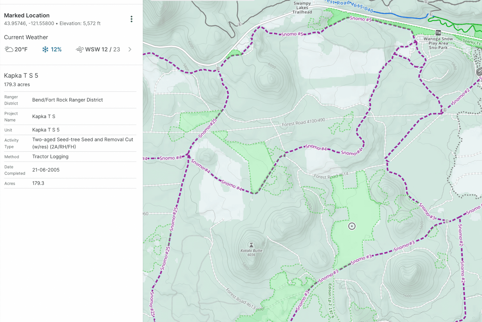
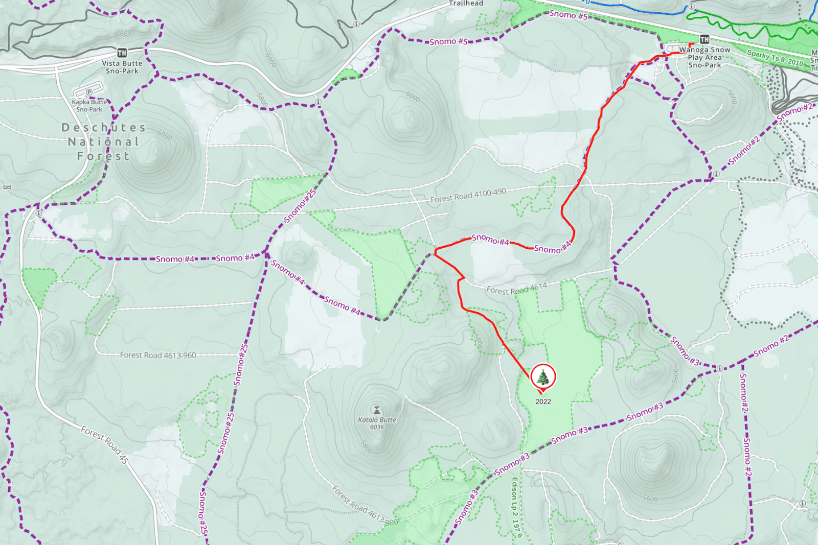
You can now plan your BDR and navigate in the field easier than ever before. Once you’ve selected your BDR of choice, upload it to your Gaia GPS account with the press of a button. You’ll automatically see the route and points of interest right in the Gaia GPS app and on gaiagps.com. While you can use any of our 300+ maps to plan your trip and navigate along the trail, we suggest starting with Gaia Overland, the world’s premiere map for offroad travel. Modeled after our proprietary Gaia Topo map, Gaia Overland comes with the same crystal-clear resolution and download efficiency you know and love from Gaia GPS. But it puts everything for motorized travel first. Download the map for offline use, and know where to go at every turn—even without cell service. 

How to Download BDRs to Gaia GPS

Uploading routes from BDR to Gaia GPS is available to anyone with a Gaia GPS account. Here’s how: 

  • Choose your BDR on ridebdr.com
  • Hit the “Upload to Gaia GPS” button
  • A new page will pull up prompting you to log in to your Gaia GPS account
  • Log in to your Gaia GPS account and click ‘authorize’ to allow your BDR routes to be imported

And voila, BDR trail data will automatically sync to your Gaia GPS account. You won’t have to login on future syncs when you click the ‘upload to Gaia GPS ’ button; the app will remember your info and sync the routes right to your account

Supporting Sustainable Tourism 

A non-profit advocacy organization, BDR also conducts rider education, safety campaigns, and promotes responsible travel for motorcyclists traveling in the backcountry. Each of the 12 BDR routes around the US generates new tourism, bringing sustainable economic relief to less-advantaged rural communities. In turn, this symbiotic relationship between riders and communities creates local stakeholders who will help fight to keep access for dual-sport and adventure motorcycles in these incredible backcountry areas.

BDR also promotes safety, knowledge sharing, and informing the community of critical issues and backcountry best practices. Learn more about BDR’s awareness programs, including Ride Right, Ride Respectfully, and Yield to Animals, on its website.

Level-Up Your Adventures with Gaia GPS Premium

Reclaim your peace of mind with a Gaia GPS Premium membership. Take your maps offline so you can always find your way, even out of cell service. Be prepared for what’s ahead with our suite of weather features. And find the perfect map for your next adventure thanks to our 300+ map catalog, including our proprietary Gaia Overland, MVUM, Public and Private Lands, USFS, and a collection of maps from National Geographic Trails Illustrated. 

April 4, 2023
0 FacebookTwitterLinkedinRedditEmail
FeaturedGaia GPS

The Secret to Getting Young Urbanites Outdoors? ‘Mappiness’

by Abby Levene March 23, 2023
written by Abby Levene

You can live in a city and love the outdoors. In fact, there’s an entire organization devoted to that premise: Mappy Hour. 

After a year ski-bumming at Alta, Mappy Hour founder Sarah Knapp came back east and organized OutdoorFest, a ten-day adventure festival that brings the outdoors to the five boroughs of New York through everything from biking to kayaking. Knapp wanted to put together a casual meetup to drum up hype for the big event. Millennials love pairing their recreating with socializing, and Mappy Hour—a portmanteau of maps and happy hour—came to life.  

“We’re all multifaceted people,” Knapp told Outside in 2017. “Mappy Hour is there to feed that side of us and make sure that it’s a part of our identities that doesn’t get lost.” While millennials and gen Z are more likely to live in cities than their parents, Knapp believes urban dwelling and time outside can coexist. “I try not to think of it as a compromise,” she says.

The first Mappy Hour event was held nine years ago at Fjallraven in Manhatten, and quickly gained popularity among outdoor enthusiasts in the city. Over time, the event expanded to include outdoor activities such as hiking, biking, and camping, and became a platform for advocacy and education around environmental issues and outdoor recreation. 

Now there are Mappy Hour chapters and events across North America, from Bentonville, AR, to Seattle, WA. Mappy Hours generally have a theme, from diversity to avalanche safety to transitioning from the climbing gym to the crag. Past meetups have ranged from a “Send It Sister” panel centered on females in the outdoor industry to “choose your own adventure” camping trips.

Mappy Hour founder Sarah Knapp (left) engages with participants.

A recent Mappy Hour in Denver, whose chapter contains a stout 900 members, included ice skating at Evergreen Lake, which at 8.5 acres is the biggest Zamboni-maintained outdoor ice rink in North America. At another, ultra runner Andrea Sansone spoke about setting the iconic Nolan’s 14 supported record last summer.

And of course, some Mappy Hours do focus on their namesake—maps. Every third Thursday in Rogers, Arkansas, Mappy Hour members bring their favorite map for an atypical bar chat and a beer. 

Built on a belief that the outdoors are for everyone, Mappy Hour welcomes those wanting to get outside but are unsure where to start to seasoned adventurers looking for new outings and friends. Upcoming Mappy Hours range from exploring the mountains and alpine lakes of Colorado with Dr. Jon Kedrowski to cleaning up Washington DC’s Rock Creek Park. Find a Mappy Hour near you.

March 23, 2023
0 FacebookTwitterLinkedinRedditEmail
rec.gov reservations in Gaia Topo
Gaia GPSNew Features

Book Campsites Right From Gaia GPS

by Abby Levene February 23, 2023
written by Abby Levene

We realize it’s still winter. But put on your sandals and sunscreen because it’s time to snag that primo campsite for summer. Many campgrounds in your favorite national parks, state parks, and national forests take reservations six months in advance. That means the best campsites in the most desirable places around America are going quick for peak summer dates. Now you can make those campsite reservations in a flash right from our Gaia Topo map.

Just open Gaia GPS and poke around the map to find that campsite with the spectacular sunrise view. Or search for a campsite far away from the crowds. Either way, you can discover and reserve the campsite of your dreams right from the map. Simply click on a campground and Gaia GPS provides the link on recreation.gov to snag a reservation.

In addition to reservations, recreation.gov gives you every detail you could possibly want about a campsite. View photos to see if the campsite has the spectacular mountain view. Find out how many cars are allowed, and if pets and campfires are permitted. Even see if there’s a fire ring or a grill.

Recreation.gov Campsites in Gaia Topo

Rec.gov campsites shown on Gaia Topo.

The ultimate tool for reserving public campsites in the US is now accessible right from our app. An official US government resource, Recreation.gov is the go-to reservation hub for 12 federal partners including the National Park Service, the US Forest Service, and the Bureau of Land Management. Rec.gov compiles reservations, venue details, and descriptions for over 130,000 recreation locations and more than 4,200 sites and activities around the country.

Plan a family trip to a national park. Or scheme up a solo bikepacking adventure through National Forest land. No matter your style, this new reservation integration makes your life a little easier. Map out your trip and book your reservations all together in one place.

Find All the Campsite Info You Need

A campsite on rec.gov shown on Gaia GPS.

Whether you’re a planner who loves to book campsites far in advance, or someone who prefers to fly by the seat of their pants, check out campgrounds in Gaia Topo to discover everything you need to know about staying there. See where each campsite is located. Find the outhouses and water spigots. Even see where the campground host resides.

Once you find a campsite that looks enticing, click the link to recreation.gov to view:

  • photos of the campsite (see if there’s a view!)
  • pet regulations
  • campfire rules
  • if RVs are permitted, and if so, maximum length
  • if tents are permitted

You also get site details, including:

  • if there is electricity
  • if the site is accessible by foot
  • check-in and check-out times
  • maximum number of people
  • if overnight camping is permitted
  • capacity rating
  • proximity to water
  • whether there’s shade
  • amenities, including if there’s a picnic table, fire pit, and grill or fire ring

And finally, scroll down for need-to-know details including whether there is water and if there are any site fees.

How to Book Campsites in Gaia GPS

Campsite reservations are found in our cornerstone Gaia Topo map. To reserve campsites from Gaia GPS, start by making sure Gaia Topo is selected as an active map layer. Gaia Topo also happens to be the premier map for dreaming up your adventures. Our cartographers designed this map to make key features for backcountry travel, like trails, scenic overlooks, and campgrounds, pop out from the landscape.

Explore Gaia Topo to find campgrounds at your destination. Look for blue campground symbols that say “Reservation Information” under the name. Zoom in further to spy individual campsites, restrooms, and the camp host site.

Once you’ve found your dream campsite, click on “Reservation Information.” The recreation.gov link to reserve campsites in that campground will pop up so you can snag your favorite site before it’s too late. Keep in mind that many public campgrounds take reservations six months in advance. And the best campsites book up quickly! Of course, please be mindful of recreation.gov’s rules and reservation policies.

Plan, Reserve, and Navigate All in One Place

With world-class maps and route-building tools, Gaia GPS provides the ultimate platform to plan your trips. Whether you’re backpacking in the Rockies, overlanding across the southwest, or simply looking for the ultimate car camping spot, choose from our deep collection of maps tailored to your adventure. Map out your route with our quick and easy snap-to-trail route builder so you know exactly where to go.

As you map out your route, you can seamlessly reserve campsites with one click. Drop a waypoint on the map to remember where the campsite is. Your future self trying to find your campsite at midnight in the pitch black will thank you. Speaking of finding your way, go ahead and download the map after you plan your route. That way you can navigate along the route and to your campsite even if you have no cell service at all.

Fun fact: Gaia Topo is so efficient that you can download the map for your entire state in a matter of minutes without clogging up precious phone storage. Don’t worry, you still get the most precise and detailed backcountry map on the market.

Recreation.Gov Campsite Reservations are Available to Everyone

Campsites in Gaia Topo.

Everyone can access the Gaia Topo map and make campsite reservations within it. You just need to create a free Gaia GPS account. To access our entire collection of maps, including hi-res satellite imagery, USFS, MVUM, and National Geographic Trails Illustrated, you’ll want to upgrade to Gaia GPS Premium.

Premium also unlocks our comprehensive suite of terrain features including weather, winter, and wildfire maps. Plus, with Premium, you can download your maps to use offline so you can find your way even when you’re out of cell service. And you can print maps so that you always have a paper backup.

February 23, 2023
2 FacebookTwitterLinkedinRedditEmail
Gaia GPSHow-ToNew Maps

Why NatGeo Trails Illustrated are America’s Favorite Maps

by Abby Levene February 9, 2023
written by Abby Levene

Whether you’re backpacking past the white granite pinnacles along JMT, offroading along the turquoise coasts of Baja, or planning a family trip to a national park, adventure with the most trusted and popular recreation maps on the planet.

Meet our collection of National Geographic Trails Illustrated maps, from the ​​eponymous map makers of world-renown. From Yosemite to Zion, the Appalachian Trail to the Pacific Crest Trail, access this coveted collection of NatGeo maps right in Gaia GPS. Priced at $15 plus a pop, get almost all of them with a Gaia GPS Premium membership.

Read on to learn about all the different NatGeo maps in Gaia GPS, why they are so special, and how their detailed notes can take your adventures to the next level. 

Adventure Confidently with Maps You Can Trust

Adventure confidently with navigational aids along the trail.

Expertly researched and crafted in conjunction with local land managers, NatGeo maps undergo rigorous review and continually set the standard for accuracy. The result: the most trusted and popular recreation maps available. 

National Geographic offers over 250 titles for America’s favorite outdoor destinations, most of which you can find right in Gaia GPS. From the long trails to your favorite national parks, NatGeo maps cover the most breathtaking and iconic scenery of the country. They’re packed with useful information, yet remain crystal clear to help you navigate down, off, and back to the trail.

Get Detailed Topographic Information

See peak and pass elevations right on the map.

While NatGeo Trails Illustrated maps cover a vast array of terrain, from the weathered Appalachians to the cavernous Grand Canyon, they all uphold a rigorous level of topographic detail. Easily spy steep slopes and gentle plains with clearly marked topo lines—enhanced with hill shading and precise contour detailing.

Get the elevation for mountain passes, summits, and major lakes right on the map. Tree shading makes finding the alpine a breeze, and rivers pop out from the map in baby blue. Wilderness boundaries are clearly defined by color, labels, and lines, making it easier to follow wilderness policies.

See Info At Every Zoom Level

Get a detailed view at low zoom levels.

Unlike our propriety Gaia Topo map, Nat Geo maps are raster files. This means that you see the same information as you zoom in and out from the map. Rasterized maps are less efficient than vectorized ones such as Gaia Topo, but they prove useful when you’re trying to pick out key landmarks from a big-picture view. Use NatGeo maps in conjunction with our trademark base maps such as Gaia Topo, Gaia Winter, and Gaia Overland to get the best of both worlds.

Stay on Track with Clearly Marked Trails

On the NatGeo Colorado Trail map, the Colorado Trail is highlighted in yellow for easy viewing.

NatGeo maps emphasize major trails, making it easier than ever to find places to explore and to navigate in the field. For trail-specific maps like the Appalachian Trail, Pacific Crest Trail, John Muir Trail, and Colorado Trail, the trail in question is highlighted in yellow and marked with the trail’s symbol.

Know how far until you reach that mountain pass, the next stream, or your campsite thanks to mile markers and distances to the next intersection, bridge, peak, or town.

Find Key Points of Interest

Find bear lockers, campsites, restrooms, water sources, and much more right on the map.

Discover essential resupply stations, water sources, and points of interest you’ll be hard-pressed to find on any other map. Spy trailheads to start your adventure, plus bathrooms and spigots to hit the trail adequately prepared. 

Find campsites, resupply stops, and restaurants along the trail for your next backpacking trip. And get off the beaten path by exploring historic sites, memorials, and viewpoints marked on the map.

Go Deeper with Navigational Aids

Get insider tips, such as when to be careful in inclement weather.

Perhaps the best part of NatGeo maps are the guidebook notes sprinkled across the map. Get a heads up on which bridges are slippery when wet. See where you’ll have to pack water before long dry spells. 

Make sure you camp on legal ground: see where camping is not allowed, and where wilderness areas begin. Get helpful notes like when to pay keen attention to trail markers, and where free shuttles make stops.

Pick the Perfect Map for Your Adventure

The NatGeo Trails Illustrated map highlights iconic trails, such as the CDT and CDT alt through Glacier National Park.

With over 240 maps, NatGeo covers many national parks, iconic trails, and breathtaking destinations across the US. Many of these maps are housed in our National Geographic Trails Illustrated map. We also have dedicated map layers for certain Nat Geo Trails Illustrated maps. Check them all out in the map catalog. 

Whether you’re planning a weekend backpacking trip in California’s Desolation Wilderness or a family excursion to Big Bend National Park, just open the NatGeo Trails Illustrated map to find iconic views, historic landmarks, and campsites to explore. Navigate Montana’s Bob Marshall Wilderness and Washington’s Wonderland Trail with ease. Discover pristine alpine lakes in Wyoming’s Cloud Peak Wilderness, and find tucked-away nature trails in California’s Joshua Tree. When it comes to the NatGeo Trails Illustrated map, the U.S. is your oyster.

Thru-Hike America’s Long Trails

Get the NatGeo AT and PCT maps in Gaia GPS.

Heading out on the Appalachian Trail, Pacific Crest Trail, John Muir Trail, or Colorado Trail? We’ve got a Nat Geo map for each of them. You can also find other long trails, like the entire Long Trail and parts of the AZT,  in the catch-all Nat Geo Trails Illustrated general map.

In 2017, NatGeo teamed up with thru-hiker and mapmaker Lon “Halfmile” Cooper to produce maps that included both NatGeo’s meticulous cartography and Halfmile’s firsthand notes and insider information. The result contains careful annotations about trail mileages, official and unofficial campsites, water sources, and other points of interest. 

You can use any NatGeo map on it’s own. Or pair a NatGeo map with Gaia Topo on your next backpacking trip to get the best of both worlds when it comes to discovering POIs, off-shoots, and camping, while also getting Nat Geo’s insider notes and easy-to-follow trails.

Explore National Parks Like a Pro

Get insider tips when visiting parks like Yosemite.

From Acadia to Zion, Nat Geo Trails Illustrated covers your favorite national parks around the country. See where the bus can take you through the park, find campsites, and even see which trails are open to horses.

Get inspired for your next family hike with trails featured on the map, and read the notes to see if it seems suitable for those in your group.

Visitor’s centers, bathrooms, wheel-chair accessible trails, and trash cans are all labeled clearly on the map, making it that much easier to spend more time soaking in the views and less time figuring out logistics. 

Climb to New Heights

The NatGeo Colorado 14ers map covers all 58 14,000 peaks in CO.

If you’re traveling to Colorado, you’re in luck. In addition to the NatGeo Colorado Trail map, you can tap into the NatGeo Colorado 14ers map which includes coverage of all 58 Colorado peaks above 14,000 feet. 

Whether climbed all 58 peaks or are setting out on your first one, check out this map to eliminate the guesswork. See how long your adventure will be, plus total elevation gain and loss. Get directions to trailhead, and see whether you’ll need four-wheel drive to reach it. 

Anticipate more engaging sections of the trail like where you can expect to scramble or encounter snow thanks to the notes right on the map. Hoping to camp half way up the hill? See where that’s allowed as well.

Find New Fishing Holes

See clearly marked river miles, access points, put-ins, and the names and ratings of rapids in the NatGeo Fishing & Rivers map.

After climbing a 14er, pull your fishing rod and the NatGeo Fishing & River Maps layer, which covers sections of the Colorado River, Arkansas River, South Platte River, Blue River, Roaring Fork, and Fryingpan Rivers in Colorado.

Built with National Geographic’s characteristic attention to detail, accuracy, and smart map design, this layer is a complete picture of not only the river courses themselves, but their banks, recreation areas, access points, and adjacent ponds and lakes. The result is a complete picture of each river ecosystem, and the boating routes within it.

The NatGeo Colorado Fishing & Rivers map includes clearly marked river miles, access points, put-ins, and the names and ratings of rapids, making it easy to locate yourself on the river, share route information, and plan trips. You’ll also find labeled stream gage sites to reference when researching flow rates at potential fishing or boating spots. Land ownership boundaries and recreation sites also make it easy to scout out campsites along the way.

How to Get the NatGeo Trails Illustrated Maps

All of the NatGeo Trails Illustrated maps are available on gaiagps.com and in the app with a Premium membership. To add any of them to your account, go to “Add map layers.” From here, you can search for a map, or find them under United States map layers or Topo maps.

Use any NatGeo map by itself, or pair it with one of our propriety base maps like Gaia Topo, Gaia Winter, or Gaia Overland for an even richer view of the landscape.

With Premium, you can also download these maps for offline use so you can find your way without cell service. Plus tap into our suite of weather features, safety tools, and hundreds of maps for every activity.

February 9, 2023
4 FacebookTwitterLinkedinRedditEmail
Backcountry SkiingGaia GPSNew Maps

Find Backcountry Skiing in Gaia Winter Map

by Abby Levene January 11, 2023
written by Abby Levene

Discover backcountry ski zones, snowmobile trails, and trails for every winter activity with our new and improved Gaia Winter map. Complete with world-wide ski resort maps plus nordic, fatbike, uphill skiing and snowshoe trails, Gaia Winter serves as the go-to map for winter travel. We’ve updated it to make it even more useful for your adventures.

Just like our original Gaia Topo, Gaia Winter comes with industry-leading clarity and download efficiency. Download the map for your entire state so you can always have a map on hand, even when you lose cell service. From backcountry ski zones to snowmobile trails to enhanced tree cover, read on to learn about the improvements and how to get the most of Gaia Winter this season.

Discover Backcountry Skiing

Backcountry skiers planning their next tour have come to the right place. We’ve added popular backcountry ski zones to the map. Areas shaded in blue show where you may find places to tour. Regions shaded in orange illustrate starting points.

Our cartographers created these backcountry start and ski zones based on where users started recording ski tracks and where their tracks took them, respectively. Backcountry ski zones are mostly contained within North America now. And you’ll also find a few zones in Iceland, Norway, and France.

Spy Snowmobile Trails

snowmobile trails in Gaia Winter

Sledders can now discover snowmobile trails right on the map. We’ve added all the snowmobile trails from our Snowmobile Trails map to Gaia Winter for your convenience. Before you go on your next tour, download Gaia Winter for offline use so you have a trail map on hand. That way you can reroute on the fly, find somewhere to refuel, or navigate in a white-out. 

Get even more trail details including grooming status, access dates/restrictions, trail width, difficulty level, trail length, and direction of travel with our interactive Snowmobile Trails map. Pair this trail overlay with Gaia Winter for optimal planning and navigation. 

Understand Landcover and Topography

Say goodbye to the blues. We’ve revamped the color palette to make Gaia Winter brighter, with more detailed landcover. As you’re planning your next ski tour, use Gaia Winter to see if you’ll be skinning over shrubs, through trees, or across tundra. Sledders can see if they’re traveling past prairies or farmlands. 

The winter-themed color palette of the map sets a seasonal tone and enhances its utility. Tour the backcountry with confidence thanks to a stronger emphasis on terrain, tree cover, and contour lines. Mountains pop out of the map, helping you scout the best uphill and ski lines. See exactly where treeline ends so you can find powdery bowls and untracked glades. Hiking, mountain bike, and other three-season trails are deemphasized to make it even easier to see ski, snowshoe, and fat bike trails.

Activate Snow Mode

Gaia Winter’s less diverse color scheme also pairs perfectly with our safety and weather maps. Pair Gaia Winter with our suite of winter safety maps, including Slope Angle shading, Avalanche Forecast, Snow Stations Daily, Snow Depth, and Satellite Imagery to help you plan safer tours. Check out our primer on how to use maps to help avoid avalanches for a refresher.

Trails for alpine skiing, cross country skiing, snowshoeing, fatbiking, uphill skiing, and snowmobiling are indicated by line type. And now you can also distinguish trail activity type thanks to icons right on the trails themselves. 

Gaia Winter is Available with a Premium Membership

Gaia Winter is available on the web and in the Gaia GPS app with a Gaia GPS Premium membership. To access this map, visit the layers menu and search for “Gaia Winter.” Or from the layers menu, select “Topo Maps.” Scroll down and tap “Gaia Winter.” Tap the “Add Layer” button. Learn how to add and manage overlays here.

A Premium Membership also gives you access to Gaia GPS’s entire map catalog, including a suite of avalanche safety maps. These include Slope Angle, Avalanche Forecast, recent satellite imagery, Snow Stations (Daily), Snow Depth, and snow forecast maps. Read up on how to use maps to help avoid avalanche danger.

Plus, with Premium, you can layer maps together. For example, you can place the Slope Angle map on top of Gaia Winter to find the best low-angle terrain. And you can download your maps (including Gaia Winter) for use without cell service, as well as print maps so you always have a backup.

Take winter to the next level. Join Gaia GPS Premium with Outside+ to get one subscription to fuel all your adventures, thanks to access to Trailforks Pro, Outside, SKI, Trail Runner, Outside Watch, and more. 

January 11, 2023
1 FacebookTwitterLinkedinRedditEmail
Gaia GPSNew FeaturesNew Maps

Our Favorite New Maps and Features

by Abby Levene December 23, 2022
written by Abby Levene

As our community dreamed up more routes, downloaded more maps, and covered more miles than ever before, our team remained hard at work making Gaia GPS even better for your adventures. Here’s a look at our favorite maps, features, and updates we launched this year. We’re counting down, 12 days of Christmas style. 

12. Map Packs (Beta): A Totally New Way to Map

To put the best of our 300+ maps in your hands, right now, we’ve totally redesigned our mapping interface. Meet map packs.

Enable this new beta feature available on iOS and get the best map presets curated by the Gaia GPS team. Whether you’re visiting a national park with your family, backpacking a long trail, or skiing in the backcountry, just tap the map pack crafted specifically for your adventure to put the right maps on your screen

Or create your own map pack so you can always have your favorite map combinations at your fingertips. Explore map packs.

11. Gaia Classic: The Map That Never Goes Out of Style

Do you yearn for the classic topo maps of old? You know, the ones not busied up with excessive colors and silliness when all you really need to know is how to plot your path from that alpine lake to that mountain pass and down the other side?

Or maybe you’ve found yourself yelling at our cartographers, “why or why can’t I see the contour lines in this blazing sun!?”

Enter Gaia Classic, the map that just may answer that call of the wild. It’s inspired by a classic aesthetic, from the colors to the fonts to the very textures of the map itself. Maybe it’s totally pointless, or maybe, just maybe it’s the only map you’ll ever need.

Check out our new map, Gaia Classic.

10. Gaia GPS Master Classes: Map Like a Pro

We’re the first to admit there’s a bit of a learning curve to mastering the breadth and depth of gaiagps.com and our app. That’s why we teamed up with Outside Learn to bring you two master classes. Find the best of our 300+ maps for your adventures. Learn how to take your maps offline. Layer maps together to unlock more terrain detail. Reroute on the fly. Share your routes with friends and family. Discover our top hacks. It’s all here. Take these two courses to brush up on your mapping skills and to get the most of the app. 

Take Gaia GPS 101 and Gaia GPS Advanced. 

9. Wildfire Maps: Spot Fires Faster

This update is lit. You can now spot wildfires on the Wildfire map as soon as they appear on InciWeb, the government website that tracks wildfire information for the public. Our cartographers also added wildfire labels right onto wildfires themselves for easy viewing. Plus, we expanded our smoke forecast maps coverage to include Alaska and Canada.

Check out the enhanced Wildfire and Smoke Forecast maps.

8. Snowmobile Trails Map: Discover Global Sledding Trails

Planning snowmobile routes and navigating across the snow has never been easier. Find sledding trails across the US, Canada, Europe, and Australia with our new Snowmobile Trails map. We’ve pulled together trail data from local, state, and federal sources to bring you some of the most comprehensive sledding coverage in the world.

Easily spy trail networks to build routes and find your way in the field. When available, see key details like trail width, grooming status, restricted access areas, and difficulty ratings. Plus, find warming huts, gas stations, and snowmobile shops.

Try out the Snowmobile Trails map.

7. Android Auto: Navigate from the Dash

We’ve revamped Gaia GPS on Android Auto so you can manipulate the map, record tracks, and drop waypoints all from your dashboard. Just connect your phone to your car display and navigate with your favorite Gaia GPS maps like Gaia Overland, MVUMs, hi-res global satellite imagery, and National Geographic Trails Illustrated—all from the luxury of the wide screen.

From expanded map controls to clearer visibility, here are the major updates. And if you’re on iOS, check out Apple CarPlay.

6. Slope Angle: Stay Safer with Highest-Res Map

Scout avalanche terrain easier than ever before. We’ve updated our Slope Angle map with the latest highest resolution 1-meter LIDAR DEM data from the USGS. This data is the gold standard for slope angle shading, rendering our Slope Angle map crisper and clearer for your winter adventures.

Whatever your objective and mode of travel, you can now enjoy the highest resolution slope angle data, wherever it’s available. Check out the updated Slope Angle map.

5. Rec.Gov: Make Campsite Reservations from the Map

Find the perfect campsite in Gaia Topo, and then reserve it right from the map. The ultimate tool for reserving public campsites in the US is now accessible right from our app and gaiagps.com. In addition to reservations, recreation.gov gives you every detail you could possibly want about a campsite. View photos to see if the campsite has the spectacular mountain view. Find out how many cars are allowed, and if pets and campfires are permitted. Even see if there’s a fire ring or a grill.

Learn more about our rec.gov integration. 

4. Trailforks MTB Map: Discover the Best Bike Trails

Trailforks’ coveted mountain bike trail database is now in Gaia GPS! Discover brand new routes, get the beta on trail conditions, and easily spy trails based on type and difficulty level with this new map.

Trailforks, a trail management system, catalogs trail networks around the world. The crowd-sourced database and moderated site provides the most accurate and comprehensive trail data available. And now you can get all 361,392 Trailforks mountain bike trails around the globe right in the Gaia GPS app and on gaiagps.com.   

Check out the Trailforks MTB map.

3. Planning Tools: Easily Dream Up Your Own Routes

Creating your own adventures in Gaia GPS got even easier—and more fun. Meet our new route editing tools, here to let you quickly fix any mistakes or changes of heart, automatically out-and-back any one-way route, send your route back to the start, and reverse your route direction.

You asked, and we listened. We added these route editing tools so that you can explore our maps with even more abandon, knowing you can painlessly erase any route-building mistakes and let our planning tools handle the tedious tasks. Enjoy these tools on Android and on the big screen at gaiagps.com. To put the cherry on top of this route creation cake, we’ve added keyboard shortcuts to the web so you can perform any of these tasks without even touching your mouse, making it even easier to carry on route building with our smart snap-to-trail planning tools.

Explore the new planning tools. 

2. OpenSnow Weather: Localized Forecasts at a Tap

While we can’t supply a crystal ball, we can supply the weather for exactly where you’re going, exactly where you need it—right on the map. We partnered with OpenSnow, the leading resource for backcountry weather, to bring you hyper-localized weather forecasts that you can access at a tap.

Just tap anywhere on the map, anywhere in the world, and get the current weather plus the forecast right in Gaia GPS. Learn more about weather at-a-tap.

1. Gaia Overland Map: World’s Best Offroading Map

Ditch the crowds with Gaia Overland, the best overlanding map you can put right on your vehicle’s dashboard. MVUM, USFS, public land boundaries—it’s all in here. Designed in-house for planning big routes, navigating tricky terrain, and rerouting on the fly, Gaia Overland is the definitive map for all of your overlanding, offroading, and motorized adventures. 

Modeled after our proprietary Gaia Topo map, Gaia Overland comes with the same crystal-clear resolution and download efficiency you know and love from Gaia GPS. But it puts everything for motorized travel first. Whether you’re embarking on a multi-day expedition or just heading to a remote trailhead, use Gaia Overland to get you there efficiently and (relatively) effortlessly.

Check out Gaia Overland.

It Wouldn’t Be the Holidays Without a Few Bonuses

Permitted Rivers Map

This map overlay shows you all the rivers that require a permit to raft or kayak. Tap to learn the river’s name, see permit information, and get the link to a permit application. Check out the Permitted Rivers map here.

Customized Waypoints

You can now change the color of waypoint borders. Use these colors of the rainbow to classify and categorize your waypoints to your heart’s desire. Learn more about all of the ways to use waypoints here. 

Ski Resort Reports Map

From Aspen to Zermatt, get conditions for ski resorts around the globe in Gaia GPS. Ski areas with fresh snow light up on our new Ski Resort Reports map. See snow totals and weather readings. Find out how many trails are open. Even read the resort’s daily report, all right within the app and on gaiagps.com. Explore the Ski Resort Reports map here.

December 23, 2022
0 FacebookTwitterLinkedinRedditEmail
Gaia GPS

2022 Mapped: Gaia GPS Year in Review

by Abby Levene December 22, 2022
written by Abby Levene

From Auckland to Zermatt, Santiago to Santa Fe, you dreamed up adventures and explored the world. No one defining region, activity, or way to use the app and website stood out in 2022. But that’s the beauty of Gaia GPS—it’s infinitely customizable for your needs and dreams.

In terms of rising tides, though, we saw water. Everywhere! This year, water lovers of all varieties flocked to Gaia GPS both for planning and recording adventures. Backcountry winter travelers quietly lurked in the wings: our Slope Angle map, used to find gentler slopes with less avalanche-prone terrain, was the most used and most downloaded map only behind our proprietary Gaia Topo.

Overlanders continued to demonstrate they’re eager to venture into the unknown. Despite not launching until halfway through the year, the Gaia Overland map quickly cracked into the top 10 downloaded maps this year.

Let’s dive into the year. You can start by checking out your personalized 2022 Mapped.

View Your 2022 Mapped

And together, let’s explore how the community adventured with Gaia GPS this year.

Those hikes, bikes, swims, runs, skis, kayaks, backpacking trips, fishing outings, bikepacking adventures, climbs, and overlanding outings added up. The community recorded 354,374,790 miles in the app.

Hiking remained our most popular activity for planning routes and recording activities. But overlanders, you’re not too far behind! Bikers of all types, cyclists, gravel grinders, mountain bikers, and commuters, took to the roads and trails this year. Biking was the third most popular activity for both planning routes and recording tracks. Not to be forgotten, snow sports rounded out the top four in both categories.

Surprisingly to us, kayaking cracked the top 10 for both planned routes and recorded activities. We love to see it! Camping, hunting, rock climbing, and fishing all snuck in there, too.

Speaking of climbing, we ascended 17,547,769,890 vertical feet. We’re out of breath just thinking about it.

Not only did we spend a lot of time doing, we also spent a lot of time dreaming. On, average every Gaia GPS user: 

  • Spent 26 hours planning routes in the app and on gaiagps.com
  • Recorded 39 adventures in the app

Unsurprisingly, our default base map Gaia Topo took home honors as the most downloaded map this year. But with industry-leading file efficiency, crystal clear resolution, and essentially every trail and point of interest you need, the ranking is well deserved.

Winter travelers looking to stay safer in avalanche terrain sought out the Slope Angle map, the second most downloaded map this year. We just recently updated this map with the highest-resolution lidar data from the USGS. See how it’s even crisper for your backcountry ski, snowshoe, and sled adventures.

A classic used across many activities, Satellite Imagery ranked third. Gaia GPS users enjoy this map to get a crystal-clear bird’s eye view of the landscape to help them find clearings for campsites, scout ski lines, and much more.

We’re stoked so many of you took advantage of the National Geographic maps you can find in Gaia GPS, including Nat Geo Trails Illustrated. These digitized maps of America’s favorite outdoor destinations are like having the very best guidebooks in your pocket—without taking up any weight or space.

Our community sought out trails off the beaten path this year, as evidenced by the fifth most downloaded map: USFS Roads and Trails. This overlay features backroads, forgotten trails, and brand-new routes currently unavailable on any other Gaia GPS map.

In addition to Satellite Imagery, three other maps overlanders love cracked into the top 10: Public Land, Private Land, and our new Gaia Overland map. Designed in-house with the help of overlanding experts, Gaia Overland takes the best of offroading map and puts in it one convenient place so you can keep your hands on the wheel and eyes mostly on the road. Offroaders, we see and solute you for your love of maps!

Another map designed by our cartography made the top 10 most downloaded list: Gaia Winter. Like Gaia Topo and Gaia Overland, this map provides razor-sharp resolution and unparalleled file efficiency so you can take it offline without taking up too much space on your phone. The key difference is Gaia Winter is designed for, well, winter. Find ski resort maps around the globe, and its winter color palette pairs perfectly with our suite of avalanche safety maps.

This list looked nearly identical for most used maps of 2022, with the Wildfire map at #9. Notably, our suite of wildfire, smoke, and air quality maps are updated in real-time, so they cannot be downloaded for offline use. So be sure to check these maps before heading out the door.

Speaking of taking maps offline, here’s where the community downloaded regions of the map. Want to take your maps offline so you can navigate out of cell service? Go Premium!

Looking at this map, we’re sensing a trend…it seems mountainous, yes, but also watery. In fact:

Take us to the beach!

Coastal areas around the world were not only the most downloaded regions of map. These places also saw the most activity for dreaming and doing. In terms of route planning, the two coasts of the US saw the highest concentrations anywhere in the world. But the United Kingdom, France, and Mediterranean regions of Europe were not far behind. The east coast of Australia, New Zealand, and coastal regions throughout Asia also put up strong showings.

Trends for recording tracks looked similar, with South America surging strong. From Columbia down to Argentina on the west, and throughout Brazil on the east, we saw huge growth in recorded tracks on both South American coasts.

From planning adventures on the map to recording adventures in the app to the locations you chose to explore, water was the defining theme of 2022.

We saw huge increases in recorded tracks for water activities: 

  • Boating – 628% increase
  • Fishing – 26% increase
  • Swimming – 12% increase

And we saw a similar increase for water-based adventures planned in the app:

  • Swimming – 237% increase
  • Fishing – 93% increase
  • Kayaking – 74% increase

X marks the spot of those special campsites you want to remember. You put more campsite waypoints on the map than any other, save the default red pin and camera icons. Whether you’re backpacking, bikepacking, backcountry ski touring, overlanding, or just vacationing, we love camping because it brings so many activities together under a shared pastime.

Speaking of camping, someone sure has a lot of time on their hands for nights on end in the great outdoors. The longest overlanding public track covered 5,414 miles. Take us with you next time, please?

Someone must really want to find Lionel Messi. The longest route planned in Gaia GPS this year circumnavigated Argentina. covering 10,021 miles. Check it out on gaiagps.com.

Many notable records went down this year with the use of Gaia GPS, including Jack Kuenzle‘s record on the Bob Graham. He bestest the mountain, trail, and ultrarunning GOAT Kilian Jornet’s time by 12 minutes. Josh Perry broke Heather Anderson’s iconic record on the Pacific Crest Trail, a time so stout it stood for nine years. Courtney Dauwalter recorded the fastest time for man or woman on Colorado’s rugged 160-mile Collegiate Loop. And Joe “Stringbean” McConaughy broke the iconic John Muir Trail FKT by over a day, before Jeff Garmire eked him out by 13 minutes a few weeks later. Check out all of their trip reports on fastestknowntime.com.

Way to get after it this year, and thank you for making Gaia GPS part of your adventures. Seeing you explore with the help of the app and gaiagps.com is the ultimate gift. Where will 2023 take you? Start dreaming.

December 22, 2022
0 FacebookTwitterLinkedinRedditEmail
slope angle shading on a 3d map
Gaia GPSNew Maps

Spy Avalanche Terrain with Higher Res Slope Angle Map

by Abby Levene December 14, 2022
written by Abby Levene

Scout avalanche terrain easier than ever before. We’ve updated our Slope Angle map with the latest highest resolution 1-meter LIDAR DEM data from the USGS. This data is the gold standard for slope angle shading, rendering our Slope Angle map crisper and clearer for your winter adventures.

Gaia GPS users primarily use our Slope Angle map in winter to avoid avalanche-prone terrain. But hikers, mountaineers, and bikepackers use it year-round to find the easiest path over mountain passes. Photographers and adventurers turn to this map to find unique rock features and waterfalls. Whatever your objective and mode of travel, you can now enjoy the highest resolution slope angle data, wherever it’s available. 

Meet the Slope Angle Gold Standard: Lidar

Last year, we developed our Slope Angle map in-house and tapped into the US Geological Survey’s 3D Elevation Program and NASA’s Digital Elevation Model. These sources allowed us to expand our coverage globally, integrate high-resolution data, and fine-tune color details.

Now we’ve updated the map even further with the best data available on the planet: LIDAR DEM. Harnessing a laser scanner, Global Positioning System (GPS), and Inertial Navigation System (INS), Light Detection and Ranging (lidar) technology produces high-resolution models of ground elevation within an accuracy of 10 centimeters, or four inches. This means our Slope Angle map contains more accurate data than ever before while also pulling out more of those smaller terrain details that can be easy to miss.

Lidar Coverage Continues to Spread Across the US

The updated Slope Angle map uses the latest lidar data wherever it’s available. Check out the map above for a full view of lidar coverage. As you can see on the map, avalanche-prone regions in the northeast, California, and the Pacific Northwest enjoy excellent lidar coverage. 

We’re still waiting for the USGS to supply full lidar coverage of the mountain west. The USGS hopes to complete its collection of lidar data for all of the U.S. and its territories soon; see the status map. Thanks to its high cloud cover and remoteness, Alaska uses Interferometric Synthetic Aperture Radar (IfSAR) instead.

Graded Color Style Picks up the Details

A continuous color ramp shows terrain changes in a graded fashion, making terrain features a snap to read on the map.

The map emphasizes 30 to 45-degree zones in orange and red colors, recognizing and calling your attention to the fact that these slopes comprise the starting zone for most avalanches. Less steep terrain—in the 20 to 25-degree range—is highlighted in green. Slopes steeper than 45 degrees are shaded in greyscale colors to point out the steepest terrain on the map. The grey shading also helps people with red/green confusion color blindness see the map details.

Identify Avalanche Terrain Worldwide 

While LIDAR DEM does not cover the entire US, our Slope Angle map continues to provide not just country-wide, but also worldwide coverage using the highest quality data available from the US Geological Survey’s 3D Elevation Program and NASA’s Digital Elevation Model. 

Whether you’re backcountry skiing the bowls or snowmobiling deep into the forest, add the Slope Angle layer to your favorite global base map like Gaia Winter or Satellite Imagery to help plan safer winter routes through the backcountry.

Keep in mind that you can tweak the opacity of the Slope Angle overlay to your needs. Turn the opacity down to reveal underlying terrain details, or dial it up to more clearly view slope steepness. 

Warnings and Limitations

Avalanche forecasting uses many tools to analyze avalanche risk in the field. Slope shading is best used for a big-picture overview of terrain. All slope angle maps, including the updated Slope Angle layer, fail to show micro terrain such as small starting zones. Snow features like wind pillows and cornices will not be on the map.

Be prepared to use an inclinometer and other on-the-ground assessments in the field in addition to the slope angle map. Change your plans accordingly if the terrain does not match up to the data depicted on the slope angle layer.

Educate yourself about avalanche and snow safety before traveling in any areas prone to avalanches. For more information on how slope angle maps are made, see Jeff Deems’ presentation about how these map overlays are made from the 2019 Colorado Snow and Avalanche Workshop or the article “Digital Mapping: Do You Know What Your Map Knows?” in September 2020 issue of The Avalanche Review.

How to Get the Slope Angle Map

The Slope Angle layer is available with a Gaia GPS premium membership. To access the layer, visit the layers menu, and select the “Features/Weather Overlays” tab. Scroll down and tap “Slope Angle.” Tap the “Add Layer“ button. Learn how to add and manage overlays here. 

Pair this map with other useful backcountry skiing maps available with a Premium membership on Gaia GPS. Read up on how to use maps, including the slope angle layer, to help avoid avalanche danger. 

December 14, 2022
1 FacebookTwitterLinkedinRedditEmail
Gaia GPS

How to Find a Christmas Tree Using Gaia GPS

by Abby Levene December 1, 2022
written by Abby Levene

Pine-ing for a tree-mendous Christmas? Spruce up your holiday decor. Celebrate the holidays outside by harvesting your own Christmas tree. 

Terrible puns aside, finding your own Christmas tree is an adventure you’ll never forget. And choosing a real tree over an artificial one is also a gift to the planet. Even the United States Forest Service agrees, writing on its site, “By cutting your own tree, you take an active part in managing your national forests!”

Gaia GPS Principal Engineer Andy and his wife Angela found their tree in a Washington forest last year.

Fir, pine, spruce, cypress, cedar—trees traditionally used for yuletide cheer provide a home to wildlife, filter air, and prevent soil erosion as they grow. Harvesting your own tree from the forest gives remaining trees breathing room to thrive. By freeing up access to water, nutrients, and sunlight, thinning the forest reduces stress and improves resiliency to disease, insects, and wildfire.

Supporting your local tree farm is always a viable option. But if you want to inject adventure into your holiday decor, go find a tree of your own. Grab your skis, snowshoes, or sled, a hot thermos, and a hand saw. Here’s how to find your own Christmas tree.

1. Find Your Forest

Many national forests around the US let you cut your own Christmas tree. Find a participating national forest near you at recreation.gov. You may need to purchase a permit for a nominal fee, which you can do on rec.gov as well. While you’re there, check your forest’s tree-cutting guidelines to keep the Christmas elves happy.

2. Hone Your Zone

O’er the fields we go! Now that you have a forest in mind, pull out the maps and make a game plan to get there. Gaia GPS provides several specific maps that will help you pinpoint where to find the perfect tree. 

Find Seasonally Open Roads

Start by opening Gaia GPS. Select the Gaia Overland map as your base map. Overlay Gaia Overland with the MVUM map. Use these two map sources to see which roads are seasonally open in your national forest of choice. If there’s snow on the ground, bring snowshoes or backcountry skis to venture off the beaten path in your search for the optimal tree.

Spot Snowmobile Trails

If you have a snowmobile, you can head even deeper into the forest beyond the reach of plowed roads. Select Gaia Winter as your base map, and add the Snowmobile Trails map if you’re in the US, or the BRMB Snowmobile Trails map if you’re in Canada. Use these maps to find groomed roads and trails, as well as roads open to sleds.

Stay on Legal Ground

No grinches allowed this Christmas. To ensure you stay on public land and away from persnickety land owners, add the Public Land and Private Land maps. Use these maps to plot how to access national forest without trespassing. 

Size Up Your Prize

And finally, find the ideally sized Christmas tree by adding the Timber Harvests map from the USFS. Timber harvests in the five-to-10-year-old range should lend way to young trees of ideal Christmas tree heights. Tap on green highlighted regions to see what year that area was forested.

Ho Ho Ho! Offline

Once you’ve mapped your tentative route, download your base map. Taking your maps offline means you can follow your route and find your way home—even without cell service. 

3. Record Your Tree Tracks

Before heading out on your adventure, choose an opportune weather window. Tap on the map to see the forecast from OpenSnow. When it’s time to head out the door, record your tracks in Gaia GPS. That way you’ll leave a breadcrumb track in the app that you can follow to find your way home. Plus, you can follow your tracks when you go Christmas tree hunting next year. Don’t forget to drop a waypoint to mark where you found your tree!

Gaia GPS Product Marketing Manager Julia, her partner Cooper, and puppy Hank found their tree in an Oregon forest this year.

Some general tree-cutting rules to keep in mind:

  • Use a handsaw. Chainsaws are generally not permitted. 
  • Do not top the tree.
  • Cut below the lowest live limb. Leave stumps no higher than six inches.
  • Avoid damage to other trees.
  • Once the new year rolls around, give your tree the proper disposal it deserves. Use your tree for wood chips, compost, mulch, or firewood.

Bundle Up with Gaia GPS Premium Powered By Outside+

Unlock all of these Christmas-tree-finding maps by upgrading to Gaia GPS Premium with Outside+. Premium also lets you download your maps for offline use so that you can find your way even without cell service. Plus, get the most out of the app by taking our masterclasses on Outside Learn. Tap into our holiday savings when you purchase on the web.

December 1, 2022
4 FacebookTwitterLinkedinRedditEmail
A person sits at the edge of a canyon holding her phone, with a ZOLEO unit attached to her backpack.
Gaia GPSOut and Back Podcast

Everything You Need to Know About Satellite Communicators

by Abby Levene December 1, 2022
written by Abby Levene

Let’s face it—there’s no excuse to get stranded off the grid anymore. Thanks to surging competition and massive technology improvements, satellite communication devices have become lightweight, user-friendly, and economical. These palm-sized units allow you to send messages from anywhere in the world, let others track your progress, and provide a direct line to help.

There’s a handful of satellite communication devices to choose from, including Bivy Stick, Somewear, ZOLEO, Garmin, and SPOT. Last year, we compared their prices and monthly subscription plans here.

How exactly do satellite communication devices work, and can you trust them? We sat down with Morris Shawn, President of ZOLEO Inc, to give you the inside scoop on how the ZOLEO Satellite Communicator works.

What is a Satellite Communicator?

A person holds his ZOLEO unit in one hand and a phone in the other while sitting above a lake.

A satellite communication device like ZOLEO’s allows two-way messaging from anywhere in the world, even without cell service. The device connects to the Iridium global satellite network, a constellation of low-hanging satellites that cover 100% of the planet. While many brands of sat communication devices employ this technology, Shawn started ZOLEO just 18 months ago because he saw a glaring gap in the market.

“Existing devices weren’t providing customers with that sort of intuitive, fully functional messaging experience that people have come to expect from their smartphones,” Shawn says.

ZOLEO puts messaging first, meaning that it’s incredibly easy to text using the ZOLEO app on your phone. ZOLEO also wisely sends the message with wifi or cell signal if that’s available. Unlike many other sat communicators on the market, ZOLEO delivers messages over cellular and wifi. This means that you’ll never miss a message again, even if your ZOLEO device is turned off.

Sat communicators also allow you to share your location with others, so they can track your progress on a project or simply check in to see where you are. Some models, such as ZOLEO’s, can give you the weather. And perhaps most importantly, these devices have an SOS button.

What happens when you press the SOS button?

A person looks at their phone in the dark. Their ZOLEO unit is hanging from their backpack.

If you or someone you encounter finds themselves in a situation in the backcountry in which they cannot get back to safety without assistance, the SOS button on your sat communicator can save you. Simply press the SOS button on the device, or the SOS button in the app. Doing so sends an SOS message along with your GPS location directly to an emergency response center. For ZOLEO, that’s the GEOS International Emergency Response Coordination Center, who manage these calls from all over the world.

GEOS communicates directly with the person who pressed the button. If they’re unavailable, GEOS reaches out to the emergency contacts indicated on your account. If help is needed, GEOS will coordinate with a local emergency response team to get help to you as soon as possible.

Seem too good to be true? Schedule a test run to see how the SOS button works. But don’t just press the SOS button for fun, Shawn warns.

“We do see a lot of accidental presses,” Shawn says. “We see people pressing the button because they are just testing the device and don’t realize doing so is going to set a whole chain of events in motion.”

If you do press the SOS button by accident, don’t panic. You’ll have a chance to cancel the SOS request.

The Gift of Safety

Person holds a ZOLEO in one hand and their phone in the other while sitting on some rocks.

December 1, 2022
2 FacebookTwitterLinkedinRedditEmail
Load More Posts

Categories

  • Adventures
  • Android
  • App Comparisons
  • App Updates
  • Backcountry Skiing
  • Boating
  • Company News
  • Emergency Response
  • Featured
  • Fishing
  • Gaia GPS
  • Gaia GPS Offroad Podcast
  • GaiaCloud
  • Hikes
  • How-To
  • Hunting
  • iOS
  • New Features
  • New Maps
  • Newsletter
  • Offroading
  • Out and Back Podcast
  • User Profiles

Recent Posts

  • The Hike Map That Broke Me: How Gaia GPS Turned an Overlander Into a Reluctant Hiker
  • A Fond Farewell to National Geographic Maps — And a Look at What’s Ahead
  • Introducing the Gaia Hike Map
  • Download the app and get a free 14-day trial of Gaia GPS Premium
    • Facebook
    • Twitter
    • Instagram
    • Youtube
    • RSS
    • Explore The Map
    • Get the App
    • Upgrade Today
    • Explore The Map Catalog
    • New Features
      • Gaia GPS

        The Hike Map That Broke Me: How Gaia…

        April 24, 2025

        Gaia GPS

        Introducing the Gaia Hike Map

        March 18, 2025

        Gaia GPS

        Unlock a New Level of Personalization in Gaia…

        December 12, 2024

        Gaia GPS

        Goodbye Clutter, Hello Streamlined Maps: Introducing Sync to…

        November 26, 2024

        Gaia GPS

        Discover Prime Stargazing Locations with Our New Light…

        August 15, 2024

        Gaia GPS

        2023 Mapped: Our Best New Features of the…

        December 27, 2023

        Gaia GPS

        Discover Adventure Easier Than Ever with New Map…

        July 27, 2023

      • New Maps
        • Gaia GPS

          Discover Prime Stargazing Locations with Our New Light…

          August 15, 2024

          Gaia GPS

          Find Prime Viewing for Total Solar Eclipse with…

          March 27, 2024

          Gaia GPS

          See the World More Clearly with New Gaia…

          May 18, 2023

          Gaia GPS

          Gaia Classic: The Only Map You’ll Ever Need?

          May 4, 2023

          Gaia GPS

          Why NatGeo Trails Illustrated are America’s Favorite Maps

          February 9, 2023

          Backcountry Skiing

          Find Backcountry Skiing in Gaia Winter Map

          January 11, 2023

          Gaia GPS

          Our Favorite New Maps and Features

          December 23, 2022

    • Activities
      • Backcountry Skiing
      • Boating
      • Emergency Response
      • Fishing
      • Offroading
    • Adventures
      • User Stories
    • Help

    @2024 - All Right Reserved. Gaia GPS


    Back To Top