Gaia GPS
  • Explore The Map
  • Get the App
  • Upgrade Today
  • Explore The Map Catalog
  • New Features
    • Gaia GPS

      The Hike Map That Broke Me: How Gaia…

      April 24, 2025

      Gaia GPS

      Introducing the Gaia Hike Map: Your Trail-Ready Adventure…

      March 18, 2025

      Gaia GPS

      Unlock a New Level of Personalization in Gaia…

      December 12, 2024

      Gaia GPS

      Goodbye Clutter, Hello Streamlined Maps: Introducing Sync to…

      November 26, 2024

      Gaia GPS

      Discover Prime Stargazing Locations with Our New Light…

      August 15, 2024

      Gaia GPS

      2023 Mapped: Our Best New Features of the…

      December 27, 2023

      Gaia GPS

      Discover Adventure Easier Than Ever with New Map…

      July 27, 2023

    • New Maps
      • Gaia GPS

        Discover Prime Stargazing Locations with Our New Light…

        August 15, 2024

        Gaia GPS

        Find Prime Viewing for Total Solar Eclipse with…

        March 27, 2024

        Gaia GPS

        See the World More Clearly with New Gaia…

        May 18, 2023

        Gaia GPS

        Gaia Classic: The Only Map You’ll Ever Need?

        May 4, 2023

        Gaia GPS

        Why NatGeo Trails Illustrated are America’s Favorite Maps

        February 9, 2023

        Backcountry Skiing

        Find Backcountry Skiing in Gaia Winter Map

        January 11, 2023

        Gaia GPS

        Our Favorite New Maps and Features

        December 23, 2022

  • Activities
    • Backcountry Skiing
    • Boating
    • Emergency Response
    • Fishing
    • Offroading
  • Adventures
    • User Stories
  • Help
Top Posts
The Hike Map That Broke Me: How Gaia...
A Fond Farewell to National Geographic Maps —...
Introducing the Gaia Hike Map: Your Trail-Ready Adventure...
Download the app and get a free 14-day...
Gaia GPS is Improving Satellite Imagery: Saying Goodbye...
How I Used Gaia GPS to Navigate Italy
Gaia GPS x Toyota: A New Way to...
Download Gaia GPS– iOS & Android App
Unlock a New Level of Personalization in Gaia...
Important Update: Changes to Esri World Imagery Offline...
Gaia GPS
  • Explore The Map
  • Get the App
  • Upgrade Today
  • Explore The Map Catalog
  • New Features
    • Gaia GPS

      The Hike Map That Broke Me: How Gaia…

      April 24, 2025

      Gaia GPS

      Introducing the Gaia Hike Map: Your Trail-Ready Adventure…

      March 18, 2025

      Gaia GPS

      Unlock a New Level of Personalization in Gaia…

      December 12, 2024

      Gaia GPS

      Goodbye Clutter, Hello Streamlined Maps: Introducing Sync to…

      November 26, 2024

      Gaia GPS

      Discover Prime Stargazing Locations with Our New Light…

      August 15, 2024

      Gaia GPS

      2023 Mapped: Our Best New Features of the…

      December 27, 2023

      Gaia GPS

      Discover Adventure Easier Than Ever with New Map…

      July 27, 2023

    • New Maps
      • Gaia GPS

        Discover Prime Stargazing Locations with Our New Light…

        August 15, 2024

        Gaia GPS

        Find Prime Viewing for Total Solar Eclipse with…

        March 27, 2024

        Gaia GPS

        See the World More Clearly with New Gaia…

        May 18, 2023

        Gaia GPS

        Gaia Classic: The Only Map You’ll Ever Need?

        May 4, 2023

        Gaia GPS

        Why NatGeo Trails Illustrated are America’s Favorite Maps

        February 9, 2023

        Backcountry Skiing

        Find Backcountry Skiing in Gaia Winter Map

        January 11, 2023

        Gaia GPS

        Our Favorite New Maps and Features

        December 23, 2022

  • Activities
    • Backcountry Skiing
    • Boating
    • Emergency Response
    • Fishing
    • Offroading
  • Adventures
    • User Stories
  • Help
Tag:

Android

Gaia GPSHow-ToNewsletter

How to Save Phone Battery Life in the Backcountry

by Joe Pasteris February 8, 2023
written by Joe Pasteris

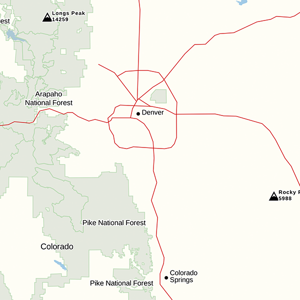
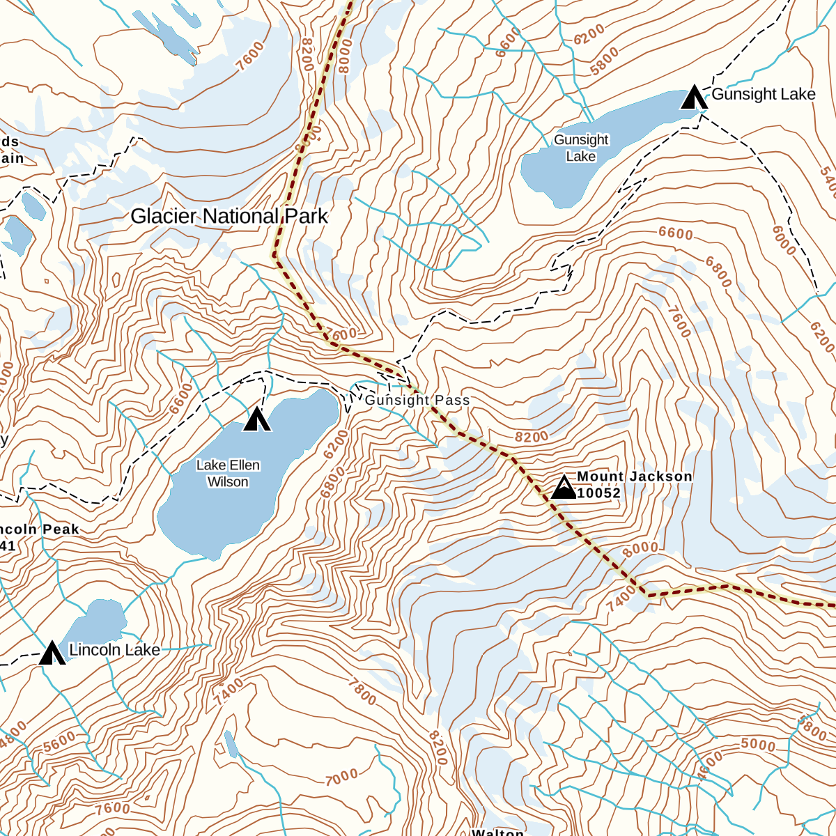
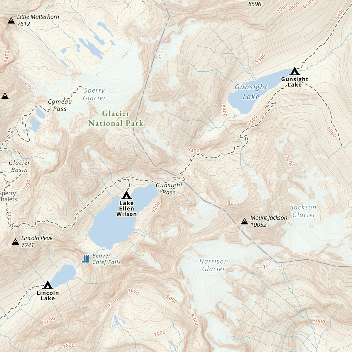
Smartphones are an excellent alternative to conventional GPS devices because they are lightweight and compact, and their large screens are ideal for viewing detailed topographic maps while using an app like Gaia GPS.

But, if you use a phone to navigate in the wild, you need to consider ways to conserve battery power so you don’t end up with a dead phone halfway through your hike. The tips in this post will allow most people to get several days, or even longer, of use from their phone in the backcountry. Having said that, it’s important to note that even if you’ve mastered battery conservation, you still must bring along a compass and paper map and the skills to use them. It only takes one unfortunate drop to leave you with a busted phone.

Download Offline Maps Before You Go

Downloading maps to your Gaia GPS app for offline use before you leave home is an essential step that allows you to use the app with your phone in airplane mode or in a location without cell coverage. With the maps downloaded on your phone, you’ll be able to use all of the functionality that Gaia GPS provides, even in the most remote of locations, far away from any cell tower. Learn how to download maps for offline use here.

Use Airplane Mode

After you’ve downloaded the maps to your phone, put your phone into airplane mode before you head out on your trek. This simple change will make a big difference in how long your battery lasts. Airplane mode will stop your phone from constantly trying to establish a network connection when you’re in an area with poor or no cell coverage. Airplane mode will not automatically disable WI-Fi or Bluetooth connectivity. Manually turn off those features in settings in your phone to save even more battery.

There’s a common misunderstanding out there that when your phone is in airplane mode, you won’t be able to use apps that rely on GPS. However, because your phone can still communicate with GPS satellites while in airplane mode, Gaia GPS works just as well on airplane mode as when you are connected to Wi-Fi or cell service, so long as you’ve downloaded maps ahead of time. Download your maps with a Gaia GPS Membership or Premium Membership.

Avoid Exposing Your Phone to Extreme Temperatures

Both hot and cold temperatures can have a dramatic effect on battery life, so it’s important to take steps to avoid extremes. Apple says that iPhones are designed to work well in temperatures between 32°F and 95°F, with the ideal range being 62°F to 72°F. If you’re going out backcountry skiing, you’ll have to find ways to keep your phone warm. Conversely, if you’re headed out hiking in the hot desert, you’ll need to keep your phone cool.

How to keep your phone warm: In below-freezing temps, use your body heat to help keep the phone warm. Keep your phone stashed in a pocket close to your body rather than in an exterior pocket or in your backpack. For extra warmth on especially chilly days, try keeping a small disposable handwarmer packet in the same pocket as your phone.

If your phone does get really cold, the battery level will plummet and the device may even power down. When this happens, try warming your phone up by placing it close to your body. Once the battery temperature warms, your phone should come back to life. If you need to charge your phone, wait until the battery is warm. Charging your phone while the battery is disabled from the cold will be ineffective and can potentially damage your battery.

How to keep your phone cool: Extreme heat can be tougher to solve for and more dangerous for the device than cold temperature exposure. In fact, high temperatures can permanently damage battery capacity, whereas the effects of cold are only temporary.

Prevent overheating by keeping your phone out of direct sunlight. You can also try removing the phone from its case, as cases tend to trap heat. Storing your phone deep inside the main compartment of your pack, wrapped up in gear and clothing, will typically insulate the phone from damaging heat. This leaves your phone fairly inaccessible, so it’s not a great option if you’re using your phone to navigate.

Two climbers review their route in Gaia GPS

Shut Down Apps You Don’t Need

Many apps sit dormant when they’re not in use and won’t drain your battery while they sit open in the background. But, some apps keep track of your location and/or refresh content in the background. Force close all the apps you don’t need during your outing to be sure there’s no background activity that will draw down your battery.

If you prefer to keep apps open, limit their ability to refresh in the background to help conserve battery life. To do this with an iPhone go to Settings > General > Background App Refresh, then tap Background App Refresh and select Off. This disables background activity for all apps. If you want to turn it off for individual apps, you can do so on the Background App Refresh menu. With an Android phone, you can restrict individual apps by going to Settings > Battery > More > Battery usage. There, you’ll see a list of apps with the percentage of battery used. For apps with high battery use, tap them and turn Background restriction on.

Customize Location Services

Do not turn off all location services as this will disable your connection with Gaia GPS. But for apps other than Gaia GPS that you want open during your trip, like your camera, you can reduce the demand on your battery by turning off location services. Of course, doing so may affect how well an app performs. With your camera, for example, turning off location services means location data won’t be recorded and you won’t be able to see where you took a particular photo. But, for many people, location data on photos is not a must-have feature.

Customize location services with an iPhone by going to Settings > Privacy > Location Services and scroll down to the apps listed as using location services. Go through and select “Never” on those apps you will open during your trip but won’t need location services for. With an Android phone, open your phone’s Settings, then tap “Location services” or “Location access” whichever your phone shows. From this screen you can customize location services for each app.

Lower Screen Brightness

A bright screen is one of the biggest drains on your phone’s battery. Dimming your screen can reduce the impact that your display has on battery life. Here are two ways to do it:

  • Manually adjust the brightness to the dimmest level that still allows you to see your maps. With an iPhone, open the Control Center and drag the slider with the sun symbol up and down or go to Settings > Display & Brightness and drag the slider left or right. With an Android phone, open your phone’s Settings app, then tap Display > Brightness level and move the slider. 
  • Turn on auto-brightness, which allows your screen to automatically adapt to the lighting, decreasing the brightness in dim conditions and increasing it in bright conditions. With an iPhone, go to Settings > Accessibility > Display & Text Size and turn Auto-Brightness on. With an Android phone, open your phone’s Settings app, then tap Display > Brightness level and turn on Adaptive brightness.

Consider Turning Your Phone Off When You Don’t Need It

Putting your phone in airplane mode and taking other battery-conserving measures will allow most phones to stay powered for several days without ever turning them off. But, if you really want to get the most out of your battery, then powering the phone down completely can be a wise move. That said, you need to consider how you use your device.

If you will be checking your phone regularly for navigation or to snap photos, then you should leave your phone on, because waking the phone up from sleep mode uses less power than turning the phone off and back on again. But, if you won’t be needing your phone for a few hours or more, such as when you’re hiking on an obvious trail that doesn’t require frequent map check-ins or when you’re sleeping at night, then powering the phone down completely will save battery power in the long run.

Bring a Backup Battery

Despite all your efforts to conserve battery power, it’s still possible that your phone will get low on juice. So, if you’ll be relying on your phone for navigation, you should always have a backup battery pack and the appropriate cable to be able to recharge your device.

February 8, 2023
47 FacebookTwitterLinkedinRedditEmail
Gaia GPS

Customize Your Maps with New Emoji Waypoints

by Mary Cochenour June 3, 2021
written by Mary Cochenour

New emoji waypoints are here! Now you can mark your favorite spots on the map with a ❤️, flag that campsite where you saw a 🐻, and add a💧 at every crucial water source along your route. Customize your waypoints in Gaia GPS using the hundreds of emoji symbols available on your phone, tablet, or computer.

It’s always been possible to customize the name and symbols of your waypoints in Gaia GPS. Now the new emoji waypoints give you almost endless possibilities to mark important places on the map. Whether you’re backpacking across the 🏜, hunting 🦌 on public land, camping 🏕 near a river, or skiing ⛷ and biking 🚲 through the mountains, emoji waypoints give you more options to add custom information to your maps.

Use Emoji Symbols to Add Custom Waypoints

emoji waypoints - say.png

Have you ever worked hard to get up to the top of a ridge and have been overcome by the view? Add a 😃 waypoint to the map to remember the joy you felt when you reached the summit. Use the 📷 emoji icon for waypoints in places with great views or to remember where you snapped photos on a trip. Flag weather conditions on the map to document which days you experienced ☔️ or ☀️ on your trip. Use emoji waypoints to mark hazards such as lightning, wind storms, and mountain snow.

How to Get Emoji Waypoints

Emoji waypoints are available to everyone on iOS, Android, and the web at www.gaiagps.com. Use emojis to customize waypoints on any map in Gaia GPS. Learn more about adding waypoints to the map in this step-by-step article from the Gaia GPS help center.

Customizing a waypoint with an emoji icon is easy. After adding a waypoint to the map, you can customize its appearance by selecting “Choose icon.” Tap the smiley face emoji in the icon menu to access your device’s emoji library. Search for and tap on the perfect emoji to customize the waypoint. Press “Save” after you’ve added the emoji icon.

You’ll need a Gaia GPS Premium Membership to download your custom waypoints and take them with you offline in places without cell service.

June 3, 2021
1 FacebookTwitterLinkedinRedditEmail
Gaia GPS

Gaia GPS Year in Review: CarPlay plus New Maps and Features for the Best Backcountry Navigation

by Mary Cochenour December 28, 2020
written by Mary Cochenour

Let’s face it, 2020 has been like a never-ending slog up a peak riddled with false summits. But as we round the ridge and see what’s on the other side of the pass, we’re reminded of how far we’ve come. Whether running on town trails or escaping for the weekend to the wilderness, Gaia GPS members recorded more tracks, downloaded more maps, and used the app to find their way in the backcountry more than ever before. Not even disrupted routines and cancelled plans stood in the way of exploring outside.

Our community’s collective energy, drive, and passion for the natural world motivated us to put our heads down and work harder to bring you new features and maps. From the little things, like making it easier to organize your saved routes, to bringing you more maps to stay safe during wildfire season, to the more technical feats of putting Gaia GPS on your dashboard screen with Apple CarPlay, we hope these advances brought you a little closer to the fresh air this year. Read on for a look at all the development highlights that you inspired us to create in 2020.

All-New Gaia Topo: Download Your Entire State Map

An iPhone screenshot of the Gaia Topo shows a swath of land ready to be downloaded.
Gaia Topo is so compact and optimized so you can easily download huge swaths of land in a single map.

Have you ever arrived at a trailhead only to realize that you forgot to download your digital maps to your phone? We now have a solution for you: Gaia Topo. We kicked off the year with a complete redesign of our worldwide flagship Gaia Topo, to bring you a map that is both easy to read and quick to download. In fact, it’s so fast that you can download your entire state— yes, the whole state — and never get caught without a topographic map again.

The new Gaia Topo is curated and constantly updated by our world class cartographer Lee France, who matched the map’s retooling and optimization with improvements in styling and design. The end result is an easy-to-read map that lets you download huge swaths of land in a snap — and without hogging up your phone’s precious storage space.

But that’s not all. Gaia Topo saw numerous additional improvements throughout the year. From introducing color-coded amenities symbols to making public lands easier to recognize, Gaia Topo is a living map that is consistently updated. In fact, you can expect an even newer version of this masterpiece in the months ahead.

Apple CarPlay: Navigate with Your Favorite Backcountry Maps on the Dashboard Screen

A car dashboard with Gaia GPS on Apple CarPlay shows turn-by-turn directions.
Pair Gaia GPS with Apple CarPlay to get-turn-by-turn directions as you navigate the backcountry.

No more squinting at your phone’s tiny screen when you navigate those bumpy backroads. We integrated Gaia GPS with Apple CarPlay this year to put trail maps right on your vehicle’s navigation screen. View all of your favorite Gaia GPS maps, from USFS Topo to MVUMs to National Geographic Trails Illustrated, with or without cell phone service. Plus, get turn-by-turn directions on off-grid adventures for any drivable, saved route.

Overlanders love CarPlay connectivity, which allows them to run Gaia GPS navigation on the dashboard screen alongside maps mounted to the dashboard with a tablet. CarPlay is useful to hikers and backpackers, too, for finding those lonely, out-of-the-way trailheads. Hook Gaia GPS up to CarPlay so you keep your eyes focused on the rugged road ahead.

New Maps: Check Out our Ever-Expanding Map Catalog

We love making new maps to help more people find their way outside. Okay, maybe this is a purely selfish endeavor. The Gaia GPS team likes to play in the backcountry, too. We’re a crew of day hikers, backpackers, trail runners, skiers, overlanders, hunters, bikepackers and climbers. Truth is, we like to make new maps so that we can use them ourselves. Some might say we went a little overboard with adding new maps this year during quarantine. Take a look at how we expanded our map catalog in 2020:

An iPhone screenshot shows a wildfire burning in the Wildfire (Satellite Detections) layer.
The Wildfire (Satellite Detections) layer shows you where wildfires are actively burning.

Wildfires Maps

Find wildfire hotspots with the new and free Wildfires (Satellite Detections) layer on Gaia GPS. This layer sources satellite data from NASA to show where wildfires are currently burning worldwide. Pair this layer with your favorite base map to plan re-routes around hot spots, predict likely trail closures, and stay safer during fire season. In response to the wildfires that ravaged the western US this summer and fall, we’re offering the Wildfire (Satellite Detections), Wildfire (Current) and Air Quality layers for free on both the app and on the web.

Avalanche Forecast Layer

We partnered with the experts at Avalanche.org to bring you the new Avalanche Forecast layer. Now you can get official, up-to-date avalanche forecasts for mountain zones in the U.S. directly from the map on your phone whenever you are online or connected to cell service. Get the avalanche danger rating and link to complete avalanche reports from professional snow safety scientists in your region. Whether you’re backcountry skiing the couloirs or snowmobiling into the back bowls, always check the complete avalanche forecast report before you head out the door. Available with a Premium membership.

Check out recent trail conditions using the FreshSat layers.

FreshSat

Examine trail conditions from the comfort of your couch using two new satellite imagery maps. FreshSat – Cloud Free shows mostly cloudless terrain. FreshSat – Recent shows as up-to-date imagery as possible. Both maps use satellite data from the Landsat-8 and Sentinel-2 government satellites, and are updated at least every 14 days. Available with a Premium membership.

Updated National Parks Maps

Gaia GPS offers an expansive collection of National Park Service maps for 45 national parks and recreation areas throughout the United States. Skip the paper map at the park entrance and view all park amenities, trailheads, and must-see stops right on your phone. Available with a Premium membership.

Gaia Streets

Not all adventures happen off the grid. Get your bearings in cities, towns, and on the road with the new Gaia Streets map. This map features more points of interest and amenity labels with less clutter, making it easy to pinpoint the places you want to go on the road. Use this map as a go-to for navigation and wayfinding through city downtowns, national park centers, and anywhere else the road takes you. Available with a Premium membership.

A desktop screenshot shows the overlapping native territories on the Native Land Territories map.
Discover which Indigenous nations call a place home using the Native Land Territories map.

Native Lands and Territories

The Native Land Territories map lets you learn more about the land you live and recreate on, plus make land acknowledgments. Created by the Canadian non-profit Native Land Digital, the Native Land Territories map marks traditional Indigenous territories across the Americas, Australia, New Zealand, and, increasingly, worldwide. Deepen your knowledge of home and the places you visit with the new Native Land Territories map.

Native Lands Digital and the Native Governance Center explain why and how you can make a land acknowledgment. To find out how to use the Native Land Territories map and deepen your knowledge even further, read Native Land Digital’s Teachers Guide. This map is available for free in the Gaia GPS app and web map.

USFS Roads and Trails

Find the best trails for hiking, biking, trail running, horseback riding, and off-roading with the color-coded USFS Roads and Trails layer in Gaia GPS. Whether you are wondering where to ride your mountain bike or looking to avoid areas that allow bikes and motor vehicles, this layer makes it easy to find the right trail for your adventure. Available with a Premium membership.

Two iPhone screenshots show cell phone coverage maps for AT&T and Verizon over the course of a route on the map.
Overlay the Cell Phone Coverage maps on your routes to find out where you will have cell phone service during your trip. AT&T displays in blue (left) and Verizon displays in red (right).

Cell Phone Coverage

Track where you can find cell service anywhere in the United States including Alaska, Hawaii, and Puerto Rico with the Cell Phone Coverage maps. You no longer need to worry about unexpectedly losing signal. These seven new overlays define where major cell phone carriers reach across the country. Available with a Premium membership.

Snow Stations (Daily)

No more trial-and-error in driving up to the trailhead to find the deepest and lightest powder. The new Snow Stations (Daily) map gives you up-to-date, 24-hour reports on snow conditions in remote areas around the western US and British Columbia. Check out the new map for real-time conditions on peaks and passes in your favorite backcountry zones. Available with a Premium membership.

A desktop screenshot shows the color variations for slope angles on the Avalanche Slope Angle map.
Use the Slope Angle-Avalanche Map to quickly and easy identify avalanche terrain.

Slope Angle

Identify avalanche terrain quicker and easier this winter with the new Slope Angle map. Designed in-house, this map expands our coverage globally and integrates high-resolution data to help make picking out steep slopes on the map a snap. Add the new slope angle layer to your favorite base map to help plan a safer route through the snow-bound backcountry. Available with a Premium membership.

Mines and Mineral Resources

Find over 300,000 mines, mills, and known mineral deposits with the new Mines and Mineral Resources map. Discover the history of old mining sites plus handy details about mine and mineral sites across the US and select regions around the world. Available with a Premium membership.

US Hydrography

Find water sources, identify river crossings, and get a better picture of any landscape with the new US Hydrography map. This layer shows more rivers, streams, lakes, and wetlands than any other map on Gaia GPS. Level up your favorite maps by pairing them with US hydrography for more precise and expanded coverage of bodies of water across the US. Available with a Premium membership.

USGS Streamflow and Gaia Fishing

Find a new favorite fishing spot or plan the perfect trip with two all-new interactive map layers. Get up-to-date streamflow and water temperature information from the new USGS Streamflow map. Plus, the brand new Gaia Fishing Map dials you in with boat access information and known fish species for select waterways in Montana and Oklahoma. Available with a Premium membership.

Nat Geo Baja California

The new National Geographic Baja California Maps on Gaia GPS now provide coverage of the Mexican states of Baja California and Baja California Sur. Find the best spots for surfing and sightseeing along the coast, or reach rugged peaks by following remote backroads. Available with a Premium membership.

New Zealand Topo

For those keen on a multi-sport adventure in New Zealand, Gaia GPS now offers detailed New Zealand topo maps of the North and South Islands. Beyond shores, Australia/NZ Nautical Chart maps provide coverage of surrounding islands and oceans. Available with a Premium membership.

Web Updates: The Most Powerful Planning Tools To Date

A desktop screenshot shows a route mapped out in Gaia GPS with campgrounds and waypoints along the way.
The new sidebar on gaiagps.com makes planning from your desktop a snap.

Planning and organizing your data on gaiagps.com is easier than ever thanks to several rounds of improvements throughout the year. Now, when you find a route or file from another website or source, you can import them directly to your Gaia GPS account with a single click. A new side bar houses all your saved map data, including tracks, waypoints, and areas. Plus you can create and measure areas and polygons on the big map with a new tool on the desktop. These improvements follow a complete revamp of gaiagps.com in 2019, and you can expect to see more improvements in the year to come.

Android and iOS App Updates: Easy and Efficient to Use

A tablet screenshot of Gaia Topo shows the peaks, campsites, and trails in Mount Rainer National Park.
Android users can now enjoy interactive map icons.

In 2020, our Android team tackled many highly requested updates and delivered the next generation of Android for Gaia GPS. Android users experienced faster downloading, interactive map icons, the all new Gaia Topo, and automatic updates. The updates didn’t stop there. More improvements brought a refreshed stats bar, better deletion, improved tablet navigation, and an overall smoother experience when using an Android device.

Save phone battery and see your maps at night using Dark Mode in the Gaia GPS app.

Dark Mode on iOS

Navigate at night with Dark Mode in the Gaia GPS app on iOS. This new development, which rolled out in the first quarter of 2020, lets you plan routes, research hikes, and navigate after sundown without straining your eyes or wasting device battery. Dark Mode inverts the traditional iOS color scheme, showing you light-colored text and icons on a dark background. The result is a beautiful new aesthetic that produces less ambient light and is easier on the eyes in low light situations. Give it a try.

2020 Stat Rewind

If you’re wondering just how far you’ve come this year, check out your yearly totals with Gaia GPS stat rewind. If you’ve recorded tracks this year, this page will tally your total trips, elevation climbed, and total mileage. It may be lights out for 2020, but it’s not too late to start planning to beat your numbers from this year. All you have to do is press the record button on all your upcoming adventures in 2021.

We’re excited to see how far the Gaia GPS community will go in the next year.

December 28, 2020
2 FacebookTwitterLinkedinRedditEmail
AndroidApp UpdatesGaia GPSNew Features

Android 2020.11: Improved Map Navigation on Your Phone and Tablet

by Julien Friedland December 9, 2020
written by Julien Friedland

The release of Android 2020.11 includes fresh updates to improve map viewing and navigation on your tablet and phone. Now you can navigate with all your trip details visible on your tablet, quickly view map legends across devices, and save photos from the app to your phone.

Learn about these new updates below and make sure you have the newest version of Gaia GPS by updating to 2020.11 in the Google Play Store.

Tablet Update: View Trip Details Right on the Map While You Navigate

Now you can view your trip, routes, and saved data on your Android tablet without losing your place on the map. When you’re headed offroad, view your distance, average speed, elevation and more alongside the map while you drive. Planning at home? You can also browse local trails and revisit old routes, all while viewing the map.

Try out this new map experience by holding your Android tablet in landscape mode (horizontally) to see the new sidebar on the left. This is where your trips, discover, saved and setting tabs now live. Navigate between the tabs to select a public track, view a saved route, check on your current trip details, or change your settings while you look at the map.

USGS map image on tablet with route and route stats showing

Easy to Use, Clutter-Free Map View

View Map Legends With a Few Taps

Now you can quickly identify a symbol, trail or any other icon on the map by viewing the map legend. Just tap the “i” icon on the bottom right corner of your screen then tap “view legend” for any active map source.

View Waypoint Clusters

Get a cleaner view of your map with new waypoint clusters. This new update gives you the option to group waypoints together, so you don’t have a mess of icons scattered across the map. Groups of waypoints appear as one waypoint as you zoom out to keep your map view clutter-free. Zoom in again to discover the individual waypoints in each area.

To turn on clustered waypoints, tap the settings icon in the bottom right corner of your device, select “map controls,” and then toggle on “clustered waypoints.”

Save Your Photos on the Trail Right to Your Phone

Gaia GPS for Android allows you to take photos in the app while you follow a route or record a track. Find a great spot for a campsite? Drop a waypoint, snap a photo, and remember it for your next visit. Now, Gaia GPS will automatically save the image to your phone’s photo gallery and in the app. This makes it easier to store, edit, and share your photos outside of the app so you can have a safe backup of any images you snap along your journey.

person holding there arms up to take a phone picture of a mountain range

How to Update to Version 2020.11

To update to version 2020.11, search for Gaia GPS in the Google Play Store. Tap the update button next to the app listing. If your app is up to date, you can open the app from here and explore by following along with the videos above.

December 9, 2020
3 FacebookTwitterLinkedinRedditEmail
AndroidApp UpdatesGaia GPS

Android 2020.5: Faster Deletion and Smoother Planning

by Julien Friedland May 9, 2020
written by Julien Friedland

The latest Android 2020.5 release includes a number of usability updates, making actions in the app more efficient and visuals more detailed. A refreshed stats bar and a number of fixes, like better deletion, add up to a smoother experience when using your Android device. After listening to your feedback, we’re excited to deliver Android 2020.5.

Update to version 2020.5 in the Play Store. Open the Play Store and check Gaia GPS has updated on your phone.

Save Time with Improved Deletion

After deleting an item, move on to your next task or close out of the app completely while the app works to delete the item. You’ll no longer have to wait for your item to delete or wonder if it deleted. Just tap delete and move on to your next task.

Completely Customize Your Stats Bar

The recently improved Stats Bar gives you the power to completely customize your map home screen. With a cleaner design and more versatility, the stats bar lets you decide exactly what trip details you want to see when you pull up the app. Choose from elevation, current speed, moving speed, average speed, ascent, sunrise/sunset, and more.

Quickly Find Campsites and Trails

Android users now have access to ‘tap to zoom’ so you can quickly zoom in on a recreation area of interest. Tap any group of amenities on Gaia Topo and discover campsites, trails, viewpoints, and other places you don’t want to miss.

View More Details for Your Saved Items and National Parks

Detail pages for saved items and national parks include more information with updated visuals. National parks and forests now display boundary lines so you can easily see where the parks begin and end. The newly designed waypoints and track detail pages provide more detail about the item, including coordinate points, elevation, and a view of your current map layer.

Android display of Yosemite National Park on Gaia GPS

Next Up for Gaia GPS on Android

Coming soon, Android users will be able to draw and measure areas on the map, by creating polygons. The polygon tool allows you to outline and save irregular shaped items on the map, and measure the perimeter. For example, you could trace the park boundaries pictured above and save the map data from just Yosemite National Park.

May 9, 2020
1 FacebookTwitterLinkedinRedditEmail
AndroidApp UpdatesGaia GPS

The Next Generation of Gaia GPS for Android

by Ashli Baldwin January 29, 2020
written by Ashli Baldwin

We built the Android release everyone has been waiting for, and it’s been a year in the making. The next generation of Gaia GPS for Android features crisp maps, fast downloads, smooth panning/scrolling, and the ability to interact with features on the map.

We consider this release foundational. It’s both a dramatic improvement the community will feel to the bones of the app, and it sets the stage for a longer laundry list of accumulated UX improvements, bugs, and new features that we’re going to deliver in 2020.

Thank you to everyone who participated in the huge round of beta testing leading up to this release. If you’d like to participate in future beta testing, sign up to be a beta tester.

Beautiful Map Display, Faster Downloads

Gaia Topo and several other sources now display as ‘vector’ maps. This improvement means labels stay crisp as you zoom in/out and enables faster scrolling, panning, zooming, and tilting.

The switch to vector maps also allows for drastically smaller map download sizes at impressive speeds. In testing Gaia Topo, we found that the state of Washington can be downloaded in fewer than 1000MB (perhaps as small as 500MB) and completes in less than 10 minutes — 10x smaller and faster than some other non-vector maps.

Interactive Map Icons

Tap icons directly on the map to get information about them. Learn about hikes, natural features, property boundaries, and other important landmarks.

Gaia Topo Gets a Slick Redesign

Perhaps the most visual change you’ll notice, the new Gaia Topo features a cleaner look and smarter labeling. You can read all about the newly updated Gaia Topo here.

tablet featuring new Gaia GPS map

Automatic Map Updates

Now, you’ll have the option to automatically update all of your map downloads for a particular source when it receives an update. No more deleting and re-downloading your public land maps every year. Anytime a map update is available, you’ll get a notification as soon as it’s live.

What’s Next for Gaia GPS Android

We’re excited about this update not only for the new maps, but also because it sets the stage for faster feature development in the future.

The Gaia GPS Android developer team remains small, but we’re still on the hunt for great software developers to join Gaia GPS. Check out our open job listings here: gaiagps.com/company/jobs

January 29, 2020
4 FacebookTwitterLinkedinRedditEmail
AndroidApp UpdatesGaia GPSHuntingiOSNew Maps

Easy to Read, Tiny to Download: The All New Gaia Topo

by Julien Friedland January 28, 2020
written by Julien Friedland

Today, we’re proud to announce the launch of one of our biggest projects yet. A combination of under-the-hood tech and visual design work, the all-new Gaia Topo combines world-class cartography with industry-leading download speeds and sizes.

Click here for instructions to access this map on iOS, the web, or in Android via the public beta.

  • Gaia Topo before
  • Gaia Topo after

World-Class Cartography

This project was driven by map-maker Lee France, who joined the Gaia GPS team this spring as the company’s first full-time cartographer. He brings over a decade of mapping experience to the new Gaia Topo, and early in his career, worked on some of the National Geographic Trails Illustrated Maps you can also access in Gaia GPS. You can read more about Lee’s background on the Gaia GPS team page.

The new Gaia Topo features a cleaner look and smarter labeling. That means it’s both easier to use and more beautiful to look at than ever before. We’ve tuned the map to the needs of many stripes of the outdoor adventurer. A new visual hierarchy system causes national and state parks, peaks, and campgrounds to appear first as you zoom in. We’ve also curated features and polished up the labeling system to improve information density. The result is a map that’s both more aesthetically pleasing and more efficient: It shows you exactly what you need at each zoom level without cluttering up your screen.

  • Water labels and contour line styling (before)
  • Water labels and contour line styling (now)
  • Road networks (before)
  • Road networks (after)

Road networks and main trails are now easier to find on the map. You’ll also find better hill-shading and toned-down landcover colors that don’t inhibit visibility.

Finally, we’ve improved contour line styling worldwide. Contour lines also appear sooner, making it easier to picture the terrain during large-scale route planning at low zoom levels. We also corrected a number of user-reported issues with the contour lines in various locations around the world.

Faster Downloads, Beautiful Rendering

With the new Gaia Topo, map downloads are faster and take up far less storage space, even though the new map has better data and styling.

To achieve that difference, we combed through all the data contained in Gaia Topo and eliminated redundant information, and did a neat trick to optimize how we packed each little map tile to be stored for offline use. This sort of optimization is something that defines R&D at Gaia GPS, and it’s what keeps our maps on the cutting edge of quality and download speed.

Download sizeDownload speed
AreaBefore updateAfter updateBefore updateAfter update
Yellowstone National Park63.8 MB28.8 MB1 min, 33 s33 s
Washington State1.34 GB470.8 MB28 min, 20 s9 min, 21 s
Great Smoky Mountains
National Park
42.2MB22.8 MB33 s24 s
Adirondack Park112.8 MB45.2 MB3 min, 19 s1 min, 8 s
Texas1.28 GB538.2 MB1 hr, 2 min20 min, 14 s

Comprehensive Geographic Information

The new Gaia Topo is more thorough and information-rich than ever before, thanks to an expanded roster of data sources. Gaia Topo pulls official government records, crowd-sourced OpenStreetMap information, and existing Gaia GPS data into a living map that constantly updates as new information becomes available.

In addition to comprehensive hiking and camping information, the new Gaia Topo highlights features specific to cyclists, thru-hikers, skiers, anglers, and other more niche categories of adventurer. You’ll find new icons for bicycle parking, ferry routes, beaches, dog parks, hot springs, forest service gates, fishing access points, and backcountry ski huts, to name a few. You can see all new icons in the Gaia Topo map legend.

We’ve also added more ski runs and cross country ski trails, styled to indicate trail difficulty. One-way trails are now marked with small arrow icons.

POI interest icons before the update(left) and after the update (right) ; Map data © OpenStreetMap contributors

How to Get the New Gaia Topo

Gaia Topo is the main map source in Gaia GPS, available to all Gaia GPS users—with or without a paid membership.

The new Gaia Topo is now available on iOS, the web, and in the latest beta test version of Gaia GPS for Android. To access it:

  • iOS: download the latest version of the Gaia GPS app for iOS
  • Android: download the latest version of the Gaia GPS app on Google Play
  • gaiagps.com – visit gaiagps.com/map.

If you had previously downloaded maps, you’ll see a notification offering to let you update your downloads.

Map data © OpenStreetMap contributors

January 28, 2020
4 FacebookTwitterLinkedinRedditEmail
AdventuresCompany NewsGaia GPS

Gaia GPS Welcomes 7 New Team Members

by Julien Friedland November 19, 2019
written by Julien Friedland

Today, we’re thrilled to introduce you to the seven newest members of the Gaia GPS team. Gaia GPS now includes 22 full-timers working on coding, design, cartography, marketing, and customer support, fully remote and distributed across the US.

It’s important that all the Gaia GPS team members are fueled by an adventurous spirit. As you’ll see below, these new folks have collectively amassed thousands of miles of exploration on foot, via bike, across open water, and in the saddle of an ATV. The team at Gaia GPS is an extension of the overall user community, and that helps keep the right focuses on new features, new maps, great user experience, and top-notch customer support.

These seven represent just the beginning of the company’s biggest round of expansion yet. If you’re interested in joining the team, click here to view our current openings and apply. We’re steadily hiring about 1 person per month.

Laura Friedland

Marketing Specialist

Favorite outdoor memory: I recently rode my bicycle from Medellín, Colombia, to the southern tip of Chile. Of the hundreds of sunsets along the way, my favorite was in Bolivia, on Salar de Uyuni—the biggest salt flat in the world. The only issue was the ~40mph winds. After three days on the salt flat, all my tent stakes were bent in half!

Proudest professional accomplishment: I teamed up with Katadyn USA and William Woodward (@wheretowillie) to create a short film about access to clean drinking water in the outdoors.

Recipe for the perfect s’more: It’s all about how you get the marshmallow off the stick. You have to clamp your stick between your knees and use two hands to sandwich the mallow between your graham crackers and chocolate. Then, you seamlessly twist the mallow off the stick into a perfect s’more. It’s a clean job every time.

Peter Liu

Software Engineer III

Favorite outdoor memory: At Þingvellir in Iceland, I walked between these two short cliffs. Turns out it was where the Eurasian and North American tectonic plates meet, and one of the only parts of that not underwater.

Proudest professional accomplishment? A few years back I built an app to help low-income housing seekers explore new neighborhoods and presented it at the Obama White House.

Recipe for the perfect s’more: I’m pretty impatient so I just eat the marshmallows raw. Like a peasant.

Melanie Wilson

Customer Support Specialist

Favorite outdoor memory: My first solo backpacking trip sleeping on the banks of Loch Avon in the Cairngorm Mountains in Scotland.

Proudest professional accomplishment:
In my previous job as a librarian, I launched a collection of circulating hotspots and tablets. This collection helped reduced the negative impact of the digital divide in Lake County, Ohio, and it allowed students without internet access to complete schoolwork at home.

Recipe for the perfect s’more:
I like a s’more with a little spice so instead of the standard Hershey’s chocolate I add chocolate with chilies.

Matt Palmer

UX/UI Designer


Favorite outdoor memory:
A 1.5-week, self-supported bikepacking trip from Orange County, California, to Hetch Hetchy, mostly following the California Aqueduct. I had to lift my 80 pounds of bike and gear over about 80 gates, but it was worth it.

Proudest professional accomplishment: As a passion project during my time at ESRI, a friend and I collected anonymous Strava data to discover places where people were stopping on-trail. Land managers could then look at the data and identify those places as spots in need of better signage, benches for resting, or trail maintenance to fix obstacles.

Recipe for the perfect s’more:
On my list to try: Some spicy cayenne dark chocolate and a cinnamon graham combo.

Adam Tootle

Software Engineer II

Favorite outdoor memory: As an anniversary gift, my wife surprised me during a trip to Mexico with an ATV tour through the Baja California Desert. None of the other scheduled riders showed up, so we ended up with a private tour. It was an amazing experience.

Proudest professional accomplishment: In the years I worked on health and wellness products, I loved receiving feedback from people who had just hit a new personal record for daily steps, or just trained for their first marathon. Building tools to help people improve their health and potentially live longer is something I’ll always be proud of.

Recipe for the perfect s’more:
The only thing I’m a stickler about is how roasted the marshmallow is. Never let the marshmallow catch on fire. You have to know how to get the marshmallow right up to catch-fire level without going too far.

Jay Crooker

Customer Support Specialist


Favorite outdoor memory:
Qualifying for (and competing in) the Ironman Triathlon World Championships in Kona, Hawai’i, in 1997.

Proudest professional accomplishment: Surviving my doctoral defense for my PhD in Analytical Chemistry.

Recipe for the perfect s’more:
Heath Bar instead of chocolate. You’re welcome.

Jim Margolis

Customer Support Specialist

Favorite outdoor memory: I climbed Pingora, a peak in Wyoming’s Wind River Range, with my mother and the Grand Teton with my father. I’m close with my parents, and those adventures have been very special to me.

Proudest professional accomplishment: I’ve spent over 150 field weeks as an instructor at NOLS (National Outdoor Leadership School) teaching climbing, mountaineering, winter, and backpacking courses.

Recipe for the perfect s’more:
I put the marshmallow on a stick and prop it about six inches from the fire until it browns. While I’m waiting, I put the chocolate on a graham cracker nearby to melt it. Once the marshmallow is ready, I use the two grahams to pull it off the stick. Really the only advanced thing I do is stuff the whole thing in my mouth at once!


Learn more about Gaia GPS’s newest employees and meet the rest of our team at gaiagps.com/company.

Still Hiring—Apply Today!

Gaia GPS is still growing. If you’re smart, motivated, and passionate about the outdoors, consider applying for a career focused on getting more people outside, and helping them stay safer every time they do. Keep an eye on the latest job postings at the Gaia GPS careers page.

November 19, 2019
0 FacebookTwitterLinkedinRedditEmail
female hiker using Gaia GPS on Android phone to navigate the trail.
AndroidApp UpdatesGaia GPS

Advanced Trail and Park Search in Gaia GPS Android Update v7.0.8

by Robyn Martin July 6, 2018
written by Robyn Martin

Hat tip this week to Andy Crampton, who joined Gaia GPS just a few weeks ago, and has already shipped a splendid Android update.

The new version (7.0.8) brings Gaia Search to Android, vastly improving search, and bringing Android in alignment with gaiagps.com and the iOS app. Andy also nailed a couple of the top bugs we’ve seen in logs and reports, so this release should be a big boon to almost everyone.

We’re expecting an accelerated ongoing Android development schedule now!

Search with Ease

Gaia GPS for Android now suggests locations as you search and marks results with descriptive icons for trails, peaks, forests, and more. Searches show a vastly improved list of possible points of interest, meticulously filtered to give more accurate suggestions. Fine-tune your selection with subtitles for each result denoting specific locale – designed to help when there are multiple results with the same name.

You may have already seen this new search capability in action on gaiagps.com or in Gaia GPS on iOS. Now that all three platforms are aligned expect to see continuous improvements to the search results you receive.

Gaia GPS for Android now suggests locations as you search and marks results with descriptive icons for trails, peaks, forests, and more.

Tap a search suggestion to be taken there on the map. The app will automatically mark a temporary pin at the location.

Gaia GPS app will automatically mark a temporary pin at the location.

Behind the Scenes

Among various usability improvements, this update relieves a sometimes slow or unresponsive ‘Saved’ menu — one of the most-common in-app freezes experienced by users. Now open saved tracks, waypoints, and routes without hesitation.

Also notable – GPX file imports are now more reliable, and we fixed an issue where the password reset button wouldn’t work.

Disable Analytics

We respect user privacy and now include an option to disable analytics. Shared analytics, diagnostics, and usage information allow us to make informed decisions about how to improve the app. You can opt-out of this setting in the app under Settings > Other.

Support and Feedback

Anyone can download or update to the latest version of Gaia GPS for free.Google Play Store button for Gaia GPSIf you like the update, spread the word by leaving a review.

Want to give more in-depth feedback? Send a note to support@gaiagps.com.

July 6, 2018
0 FacebookTwitterLinkedinRedditEmail
App UpdatesCompany NewsGaia GPS

New Year, New Gaia GPS for Android

by Nathan Copeland December 18, 2017
written by Nathan Copeland

With the closing of 2017, the beginning of a new year also brings the next generation of Gaia GPS for Android. The v7.0 update for Gaia GPS includes shared folders and a completely redesigned interface. Gaia GPS v7.0 also brings an overall upgrade in performance speed and syncing with gaiagps.com.

Shared Folders

Going on a group trip or use Gaia GPS as an organization? Check out the new shared folders feature to create a folder that everyone can access or add waypoints, maps, or routes too.

Groups or organizations ranging from two to 100+ Gaia GPS users can receive real-time updates to the shared folders with an internet connection. When creating a shared folder, you have complete control over who can edit and who can only read the data.

Gaia GPS v7.0 shared folder settings

Follow these steps to convert any of your existing folders into a shared folder:

  1. Download or update to Gaia GPS v7.0 from the Google Play Store
  2. Head to the Saved tab in Gaia GPS
  3. Pick a folder you want to share
  4. Tap the   icon
  5. Tap the “+” icon next to Authorized Users to invite users to your folder
  6. Enter the email address for who you want to share folder access with

People with “Edit” access to the folder will be able to add data directly to the folder, and the data will automatically be shared with your device.


Streamlined Interface

At first glance, you will notice the updated user interface which gives easy access to the main map, track recording, any saved data and the settings menu from anywhere in Gaia GPS.

Gaia GPS v7.0’s new menu bars


The redesign Saved menu also offers a quick and easy option to filter your data by type.

View all of your saved data or filter the Saved menu and only view your waypoints.


All of the great Gaia GPS tools like adding waypoints, creating routes, and downloading offline maps have been surfaced for quick access.

The new Create menu gives easy access to all of the tools you need for your next trip.


Try it For Free Today

Anyone can download or update to the latest version of Gaia GPS for free.


December 18, 2017
0 FacebookTwitterLinkedinRedditEmail
Load More Posts

Categories

  • Adventures
  • Android
  • App Comparisons
  • App Updates
  • Backcountry Skiing
  • Boating
  • Company News
  • Emergency Response
  • Featured
  • Fishing
  • Gaia GPS
  • Gaia GPS Offroad Podcast
  • GaiaCloud
  • Hikes
  • How-To
  • Hunting
  • iOS
  • New Features
  • New Maps
  • Newsletter
  • Offroading
  • Out and Back Podcast
  • User Profiles

Recent Posts

  • The Hike Map That Broke Me: How Gaia GPS Turned an Overlander Into a Reluctant Hiker
  • A Fond Farewell to National Geographic Maps — And a Look at What’s Ahead
  • Introducing the Gaia Hike Map: Your Trail-Ready Adventure Buddy
  • Download the app and get a free 14-day trial of Gaia GPS Premium
    • Facebook
    • Twitter
    • Instagram
    • Youtube
    • RSS
    • Explore The Map
    • Get the App
    • Upgrade Today
    • Explore The Map Catalog
    • New Features
      • Gaia GPS

        The Hike Map That Broke Me: How Gaia…

        April 24, 2025

        Gaia GPS

        Introducing the Gaia Hike Map: Your Trail-Ready Adventure…

        March 18, 2025

        Gaia GPS

        Unlock a New Level of Personalization in Gaia…

        December 12, 2024

        Gaia GPS

        Goodbye Clutter, Hello Streamlined Maps: Introducing Sync to…

        November 26, 2024

        Gaia GPS

        Discover Prime Stargazing Locations with Our New Light…

        August 15, 2024

        Gaia GPS

        2023 Mapped: Our Best New Features of the…

        December 27, 2023

        Gaia GPS

        Discover Adventure Easier Than Ever with New Map…

        July 27, 2023

      • New Maps
        • Gaia GPS

          Discover Prime Stargazing Locations with Our New Light…

          August 15, 2024

          Gaia GPS

          Find Prime Viewing for Total Solar Eclipse with…

          March 27, 2024

          Gaia GPS

          See the World More Clearly with New Gaia…

          May 18, 2023

          Gaia GPS

          Gaia Classic: The Only Map You’ll Ever Need?

          May 4, 2023

          Gaia GPS

          Why NatGeo Trails Illustrated are America’s Favorite Maps

          February 9, 2023

          Backcountry Skiing

          Find Backcountry Skiing in Gaia Winter Map

          January 11, 2023

          Gaia GPS

          Our Favorite New Maps and Features

          December 23, 2022

    • Activities
      • Backcountry Skiing
      • Boating
      • Emergency Response
      • Fishing
      • Offroading
    • Adventures
      • User Stories
    • Help

    @2024 - All Right Reserved. Gaia GPS


    Back To Top