Gaia GPS
  • Explore The Map
  • Get the App
  • Upgrade Today
  • Explore The Map Catalog
  • New Features
    • Gaia GPS

      The Hike Map That Broke Me: How Gaia…

      April 24, 2025

      Gaia GPS

      Introducing the Gaia Hike Map: Plan Your Hike,…

      March 18, 2025

      Gaia GPS

      Unlock a New Level of Personalization in Gaia…

      December 12, 2024

      Gaia GPS

      Goodbye Clutter, Hello Streamlined Maps: Introducing Sync to…

      November 26, 2024

      Gaia GPS

      Discover Prime Stargazing Locations with Our New Light…

      August 15, 2024

      Gaia GPS

      2023 Mapped: Our Best New Features of the…

      December 27, 2023

      Gaia GPS

      Discover Adventure Easier Than Ever with New Map…

      July 27, 2023

    • New Maps
      • Gaia GPS

        Introducing the Gaia Hike Map: Plan Your Hike,…

        March 18, 2025

        Gaia GPS

        Discover Prime Stargazing Locations with Our New Light…

        August 15, 2024

        Gaia GPS

        Find Prime Viewing for Total Solar Eclipse with…

        March 27, 2024

        Gaia GPS

        See the World More Clearly with New Gaia…

        May 18, 2023

        Gaia GPS

        Gaia Classic: The Only Map You’ll Ever Need?

        May 4, 2023

        Backcountry Skiing

        Find Backcountry Skiing in Gaia Winter Map

        January 11, 2023

        Gaia GPS

        Our Favorite New Maps and Features

        December 23, 2022

  • Activities
    • Backcountry Skiing
    • Boating
    • Emergency Response
    • Fishing
    • Offroading
  • Adventures
    • User Stories
  • Help
Top Posts
Trip Report: A Rider’s Guide to Bikepacking in...
How to Hike a Colorado 14er: A Step-by-Step...
Trip Report: A Rider’s Guide to link Boulder...
Trip Report: A Rider’s Guide to the South...
Battling the Wind: Setting Your Shocks to Firm...
The Hike Map That Broke Me: How Gaia...
A Fond Farewell to National Geographic Maps —...
Introducing the Gaia Hike Map: Plan Your Hike,...
Download the app and get a free 14-day...
Gaia GPS is Improving Satellite Imagery: Saying Goodbye...
Gaia GPS
  • Explore The Map
  • Get the App
  • Upgrade Today
  • Explore The Map Catalog
  • New Features
    • Gaia GPS

      The Hike Map That Broke Me: How Gaia…

      April 24, 2025

      Gaia GPS

      Introducing the Gaia Hike Map: Plan Your Hike,…

      March 18, 2025

      Gaia GPS

      Unlock a New Level of Personalization in Gaia…

      December 12, 2024

      Gaia GPS

      Goodbye Clutter, Hello Streamlined Maps: Introducing Sync to…

      November 26, 2024

      Gaia GPS

      Discover Prime Stargazing Locations with Our New Light…

      August 15, 2024

      Gaia GPS

      2023 Mapped: Our Best New Features of the…

      December 27, 2023

      Gaia GPS

      Discover Adventure Easier Than Ever with New Map…

      July 27, 2023

    • New Maps
      • Gaia GPS

        Introducing the Gaia Hike Map: Plan Your Hike,…

        March 18, 2025

        Gaia GPS

        Discover Prime Stargazing Locations with Our New Light…

        August 15, 2024

        Gaia GPS

        Find Prime Viewing for Total Solar Eclipse with…

        March 27, 2024

        Gaia GPS

        See the World More Clearly with New Gaia…

        May 18, 2023

        Gaia GPS

        Gaia Classic: The Only Map You’ll Ever Need?

        May 4, 2023

        Backcountry Skiing

        Find Backcountry Skiing in Gaia Winter Map

        January 11, 2023

        Gaia GPS

        Our Favorite New Maps and Features

        December 23, 2022

  • Activities
    • Backcountry Skiing
    • Boating
    • Emergency Response
    • Fishing
    • Offroading
  • Adventures
    • User Stories
  • Help
Tag:

Gaia GPS

Gaia GPSHow-ToOffroading

How to Get Started Overlanding

by Bryan Rogala January 9, 2023
written by Bryan Rogala

Image Credit: 4X Overland Adventures

Overlanding has taken the outdoor industry by storm in the last few years. If you’re unfamiliar, it’s a term used to describe vehicle-based travel that typically involves dirt roads, four wheel drive, and getting as far off the beaten path as possible. Overland Journal, the longtime authority on the subject in the U.S., describes the pastime as “self-reliant adventure travel to remote destinations where the journey is the primary goal.”

Think of it as backpacking with a 4×4. Overlanding originated in Australia and Africa and can involve anything from driving the Pan American Highway in a Volkswagen Syncro, to circumnavigating Africa in a Jeep Wrangler, to an overnighter at a dispersed campsite on a local Forest Service road. While the method of transportation plays a role, more than anything overlanding is about the journey and the experience along the way. Anyone can do it with some basic knowledge, a mechanically sound vehicle, and a thirst for adventure.

In this article, we’ll cover what an overlanding route looks like, along with the type of vehicle and equipment you’ll need, and some tips for getting started. Here’s what you need to know to get into overlanding.

What an Overlanding Route Looks Like

Overlanding routes vary greatly in terrain and difficulty, a lot of which depends on where they are located. Routes in the Western U.S. tend to be longer and more remote, and can involve high mountain passes, vast swaths of empty desert, or long stretches of rough roads. Routes in the Eastern U.S. are typically shorter in length but can be tighter and trickier to navigate with a large vehicle.

An overlanding route planned using the Gaia Overland map in Gaia GPS.

If you’ve ever driven a vehicle off road, you likely already know what type of obstacles to expect. Rough dirt roads, washboard, deep ruts, stream crossings, sandy washes, mud, loose hill climbs, tight switchbacks, and even snow are all common road conditions you might encounter. That being said, overlanding differs from four wheeling, rock crawling, and other forms of off-roading because it takes place for an extended period of time, includes driving on pavement, and typically doesn’t involve “extreme” obstacles like you might see a Jeep Wrangler tackling in Moab.

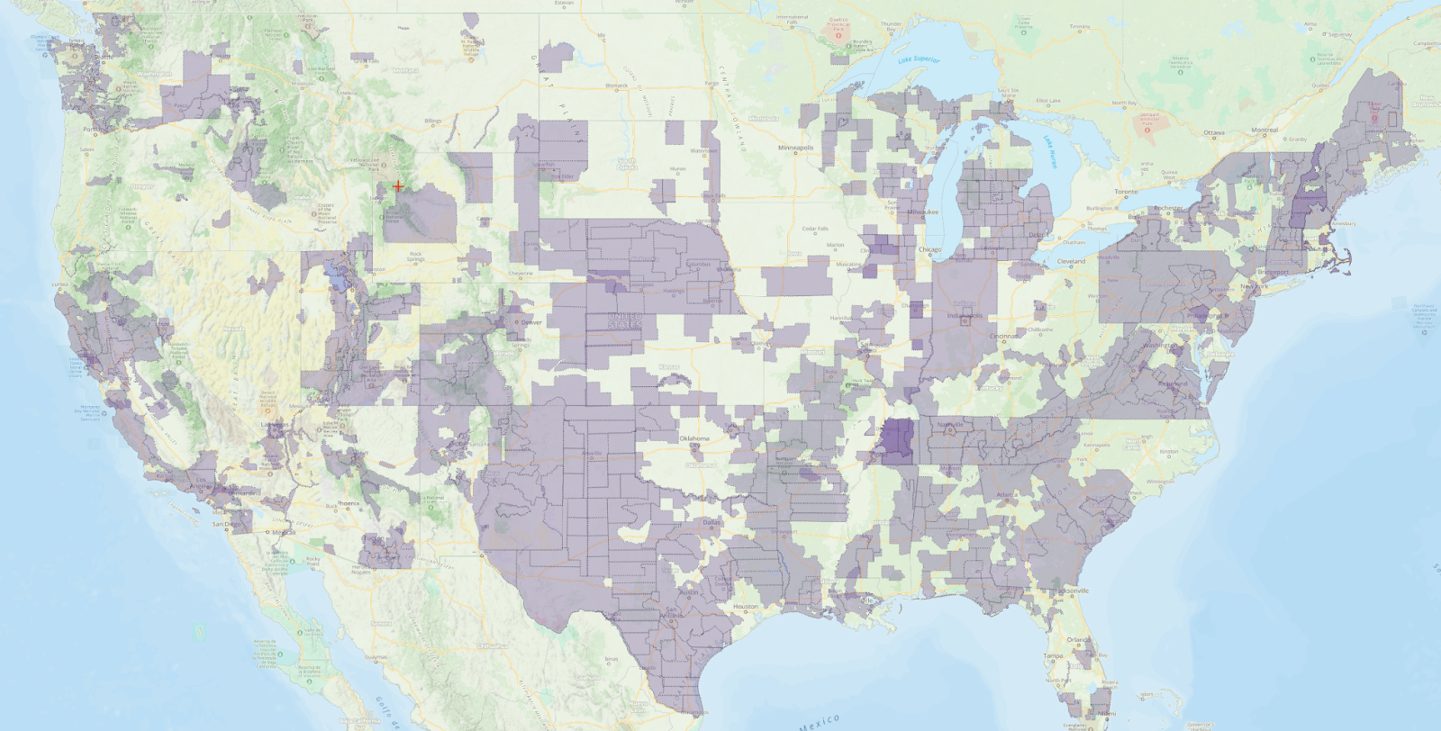
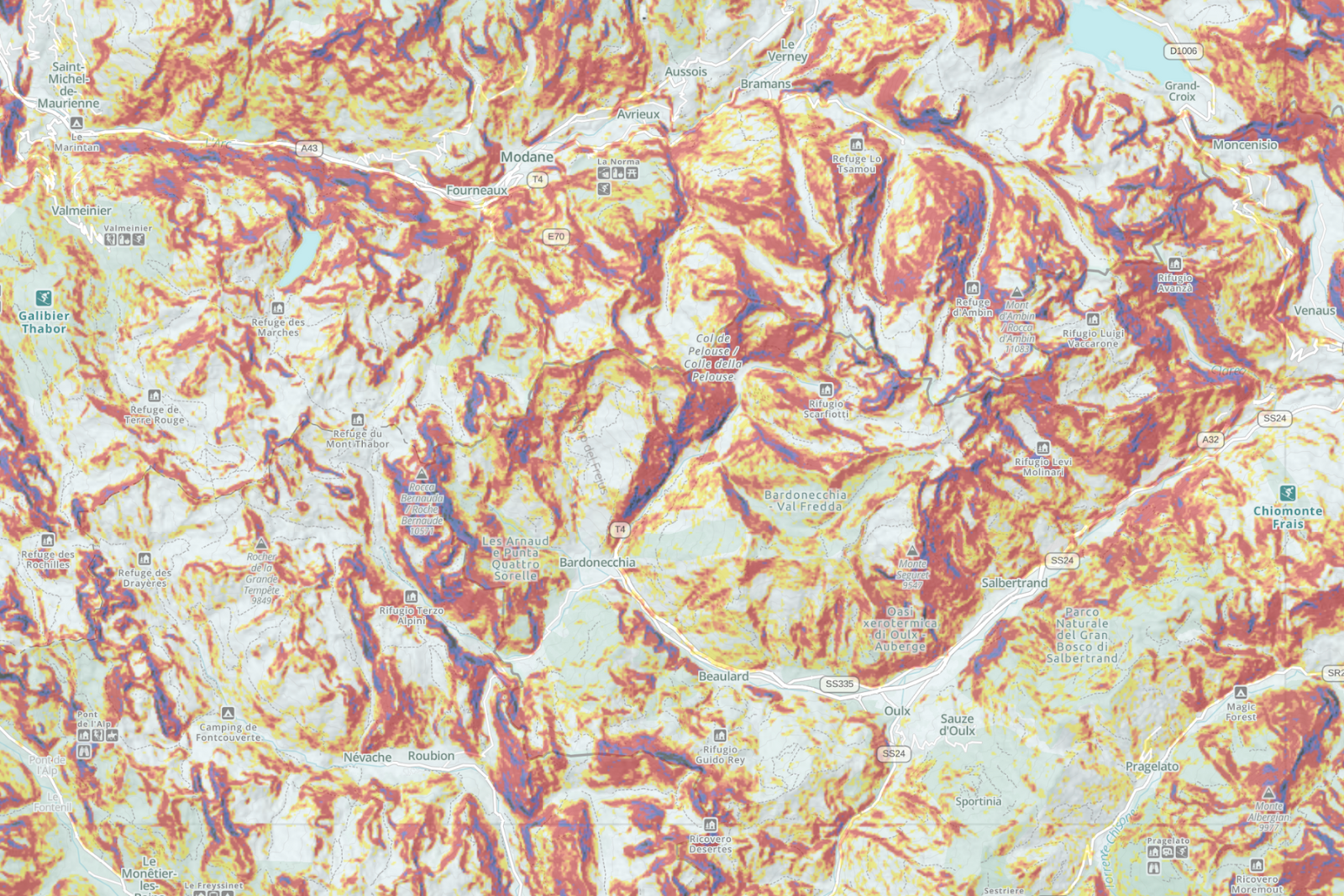
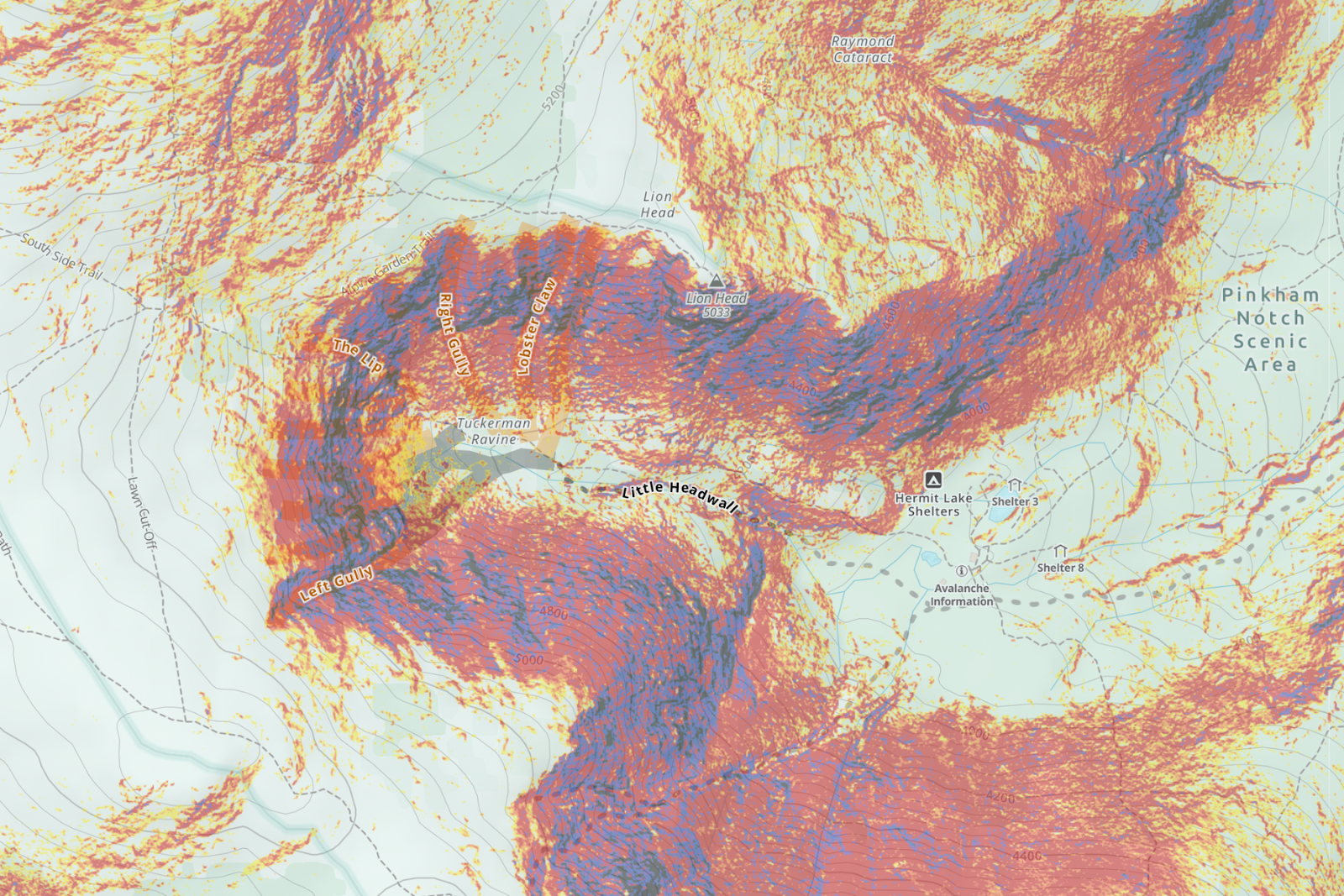
Overlanding draws you to remote, uninhabited places to enjoy the scenery and solitude, and you’ll need maps to find your way. Gaia GPS offers a catalog of off road and 4×4 maps that show you what kind of terrain you’ll encounter and how difficult your route will be. You can download the maps for offline use with a premium subscription and use them out on the trail, which is far more useful than just a paper map. Toggling between Gaia’s proprietary Gaia Overland map, NatGeo Trails Illustrated map, the MVUM (USFS) (US Forest Service Motor Vehicle Use Map), the USFS Roads and Trails Map, and Gaia Topo layers gives you on-demand access to trail junctions, road conditions and closures, dispersed camping sites and terrain features. Using these at home on a desktop helps with route planning, and then using them offline on a phone helps with navigation in the field and allows you to deal with unexpected route changes, like deadfall across a road or another impassable obstacle.

Tread Lightly, Stay on Established Roads

The USFS MVUM and Roads and Trails Maps are indispensable because they also have notes on road closures and status, grade, road material, and even whether a road is passable in a passenger car or requires high-clearance and four-wheel drive. It’s also important to stay on legal roads—driving off-road doesn’t mean pointing your truck into the woods and creating your own path, it just means driving off pavement, on a dirt road. The key here is that you’re still driving on a legal road of some kind, and it’s important to follow Leave No Trace principles and guidelines for responsible 4×4 use from Tread Lightly.

Vehicle Considerations

The vehicle you drive plays the largest role in an overlanding trip. It will act as your home base, and needs to be comfortable both on and off pavement. While you can technically overland with whatever vehicle you’ve already got, there are some things most overland rigs have in common.

Four Wheel Drive Versus All Wheel Drive

First, you’re going to want four wheel drive, or at the very least, all wheel drive. Traditional four-wheel-drive vehicles have a transfer case that allows the driver to send power to both the front and rear wheels, and the power is typically split 50/50. Four-wheel-drive trucks and SUVs, like a Toyota Tacoma, let you select from a high or low range, the latter of which increases torque, helps you navigate steep hills, and generally puts more power to the wheels. Overlanders prefer true four wheel drive for a number of reasons, but mainly because it’s more capable off road than all wheel drive.

A Subaru Outback negotiates a stream running through a field.

All wheel drive, like what you find in a Subaru Outback, automatically sends power to whichever wheel has lost traction, and typically doesn’t split the power evenly between the front and rear wheels. This type of system works well on icy or wet pavement, and can certainly get you down a dirt road, but it’s not as robust and doesn’t work as well in the serious off-road situations many overlanders face. Learn more on the differences between four and all wheel drive.

Ground Clearance

Another important consideration is your vehicle’s ground clearance. Most passenger cars and some crossovers don’t have enough clearance to safely navigate rocks and ruts off road. Subaru’s Outback and Forester have 8.7 inches of ground clearance, which is plenty for most situations, while a Toyota Tacoma has 9.4 inches and a Jeep Wrangler Rubicon has 10.8 inches.

Storage Space

An SUV with a roof rack is parked on a beach at sunset.

Storage space and payload capacity are also particularly important for an overland rig since you’ll be camping and need to be fully self-sufficient for the duration of your trip. Smaller SUVs like a Jeep Wrangler are great for rock crawling and general trail riding, but their limited interior size and small payload doesn’t make them particularly well-suited to overlanding. A full-size truck, or a larger, truck-based SUV like a Toyota Land Cruiser often works better because you can load it up with gear and it is rated to carry heavier loads. It’s very easy to exceed your vehicle’s payload capacity once you include the weight of passengers, gear, and any accessories like roof racks, rooftop tents, or a winch, which can impact the vehicle’s drivability and safety. Longer trips also often require bringing spare parts since you’ll be far away from help, so having lots of storage space is always a good idea.

Accessories and How to Use the Rig You’ve Got

If you spend much time around the overlanding crowd you’ll quickly realize that outfitting your rig with aftermarket parts and accessories in order to make it more capable and comfortable is extremely popular. Things like heavy-duty off road bumpers, skid plates, winches, additional off-road lighting, as well as suspension lifts and locking differentials are all popular upgrades. If you already own a vehicle that would make a good candidate for an overlander, upgrades like that can be a good way to protect your vehicle from damage and ensure that you can make it further into the backcountry.

How to Upgrade the Vehicle You Already Own

You can make your vehicle more off-road worthy with a few simple upgrades, no matter what you drive. Tires are the most important modification you can make to a vehicle if you want to drive off road because they provide your vehicle’s traction. A tricked-out 4×4 won’t get very far if it’s rolling on street tires without an aggressive tread pattern. All-terrain tires are a good choice for most overlanders because they offer a mix of on-and-off road performance. The BFGoodrich T/A KO2 gives you great traction in dirt, mud, and snow, and is still quiet and comfortable on pavement. If you want to try overlanding in your crossover or smaller SUV, you should consider something like the Falken Wildpeak A/T Trail. This tire weighs less than the KO2, but still provides improved off-road traction and is a better fit for something smaller like a Subaru or Toyota Rav4.

A close-up of a vehicle with flat tire on a dirt road.

You can’t do anything to increase a vehicle’s payload capacity, but you can increase storage space by adding a roof rack. You don’t want to strap too much stuff on top of your vehicle because you’ll increase the center of gravity and have a greater rollover risk, but a good roof rack like Frontrunner’s Slimline II will allow you to easily carry gear you can’t fit inside the car. You can also bolt on accessories like bike, ski, or kayak carriers, mount a storage box on top, or carry a rooftop tent and an awning to protect you from the elements.

Two people sit outside a van parked at sunset.

The Equipment You’ll Need

It’s very easy to overthink what type of gear to bring and how much of it you’ll need on an overland trip. In this article, we’ll cover just the basics to get you started; just keep in mind that you can acquire a lot of this equipment over time as you learn what your needs are and how your vehicle performs.

Sleeping: Rooftop Tents

People stand around a bonfire at night with a flock of jeeps parked in the background.

Essentially an off-the-beaten-path road trip, overlanding brings you to dirt roads where you camp along the way. You’ll need to decide where you’ll sleep. The easiest and cheapest option is to simply use a tent. Many overlanders with larger SUV’s (or pickup trucks with a camper shell) choose to sleep inside their vehicle to keep things simple. This offers more weather protection than a tent, but you need a vehicle with a bed or seats that fold flat. Sleeping inside the vehicle becomes more complicated for two people traveling together since you’ll need to move all of your gear outside the vehicle to create enough space for sleeping at night.

A jeep with a roof tent is parked in the desert. Off to the side, two people sit in camp chairs around a fire, gazing at the sun setting behind the mountains in the distance.

Many people opt to sleep on top of their vehicles in rooftop tents. Rooftop tents (or RTTs) attach to your vehicle’s roof rack and either have hard sides that pop straight up, or soft sides that fold out into a traditional tent shape. RTTs have a couple of advantages: they eliminate the need for a flat piece of ground free of rocks and offer a comfortable memory foam mattress where you can store your sleeping bags. They’re also quicker to set up than a ground tent, which is something overlanders value because it allows you to spend less time setting up camp and more time exploring and enjoying time outside. The downside is they’re quite heavy (usually around 150lbs), and they can negatively impact your vehicle’s fuel economy.

Campers

A modified truck with a storage unit in the back and a rooftop tent is parked at a beach on a sunny day. Turquoise water laps behind and stratocumulus clouds cover the blue sky.

The next step up from a ground tent or rooftop tent is either a camper of some sort built into your vehicle, or pulling a camping trailer. There are pros and cons to every option, and ultimately you’ll have to weigh factors like convenience, comfort, and budget to determine the best solution for you. A self-contained camper performs better off road, and allows you to maneuver in tight spots more easily. It’s also easier to park and drive around town, but it’s easy to overload your vehicle and exceed it’s payload capacity if your build is too heavy, which can be dangerous.

Trailers

A truck with a covered back and a trailer hitch drives across dry, grassy plains with mountains in the distance.

A camping trailer, can store all of your camping equipment full-time, making it easier to hit the road since you won’t need to pack your vehicle each time. But it takes more skill to maneuver a trailer on technical trails. Some trailers, like Hiker Trailer’s Extreme Off Road Deluxe model, are overland-specific and have modified suspension systems that make them incredibly capable off-road. Trailers also allow you to unhitch and create a base camp, so you can use your tow vehicle to run into town for supplies, or drive to a trailhead without breaking down camp. Some trailers like Off Grid Trailers even include kitchen components, a shower, and ample sleeping space. However you choose to camp, the key is to keep your setup as simple as possible and make it easy to access your gear and break down camp to continue your trip.

Basic Camping Equipment

Chances are you already own all of the camping gear you’ll need. Overlanding doesn’t require any specialized camping gear, but the beauty of camping out of your rig is that you can afford to bring heavier stuff, like thick sleeping pads, blankets, and camp tables to make your experience more comfortable. Two things to consider are how you’ll be storing food and water. If you’re going out for a long weekend and won’t have access to more drinking water, you should bring at least seven gallons with you. That will ensure you and your trip mates have enough water to drink, do dishes, and rinse things off. Some people like to have access to a shower while overlanding, which can be easily done with something like a RoadShower. You can even make your own solar shower if you’re so inclined.

An overlander sits in a camping chair, tending to scrambled eggs in a skillet on a two-burner portable stove. Vegetables sauté in the a pan on the other skillet. A pack of sausages sit on a cooler in the foreground.

Food Storage

Someone stands with their back to the camera. They work on a laptop placed on a standing desk, which faces out of the back of a built-out van.

Coolers work perfectly fine to store food that needs to be refrigerated, but a popular upgrade for overlanders is an electric cooler. You can power one from your vehicle or a portable battery, and they’re particularly nice for overlanding because you won’t need to worry about melting ice and soggy food after several days of off-grid travel.

Recovery Gear

A close-up of vehicle shows a flat tire with a torque wrench wedged in the hub.

Recovery gear is also essential. Since you’ll be traveling on dirt roads, your vehicle may lose traction and get stuck in deep mud, sand or snow at some point. You should be prepared to get yourself or another vehicle unstuck. A winch on the front bumper is a great choice, but at the very least you’ll want to have a recovery kit with tow straps, and a set of MaxTrax. MaxTrax are traction boards you slide under your tires to give you more traction. It gives them something to grip onto when they’re spinning freely and not moving your vehicle anywhere. They work incredibly well thanks to the raised “teeth” that give your tires something to dig into, and they are built to last for decades without wearing out.

Trip Planning Tips

Once you get all of your gear sorted, it’s time for a trip. You can start with a day trip to ease into things, and then plan a two-day, one-night weekend trip after that, so you don’t have to worry about packing too many supplies and can instead focus on having fun. Pick an easy, well-known, and well-driven route for your first trip, like the Valley of the Gods road near Mexican Hat, Utah, or a trip to North Carolina’s South Core Banks. That way if you run into trouble or have some sort of mechanical problem, there’s a better chance of someone being able to help you.

Travel with another vehicle, especially on your first few trips so that if something happens to you or your vehicle you’ll have help and can avoid a long hike out. It’s also wise to check whether there will be cell service along your route in case you need to call for a tow or other assistance.

Start simple when it comes to route choice. If you don’t live near any famous overland routes, start by finding dispersed campsites on nearby public lands or by finding Forest Service roads in an area you’ve wanted to visit and create your own route. Make sure to pack light, keep it simple, and most importantly, bring plenty of good food. Finally, don’t stress too much about the gear; the beauty of overlanding is in the journey itself and the simple joy of having an adventure.

If you’re excited about overlanding and want to hear more, listen to our interview with Lifestyle Overland on the Out and Back podcast, sponsored by Gaia GPS.

January 9, 2023
7 FacebookTwitterLinkedinRedditEmail
Gaia GPSNew FeaturesNew Maps

Our Favorite New Maps and Features

by Abby Levene December 23, 2022
written by Abby Levene

As our community dreamed up more routes, downloaded more maps, and covered more miles than ever before, our team remained hard at work making Gaia GPS even better for your adventures. Here’s a look at our favorite maps, features, and updates we launched this year. We’re counting down, 12 days of Christmas style. 

12. Map Packs (Beta): A Totally New Way to Map

To put the best of our 300+ maps in your hands, right now, we’ve totally redesigned our mapping interface. Meet map packs.

Enable this new beta feature available on iOS and get the best map presets curated by the Gaia GPS team. Whether you’re visiting a national park with your family, backpacking a long trail, or skiing in the backcountry, just tap the map pack crafted specifically for your adventure to put the right maps on your screen

Or create your own map pack so you can always have your favorite map combinations at your fingertips. Explore map packs.

11. Gaia Classic: The Map That Never Goes Out of Style

Do you yearn for the classic topo maps of old? You know, the ones not busied up with excessive colors and silliness when all you really need to know is how to plot your path from that alpine lake to that mountain pass and down the other side?

Or maybe you’ve found yourself yelling at our cartographers, “why or why can’t I see the contour lines in this blazing sun!?”

Enter Gaia Classic, the map that just may answer that call of the wild. It’s inspired by a classic aesthetic, from the colors to the fonts to the very textures of the map itself. Maybe it’s totally pointless, or maybe, just maybe it’s the only map you’ll ever need.

Check out our new map, Gaia Classic.

10. Gaia GPS Master Classes: Map Like a Pro

We’re the first to admit there’s a bit of a learning curve to mastering the breadth and depth of gaiagps.com and our app. That’s why we teamed up with Outside Learn to bring you two master classes. Find the best of our 300+ maps for your adventures. Learn how to take your maps offline. Layer maps together to unlock more terrain detail. Reroute on the fly. Share your routes with friends and family. Discover our top hacks. It’s all here. Take these two courses to brush up on your mapping skills and to get the most of the app. 

Take Gaia GPS 101 and Gaia GPS Advanced. 

9. Wildfire Maps: Spot Fires Faster

This update is lit. You can now spot wildfires on the Wildfire map as soon as they appear on InciWeb, the government website that tracks wildfire information for the public. Our cartographers also added wildfire labels right onto wildfires themselves for easy viewing. Plus, we expanded our smoke forecast maps coverage to include Alaska and Canada.

Check out the enhanced Wildfire and Smoke Forecast maps.

8. Snowmobile Trails Map: Discover Global Sledding Trails

Planning snowmobile routes and navigating across the snow has never been easier. Find sledding trails across the US, Canada, Europe, and Australia with our new Snowmobile Trails map. We’ve pulled together trail data from local, state, and federal sources to bring you some of the most comprehensive sledding coverage in the world.

Easily spy trail networks to build routes and find your way in the field. When available, see key details like trail width, grooming status, restricted access areas, and difficulty ratings. Plus, find warming huts, gas stations, and snowmobile shops.

Try out the Snowmobile Trails map.

7. Android Auto: Navigate from the Dash

We’ve revamped Gaia GPS on Android Auto so you can manipulate the map, record tracks, and drop waypoints all from your dashboard. Just connect your phone to your car display and navigate with your favorite Gaia GPS maps like Gaia Overland, MVUMs, hi-res global satellite imagery, and National Geographic Trails Illustrated—all from the luxury of the wide screen.

From expanded map controls to clearer visibility, here are the major updates. And if you’re on iOS, check out Apple CarPlay.

6. Slope Angle: Stay Safer with Highest-Res Map

Scout avalanche terrain easier than ever before. We’ve updated our Slope Angle map with the latest highest resolution 1-meter LIDAR DEM data from the USGS. This data is the gold standard for slope angle shading, rendering our Slope Angle map crisper and clearer for your winter adventures.

Whatever your objective and mode of travel, you can now enjoy the highest resolution slope angle data, wherever it’s available. Check out the updated Slope Angle map.

5. Rec.Gov: Make Campsite Reservations from the Map

Find the perfect campsite in Gaia Topo, and then reserve it right from the map. The ultimate tool for reserving public campsites in the US is now accessible right from our app and gaiagps.com. In addition to reservations, recreation.gov gives you every detail you could possibly want about a campsite. View photos to see if the campsite has the spectacular mountain view. Find out how many cars are allowed, and if pets and campfires are permitted. Even see if there’s a fire ring or a grill.

Learn more about our rec.gov integration. 

4. Trailforks MTB Map: Discover the Best Bike Trails

Trailforks’ coveted mountain bike trail database is now in Gaia GPS! Discover brand new routes, get the beta on trail conditions, and easily spy trails based on type and difficulty level with this new map.

Trailforks, a trail management system, catalogs trail networks around the world. The crowd-sourced database and moderated site provides the most accurate and comprehensive trail data available. And now you can get all 361,392 Trailforks mountain bike trails around the globe right in the Gaia GPS app and on gaiagps.com.   

Check out the Trailforks MTB map.

3. Planning Tools: Easily Dream Up Your Own Routes

Creating your own adventures in Gaia GPS got even easier—and more fun. Meet our new route editing tools, here to let you quickly fix any mistakes or changes of heart, automatically out-and-back any one-way route, send your route back to the start, and reverse your route direction.

You asked, and we listened. We added these route editing tools so that you can explore our maps with even more abandon, knowing you can painlessly erase any route-building mistakes and let our planning tools handle the tedious tasks. Enjoy these tools on Android and on the big screen at gaiagps.com. To put the cherry on top of this route creation cake, we’ve added keyboard shortcuts to the web so you can perform any of these tasks without even touching your mouse, making it even easier to carry on route building with our smart snap-to-trail planning tools.

Explore the new planning tools. 

2. OpenSnow Weather: Localized Forecasts at a Tap

While we can’t supply a crystal ball, we can supply the weather for exactly where you’re going, exactly where you need it—right on the map. We partnered with OpenSnow, the leading resource for backcountry weather, to bring you hyper-localized weather forecasts that you can access at a tap.

Just tap anywhere on the map, anywhere in the world, and get the current weather plus the forecast right in Gaia GPS. Learn more about weather at-a-tap.

1. Gaia Overland Map: World’s Best Offroading Map

Ditch the crowds with Gaia Overland, the best overlanding map you can put right on your vehicle’s dashboard. MVUM, USFS, public land boundaries—it’s all in here. Designed in-house for planning big routes, navigating tricky terrain, and rerouting on the fly, Gaia Overland is the definitive map for all of your overlanding, offroading, and motorized adventures. 

Modeled after our proprietary Gaia Topo map, Gaia Overland comes with the same crystal-clear resolution and download efficiency you know and love from Gaia GPS. But it puts everything for motorized travel first. Whether you’re embarking on a multi-day expedition or just heading to a remote trailhead, use Gaia Overland to get you there efficiently and (relatively) effortlessly.

Check out Gaia Overland.

It Wouldn’t Be the Holidays Without a Few Bonuses

Permitted Rivers Map

This map overlay shows you all the rivers that require a permit to raft or kayak. Tap to learn the river’s name, see permit information, and get the link to a permit application. Check out the Permitted Rivers map here.

Customized Waypoints

You can now change the color of waypoint borders. Use these colors of the rainbow to classify and categorize your waypoints to your heart’s desire. Learn more about all of the ways to use waypoints here. 

Ski Resort Reports Map

From Aspen to Zermatt, get conditions for ski resorts around the globe in Gaia GPS. Ski areas with fresh snow light up on our new Ski Resort Reports map. See snow totals and weather readings. Find out how many trails are open. Even read the resort’s daily report, all right within the app and on gaiagps.com. Explore the Ski Resort Reports map here.

December 23, 2022
0 FacebookTwitterLinkedinRedditEmail
Gaia GPS

2022 Mapped: Gaia GPS Year in Review

by Abby Levene December 22, 2022
written by Abby Levene

From Auckland to Zermatt, Santiago to Santa Fe, you dreamed up adventures and explored the world. No one defining region, activity, or way to use the app and website stood out in 2022. But that’s the beauty of Gaia GPS—it’s infinitely customizable for your needs and dreams.

In terms of rising tides, though, we saw water. Everywhere! This year, water lovers of all varieties flocked to Gaia GPS both for planning and recording adventures. Backcountry winter travelers quietly lurked in the wings: our Slope Angle map, used to find gentler slopes with less avalanche-prone terrain, was the most used and most downloaded map only behind our proprietary Gaia Topo.

Overlanders continued to demonstrate they’re eager to venture into the unknown. Despite not launching until halfway through the year, the Gaia Overland map quickly cracked into the top 10 downloaded maps this year.

Let’s dive into the year. You can start by checking out your personalized 2022 Mapped.

View Your 2022 Mapped

And together, let’s explore how the community adventured with Gaia GPS this year.

Those hikes, bikes, swims, runs, skis, kayaks, backpacking trips, fishing outings, bikepacking adventures, climbs, and overlanding outings added up. The community recorded 354,374,790 miles in the app.

Hiking remained our most popular activity for planning routes and recording activities. But overlanders, you’re not too far behind! Bikers of all types, cyclists, gravel grinders, mountain bikers, and commuters, took to the roads and trails this year. Biking was the third most popular activity for both planning routes and recording tracks. Not to be forgotten, snow sports rounded out the top four in both categories.

Surprisingly to us, kayaking cracked the top 10 for both planned routes and recorded activities. We love to see it! Camping, hunting, rock climbing, and fishing all snuck in there, too.

Speaking of climbing, we ascended 17,547,769,890 vertical feet. We’re out of breath just thinking about it.

Not only did we spend a lot of time doing, we also spent a lot of time dreaming. On, average every Gaia GPS user: 

  • Spent 26 hours planning routes in the app and on gaiagps.com
  • Recorded 39 adventures in the app

Unsurprisingly, our default base map Gaia Topo took home honors as the most downloaded map this year. But with industry-leading file efficiency, crystal clear resolution, and essentially every trail and point of interest you need, the ranking is well deserved.

Winter travelers looking to stay safer in avalanche terrain sought out the Slope Angle map, the second most downloaded map this year. We just recently updated this map with the highest-resolution lidar data from the USGS. See how it’s even crisper for your backcountry ski, snowshoe, and sled adventures.

A classic used across many activities, Satellite Imagery ranked third. Gaia GPS users enjoy this map to get a crystal-clear bird’s eye view of the landscape to help them find clearings for campsites, scout ski lines, and much more.

We’re stoked so many of you took advantage of the National Geographic maps you can find in Gaia GPS, including Nat Geo Trails Illustrated. These digitized maps of America’s favorite outdoor destinations are like having the very best guidebooks in your pocket—without taking up any weight or space.

Our community sought out trails off the beaten path this year, as evidenced by the fifth most downloaded map: USFS Roads and Trails. This overlay features backroads, forgotten trails, and brand-new routes currently unavailable on any other Gaia GPS map.

In addition to Satellite Imagery, three other maps overlanders love cracked into the top 10: Public Land, Private Land, and our new Gaia Overland map. Designed in-house with the help of overlanding experts, Gaia Overland takes the best of offroading map and puts in it one convenient place so you can keep your hands on the wheel and eyes mostly on the road. Offroaders, we see and solute you for your love of maps!

Another map designed by our cartography made the top 10 most downloaded list: Gaia Winter. Like Gaia Topo and Gaia Overland, this map provides razor-sharp resolution and unparalleled file efficiency so you can take it offline without taking up too much space on your phone. The key difference is Gaia Winter is designed for, well, winter. Find ski resort maps around the globe, and its winter color palette pairs perfectly with our suite of avalanche safety maps.

This list looked nearly identical for most used maps of 2022, with the Wildfire map at #9. Notably, our suite of wildfire, smoke, and air quality maps are updated in real-time, so they cannot be downloaded for offline use. So be sure to check these maps before heading out the door.

Speaking of taking maps offline, here’s where the community downloaded regions of the map. Want to take your maps offline so you can navigate out of cell service? Go Premium!

Looking at this map, we’re sensing a trend…it seems mountainous, yes, but also watery. In fact:

Take us to the beach!

Coastal areas around the world were not only the most downloaded regions of map. These places also saw the most activity for dreaming and doing. In terms of route planning, the two coasts of the US saw the highest concentrations anywhere in the world. But the United Kingdom, France, and Mediterranean regions of Europe were not far behind. The east coast of Australia, New Zealand, and coastal regions throughout Asia also put up strong showings.

Trends for recording tracks looked similar, with South America surging strong. From Columbia down to Argentina on the west, and throughout Brazil on the east, we saw huge growth in recorded tracks on both South American coasts.

From planning adventures on the map to recording adventures in the app to the locations you chose to explore, water was the defining theme of 2022.

We saw huge increases in recorded tracks for water activities: 

  • Boating – 628% increase
  • Fishing – 26% increase
  • Swimming – 12% increase

And we saw a similar increase for water-based adventures planned in the app:

  • Swimming – 237% increase
  • Fishing – 93% increase
  • Kayaking – 74% increase

X marks the spot of those special campsites you want to remember. You put more campsite waypoints on the map than any other, save the default red pin and camera icons. Whether you’re backpacking, bikepacking, backcountry ski touring, overlanding, or just vacationing, we love camping because it brings so many activities together under a shared pastime.

Speaking of camping, someone sure has a lot of time on their hands for nights on end in the great outdoors. The longest overlanding public track covered 5,414 miles. Take us with you next time, please?

Someone must really want to find Lionel Messi. The longest route planned in Gaia GPS this year circumnavigated Argentina. covering 10,021 miles. Check it out on gaiagps.com.

Many notable records went down this year with the use of Gaia GPS, including Jack Kuenzle‘s record on the Bob Graham. He bestest the mountain, trail, and ultrarunning GOAT Kilian Jornet’s time by 12 minutes. Josh Perry broke Heather Anderson’s iconic record on the Pacific Crest Trail, a time so stout it stood for nine years. Courtney Dauwalter recorded the fastest time for man or woman on Colorado’s rugged 160-mile Collegiate Loop. And Joe “Stringbean” McConaughy broke the iconic John Muir Trail FKT by over a day, before Jeff Garmire eked him out by 13 minutes a few weeks later. Check out all of their trip reports on fastestknowntime.com.

Way to get after it this year, and thank you for making Gaia GPS part of your adventures. Seeing you explore with the help of the app and gaiagps.com is the ultimate gift. Where will 2023 take you? Start dreaming.

December 22, 2022
0 FacebookTwitterLinkedinRedditEmail
slope angle shading on a 3d map
Gaia GPSNew Maps

Spy Avalanche Terrain with Higher Res Slope Angle Map

by Abby Levene December 14, 2022
written by Abby Levene

Scout avalanche terrain easier than ever before. We’ve updated our Slope Angle map with the latest highest resolution 1-meter LIDAR DEM data from the USGS. This data is the gold standard for slope angle shading, rendering our Slope Angle map crisper and clearer for your winter adventures.

Gaia GPS users primarily use our Slope Angle map in winter to avoid avalanche-prone terrain. But hikers, mountaineers, and bikepackers use it year-round to find the easiest path over mountain passes. Photographers and adventurers turn to this map to find unique rock features and waterfalls. Whatever your objective and mode of travel, you can now enjoy the highest resolution slope angle data, wherever it’s available. 

Meet the Slope Angle Gold Standard: Lidar

Last year, we developed our Slope Angle map in-house and tapped into the US Geological Survey’s 3D Elevation Program and NASA’s Digital Elevation Model. These sources allowed us to expand our coverage globally, integrate high-resolution data, and fine-tune color details.

Now we’ve updated the map even further with the best data available on the planet: LIDAR DEM. Harnessing a laser scanner, Global Positioning System (GPS), and Inertial Navigation System (INS), Light Detection and Ranging (lidar) technology produces high-resolution models of ground elevation within an accuracy of 10 centimeters, or four inches. This means our Slope Angle map contains more accurate data than ever before while also pulling out more of those smaller terrain details that can be easy to miss.

Lidar Coverage Continues to Spread Across the US

The updated Slope Angle map uses the latest lidar data wherever it’s available. Check out the map above for a full view of lidar coverage. As you can see on the map, avalanche-prone regions in the northeast, California, and the Pacific Northwest enjoy excellent lidar coverage. 

We’re still waiting for the USGS to supply full lidar coverage of the mountain west. The USGS hopes to complete its collection of lidar data for all of the U.S. and its territories soon; see the status map. Thanks to its high cloud cover and remoteness, Alaska uses Interferometric Synthetic Aperture Radar (IfSAR) instead.

Graded Color Style Picks up the Details

A continuous color ramp shows terrain changes in a graded fashion, making terrain features a snap to read on the map.

The map emphasizes 30 to 45-degree zones in orange and red colors, recognizing and calling your attention to the fact that these slopes comprise the starting zone for most avalanches. Less steep terrain—in the 20 to 25-degree range—is highlighted in green. Slopes steeper than 45 degrees are shaded in greyscale colors to point out the steepest terrain on the map. The grey shading also helps people with red/green confusion color blindness see the map details.

Identify Avalanche Terrain Worldwide 

While LIDAR DEM does not cover the entire US, our Slope Angle map continues to provide not just country-wide, but also worldwide coverage using the highest quality data available from the US Geological Survey’s 3D Elevation Program and NASA’s Digital Elevation Model. 

Whether you’re backcountry skiing the bowls or snowmobiling deep into the forest, add the Slope Angle layer to your favorite global base map like Gaia Winter or Satellite Imagery to help plan safer winter routes through the backcountry.

Keep in mind that you can tweak the opacity of the Slope Angle overlay to your needs. Turn the opacity down to reveal underlying terrain details, or dial it up to more clearly view slope steepness. 

Warnings and Limitations

Avalanche forecasting uses many tools to analyze avalanche risk in the field. Slope shading is best used for a big-picture overview of terrain. All slope angle maps, including the updated Slope Angle layer, fail to show micro terrain such as small starting zones. Snow features like wind pillows and cornices will not be on the map.

Be prepared to use an inclinometer and other on-the-ground assessments in the field in addition to the slope angle map. Change your plans accordingly if the terrain does not match up to the data depicted on the slope angle layer.

Educate yourself about avalanche and snow safety before traveling in any areas prone to avalanches. For more information on how slope angle maps are made, see Jeff Deems’ presentation about how these map overlays are made from the 2019 Colorado Snow and Avalanche Workshop or the article “Digital Mapping: Do You Know What Your Map Knows?” in September 2020 issue of The Avalanche Review.

How to Get the Slope Angle Map

The Slope Angle layer is available with a Gaia GPS premium membership. To access the layer, visit the layers menu, and select the “Features/Weather Overlays” tab. Scroll down and tap “Slope Angle.” Tap the “Add Layer“ button. Learn how to add and manage overlays here. 

Pair this map with other useful backcountry skiing maps available with a Premium membership on Gaia GPS. Read up on how to use maps, including the slope angle layer, to help avoid avalanche danger. 

December 14, 2022
1 FacebookTwitterLinkedinRedditEmail
Gaia Winter map showing Aspen.
Gaia GPSNew Maps

Activate Snow Mode with Gaia Winter

by Abby Levene October 26, 2022
written by Abby Levene

The world’s best backcountry navigation app is now available in winter mode! Ride the lifts, tour the backcountry, and explore nordic, fat bike, and snowshoe trails with confidence thanks to the all-new Gaia Winter topographic map.

Our in-house cartographers designed this new base map specifically for your favorite winter activities. A stronger emphasis on terrain, tree cover, and contours make it easy to navigate in an endless world of white. A special “winter” color palette pairs perfectly with our suite of winter maps, including Avalanche Forecast, Slope Angle, Snow Depth, Snow Stations (Daily), and 24, 48, and 72-hour Snow Forecast maps. Plus, see every run at the ski resort, along with nordic, snowshoe, fat bike, and uphill trails.

Just like our original Gaia Topo, Gaia Winter comes with industry-leading download efficiency. A tiny file size and lightning-quick download speeds let you save your entire state so you can always have a map on hand, even when you lose cell service. Whether you’re riding the lifts, sliding into the side country, or touring untouched terrain, bring Gaia Winter along with you so that you can always find your location — and your way back.

Get All the Ski Resort Maps in One Place

You always have the ski resort map in your pocket with Gaia Winter. If you get lost on the trails, just pull up the map to see exactly where you are. Zoom in to any ski resort to see all the ski trails, represented by thick, partially transparent lines.

Runs are color-coded by the corresponding difficulty level: green for easiest, blue for intermediate, and black for difficult. The most difficult and “extreme” terrain (double black diamonds) is shaded in orange. You’ll also see the names of the trails.

Whether you’re trying to avoid getting stuck on the cat tracks or want to stay off the bumps, use Gaia Winter to pick your best line down the hill. Chairlifts are easy to spot in red. We’ve added the chairlift names to make it even easier to place yourself on the map.

When you’re ready for lunch, consult Gaia Winter to find a lodge nearby. Easily spot major hotels, highlighted on the map in blue. Check out the best après ski options in town, as well as gas stations and grocery stores, all highlighted in orange. Record your tracks in the app so you can relive the day’s adventures. Pro tip: check out your tracks in 3D mode on gaiagps.com!

Explore Nordic, Snowshoe, and Fat Bike Trails

In addition to downhill ski resorts, Gaia Winter shows other trails designed for snow travel. Nordic trails are represented as thinner solid lines. They’re also color-coded by the corresponding difficulty level. Zoom in or click on a trail to see its name.

Dotted trails with highlighting denote snowshoe, fat bike, and uphill trails. Click on a trail to get more details, including distance and elevation gain.

Designed for the Demands of Winter

Gaia Winter immediately sets a seasonal tone with a winter-themed color scheme. The blue-grey palette also makes Gaia Winter easy to distinguish from the greens and browns of our classic base map, Gaia Topo.

At a zoomed-out level, the landscape appears pale blue, with mountainous and forested areas in shades of pale mint green. Once you zoom in, tree shading appears in a pale mint green, while exposed surfaces look white. Rivers and bodies of water appear ice blue.

Tour the backcountry with confidence thanks to a stronger emphasis on terrain, tree cover, and contour lines. The mountains pop out of the map, helping you scout the best uphill and ski lines. See exactly where treeline ends so you can find powdery bowls and untracked glades. Hiking, mountain bike, and other three-season trails are deemphasized to make it even easier to see ski, snowshoe, and fat bike trails.

Streamlined Integration with Winter Maps

Gaia Winter showing Jackson Hole overlayed with the Slope Angle map.

This less-diverse color palette also serves a functional purpose. Gaia Winter is expertly styled to pair perfectly with our suite of winter maps. Whether you’re accessing the side country from the resort or going out for an all-day backcountry tour, layer the Slope Angle map over Gaia Winter to find low-angle terrain. Pair the Avalanche Forecast maps over Gaia Winter to clearly see which zones are green, signifying the lowest rating for avalanche risk.

And of course, don’t forget to check out our snowfall map layers, including Snow Stations (Daily), to get 24-hour snowfall reports for remote mountain areas in the western US and British Columbia. View water density readings to see if the snow is light like Wasatch powder or heavy like Sierra cement. Get more information on snow conditions in the Lower 48 and find areas holding the deepest snow with the Snow Depth layer. Plus, check the snow forecast straight from NOAA with 24-, 48-, and 72-hour Snowfall Forecast overlays.

Navigate at Night with Dark Mode

Gaia Winter in dark mode on an iPhone.

Just like Gaia Topo, Gaia Winter also comes in Dark Mode. Save your eyes and your battery life by switching to Dark mode at night. Dark Mode inverts the traditional color scheme, giving you a gorgeous aesthetic that produces less ambient light. The map appears dark grey, while trails and icons pop in fluorescent colors.

For an even better viewing experience, enable the Dark Mode responsive Gaia Topo map and your eyes will thank you. To turn on this feature, go to Settings > Display & Brightness > Appearance. Then, tap “Dark” to set the display to Dark Mode. Gaia GPS will automatically adjust its own display settings to match. To ensure that your screen settings are always suited to your environment, tap “Automatic” under “Display & Brightness” to sync up Dark Mode with sunset and sunrise. You can also set it to adjust according to a schedule of your own choosing.

Gaia Winter is Available with a Premium Membership

Gaia Winter is available on the web and in the Gaia GPS app with a Gaia GPS Premium membership. To access this map, visit the layers menu and search for “Gaia Winter.” Or from the layers menu, select “Topo Maps.” Scroll down and tap “Gaia Winter.” Tap the “Add Layer” button. Learn how to add and manage overlays here.

A Premium Membership also gives you access to Gaia GPS’s entire map catalog, including a suite of avalanche safety maps. These include Slope Angle, Avalanche Forecast, recent satellite imagery, Snow Stations (Daily), Snow Depth, and snow forecast maps. Read up on how to use maps to help avoid avalanche danger.

Plus, with Premium, you can layer maps together. For example, you can place the Slope Angle map on top of Gaia Winter to find the best low-angle terrain. And you can download your maps (including Gaia Winter) for use without cell service, as well as print maps so you always have a backup.

October 26, 2022
6 FacebookTwitterLinkedinRedditEmail
Two people look at Gaia GPS on their phone while standing in front of mountains.
Gaia GPSHow-To

Unlock the Full Power of Gaia GPS with Our New Advanced Online Course

by Abby Levene October 25, 2022
written by Abby Levene

Gaia GPS is a great tool to have in your back pocket for when sh*t hits the fan. But also proves invaluable for taking adventuring into your own hands. By unlocking the full power of Gaia GPS, you unlock the power within yourself to create – and go on – your own adventures.

Our new online course from Outside Learn, Gaia GPS Advanced, teaches you how to use every feature of the app and gaiagps.com to the fullest. Plus, get the insider tour of our 300+ map catalog, as well as how to layer maps together to reveal even more terrain features. And learn how to tap into our curated collection of map packs, as well as how to build your own so you can put your favorite map combinations in your hands at any moment.

Whether you are just getting started with Gaia GPS, or you’re looking to use more advanced tools, this seven-part course will help you quickly hone your skills. 

You’ll learn:

  • How to take your maps offline so you can navigate without cell service 
  • How to modify your route or create a new one while on the trail
  • How to find the perfect campsite using the Gaia GPS
  • How to customize your maps with adventure-specific details
  • How to organize and share your maps and routes
  • Our best, top-secret tips and tricks

Take Gaia GPS Advanced with Gaia GPS Premium powered by Outside+, the one subscription to fuel all of your adventures. 

p.s. If you’re just getting started, check out Gaia GPS 101 on Outside Learn or Youtube!

October 25, 2022
1 FacebookTwitterLinkedinRedditEmail
How to go Hunting with Gaia GPS Map Sources
Hunting

How to Hunt with Gaia GPS

by Nathan Copeland October 19, 2022
written by Nathan Copeland

Stay safer and find legal ground while hunting across the United States. You just need that little app you already have on your phone – Gaia GPS.

With Gaia GPS Premium, you unlock our comprehensive catalog of maps for hunters, including private land parcels, public land boundaries, game management units (GMUs) for each State, combined with the best digital topo maps and vivid satellite imagery.

And with tools for scouting and navigation, Gaia GPS helps you find locations, plan, navigate, and mark important spots out in the field.

Use Gaia GPS Maps to Find that New Spot

Hunting Catalog

The Gaia GPS catalog tailored for hunting includes private and public land ownership overlays and state-specific game management units.

All hunters will find the Private Land overlay useful for viewing property lines and land ownership information.

When hunting a specific game management unit, add the corresponding Game Management Unit overlay to your favorite based map layer to easily view the boundaries of the unit as you hunt.

With nearly 640 million acres of public land available for use by hunters the Public Land overlay make quick work of showing the location of public land and the managing agency.

Combining the Private Land overlay, with the Public Land overlay and your state’s game management units produces the ultimate hunt map for any hunter not matter if you are chasing elusive bighorn sheep in the Montana backcountry or working bird dogs through the savannas of Georgia.

Montana Big Horn Sheep GMU, US Private Land, and Publlic Land overlays layered on top of Gaia Topo

Base Maps

Gaia GPS includes dozens of great base maps, however, hunters will benefit the most from these base maps:

Satellite Imagery

Choose from crisp satellite imagery with or without labels to get a bird’s eye view of the terrain. You can also use near-in-time satellite imagery to get a sense of real-time conditions on the ground. Check out our suite of Satellite maps here.

Gaia Topo

Gaia Topo not only makes a great map layer for discovering trails and access points; it also helps identify key land features like funnels, tucked away creek draws, and hidden meadows. Check out Gaia Topo here.

USFS Classic & USFS 2016

With a large portion of the West designated as national forest, the USFS maps provide great coverage for finding access points and undiscovered hunting spots on national forest and grasslands.

Scout from within the App or on gaiagps.com

When you scout with Gaia GPS, you should adjust your map layers to highlight the best data for your hunt. For the base map, try Gaia Topo, Satellite Imagery, or one of the USFS options. Then add any of the hunting overlays and adjust their transparency to create the prefect hunt map.

Gaia Topo & US Shaded Relief

Gaia Topo combined with the US Shaded Relief overlay

Produce a 3D base map for your hunt by layering the US Shaded Relief overlay at 50% transparency on top of Gaia Topo.

Satellite Imagery & Contour Lines

Contours overlay layered on to the Satellite with Labels base map

The combination of the Contour Overlay and the Satellite map can shed some light on the local flora and lay of the land.

USFS 2016 & USFS MVUM

USFS MVUM overlay and the USFS 2016 base map

The addition of the USFS MVUM overlay to the USFS map makes identifying access points straight forward when hunting national forests or grasslands. 

Land Ownership & Game Management Units

Colorado Big Game GMUs, Private Land, Public Land, and US Shaded Relief layered over Gaia Topo

After customizing your base map, add the relevant game management unit overlay for your hunt at 100% transparency to easily distinguish the borders of the game management unit.

Then go ahead and add the Private and Public Land overlays as the top two layers. Organizing the layers in this way allows you to quickly adjust the transparency of these land ownership overlays so you can know whether you have open access to hunt an area or contact the listed owner for access.

Scouting

Now start locating possible glassing spots, bedding areas, travel corridors, trail camera and tree stand sites with custom waypoint icons.

NeoTreks Land Use base map with custom waypoints

After you have finished scouting, use the app to download an offline copy of your custom hunt map and sync your custom waypoints to the app if you used gaiagps.com to scout.

Hunting with Gaia GPS

While in the field, use Gaia GPS to make quick work of finding down game by recording a track and saving waypoints along the blood trail.

Using the Guide Me feature can also help shaves minutes off your pre-dawn hike to your new hunting spot or review your trip stats to estimate just how long it will take to pack out your harvest.

Organizing your hunting waypoints, tracks, and offline maps into separate folders for each management unit or state you hunt, can create an easily accessible digital hunting journal.

Whether planning a solo hunt or a group hunt, Gaia GPS can assist everyone prepare for opening day, no matter if your spot is 1,500 miles away or just a mile from the house.

Spend more time in the field creating memories than stressing over what lies beyond the next ridge.

Join the conversation on the Gaia GPS Community Forums and share how you use Gaia GPS on your hunting adventures.

October 19, 2022
0 FacebookTwitterLinkedinRedditEmail
Hiker looks at phone in front of Lake Tahoe.
Gaia GPSHow-To

Master the Fundamentals of Gaia GPS with Our New Course

by Abby Levene October 12, 2022
written by Abby Levene

From exploring out the front door to adventuring around the deepest corners of the backcountry, Gaia GPS unlocks a new world of opportunity. You just need to know how to use it. 

And here’s the thing: Gaia GPS is such a powerful mapping and navigation tool that even we’ll admit there’s a little bit of a learning curve to mastering its breadth and depth. That’s why we teamed up with our friends over at Outside Learn to create Gaia GPS 101, our brand new course designed to save you time and help you get the most out of the app.

Whether you’re just getting into hiking, backpacking around the world, or navigating tricky mountain passes in your rig, this course is for you. Follow along with our seven short lessons and you’ll be fully equipped to plan your own adventures on foot, skis, boats, or wheels.

In this course, professional ultra runner and Gaia GPS team member Abby Levene teaches you the fundamentals of the app. Learn how to find your way if you lose the trail, use waypoints to enhance your adventures, stay safer with weather and terrain features, and plan and navigate along your own routes. 

Watch the full course below for free and grow empowered to explore. Outside+ members can also take the course on Outside Learn.

Gaia GPS 101 covers:

  • Customizing your app
  • Orienting yourself on the map
  • Checking localized weather
  • Creating your own routes
  • Navigating along a route
  • Free map layers and how to use them

Pssst if you want to take your skills to the next level, stay tuned for Gaia GPS Advanced, coming soon!

October 12, 2022
14 FacebookTwitterLinkedinRedditEmail
Gaia Overland map on the dash.
Gaia GPSNew MapsOffroading

Gaia Overland: One Map to Rule Them All

by Abby Levene May 24, 2022
written by Abby Levene

Ditch the crowds with our brand new overlanding map. Meet Gaia Overland, the best overlanding map you can put right on your vehicle’s dashboard. MVUM, USFS, public land boundaries – it’s all in here. Designed in-house for planning big routes, navigating tricky terrain, and rerouting on the fly, Gaia Overland is the definitive map for all of your overlanding, offroading, and motorized adventures. 

Modeled after our proprietary Gaia Topo map, Gaia Overland comes with the same crystal-clear resolution and download efficiency you know and love from Gaia GPS. But it puts everything for motorized travel first. Whether you’re embarking on a multi-day expedition or just heading to a remote trailhead, use Gaia Overland to get you there efficiently and (relatively) effortlessly.

Our maps team worked closely with overlanding experts Chris Kracht and Wade May to carefully craft this map to your specific needs, both planning on the big screen at home and navigating from the dashboard, an iPad, or your phone on the road.

See every road, from major highways to unmaintained 4×4 tracks. Get all the info you need to make smart navigation decisions, from surface type to road closure dates, just by glancing at the map. Roads are emphasized, and trails closed to vehicles are deemphasized, to make it easier than ever to plan and navigate your motorized adventures. Find water sources, gas stations, and campsites. Take Gaia Overland offline for your entire trip so you can reroute on the fly and find your way home – even when you’re far from cell service.

See All Road Info on One Map

Gaia Overland map on the desktop.

Gaia Overland puts all the roads, trails, public land boundaries, and all the other info you need on one map. Sourcing information from Open Street Map, US Forest Service Motor Vehicle Use Maps (MVUM), US Forest Service road and trail data, and BLM road and trail data, Gaia Overland covers the entire US to show you:

Road Surface Type

Road surface type is conveniently denoted by road styling. Paved, gravel, or dirt? Maintained or unmaintained? Just glance at the map to find everything from highways to forest service roads to double track. 

Vehicle Constraints

Learn what kind of vehicles can access which roads just by glancing at the map.

Closure Info

See seasonal road closure information right on the map.

Road Numbers

Forest roads and trails are stamped with badges showing the number reflected on on-the-ground signage to make navigating even easier. 

Permitted Vehicles

Icons right along the trail show what types of motorized vehicles are permitted. See if you can ATV or dirt bike on the trails around camp.

Mileage Markers

Distance to the next intersection is clearly marked on the map for quick reference. Eyeball the map to get a sense of how far until the gas station or your campsite.

High Vis for High Speeds

Gaia Overland map in the app.

Gaia Overland is styled specifically for your planning needs at home and driving needs on the road. The map contains more roads at lower zooms so you can see the big picture while you plan on your desktop at home or iPad on the go.

High-contrast coloring and bold fonts help you see where you are, even with car glare or on the move. Roads and trails pop from the map, and exaggerated road surface styling means you’ll always know the road surface type. 

Emphasized public land boundaries help you stay on legal ground. Bright colors show land ownership so you can easily tell if you’re on BLM or national forest land, for example.

Find Camping that Suits Your Style

Gaia Overland map in the app.

Whether you want to enjoy the amenities of a designated campground or ditch the crowds with a secluded spot on public land, Gaia Overland is designed to help you find the best camping that suits your style.

If you’re looking for campgrounds with bathrooms, water, and outlets, peruse the map for official campgrounds and campsites. Campground symbols will show you both where to find campsites and often what amenities are available.

Refuel & Resupply

Gaia Overland map in the app.

Gaia Overland puts all your potential stops and destinations right at your fingertips. We’ve added potable water stops, gas and charging stations, and grocery stores to the map to make it as seamless as possible for you to refuel and resupply on the go. Hotels, post offices, and other stops you may want to make along the way are also emphasized on the map. 

Avoid Hazards & Bottlenecks 

Gaia Overland map on the dash.

Gates, one-way roads, and many other key navigation points are marked right on the map to help you avoid getting stuck or in over your head.

Reroute on the Fly with Offline Maps

Explore without the worry of getting lost. Take Gaia Overland offline to efficiently problem solve on the move. Use Gaia GPS’s smart snap-to-trail route planning tool to reroute, explore side trails, and find your way back to the start.

Gaia Overland is designed with Gaia GPS’s prototypical file efficiency. This means you can take huge swaths of the map offline in a matter of minutes without hogging up your phone’s precious storage space. Download the map for your entire route, or even your entire state, and never be caught without a map again.

Offline maps let you see your location, even without cell service. Plus, check how much farther until camp, or how many more miles of technical descent you must maneuver before you can relax.

Navigate from your Dashboard with Apple CarPlay & Android Auto

Gaia Overland map on vehicle dashboard.

Gaia GPS connects with both Apple CarPlay and Android Auto so you can enjoy your favorite maps like Gaia Overland on your vehicle’s navigation screen. Plus, you can drop waypoints, follow turn-by-turn directions, and record tracks. Just connect your phone to the car display and store your phone away for safekeeping.

Learn more about connecting Gaia GPS to Apple Carplay and Android Auto.

Get Gaia Overland with Gaia GPS Premium

The best map for overlanding is available with a Gaia GPS Premium membership. Premium also unlocks our entire world-renowned map catalog, including high-resolution satellite imagery, USGS and USFS maps, and MVUM. Plus, get wildfire, air quality, weather, mining, and historical maps.

With Premium, you also get full map customization so you can take categorizing and organizing all your data to the next level. And take maps offline so you can always get yourself out of a pickle.

May 24, 2022
15 FacebookTwitterLinkedinRedditEmail
Gaia GPSNew Maps

Discover Snowmobile Trails Across the Globe

by Abby Levene February 9, 2022
written by Abby Levene

Planning snowmobile routes and navigating across the snow has never been easier. Find sledding trails across the US, Canada, Europe, and Australia with our new Snowmobile Trails map. We’ve pulled together trail data from local, state, and federal sources to bring you some of the most comprehensive sledding coverage in the world.

Easily spy trail networks to build routes and find your way in the field. When available, see key details like trail width, grooming status, restricted access areas, and difficulty ratings. Plus, find warming huts, gas stations, and snowmobile shops.

Snowmobile Trails Map Provides Coverage Around the World

Snowmobile Trails map on  the desktop.

No need to rifle through various guidebooks, websites, and maps on your next snow machine adventure. Enjoy trail coverage from local, state, and federal organizations all in one place with the Snowmobile Trails map on gaiagps.com or in the Gaia GPS app.

The Snowmobile Trails map provides comprehensive coverage across many northern states of the US. You’ll also find limited coverage in Canada, Europe, and Australia. If you don’t see the trails near you on the map, hang in there. We’re working hard to expand coverage as quickly as we can.

Styled for Hi-Vis at High Speed

Our cartographers designed the Snowmobile Trails map to make finding trails a snap. The purple trails pop out from the map, helping ensure you see them while flying across the snow. Plus, trails appear at relatively high zoom levels so you can easily discover new networks.

As the key illustrates, trail type is designated right on the map. Trail closures are indicated directly on the map as well.

Get Key Trail Details like Difficulty, Width, & Direction

snowmobile trails map

In addition to all the info you get directly on the map, click on a trail, junction, trailhead, or waypoint to get everything from the difficulty rating to grooming status. Find out which directions of travel are permitted and the width of the trail, when this information is available.

Find Warming Huts, Fuel, & Food

In addition to the designated snowmobile trails themselves, the Snow Mobile Trails map provides all the info you need for a full day of adventure. See key points of interest, parking lots, warming huts, and even where to fill the tank, when this information is available. Plus, easily decipher where you can and can’t go. The map indicates winter closure areas and restricted access areas.

How to Use the Snowmobile Trails Map

Snowmobile Trails map on desktop.

To use the Snowmobile Trails map, start by adding Gaia Winter as your base map. Our cartographers designed Gaia Winter specifically for cold weather activities. Key winter points of interest like ski resorts are emphasized on the map. Best of all, the Snowmobile Trails map overlay is designed to pair perfectly with Gaia Winter. The purple snowmobile trails pop against Gaia Winter’s blue-grey palette.

Once you’ve added Gaia Winter as your base map, add the Snowmobile Trails overlay on top of it. Now you’re ready to build a route on your desktop using gaiagps.com or on your phone or tablet using the app. Make sure to download your maps so you can use them deep in the backcountry without cell service.

If you’re worried about finding your way home, record your tracks to leave a breadcrumb trail. Drop waypoints and photos to mark down trees, river crossings, moose sightings, or whatever else you like.

Snowmobile Trails Map is Available with a Premium Membership

The Snowmobile Trails map is available with a Gaia GPS Premium membership. To access this map, visit the layers menu and search for “Snowmobile Trails.” Or from the layers menu, select “Feature/Weather Overlays.” Scroll down and tap “Snowmobile Trails.” Tap the “Add Layer” button. Learn how to add and manage overlays here.

Premium also grants you access to our entire map catalog, including Gaia Winter, avalanche maps like slope angle and avalanche forecast, and weather maps like snow depth and snow forecasts. With Premium, you can also download your maps for use without cell service. And print maps so you always have a paper backup.

February 9, 2022
0 FacebookTwitterLinkedinRedditEmail
Load More Posts

Categories

  • Adventures
  • Android
  • App Comparisons
  • App Updates
  • Backcountry Skiing
  • Boating
  • Company News
  • Emergency Response
  • Featured
  • Fishing
  • Gaia GPS
  • Gaia GPS Offroad Podcast
  • GaiaCloud
  • Hikes
  • How-To
  • Hunting
  • iOS
  • New Features
  • New Maps
  • Newsletter
  • Offroading
  • Out and Back Podcast
  • Overlanding
  • User Profiles

Recent Posts

  • Trip Report: A Rider’s Guide to Bikepacking in Bears Ears National Monument
  • How to Hike a Colorado 14er: A Step-by-Step Guide with Gaia GPS
  • Trip Report: A Rider’s Guide to link Boulder and Steamboat Springs
  • Trip Report: A Rider’s Guide to the South Platte’s Best Trails and Roads
    • Facebook
    • Twitter
    • Instagram
    • Youtube
    • RSS
    • Explore The Map
    • Get the App
    • Upgrade Today
    • Explore The Map Catalog
    • New Features
      • Gaia GPS

        The Hike Map That Broke Me: How Gaia…

        April 24, 2025

        Gaia GPS

        Introducing the Gaia Hike Map: Plan Your Hike,…

        March 18, 2025

        Gaia GPS

        Unlock a New Level of Personalization in Gaia…

        December 12, 2024

        Gaia GPS

        Goodbye Clutter, Hello Streamlined Maps: Introducing Sync to…

        November 26, 2024

        Gaia GPS

        Discover Prime Stargazing Locations with Our New Light…

        August 15, 2024

        Gaia GPS

        2023 Mapped: Our Best New Features of the…

        December 27, 2023

        Gaia GPS

        Discover Adventure Easier Than Ever with New Map…

        July 27, 2023

      • New Maps
        • Gaia GPS

          Introducing the Gaia Hike Map: Plan Your Hike,…

          March 18, 2025

          Gaia GPS

          Discover Prime Stargazing Locations with Our New Light…

          August 15, 2024

          Gaia GPS

          Find Prime Viewing for Total Solar Eclipse with…

          March 27, 2024

          Gaia GPS

          See the World More Clearly with New Gaia…

          May 18, 2023

          Gaia GPS

          Gaia Classic: The Only Map You’ll Ever Need?

          May 4, 2023

          Backcountry Skiing

          Find Backcountry Skiing in Gaia Winter Map

          January 11, 2023

          Gaia GPS

          Our Favorite New Maps and Features

          December 23, 2022

    • Activities
      • Backcountry Skiing
      • Boating
      • Emergency Response
      • Fishing
      • Offroading
    • Adventures
      • User Stories
    • Help

    @2024 - All Right Reserved. Gaia GPS


    Back To Top