skis should be considered essential equipment for early
season tours.
For many backcountry skiers with sticks to spare, early season ski tours mark the start of a months-long pursuit of fresh lines and high adventure. However, these outings come with their own unique challenges: thin snowpacks, unpredictable conditions, and a whole lot of rocks. That’s why proper planning and on-the-ground navigation are essential—and Gaia GPS is one of the best tools to make this process as efficient and safe as possible.
This is the second post in my series about using Gaia GPS in real-world situations. In part one, I focused on how to use Gaia GPS’s web browser interface to plan trips before heading out. This time, I’ll look at how to use Gaia GPS during the adventure itself—navigating your route, adapting to conditions on-the-ground, and using the app’s features to stay safe and maximize your ski day.
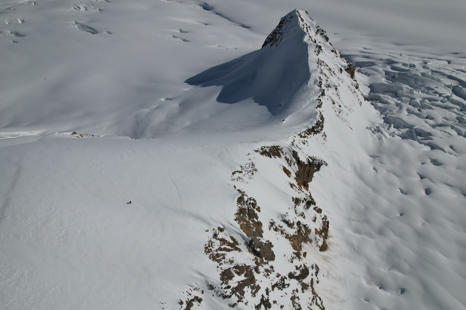
This past Friday, I set out on my first ski tour of the 2024 season: a pre-work dawn patrol at Berthoud Pass, hunting down cool lines for the winter. I’ll walk you through my preparation and navigation on this trip, dishing out practical tips to get the most out of Gaia GPS.
What to do Before Leaving the House
Although this post focuses on the real-time use of Gaia GPS, it’s worth briefly revisiting the pre-trip steps that set the foundation for a successful day in the backcountry.
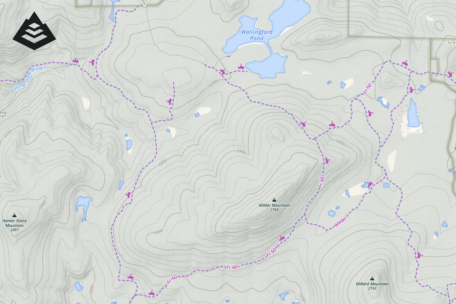
I planned my route on the Gaia GPS web browser. This process allows for precise route creation and layering of important information, all of which syncs seamlessly to the mobile app. Here are the key steps I took:

1. Cleaning Up the Mobile App with Toggle Mobile Sync
Gaia’s “Toggle Mobile Sync” feature is a great tool, and it’s also brand new. This feature lets you remove unnecessary data from your mobile device while keeping it accessible on the web browser. For ski tours, this means I can focus on the route and waypoints relevant to that specific outing, ensuring my interface is clean and easy to use for quick reference when I’m on the move. To get the full scoop, check out this article: Goodbye Clutter, Hello Streamlined Maps: Introducing Sync to Mobile
2. Selecting the Right Layers
For early season tours, I rely on two layers:
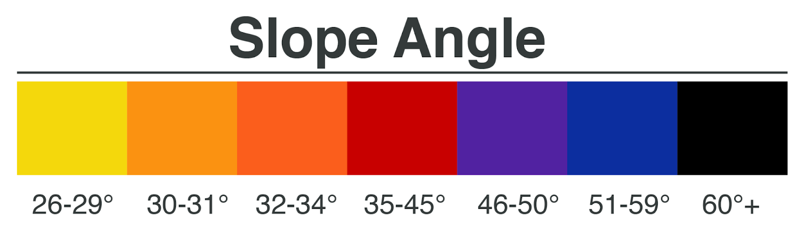
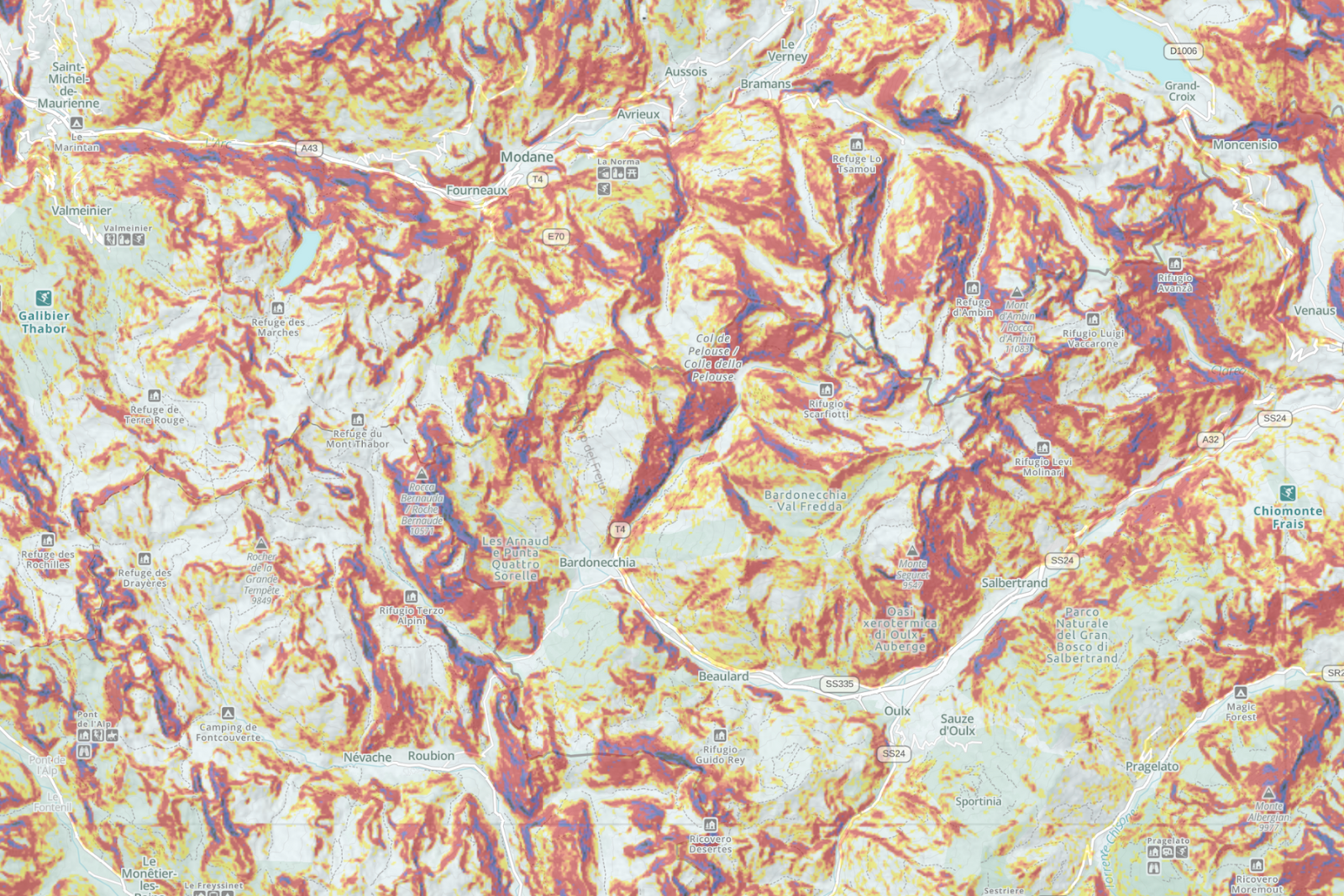
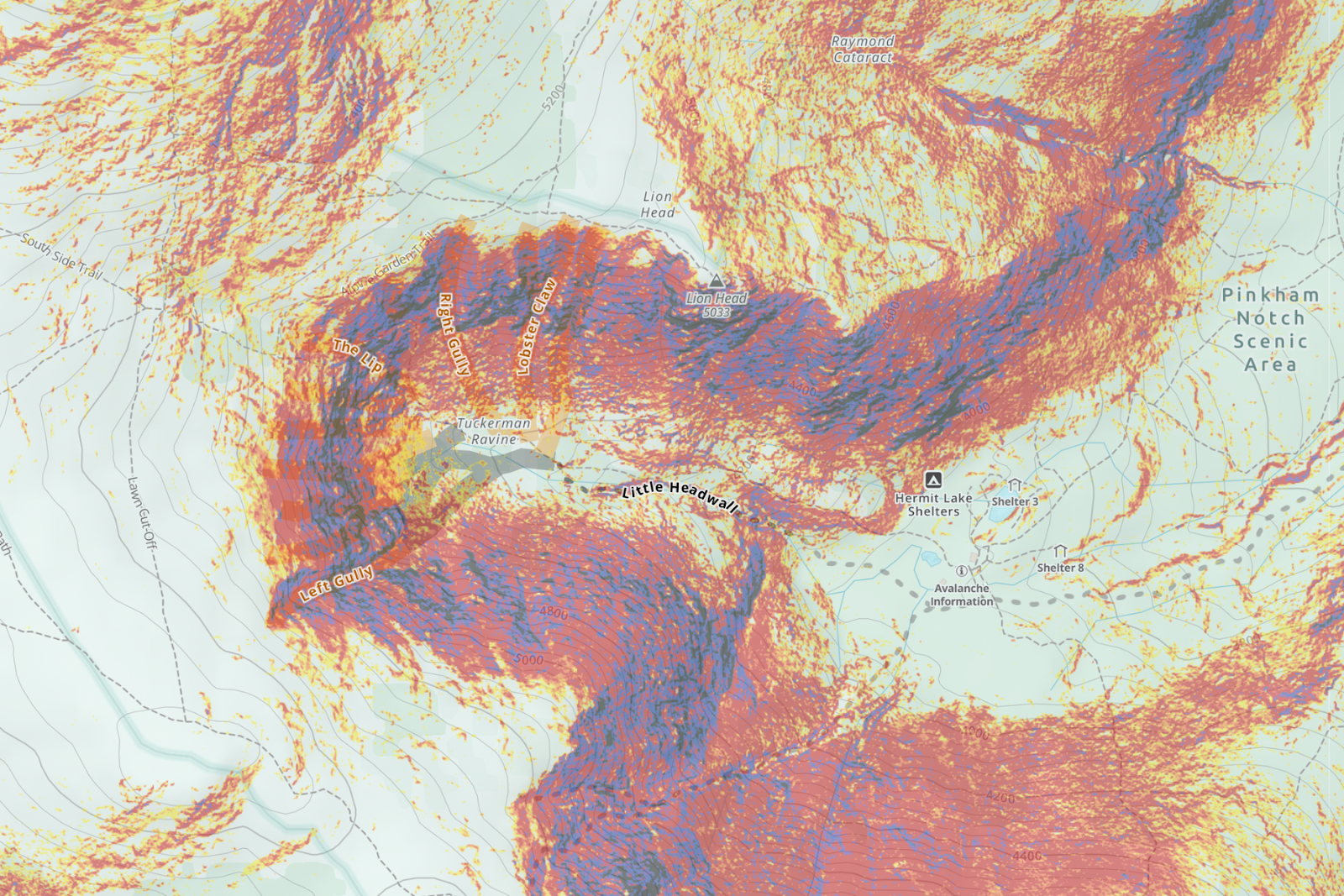
- Slope Angle Layer: This is essential for evaluating avalanche risk. Using this in conjunction with avalanche forecasts from the Colorado Avalanche Information Center (CAIC) helps me to identify safe routes at a glance.
- Gaia Topo: This detailed topographic map is ideal for backcountry navigation. I use this layer to plan ascents and minimize exposure to steeper, avalanche-prone slopes and terrain traps.
Pro Tip: Early in the season, avoid snow depth layers, as they’re often inaccurate for sun-exposed aspects. Instead, focus on slope angle and terrain features to assess conditions.
3. Planning an Efficient Route
My goal for this outing was a quick, safe tour that I could wrap up before heading home to clock in for work. I used the web browser to create a route that followed a wide ridge line and minimized steep sections. This had the dual effect of keeping the hike up easy and minimizing avalanche risk. Once the route was finalized, I synced it to my phone for use in the field and checked to make sure that I had maps for the region downloaded.
Navigating the Route in Real Time
Once I arrived at Berthoud Pass and clicked into my rock skis, Gaia GPS became my primary navigation tool. Here’s how I used the app during the tour:

1. Following the Pre-Planned Route
My route served as a reliable guide throughout the tour. By referencing the route on my phone, I could stay on track without constantly second-guessing my path.
2. Use Waypoints!
During the hike, I used waypoints to mark cool spots or lines for future reference. This is a critical habit for anyone exploring the backcountry, as it helps build a mental and digital map of the terrain. Here are the types of waypoints I added:
- Future Objectives: I pin interesting ski lines that looked promising for later in the season.
- Avalanches: I drop waypoints wherever I see avalanches or signs that one might happen.
- Reference Points: Landmarks like prominent trees or rock outcroppings (or in this case, large metal towers) to make it easier to orient myself, both on the way down, or on future occasions. Most critically, once I’m getting ready to transition and ski down, I almost always drop a waypoint or two at the topographic lines that indicate my point of no return: the minimum elevation I can ski to without having to hike back up to my truck.
3. Recording Tracks
I also used the app to record my track. In the moment, the recording is not necessarily critical, but I find that recordings are incredibly handy to use for reference when I am making repeated trips to an area.I can drop waypoints along the track, and I can refer back to the old tracks whenever I’m building a new route.
Pro Tip: I like to look back and see where my actual track differs from my planned route, which helps me to plan more efficiently in the future, or make note of hazards (like the wind slab).
Safety First!
Safety is always the top priority in the backcountry when I’m out alone, especially during the early season when rocks and thin snowpacks combine with avalanche danger to create unpredictable, often risky conditions. As one of my favorite guidebooks states: “They’re called the Rocky Mountains, not the Snowy Mountains.”
Here’s how I use the app as part of my safety toolkit:

1. Slope Angle and Avalanche Forecasts
Before heading out, I review the CAIC avalanche forecast to get an idea of the snow conditions and what to watch out for. On the way up, I use the slope angle layer to maintain awareness of the terrain I’m in and the avalanche risk, especially when I venture off of the route I had planned out. It’s also important to note that this layer provides a broad overview of slope angles but doesn’t account for localized terrain features, so you’ll still need to use your best judgement when assessing slope steepness.
2. On the Fly Adjustments
Gaia GPS is an excellent planning tool, but it’s no substitute for real-time decision making. You’ll need to detour around hazards and obstacles, adjust your ski plan on the move, and stay on track to reach your destination. This is a huge reason that I always try to have a route built and available in Gaia GPS. While tracking myself, I can easily check my location against the route, and work my way back over to the intended path.
3. Avoiding Terrain Traps
This becomes especially important on the way down, doubly so when I’m exploring new areas. When I’m somewhere new, I’ll stop and check the topo layer or map layer periodically to make sure that I’m not running myself toward a drainage or terrain hazard like cliffs or gullies.
Wrapping Up the Tour
The final phase of any ski tour is returning safely to the trailhead. Here’s how I used Gaia GPS to finish my day on a high note:
1. Navigating Back to the Trailhead
After completing my descent, I used the app to navigate back to the parking area. By following my recorded track and the waypoints I dropped along the way, I avoided my most common mistakes like veering off course or ending up on the wrong side of a drainage. Nothing saddens me more than putting the skins back on for a hike up to the truck after a beautiful run.
2. Post Tour Beers and Review
Back at home (or a conveniently placed brewery), I reviewed my recorded track to evaluate the day’s route. This process is incredibly useful for identifying areas where I can improve, such as finding new routes, or making note of hazards I ran into on the way up. Whenever I come across something particularly cool, I like to export it and share it with my skiing partners for future consideration.
Early season ski tours come with lots of challenges, but with the right tools (a good pair of rock skis) and preparation, these adventures can be almost as much fun as powder days, and every day on skis is a good day. Gaia GPS is an invaluable resource for both planning and pursuing backcountry trips, providing the information and flexibility needed to stay safe and make the most of your time in the mountains.