Gaia GPS
  • Explore The Map
  • Get the App
  • Upgrade Today
  • Explore The Map Catalog
  • New Features
    • Gaia GPS

      The Hike Map That Broke Me: How Gaia…

      April 24, 2025

      Gaia GPS

      Introducing the Gaia Hike Map: Your Trail-Ready Adventure…

      March 18, 2025

      Gaia GPS

      Unlock a New Level of Personalization in Gaia…

      December 12, 2024

      Gaia GPS

      Goodbye Clutter, Hello Streamlined Maps: Introducing Sync to…

      November 26, 2024

      Gaia GPS

      Discover Prime Stargazing Locations with Our New Light…

      August 15, 2024

      Gaia GPS

      2023 Mapped: Our Best New Features of the…

      December 27, 2023

      Gaia GPS

      Discover Adventure Easier Than Ever with New Map…

      July 27, 2023

    • New Maps
      • Gaia GPS

        Discover Prime Stargazing Locations with Our New Light…

        August 15, 2024

        Gaia GPS

        Find Prime Viewing for Total Solar Eclipse with…

        March 27, 2024

        Gaia GPS

        See the World More Clearly with New Gaia…

        May 18, 2023

        Gaia GPS

        Gaia Classic: The Only Map You’ll Ever Need?

        May 4, 2023

        Gaia GPS

        Why NatGeo Trails Illustrated are America’s Favorite Maps

        February 9, 2023

        Backcountry Skiing

        Find Backcountry Skiing in Gaia Winter Map

        January 11, 2023

        Gaia GPS

        Our Favorite New Maps and Features

        December 23, 2022

  • Activities
    • Backcountry Skiing
    • Boating
    • Emergency Response
    • Fishing
    • Offroading
  • Adventures
    • User Stories
  • Help
Top Posts
The Hike Map That Broke Me: How Gaia...
A Fond Farewell to National Geographic Maps —...
Introducing the Gaia Hike Map: Your Trail-Ready Adventure...
Download the app and get a free 14-day...
Gaia GPS is Improving Satellite Imagery: Saying Goodbye...
How I Used Gaia GPS to Navigate Italy
Gaia GPS x Toyota: A New Way to...
Download Gaia GPS– iOS & Android App
Unlock a New Level of Personalization in Gaia...
Important Update: Changes to Esri World Imagery Offline...
Gaia GPS
  • Explore The Map
  • Get the App
  • Upgrade Today
  • Explore The Map Catalog
  • New Features
    • Gaia GPS

      The Hike Map That Broke Me: How Gaia…

      April 24, 2025

      Gaia GPS

      Introducing the Gaia Hike Map: Your Trail-Ready Adventure…

      March 18, 2025

      Gaia GPS

      Unlock a New Level of Personalization in Gaia…

      December 12, 2024

      Gaia GPS

      Goodbye Clutter, Hello Streamlined Maps: Introducing Sync to…

      November 26, 2024

      Gaia GPS

      Discover Prime Stargazing Locations with Our New Light…

      August 15, 2024

      Gaia GPS

      2023 Mapped: Our Best New Features of the…

      December 27, 2023

      Gaia GPS

      Discover Adventure Easier Than Ever with New Map…

      July 27, 2023

    • New Maps
      • Gaia GPS

        Discover Prime Stargazing Locations with Our New Light…

        August 15, 2024

        Gaia GPS

        Find Prime Viewing for Total Solar Eclipse with…

        March 27, 2024

        Gaia GPS

        See the World More Clearly with New Gaia…

        May 18, 2023

        Gaia GPS

        Gaia Classic: The Only Map You’ll Ever Need?

        May 4, 2023

        Gaia GPS

        Why NatGeo Trails Illustrated are America’s Favorite Maps

        February 9, 2023

        Backcountry Skiing

        Find Backcountry Skiing in Gaia Winter Map

        January 11, 2023

        Gaia GPS

        Our Favorite New Maps and Features

        December 23, 2022

  • Activities
    • Backcountry Skiing
    • Boating
    • Emergency Response
    • Fishing
    • Offroading
  • Adventures
    • User Stories
  • Help
Tag:

maps

Gaia GPSNew Features

Discover Adventure Easier Than Ever with New Map Spotlight

by Abby Levene July 27, 2023
written by Abby Levene

Gaia GPS provides the best backcountry maps in the world. (We’re not biased or anything.) Our proprietary Gaia Topo, Gaia Overland, and Gaia Winter maps equip backcountry travelers on foot, wheels, and skis with the information they need to adventure safely and confidently From trails color-coded by activity type to lands shaded by ownership, to amenities to points of interest, these maps have a lot of information packed in them. Honestly, it’s a lot to take in. (In the best way.) That’s where the map legend comes in.

The map legend cracks the code. And now the map legend is even easier to find, decipher, and use. 

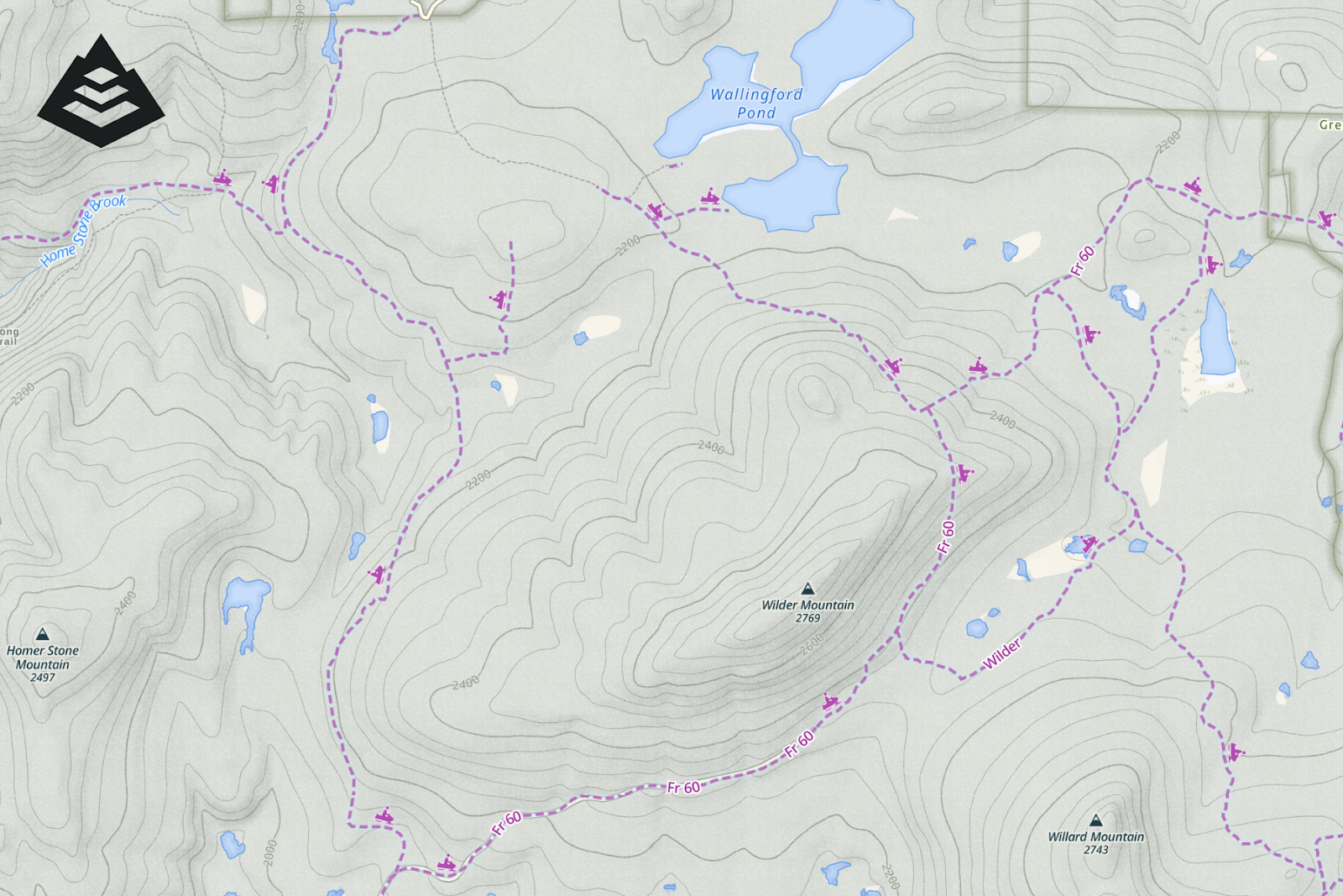
Meet our brand new interactive map spotlight on gaiagps.com. Simply click on a symbol and the map lights up, showing you the trails, amenities, or points of interest you’re looking for. Whether you’re searching for a waterfall, an ice cream shop, or a horseback riding trail, the spotlight puts the world at your fingertips.

Find Trails, Campsites, Amenities, and Much More

Gaia Topo, Gaia Overland, and Gaia Winter each contain over 100 icons, symbols, and trail types so you can find new trails, campgrounds, ski resorts, and beyond. Don’t worry, there’s no need to memorize them all! Whether you’re looking for hiking trails, peaks, or hot springs, backcountry skiing, viewpoints, or gas stations, the map legend spotlight will light them up on the map.

How to Use the Map Legend Spotlight

Just head over to gaiagps.com on your computer. (Trust us, the big screen is the optimal place for route planning.) Open up Gaia Topo, Gaia Overland, or Gaia Winter. And then click the map legend icon in the bottom right corner. The pop-out will automatically show you the symbols most prominently displayed in the region of the map on your screen. Hover over a symbol, and watch the map come to life.

RELATED: CREATE YOUR OWN ADVENTURE ON THE BIG SCREEN WITH GAIA GPS

Zoom in and out and pan around on the map to find other points of interest.

If you just want to look at the good old fashioned map legend, never fear. We have that too. View the entire map legend at once by clicking “View Layer Details” on the bottom of the map legend popout. 

Map Spotlight is Available for Everyone on the Web

Anyone with a Gaia GPS account can take advantage of this shiny new feature on their computers at gaiagps.com. To access our premium maps such as Gaia Overland and Gaia Winter, upgrade to a Gaia GPS Premium or an Outside+ membership. 

Gaia GPS Premium or Outside+ gives you access to the entire 300+ map catalog, including high-resolution, world-wide satellite imagery; our suite of National Geographic maps; and specialty maps ranging from historic topos to slope angle shading.With Premium, you can also download maps for offline use so you can find your way—even without cell service. You can layer maps together to reveal even more terrain, weather, and safety features. And you can print custom maps.

July 27, 2023
0 FacebookTwitterLinkedinRedditEmail
a black and white topo map
Gaia GPSNew Maps

See the World More Clearly with New Gaia Black and White Map

by Abby Levene May 18, 2023
written by Abby Levene

Move over technicolor, black and white is back in style. Meet Gaia Black and White, our brand new, very first all-black-and-white topo map. Whether you’re color vision deficient or want a crystal-clear paper map printout on hand, Gaia Black and White is for you.

Styled in the same manner as our other proprietary topo maps designed in-house, Gaia Black and White brings you industry-leading clarity, accuracy, and file-efficiency. Like our other Gaia Series maps, Gaia Black and White provides world-wide coverage. Download the map to use offline for your entire state so you can always find your way—even without cell service.  Read on to learn how this map came to be and how it’s styled specifically to help you explore with confidence and peace of mind. 

Accessibility-Forward

Born out of Gaia GPS’s Accessibility Assembly, Gaia Black and White prioritizes the needs of our community with color vision deficiencies. Our cartographers run each of our maps through a color vision deficiency filter. But sometimes their cartographic goals directly conflict with optimizing the map for color vision needs. Since it’s sometimes impossible to best serve all communities at once, we chose to optimize Gaia Topo for those who see the full color spectrum, and we created Gaia Black and White for those who do not. Distinguish topo lines, public land use boundaries, tree coverage, trail types, and labels quickly and easily thanks to crisp shading, clear lines, and bold fonts.

Printer Perfect

a paper map print-out preview of Gaia Black and White
A paper map print-out preview of Gaia Black and White

Gaia Black and White is also optimized for printing in black and white. (In case you didn’t know, it’s super easy to print any of our maps!) Whether you’re heading out on a family trip to a national park, backpacking over the weekend, or overlanding across the country, it’s never a bad idea to idea to print a paper map backup just in case. On Gaia Topo, trails are color-coded by activity—a useful feature for finding horse-friendly zones, mountain bike regions, and trails devoid of all activities except foot travel. Gaia Black and White translates those color-coded trails into line-marking-coded trails, which means now you can bring a black-and-white map printout and still distinguish trail types from each other.

Full-Featured Topo Map for Your Adventures

The colors may be gone, but the full spectrum of features, detail, precision, and accuracy you know and love in our maps remains. Our cartographers have painstakingly translated our colorized maps into black and white to bring you a world-class topo map rich with the clarity and information you need to adventure safely and confidently:

High-contrast shading 

Landcover shading on Gaia Black and White hits the sweet spot: it’s dark enough that you can distinguish tree cover and find the alpine; find bodies of water for drinking and recreation; and spy screefields from home. And the shading remains light enough that labels, topo lines, roads, and trails pop from the map, making them easy to find and read. 

To keep the map uncluttered and clear, we’ve simplified the land ownership shading schema from our other maps. But easily spy public land for free, dispersed camping thanks to dotted borders with black and white shading, along with labels.

Distinctive Trail Markings

Gaia Black and White expertly uses line markings of various weights and patterns to distinguish various types of roads and trails from each other. Use the map legend to find trails for horses, mountain bikes, motorized activity, and backpacking in solitude.

Bold fonts

We’ve added some new fonts to our catalog to make deciphering labels even easier. Determine which labels refer to rock climbing walls based on the font alone. (Although the associated climbing icon doesn’t hurt either.) Same goes for rivers, roads, mountains, trailheads, towns, and trails.

How to Get Gaia Black and White

Gaia Black and White is available on gaiagps.com and in the app with a Premium membership. To add this map to your account, go to “Add map layers.” From here, you can search for the map or find it under Topo maps.

Gaia GPS Premium gives you access to the entire 300+ map catalog, including high-resolution, world-wide satellite imagery; our suite of National Geographic maps; and specialty maps ranging from historic topos to slope angle shading.

With Premium, you can also download maps for offline use so you can find your way—even without cell service. You can layer maps together to reveal even more terrain, weather, and safety features. And you can print custom maps.

May 18, 2023
0 FacebookTwitterLinkedinRedditEmail
Gaia Classic map
Gaia GPSNew Maps

Gaia Classic: The Only Map You’ll Ever Need?

by Abby Levene May 4, 2023
written by Abby Levene

Calling all diehard map fans! 

Do you yearn for the classic topo maps of old? You know, the ones not busied up with excessive colors and silliness when all you really need to know is how to plot your path from that alpine lake to that mountain pass and down the other side?

Or maybe you’ve found yourself yelling at our cartographers, “why oh why can’t I see the contour lines in this blazing sun!?”

Enter Gaia Classic, the map that just may answer that call of the wild. It’s inspired by a classic aesthetic, from the colors to the fonts to the very textures of the map itself. Maybe it’s totally pointless, or maybe, just maybe it’s the only map you’ll ever need.

Get to know Gaia Classic, our freshly updated map born out of the pages of history.

An Ode to the Maps of Old

Gaia Classic pays homage to the topo maps from the United States Geological Survey, otherwise known as the USGS. Often referred to as quadrangle maps, or quads, USGS maps have been the definitive resource for US topo maps since the 1880s.

Enjoy a classic aesthetic married with the crystal-clear resolution and file efficiency you know and love from our other proprietary maps. Download the map for your whole state in a manner of minutes and never get caught in the wild without a map again.

Our cartography team poured over the USGS map in Gaia GPS to gather design inspiration for Gaia Classic. They paid particular attention to the quads in Glacier National Park, whose landscape teaming with relief, steep terrain, glaciers, and recreation infrastructure makes it ideal for map modeling. These details are reflected throughout every aspect of the map.

Pared Down Color Palette 

If you just want to see bodies of water, clearings, and treeline without the distractions of modern maps, Gaia Classic is for you. Enjoy a pared down color palette that’s easy on the eyes—and easy to reference in the backcountry. While our default Gaia Topo map contains a plethora of shadings for various forms of landcover, water, and land ownership, Gaia Classic sticks to the basics. Which, let’s be real, is often all you need.

Clear Topo Lines

Topo map lovers rejoice! Dark brown topo lines pop on the subtle map shading underneath, making reading ridges, valleys, peaks, and plains a snap.

Simple Tree Cover

Find the alpine thanks to two-toned tree and shrub shading that’s not muddled by other forms of land shading like crops and grass.

Distinct Trails

Find trails in a glance with clear, black dashed trail markings, along with distinct markings for alpine hiking routes, double track trials, and unmaintained trails, among others.

Classic Font

If the font looks familiar, that’s for good reason. Gaia Classic uses Bell Topo Sans, a font designed by cartographer Sarah Bell to resemble the classic typefaces from antique USGS quads.

Navigate Easier than Ever with Fresh Updates

We’ve freshly updated the map to make it even easier to use in the field. Enjoy updated landcover data and richer tree texture in forested and shrub areas. Scout out ridge lines, ravines, and peaks with darker contours. And spy landmarks easier thanks to blacker labels and trails.

How to Get Gaia Classic 

Gaia Classic is available on gaiagps.com and in the app with a Premium membership. To add this map to your account, go to “Add map layers.” From here, you can search for the map or find it under Topo maps.

Gaia GPS Premium gives you access to the entire 300+ map catalog, including high-resolution, world-wide satellite imagery; our suite of National Geographic maps; and specialty maps ranging from historic topos to slope angle shading.

With Premium, you can also download maps for offline use so you can find your way—even without cell service. And you can layer maps together to reveal even more terrain, weather, and safety features. 

May 4, 2023
0 FacebookTwitterLinkedinRedditEmail
Gaia GPSHow-ToNew Features

Meet Map Packs: A Totally New Way to Map

by Abby Levene April 20, 2023
written by Abby Levene

A totally new way to map is now available for all users! Meet map packs.

With over 300 maps, our deep map catalog is one of our greatest assets. And yet we offer so many maps, it can be hard to even discover them all — much less learn how to use them all. To put the best maps in your hands, right now, we’ve totally redesigned our mapping interface. 

Turn on map packs and get the best map presets curated by the Gaia GPS team. Whether you’re visiting a national park with your family, backpacking a long trail, or skiing in the backcountry, just tap the map pack crafted specifically for your adventure. Or create your own map pack so you can always have your favorite map combinations at your fingertips. 

And don’t worry, you can still use our maps exactly as you always have, if you prefer. 

What are Map Packs?

Map packs instantaneously put the best maps in your hands in one tap. No fuss. No digging into the depths of your memory to remember the exact map combinations you like for each activity.

Traditionally, Gaia GPS works by choosing a base map, which you can use on its own. Or you can layer additional maps and overlays on top of it. The most classic example is selecting Gaia Topo, our proprietary map designed in-house, as your base map. You can use Gaia Topo all on its own. Or you can use Gaia Topo as a base map and put weather overlays, cell coverage maps, wildfire maps, or any other map or overlay on top of it. We call this “map layering.”

Map packs does all of this layering for you, saving you time and brain power. Our team has curated the most useful map combinations and meticulously selected just the right opacity for each layer in the pack.

Whether you’re overlanding, stargazing, or just want to check the weather for the weekend, select the map pack perfectly curated for your needs. For example, rather than individually selecting Gaia Winter with Slope Angle, Avalanche Forecast, SNOTEL, and Snow Depth when you go backcountry skiing. Just choose the Backcountry Skiing map pack and you’re good to go, with each map layered to just the right opacity so that you can access the info you need to ski smartly and safely. 

So, if you choose to use map packs, all you have to do is select the map pack you would like, whether that be for wildfires, weather, cell coverage, you name it. And voila, the map shows you all the info you need. In short, map packs give you the maps you want, hassle free.

How to Activate Map Packs 

If you’re an iOS user, you may remember we rolled out this beta feature last year. We’re pleased to report map packs are now available on Android as well. To try map packs out: tap “Settings” (bottom right corner of the app) → “Map Controls” → toggle on “Map Packs (beta).”

Once you turn on map packs, you’ll notice that changing the map sources displayed on your screen looks different. To change maps:

  • Click the map icon on the bottom left corner of the map.
  • From here, you can peruse our curated collection of map packs by scrolling through the list or searching for a specific map or activity.

You can also build your own map pack:

  • Tap “Build a New Map Pack”
  • Select the layers you want
  • Change the opacity and order in which the maps are layered.
  • Add a memorable title and a description, if you like.
  • Tap “Done.”

Want to check the weather, the snow depth, or the air quality? You can also add overlays in one tap, pre-set to the opacity we’ve deemed most useful.

You’ll notice this same map icon on the bottom left corner is now where you can toggle on and off saved waypoints, tracks, routes, and areas.

A Note About Syncing

As a beta feature, map packs currently do not sync from one device to another. In addition, you will lose your map pack data if you uninstall and reinstall the app, or clear the app data in Settings.

Unlock all Map Packs with Premium

Access the best map packs for every activity like overlanding, hiking, and bikepacking by upgrading to Gaia GPS Premium. Premium also gets you weather forecasts, air quality maps, slope angle shading, and every other feature available in the app.

Please Share Your Feedback!

We’re continuously improving map packs. We know this beta feature isn’t perfect, and we would love your help to make it better. Help us make using our maps as easy as possible by leaving us some feedback. What do you love about map packs? What do you hate? How can map packs (and using maps in general) better help you get outside on your adventures?

Share your feedback with us by contacting our Support team. You can also Tweet at us or post on Reddit… 

April 20, 2023
0 FacebookTwitterLinkedinRedditEmail
FeaturedGaia GPS

The Secret to Getting Young Urbanites Outdoors? ‘Mappiness’

by Abby Levene March 23, 2023
written by Abby Levene

You can live in a city and love the outdoors. In fact, there’s an entire organization devoted to that premise: Mappy Hour. 

After a year ski-bumming at Alta, Mappy Hour founder Sarah Knapp came back east and organized OutdoorFest, a ten-day adventure festival that brings the outdoors to the five boroughs of New York through everything from biking to kayaking. Knapp wanted to put together a casual meetup to drum up hype for the big event. Millennials love pairing their recreating with socializing, and Mappy Hour—a portmanteau of maps and happy hour—came to life.  

“We’re all multifaceted people,” Knapp told Outside in 2017. “Mappy Hour is there to feed that side of us and make sure that it’s a part of our identities that doesn’t get lost.” While millennials and gen Z are more likely to live in cities than their parents, Knapp believes urban dwelling and time outside can coexist. “I try not to think of it as a compromise,” she says.

The first Mappy Hour event was held nine years ago at Fjallraven in Manhatten, and quickly gained popularity among outdoor enthusiasts in the city. Over time, the event expanded to include outdoor activities such as hiking, biking, and camping, and became a platform for advocacy and education around environmental issues and outdoor recreation. 

Now there are Mappy Hour chapters and events across North America, from Bentonville, AR, to Seattle, WA. Mappy Hours generally have a theme, from diversity to avalanche safety to transitioning from the climbing gym to the crag. Past meetups have ranged from a “Send It Sister” panel centered on females in the outdoor industry to “choose your own adventure” camping trips.

Mappy Hour founder Sarah Knapp (left) engages with participants.

A recent Mappy Hour in Denver, whose chapter contains a stout 900 members, included ice skating at Evergreen Lake, which at 8.5 acres is the biggest Zamboni-maintained outdoor ice rink in North America. At another, ultra runner Andrea Sansone spoke about setting the iconic Nolan’s 14 supported record last summer.

And of course, some Mappy Hours do focus on their namesake—maps. Every third Thursday in Rogers, Arkansas, Mappy Hour members bring their favorite map for an atypical bar chat and a beer. 

Built on a belief that the outdoors are for everyone, Mappy Hour welcomes those wanting to get outside but are unsure where to start to seasoned adventurers looking for new outings and friends. Upcoming Mappy Hours range from exploring the mountains and alpine lakes of Colorado with Dr. Jon Kedrowski to cleaning up Washington DC’s Rock Creek Park. Find a Mappy Hour near you.

March 23, 2023
0 FacebookTwitterLinkedinRedditEmail
rec.gov reservations in Gaia Topo
Gaia GPSNew Features

Book Campsites Right From Gaia GPS

by Abby Levene February 23, 2023
written by Abby Levene

We realize it’s still winter. But put on your sandals and sunscreen because it’s time to snag that primo campsite for summer. Many campgrounds in your favorite national parks, state parks, and national forests take reservations six months in advance. That means the best campsites in the most desirable places around America are going quick for peak summer dates. Now you can make those campsite reservations in a flash right from our Gaia Topo map.

Just open Gaia GPS and poke around the map to find that campsite with the spectacular sunrise view. Or search for a campsite far away from the crowds. Either way, you can discover and reserve the campsite of your dreams right from the map. Simply click on a campground and Gaia GPS provides the link on recreation.gov to snag a reservation.

In addition to reservations, recreation.gov gives you every detail you could possibly want about a campsite. View photos to see if the campsite has the spectacular mountain view. Find out how many cars are allowed, and if pets and campfires are permitted. Even see if there’s a fire ring or a grill.

Recreation.gov Campsites in Gaia Topo

Rec.gov campsites shown on Gaia Topo.

The ultimate tool for reserving public campsites in the US is now accessible right from our app. An official US government resource, Recreation.gov is the go-to reservation hub for 12 federal partners including the National Park Service, the US Forest Service, and the Bureau of Land Management. Rec.gov compiles reservations, venue details, and descriptions for over 130,000 recreation locations and more than 4,200 sites and activities around the country.

Plan a family trip to a national park. Or scheme up a solo bikepacking adventure through National Forest land. No matter your style, this new reservation integration makes your life a little easier. Map out your trip and book your reservations all together in one place.

Find All the Campsite Info You Need

A campsite on rec.gov shown on Gaia GPS.

Whether you’re a planner who loves to book campsites far in advance, or someone who prefers to fly by the seat of their pants, check out campgrounds in Gaia Topo to discover everything you need to know about staying there. See where each campsite is located. Find the outhouses and water spigots. Even see where the campground host resides.

Once you find a campsite that looks enticing, click the link to recreation.gov to view:

  • photos of the campsite (see if there’s a view!)
  • pet regulations
  • campfire rules
  • if RVs are permitted, and if so, maximum length
  • if tents are permitted

You also get site details, including:

  • if there is electricity
  • if the site is accessible by foot
  • check-in and check-out times
  • maximum number of people
  • if overnight camping is permitted
  • capacity rating
  • proximity to water
  • whether there’s shade
  • amenities, including if there’s a picnic table, fire pit, and grill or fire ring

And finally, scroll down for need-to-know details including whether there is water and if there are any site fees.

How to Book Campsites in Gaia GPS

Campsite reservations are found in our cornerstone Gaia Topo map. To reserve campsites from Gaia GPS, start by making sure Gaia Topo is selected as an active map layer. Gaia Topo also happens to be the premier map for dreaming up your adventures. Our cartographers designed this map to make key features for backcountry travel, like trails, scenic overlooks, and campgrounds, pop out from the landscape.

Explore Gaia Topo to find campgrounds at your destination. Look for blue campground symbols that say “Reservation Information” under the name. Zoom in further to spy individual campsites, restrooms, and the camp host site.

Once you’ve found your dream campsite, click on “Reservation Information.” The recreation.gov link to reserve campsites in that campground will pop up so you can snag your favorite site before it’s too late. Keep in mind that many public campgrounds take reservations six months in advance. And the best campsites book up quickly! Of course, please be mindful of recreation.gov’s rules and reservation policies.

Plan, Reserve, and Navigate All in One Place

With world-class maps and route-building tools, Gaia GPS provides the ultimate platform to plan your trips. Whether you’re backpacking in the Rockies, overlanding across the southwest, or simply looking for the ultimate car camping spot, choose from our deep collection of maps tailored to your adventure. Map out your route with our quick and easy snap-to-trail route builder so you know exactly where to go.

As you map out your route, you can seamlessly reserve campsites with one click. Drop a waypoint on the map to remember where the campsite is. Your future self trying to find your campsite at midnight in the pitch black will thank you. Speaking of finding your way, go ahead and download the map after you plan your route. That way you can navigate along the route and to your campsite even if you have no cell service at all.

Fun fact: Gaia Topo is so efficient that you can download the map for your entire state in a matter of minutes without clogging up precious phone storage. Don’t worry, you still get the most precise and detailed backcountry map on the market.

Recreation.Gov Campsite Reservations are Available to Everyone

Campsites in Gaia Topo.

Everyone can access the Gaia Topo map and make campsite reservations within it. You just need to create a free Gaia GPS account. To access our entire collection of maps, including hi-res satellite imagery, USFS, MVUM, and National Geographic Trails Illustrated, you’ll want to upgrade to Gaia GPS Premium.

Premium also unlocks our comprehensive suite of terrain features including weather, winter, and wildfire maps. Plus, with Premium, you can download your maps to use offline so you can find your way even when you’re out of cell service. And you can print maps so that you always have a paper backup.

February 23, 2023
2 FacebookTwitterLinkedinRedditEmail
Gaia GPSHow-ToNew Maps

Why NatGeo Trails Illustrated are America’s Favorite Maps

by Abby Levene February 9, 2023
written by Abby Levene

Whether you’re backpacking past the white granite pinnacles along JMT, offroading along the turquoise coasts of Baja, or planning a family trip to a national park, adventure with the most trusted and popular recreation maps on the planet.

Meet our collection of National Geographic Trails Illustrated maps, from the ​​eponymous map makers of world-renown. From Yosemite to Zion, the Appalachian Trail to the Pacific Crest Trail, access this coveted collection of NatGeo maps right in Gaia GPS. Priced at $15 plus a pop, get almost all of them with a Gaia GPS Premium membership.

Read on to learn about all the different NatGeo maps in Gaia GPS, why they are so special, and how their detailed notes can take your adventures to the next level. 

Adventure Confidently with Maps You Can Trust

Adventure confidently with navigational aids along the trail.

Expertly researched and crafted in conjunction with local land managers, NatGeo maps undergo rigorous review and continually set the standard for accuracy. The result: the most trusted and popular recreation maps available. 

National Geographic offers over 250 titles for America’s favorite outdoor destinations, most of which you can find right in Gaia GPS. From the long trails to your favorite national parks, NatGeo maps cover the most breathtaking and iconic scenery of the country. They’re packed with useful information, yet remain crystal clear to help you navigate down, off, and back to the trail.

Get Detailed Topographic Information

See peak and pass elevations right on the map.

While NatGeo Trails Illustrated maps cover a vast array of terrain, from the weathered Appalachians to the cavernous Grand Canyon, they all uphold a rigorous level of topographic detail. Easily spy steep slopes and gentle plains with clearly marked topo lines—enhanced with hill shading and precise contour detailing.

Get the elevation for mountain passes, summits, and major lakes right on the map. Tree shading makes finding the alpine a breeze, and rivers pop out from the map in baby blue. Wilderness boundaries are clearly defined by color, labels, and lines, making it easier to follow wilderness policies.

See Info At Every Zoom Level

Get a detailed view at low zoom levels.

Unlike our propriety Gaia Topo map, Nat Geo maps are raster files. This means that you see the same information as you zoom in and out from the map. Rasterized maps are less efficient than vectorized ones such as Gaia Topo, but they prove useful when you’re trying to pick out key landmarks from a big-picture view. Use NatGeo maps in conjunction with our trademark base maps such as Gaia Topo, Gaia Winter, and Gaia Overland to get the best of both worlds.

Stay on Track with Clearly Marked Trails

On the NatGeo Colorado Trail map, the Colorado Trail is highlighted in yellow for easy viewing.

NatGeo maps emphasize major trails, making it easier than ever to find places to explore and to navigate in the field. For trail-specific maps like the Appalachian Trail, Pacific Crest Trail, John Muir Trail, and Colorado Trail, the trail in question is highlighted in yellow and marked with the trail’s symbol.

Know how far until you reach that mountain pass, the next stream, or your campsite thanks to mile markers and distances to the next intersection, bridge, peak, or town.

Find Key Points of Interest

Find bear lockers, campsites, restrooms, water sources, and much more right on the map.

Discover essential resupply stations, water sources, and points of interest you’ll be hard-pressed to find on any other map. Spy trailheads to start your adventure, plus bathrooms and spigots to hit the trail adequately prepared. 

Find campsites, resupply stops, and restaurants along the trail for your next backpacking trip. And get off the beaten path by exploring historic sites, memorials, and viewpoints marked on the map.

Go Deeper with Navigational Aids

Get insider tips, such as when to be careful in inclement weather.

Perhaps the best part of NatGeo maps are the guidebook notes sprinkled across the map. Get a heads up on which bridges are slippery when wet. See where you’ll have to pack water before long dry spells. 

Make sure you camp on legal ground: see where camping is not allowed, and where wilderness areas begin. Get helpful notes like when to pay keen attention to trail markers, and where free shuttles make stops.

Pick the Perfect Map for Your Adventure

The NatGeo Trails Illustrated map highlights iconic trails, such as the CDT and CDT alt through Glacier National Park.

With over 240 maps, NatGeo covers many national parks, iconic trails, and breathtaking destinations across the US. Many of these maps are housed in our National Geographic Trails Illustrated map. We also have dedicated map layers for certain Nat Geo Trails Illustrated maps. Check them all out in the map catalog. 

Whether you’re planning a weekend backpacking trip in California’s Desolation Wilderness or a family excursion to Big Bend National Park, just open the NatGeo Trails Illustrated map to find iconic views, historic landmarks, and campsites to explore. Navigate Montana’s Bob Marshall Wilderness and Washington’s Wonderland Trail with ease. Discover pristine alpine lakes in Wyoming’s Cloud Peak Wilderness, and find tucked-away nature trails in California’s Joshua Tree. When it comes to the NatGeo Trails Illustrated map, the U.S. is your oyster.

Thru-Hike America’s Long Trails

Get the NatGeo AT and PCT maps in Gaia GPS.

Heading out on the Appalachian Trail, Pacific Crest Trail, John Muir Trail, or Colorado Trail? We’ve got a Nat Geo map for each of them. You can also find other long trails, like the entire Long Trail and parts of the AZT,  in the catch-all Nat Geo Trails Illustrated general map.

In 2017, NatGeo teamed up with thru-hiker and mapmaker Lon “Halfmile” Cooper to produce maps that included both NatGeo’s meticulous cartography and Halfmile’s firsthand notes and insider information. The result contains careful annotations about trail mileages, official and unofficial campsites, water sources, and other points of interest. 

You can use any NatGeo map on it’s own. Or pair a NatGeo map with Gaia Topo on your next backpacking trip to get the best of both worlds when it comes to discovering POIs, off-shoots, and camping, while also getting Nat Geo’s insider notes and easy-to-follow trails.

Explore National Parks Like a Pro

Get insider tips when visiting parks like Yosemite.

From Acadia to Zion, Nat Geo Trails Illustrated covers your favorite national parks around the country. See where the bus can take you through the park, find campsites, and even see which trails are open to horses.

Get inspired for your next family hike with trails featured on the map, and read the notes to see if it seems suitable for those in your group.

Visitor’s centers, bathrooms, wheel-chair accessible trails, and trash cans are all labeled clearly on the map, making it that much easier to spend more time soaking in the views and less time figuring out logistics. 

Climb to New Heights

The NatGeo Colorado 14ers map covers all 58 14,000 peaks in CO.

If you’re traveling to Colorado, you’re in luck. In addition to the NatGeo Colorado Trail map, you can tap into the NatGeo Colorado 14ers map which includes coverage of all 58 Colorado peaks above 14,000 feet. 

Whether climbed all 58 peaks or are setting out on your first one, check out this map to eliminate the guesswork. See how long your adventure will be, plus total elevation gain and loss. Get directions to trailhead, and see whether you’ll need four-wheel drive to reach it. 

Anticipate more engaging sections of the trail like where you can expect to scramble or encounter snow thanks to the notes right on the map. Hoping to camp half way up the hill? See where that’s allowed as well.

Find New Fishing Holes

See clearly marked river miles, access points, put-ins, and the names and ratings of rapids in the NatGeo Fishing & Rivers map.

After climbing a 14er, pull your fishing rod and the NatGeo Fishing & River Maps layer, which covers sections of the Colorado River, Arkansas River, South Platte River, Blue River, Roaring Fork, and Fryingpan Rivers in Colorado.

Built with National Geographic’s characteristic attention to detail, accuracy, and smart map design, this layer is a complete picture of not only the river courses themselves, but their banks, recreation areas, access points, and adjacent ponds and lakes. The result is a complete picture of each river ecosystem, and the boating routes within it.

The NatGeo Colorado Fishing & Rivers map includes clearly marked river miles, access points, put-ins, and the names and ratings of rapids, making it easy to locate yourself on the river, share route information, and plan trips. You’ll also find labeled stream gage sites to reference when researching flow rates at potential fishing or boating spots. Land ownership boundaries and recreation sites also make it easy to scout out campsites along the way.

How to Get the NatGeo Trails Illustrated Maps

All of the NatGeo Trails Illustrated maps are available on gaiagps.com and in the app with a Premium membership. To add any of them to your account, go to “Add map layers.” From here, you can search for a map, or find them under United States map layers or Topo maps.

Use any NatGeo map by itself, or pair it with one of our propriety base maps like Gaia Topo, Gaia Winter, or Gaia Overland for an even richer view of the landscape.

With Premium, you can also download these maps for offline use so you can find your way without cell service. Plus tap into our suite of weather features, safety tools, and hundreds of maps for every activity.

February 9, 2023
4 FacebookTwitterLinkedinRedditEmail
Two skiers skin up a low-angle snowfield in single file. It's sunny and mountains extend in the distance.
Backcountry SkiingGaia GPSHow-To

How to Plan a Backcountry Ski Tour with Gaia GPS

by Devin Lehman January 26, 2023
written by Devin Lehman

Devin Lehman is the Product Manager for Gaia GPS. Join him in planning and going on a backcountry ski tour, and to learn how to use Gaia GPS for your winter backcountry excursions. 

I’m a backcountry snowboarder who happens to work in tech. It’s a lame joke I’ve told coworkers over the past decade. (And it’s a joke that needs no explanation to my coworkers at Gaia GPS.) So when winter swung into central Oregon and the avalanche forecast looked promising, I jumped on the opportunity to tour Mount Bachelor with some friends before opening day. Here’s how I did it, from start to finish.

A New Mapping Paradigm

Technology has revolutionized ski tour planning. Growing up on ice coast of Maine, I spent many weekends with friends and family bootpacking up the Camden Snow Bowl to get a few edgeable turns. Hail, sleet, snow, and freezing temperatures rarely stopped us from having a good time outdoors. 

We didn’t have the best gear in the late ’90s. I wasn’t sure what “gore-tex” meant and jeans with sweatpants underneath often served as our premier choice of winter clothing. Checking conditions around Belfast, Camden, or Carrabassett Valley included picking up paper maps to look at terrain. We’d open a local newspaper to see weather forecasts. We’d talk to park rangers about conditions. And we’d turn on Maine Public Broadcasting to find out if school was canceled or if we’d be begging our parents to call in “sick” for us. These were the best methods we had at the time to plan, adventure, and share our outdoor experiences.

Enter Gaia GPS. Over the years, this app has transformed how outdoor enthusiasts, professionals, and weekend warriors adventure—including me.

Armed with vastly better tools and relocated to the opposite coast, my mission remains the same. When my friends and I decided we wanted to tour Mount Bachelor, I just had to turn to one resource to bring the trip to life.

Route Plan on the Web

With the best route planning tools available, gaiagps.com is the place I like to start planning any adventure. Plus, a desktop’s big screen also lets you get a better, bigger sense of the terrain than the tiny screen of a phone.

So start by going to gaiagps.com. Hit the locate button in the bottom right corner to center yourself on the map. Since I’m not planning this ski tour from my front door, I type “Mount Bachelor” into the search bar to bring me to my destination on the map. Conveniently, I can see the localized weather forecast from OpenSnow just by tapping anywhere on the map.

Activate Winter Maps

The Gaia Winter map shows backcountry ski start zones in orange, and touring zones in blue.

Of Gaia GPS’s hundreds of maps, a handful prove essential for every backcountry tour. I start by selecting Gaia Winter as my basemap. Designed in-house, Gaia Winter boasts the same clarity and file efficiency as Gaia Topo, but prioritizes winter travel. Backcountry ski zones conveniently pop-out from the map in blue and starting zones stand out in orange, making it easy to find places to tour. Gaia Winter’s winter color palette also pairs perfectly with the suite of winter safety maps we’re going to layer on top of it.

Snow Safety Maps

Next, I add the Slope Angle shading map and layer it on top of Gaia Winter. (Just drag Slope Angle to the top of the active map queue.) I turn the opacity down to about 30 or 40 percent so I can still see the underlying topographic terrain. Wondering what the colors mean? Tap the map name in the sidebar and scroll down to the bottom to see the map legend. Since I want to avoid slopes above 30 degrees, which could yield avalanche-prone terrain, I can easily pick my route through terrain that’s shaded yellow (26 to 29 degrees) or has no shading at all (less than 26 degrees).

Now that I’ve got a sense of the terrain, I add the Avalanche Forecast layer to the top so I can scope out the regional avalanche forecast for the day. By zooming out a bit on the map, I can see that the avalanche forecast for the central cascades is green. But I want to read the full report anyway, so I click on the link to the full forecast from the Central Oregon Avalanche Center. 

Weather Maps

I also add the Snow Stations Daily map to get snow conditions for the area, including the snow depth, how much new snow has accumulated, and the snow water equivalent, which tells you whether you’ll be skiing Montana cold smoke or Sierra cement. Since we’re touring a ski resort, I can also add the Ski Resort Reports map to get official conditions from the mountain. (Resorts with fresh snow glow on the map.) I can also add the Snow Depth map to get a visual on estimated snow depths throughout the area. Once again, tap the map in the sidebar and scroll down to the bottom for the map legend to see which colors correspond with what snow depths.

Given the late-season wildfires, I also add the Wildfire and Smoke Forecast maps just to make sure our plans don’t go up in smoke.

Finally, I add the Satellite Imagery map so I can get a sense of how treed the terrain will be, where we’ll hit treeline, and where avalanche paths may exist. I’m going to keep this map as an inactive layer for now; we’ll turn to it once we activate 3D mode.

Hone in on the Zone

Now that we’ve got all of our maps, I start to scout out potential zones for the tour. I’ve already decided I want to ski around Mount Bachelor. Using Gaia Winter, I can see the backcountry skiing start and touring zones are on the northeast aspect of the mountain. The Slope Angle map shows there are some clear low-angle paths up this side of the mountain as well. 

For easy reference, I mark this region of the map with a polygon. That way I can spy this area of the map at low zoom levels, and my touring partners can get a sense of where we’re going. To add a polygon, or “area,” click “Area” in the sidebar and add points to mark the perimeter of the zone. If the polygon shading gets in the way of seeing the map underneath, just turn it off by either toggling off “Areas” in the “Map Overlays” section of the sidebar. Or tap the area on the map, click the polygon in the sidebar, and turn the map visibility off. 

Map Route with Snap-To-Trail

Now that I’ve got a sense of the terrain and the region we’ll be touring, I’m going to map out a potential uphill route. Of course, this may change as we assess the conditions and terrain upon arrival, but it’s useful to have a sense of where we’re going and how long the route may be.

Zooming into the orange “start” zone near Mount Bachelor, I see there is a parking lot. I’m going to mark that as our starting point by dropping a waypoint on the map. Next, I’m going to map out the route. After clicking “Route” on the sidebar, I’m going to follow one of the trails switchbacking up the mountain. Mount Bachelor actually has designated uphill routes when the lifts are spinning, so I want to abide by this uphill route in case there are any employees working–I’d hate to pop up in front of a groomer or patrolling and startle them! Gaia GPS’s smart snap-to-trail routing automatically snaps to the trail as I plot out points along it. When I make a careless click on the web, using the undo feature makes route correction a breeze.

About two a half miles and 1,500 feet of climbing up the trail, we reach a saddle. As we had a group of folks with varying levels of experience, I want to create two options. One more mellow mid-mountain approach, and another option to summit if conditions are right. While creating the routes, I’m able to see the right statistics (weather, ascent, slope angle, avalanche conditions) and tailor the route accordingly. 

Some people may want to transition and ski back down here, so I’m going to end the route and give it a name: “Main plan.” For those who may want to continue on to the summit if conditions allow, I’m going to start a new route here in a different color. Once again, I let Gaia GPS’s smart planning tools do most of the work for me until the route reaches the summit.

For fun I even dropped a waypoint that could be a nice lunch spot for us to eat our pocket-tacos, a staple diet for touring adventures. 

Scout in 3D

Now that I’ve drawn some potential routes on the map, I want to get a better understanding of the terrain we will be covering by looking a the map in 3D. So I hit the “3D” button in the bottom right corner. Next, I add the Satellite Map to the top of our active map layers. Following the route up the mountain, I can see that the first half of the skin track goes straight up a ski slope with trees on either side. The second half switchbacks up a ridge above the treeline. Panning around this northeast face of the mountain, I can see some potential skiable chutes and faces.

Share with Friends

I want to share my routes, waypoints, and area with my friends so they can prepare for the tour at home and navigate in the field. First, I add all of these items to a new folder. Now it’s easy to share it with my partners. Just click on the folder, hit “Invite others to this folder,” and enter their email addresses.

Now when my friends open their Gaia GPS accounts on gaiagps.com, they’ll see a notification on the bell (top right of the screen) inviting them to add my folder to their accounts.

Sync Route to Phone

While gaiagps.com serves as the powerhouse for planning at home, I want to see all my new data in the field once we get going. To ensure it shows up in the app, open your Gaia GPS app at home. Tap the “Saved items” button on the bottom bar. Swipe down to automatically sync the items on your web and app accounts.

Take Maps Offline

We may not have cell coverage for the full tour. Plus, sometimes I like to put my phone in airplane mode to save battery life. To ensure I can see the map regardless of cell service, I’m going to download Gaia Winter and Slope Angle shading for offline use. 

To download the maps on the app, tap the plus button on the top bar. Select Download Maps, and move the rectangle over the area in question. I like to download a little extra map, just in case. Next, press “Save” and choose which maps you want to download for offline use. You also have the option to download the data that will let you create new snap-to-trail routes in the field without cell service. Why not, it can’t hurt–toggle on “Include data to create and navigate routes offline.” Hit next. Keep the app open while the maps download. If you have decent wifi, it should be quick.

Navigate with the App

The squad reviewed the routes overnight, and now it’s go time! Before I leave the house, I like to double check that my maps are downloaded for offline use and are set as active map layers. While I’m in the app, I can get driving directions to the parking lot. Just tap the route, hit the “More” button, and select “Driving Directions.” 

Upon arriving at the mountain, we meet up for a check in focusing on General headspace, Fitness, Willingness to suffer, Skiing ability and Avalanche risk tolerance. Once we completed the checks, the group agreed the mid-mountain lunch tour made the most sense.

Record Tracks

I like to record my adventures in Gaia GPS for a few reasons. One, recording your tracks leaves a breadcrumb trail of your progress in the app. That way if I need to retrace my steps, I can just turn around and follow the line on the map. Second, recording your tracks in the app lets you relive your adventure in 3D on the web once you get home.

So after I turn on my beacon and we do our checks, I start recording my tracks. Once again, tap the plus button. Select “Record a Track.”

Drop Waypoints

As we skin up the mountain, I drop waypoints to mark snow features, views, and to add notes about the snow pack and any other observations our team makes in the field. You can also drop a photo waypoint. Just tap the plus button and select “Take Picture.” Don’t forget to mark up the map with your memories.

Après 

The conditions were way too reminiscent of my ice-coast heritage, and side-hilling became the name of the game. For one member of our group, however, that was no issue. It definitely helps to have four paws with integrated crampons. We hit our top-out point, snacked a bit, and started the descent. While we didn’t have any deep pow lines to drop or slashes to throw, we sure did have a lot of fun. With Gaia GPS as our planning and adventuring tool, we were able to make a route directly back to the car without throwing our skins back on. A win in any backcountry enthusiast’s book! 

As snow keeps piling up in Bend and we watch the conditions, rest assured I’ll be counting down the minutes until I can get back into the mountains. Gaia GPS and Outside have elevated my ability to educate myself, plan, and execute some of my most fun adventures. I’m incredibly lucky to have found a place where I get to combine my passion for the outdoors with my love of working in tech. That lame joke has now become a dream come true–something I am grateful for. 

Cheers to Gaia GPS, Outside, and the outdoor community.

January 26, 2023
8 FacebookTwitterLinkedinRedditEmail
Backcountry SkiingGaia GPSNew Maps

Find Backcountry Skiing in Gaia Winter Map

by Abby Levene January 11, 2023
written by Abby Levene

Discover backcountry ski zones, snowmobile trails, and trails for every winter activity with our new and improved Gaia Winter map. Complete with world-wide ski resort maps plus nordic, fatbike, uphill skiing and snowshoe trails, Gaia Winter serves as the go-to map for winter travel. We’ve updated it to make it even more useful for your adventures.

Just like our original Gaia Topo, Gaia Winter comes with industry-leading clarity and download efficiency. Download the map for your entire state so you can always have a map on hand, even when you lose cell service. From backcountry ski zones to snowmobile trails to enhanced tree cover, read on to learn about the improvements and how to get the most of Gaia Winter this season.

Discover Backcountry Skiing

Backcountry skiers planning their next tour have come to the right place. We’ve added popular backcountry ski zones to the map. Areas shaded in blue show where you may find places to tour. Regions shaded in orange illustrate starting points.

Our cartographers created these backcountry start and ski zones based on where users started recording ski tracks and where their tracks took them, respectively. Backcountry ski zones are mostly contained within North America now. And you’ll also find a few zones in Iceland, Norway, and France.

Spy Snowmobile Trails

snowmobile trails in Gaia Winter

Sledders can now discover snowmobile trails right on the map. We’ve added all the snowmobile trails from our Snowmobile Trails map to Gaia Winter for your convenience. Before you go on your next tour, download Gaia Winter for offline use so you have a trail map on hand. That way you can reroute on the fly, find somewhere to refuel, or navigate in a white-out. 

Get even more trail details including grooming status, access dates/restrictions, trail width, difficulty level, trail length, and direction of travel with our interactive Snowmobile Trails map. Pair this trail overlay with Gaia Winter for optimal planning and navigation. 

Understand Landcover and Topography

Say goodbye to the blues. We’ve revamped the color palette to make Gaia Winter brighter, with more detailed landcover. As you’re planning your next ski tour, use Gaia Winter to see if you’ll be skinning over shrubs, through trees, or across tundra. Sledders can see if they’re traveling past prairies or farmlands. 

The winter-themed color palette of the map sets a seasonal tone and enhances its utility. Tour the backcountry with confidence thanks to a stronger emphasis on terrain, tree cover, and contour lines. Mountains pop out of the map, helping you scout the best uphill and ski lines. See exactly where treeline ends so you can find powdery bowls and untracked glades. Hiking, mountain bike, and other three-season trails are deemphasized to make it even easier to see ski, snowshoe, and fat bike trails.

Activate Snow Mode

Gaia Winter’s less diverse color scheme also pairs perfectly with our safety and weather maps. Pair Gaia Winter with our suite of winter safety maps, including Slope Angle shading, Avalanche Forecast, Snow Stations Daily, Snow Depth, and Satellite Imagery to help you plan safer tours. Check out our primer on how to use maps to help avoid avalanches for a refresher.

Trails for alpine skiing, cross country skiing, snowshoeing, fatbiking, uphill skiing, and snowmobiling are indicated by line type. And now you can also distinguish trail activity type thanks to icons right on the trails themselves. 

Gaia Winter is Available with a Premium Membership

Gaia Winter is available on the web and in the Gaia GPS app with a Gaia GPS Premium membership. To access this map, visit the layers menu and search for “Gaia Winter.” Or from the layers menu, select “Topo Maps.” Scroll down and tap “Gaia Winter.” Tap the “Add Layer” button. Learn how to add and manage overlays here.

A Premium Membership also gives you access to Gaia GPS’s entire map catalog, including a suite of avalanche safety maps. These include Slope Angle, Avalanche Forecast, recent satellite imagery, Snow Stations (Daily), Snow Depth, and snow forecast maps. Read up on how to use maps to help avoid avalanche danger.

Plus, with Premium, you can layer maps together. For example, you can place the Slope Angle map on top of Gaia Winter to find the best low-angle terrain. And you can download your maps (including Gaia Winter) for use without cell service, as well as print maps so you always have a backup.

Take winter to the next level. Join Gaia GPS Premium with Outside+ to get one subscription to fuel all your adventures, thanks to access to Trailforks Pro, Outside, SKI, Trail Runner, Outside Watch, and more. 

January 11, 2023
1 FacebookTwitterLinkedinRedditEmail
Gaia GPSNew FeaturesNew Maps

Our Favorite New Maps and Features

by Abby Levene December 23, 2022
written by Abby Levene

As our community dreamed up more routes, downloaded more maps, and covered more miles than ever before, our team remained hard at work making Gaia GPS even better for your adventures. Here’s a look at our favorite maps, features, and updates we launched this year. We’re counting down, 12 days of Christmas style. 

12. Map Packs (Beta): A Totally New Way to Map

To put the best of our 300+ maps in your hands, right now, we’ve totally redesigned our mapping interface. Meet map packs.

Enable this new beta feature available on iOS and get the best map presets curated by the Gaia GPS team. Whether you’re visiting a national park with your family, backpacking a long trail, or skiing in the backcountry, just tap the map pack crafted specifically for your adventure to put the right maps on your screen

Or create your own map pack so you can always have your favorite map combinations at your fingertips. Explore map packs.

11. Gaia Classic: The Map That Never Goes Out of Style

Do you yearn for the classic topo maps of old? You know, the ones not busied up with excessive colors and silliness when all you really need to know is how to plot your path from that alpine lake to that mountain pass and down the other side?

Or maybe you’ve found yourself yelling at our cartographers, “why or why can’t I see the contour lines in this blazing sun!?”

Enter Gaia Classic, the map that just may answer that call of the wild. It’s inspired by a classic aesthetic, from the colors to the fonts to the very textures of the map itself. Maybe it’s totally pointless, or maybe, just maybe it’s the only map you’ll ever need.

Check out our new map, Gaia Classic.

10. Gaia GPS Master Classes: Map Like a Pro

We’re the first to admit there’s a bit of a learning curve to mastering the breadth and depth of gaiagps.com and our app. That’s why we teamed up with Outside Learn to bring you two master classes. Find the best of our 300+ maps for your adventures. Learn how to take your maps offline. Layer maps together to unlock more terrain detail. Reroute on the fly. Share your routes with friends and family. Discover our top hacks. It’s all here. Take these two courses to brush up on your mapping skills and to get the most of the app. 

Take Gaia GPS 101 and Gaia GPS Advanced. 

9. Wildfire Maps: Spot Fires Faster

This update is lit. You can now spot wildfires on the Wildfire map as soon as they appear on InciWeb, the government website that tracks wildfire information for the public. Our cartographers also added wildfire labels right onto wildfires themselves for easy viewing. Plus, we expanded our smoke forecast maps coverage to include Alaska and Canada.

Check out the enhanced Wildfire and Smoke Forecast maps.

8. Snowmobile Trails Map: Discover Global Sledding Trails

Planning snowmobile routes and navigating across the snow has never been easier. Find sledding trails across the US, Canada, Europe, and Australia with our new Snowmobile Trails map. We’ve pulled together trail data from local, state, and federal sources to bring you some of the most comprehensive sledding coverage in the world.

Easily spy trail networks to build routes and find your way in the field. When available, see key details like trail width, grooming status, restricted access areas, and difficulty ratings. Plus, find warming huts, gas stations, and snowmobile shops.

Try out the Snowmobile Trails map.

7. Android Auto: Navigate from the Dash

We’ve revamped Gaia GPS on Android Auto so you can manipulate the map, record tracks, and drop waypoints all from your dashboard. Just connect your phone to your car display and navigate with your favorite Gaia GPS maps like Gaia Overland, MVUMs, hi-res global satellite imagery, and National Geographic Trails Illustrated—all from the luxury of the wide screen.

From expanded map controls to clearer visibility, here are the major updates. And if you’re on iOS, check out Apple CarPlay.

6. Slope Angle: Stay Safer with Highest-Res Map

Scout avalanche terrain easier than ever before. We’ve updated our Slope Angle map with the latest highest resolution 1-meter LIDAR DEM data from the USGS. This data is the gold standard for slope angle shading, rendering our Slope Angle map crisper and clearer for your winter adventures.

Whatever your objective and mode of travel, you can now enjoy the highest resolution slope angle data, wherever it’s available. Check out the updated Slope Angle map.

5. Rec.Gov: Make Campsite Reservations from the Map

Find the perfect campsite in Gaia Topo, and then reserve it right from the map. The ultimate tool for reserving public campsites in the US is now accessible right from our app and gaiagps.com. In addition to reservations, recreation.gov gives you every detail you could possibly want about a campsite. View photos to see if the campsite has the spectacular mountain view. Find out how many cars are allowed, and if pets and campfires are permitted. Even see if there’s a fire ring or a grill.

Learn more about our rec.gov integration. 

4. Trailforks MTB Map: Discover the Best Bike Trails

Trailforks’ coveted mountain bike trail database is now in Gaia GPS! Discover brand new routes, get the beta on trail conditions, and easily spy trails based on type and difficulty level with this new map.

Trailforks, a trail management system, catalogs trail networks around the world. The crowd-sourced database and moderated site provides the most accurate and comprehensive trail data available. And now you can get all 361,392 Trailforks mountain bike trails around the globe right in the Gaia GPS app and on gaiagps.com.   

Check out the Trailforks MTB map.

3. Planning Tools: Easily Dream Up Your Own Routes

Creating your own adventures in Gaia GPS got even easier—and more fun. Meet our new route editing tools, here to let you quickly fix any mistakes or changes of heart, automatically out-and-back any one-way route, send your route back to the start, and reverse your route direction.

You asked, and we listened. We added these route editing tools so that you can explore our maps with even more abandon, knowing you can painlessly erase any route-building mistakes and let our planning tools handle the tedious tasks. Enjoy these tools on Android and on the big screen at gaiagps.com. To put the cherry on top of this route creation cake, we’ve added keyboard shortcuts to the web so you can perform any of these tasks without even touching your mouse, making it even easier to carry on route building with our smart snap-to-trail planning tools.

Explore the new planning tools. 

2. OpenSnow Weather: Localized Forecasts at a Tap

While we can’t supply a crystal ball, we can supply the weather for exactly where you’re going, exactly where you need it—right on the map. We partnered with OpenSnow, the leading resource for backcountry weather, to bring you hyper-localized weather forecasts that you can access at a tap.

Just tap anywhere on the map, anywhere in the world, and get the current weather plus the forecast right in Gaia GPS. Learn more about weather at-a-tap.

1. Gaia Overland Map: World’s Best Offroading Map

Ditch the crowds with Gaia Overland, the best overlanding map you can put right on your vehicle’s dashboard. MVUM, USFS, public land boundaries—it’s all in here. Designed in-house for planning big routes, navigating tricky terrain, and rerouting on the fly, Gaia Overland is the definitive map for all of your overlanding, offroading, and motorized adventures. 

Modeled after our proprietary Gaia Topo map, Gaia Overland comes with the same crystal-clear resolution and download efficiency you know and love from Gaia GPS. But it puts everything for motorized travel first. Whether you’re embarking on a multi-day expedition or just heading to a remote trailhead, use Gaia Overland to get you there efficiently and (relatively) effortlessly.

Check out Gaia Overland.

It Wouldn’t Be the Holidays Without a Few Bonuses

Permitted Rivers Map

This map overlay shows you all the rivers that require a permit to raft or kayak. Tap to learn the river’s name, see permit information, and get the link to a permit application. Check out the Permitted Rivers map here.

Customized Waypoints

You can now change the color of waypoint borders. Use these colors of the rainbow to classify and categorize your waypoints to your heart’s desire. Learn more about all of the ways to use waypoints here. 

Ski Resort Reports Map

From Aspen to Zermatt, get conditions for ski resorts around the globe in Gaia GPS. Ski areas with fresh snow light up on our new Ski Resort Reports map. See snow totals and weather readings. Find out how many trails are open. Even read the resort’s daily report, all right within the app and on gaiagps.com. Explore the Ski Resort Reports map here.

December 23, 2022
0 FacebookTwitterLinkedinRedditEmail
Load More Posts

Categories

  • Adventures
  • Android
  • App Comparisons
  • App Updates
  • Backcountry Skiing
  • Boating
  • Company News
  • Emergency Response
  • Featured
  • Fishing
  • Gaia GPS
  • Gaia GPS Offroad Podcast
  • GaiaCloud
  • Hikes
  • How-To
  • Hunting
  • iOS
  • New Features
  • New Maps
  • Newsletter
  • Offroading
  • Out and Back Podcast
  • User Profiles

Recent Posts

  • The Hike Map That Broke Me: How Gaia GPS Turned an Overlander Into a Reluctant Hiker
  • A Fond Farewell to National Geographic Maps — And a Look at What’s Ahead
  • Introducing the Gaia Hike Map: Your Trail-Ready Adventure Buddy
  • Download the app and get a free 14-day trial of Gaia GPS Premium
    • Facebook
    • Twitter
    • Instagram
    • Youtube
    • RSS
    • Explore The Map
    • Get the App
    • Upgrade Today
    • Explore The Map Catalog
    • New Features
      • Gaia GPS

        The Hike Map That Broke Me: How Gaia…

        April 24, 2025

        Gaia GPS

        Introducing the Gaia Hike Map: Your Trail-Ready Adventure…

        March 18, 2025

        Gaia GPS

        Unlock a New Level of Personalization in Gaia…

        December 12, 2024

        Gaia GPS

        Goodbye Clutter, Hello Streamlined Maps: Introducing Sync to…

        November 26, 2024

        Gaia GPS

        Discover Prime Stargazing Locations with Our New Light…

        August 15, 2024

        Gaia GPS

        2023 Mapped: Our Best New Features of the…

        December 27, 2023

        Gaia GPS

        Discover Adventure Easier Than Ever with New Map…

        July 27, 2023

      • New Maps
        • Gaia GPS

          Discover Prime Stargazing Locations with Our New Light…

          August 15, 2024

          Gaia GPS

          Find Prime Viewing for Total Solar Eclipse with…

          March 27, 2024

          Gaia GPS

          See the World More Clearly with New Gaia…

          May 18, 2023

          Gaia GPS

          Gaia Classic: The Only Map You’ll Ever Need?

          May 4, 2023

          Gaia GPS

          Why NatGeo Trails Illustrated are America’s Favorite Maps

          February 9, 2023

          Backcountry Skiing

          Find Backcountry Skiing in Gaia Winter Map

          January 11, 2023

          Gaia GPS

          Our Favorite New Maps and Features

          December 23, 2022

    • Activities
      • Backcountry Skiing
      • Boating
      • Emergency Response
      • Fishing
      • Offroading
    • Adventures
      • User Stories
    • Help

    @2024 - All Right Reserved. Gaia GPS


    Back To Top