Gaia GPS
  • Explore The Map
  • Get the App
  • Upgrade Today
  • Explore The Map Catalog
  • New Features
    • Gaia GPS

      The Hike Map That Broke Me: How Gaia…

      April 24, 2025

      Gaia GPS

      Introducing the Gaia Hike Map: Plan Your Hike,…

      March 18, 2025

      Gaia GPS

      Unlock a New Level of Personalization in Gaia…

      December 12, 2024

      Gaia GPS

      Goodbye Clutter, Hello Streamlined Maps: Introducing Sync to…

      November 26, 2024

      Gaia GPS

      Discover Prime Stargazing Locations with Our New Light…

      August 15, 2024

      Gaia GPS

      2023 Mapped: Our Best New Features of the…

      December 27, 2023

      Gaia GPS

      Discover Adventure Easier Than Ever with New Map…

      July 27, 2023

    • New Maps
      • Gaia GPS

        Introducing the Gaia Hike Map: Plan Your Hike,…

        March 18, 2025

        Gaia GPS

        Discover Prime Stargazing Locations with Our New Light…

        August 15, 2024

        Gaia GPS

        Find Prime Viewing for Total Solar Eclipse with…

        March 27, 2024

        Gaia GPS

        See the World More Clearly with New Gaia…

        May 18, 2023

        Gaia GPS

        Gaia Classic: The Only Map You’ll Ever Need?

        May 4, 2023

        Backcountry Skiing

        Find Backcountry Skiing in Gaia Winter Map

        January 11, 2023

        Gaia GPS

        Our Favorite New Maps and Features

        December 23, 2022

  • Activities
    • Backcountry Skiing
    • Boating
    • Emergency Response
    • Fishing
    • Offroading
  • Adventures
    • User Stories
  • Help
Top Posts
Battling the Wind: Setting Your Shocks to Firm...
The Hike Map That Broke Me: How Gaia...
A Fond Farewell to National Geographic Maps —...
Introducing the Gaia Hike Map: Plan Your Hike,...
Download the app and get a free 14-day...
Gaia GPS is Improving Satellite Imagery: Saying Goodbye...
How I Used Gaia GPS to Navigate Italy
Gaia GPS x Toyota: A New Way to...
Download Gaia GPS– iOS & Android App
Unlock a New Level of Personalization in Gaia...
Gaia GPS
  • Explore The Map
  • Get the App
  • Upgrade Today
  • Explore The Map Catalog
  • New Features
    • Gaia GPS

      The Hike Map That Broke Me: How Gaia…

      April 24, 2025

      Gaia GPS

      Introducing the Gaia Hike Map: Plan Your Hike,…

      March 18, 2025

      Gaia GPS

      Unlock a New Level of Personalization in Gaia…

      December 12, 2024

      Gaia GPS

      Goodbye Clutter, Hello Streamlined Maps: Introducing Sync to…

      November 26, 2024

      Gaia GPS

      Discover Prime Stargazing Locations with Our New Light…

      August 15, 2024

      Gaia GPS

      2023 Mapped: Our Best New Features of the…

      December 27, 2023

      Gaia GPS

      Discover Adventure Easier Than Ever with New Map…

      July 27, 2023

    • New Maps
      • Gaia GPS

        Introducing the Gaia Hike Map: Plan Your Hike,…

        March 18, 2025

        Gaia GPS

        Discover Prime Stargazing Locations with Our New Light…

        August 15, 2024

        Gaia GPS

        Find Prime Viewing for Total Solar Eclipse with…

        March 27, 2024

        Gaia GPS

        See the World More Clearly with New Gaia…

        May 18, 2023

        Gaia GPS

        Gaia Classic: The Only Map You’ll Ever Need?

        May 4, 2023

        Backcountry Skiing

        Find Backcountry Skiing in Gaia Winter Map

        January 11, 2023

        Gaia GPS

        Our Favorite New Maps and Features

        December 23, 2022

  • Activities
    • Backcountry Skiing
    • Boating
    • Emergency Response
    • Fishing
    • Offroading
  • Adventures
    • User Stories
  • Help

New Maps

HuntingNew Maps

U.S. Forest Service Motor Vehicle Use Maps Now Available

by Ashli Baldwin June 29, 2017
written by Ashli Baldwin

Find Forest Service roads and trails to drive with the new motor vehicle use maps (MVUM) layer, a Premium Member overlay available in Gaia GPS version 1.1 for iOS.

Now you can route motorized treks in advance and navigate your way through U.S. National Forests from directly within the app. If you’re not familiar with MVUMs, consider using them using them for off-roading, finding primitive camping areas, and other adventures.

Identifying Forest Service Roads

To activate the layer, look for the Premium Maps category in the Edit maps menu, and choose Overlays. Use the overlay within areas representing U.S. National Forests.

Green lines indicate roads and trails that are open to motor vehicles year-round, yellow lines indicate use with restrictions and red indicates no motorized vehicle use.

Motor Vehicle Use Maps

Legend for Motor Vehicle Use Maps

Motor Vehicle Use Maps – An Interactive Layer

Motor Vehicle Use Maps

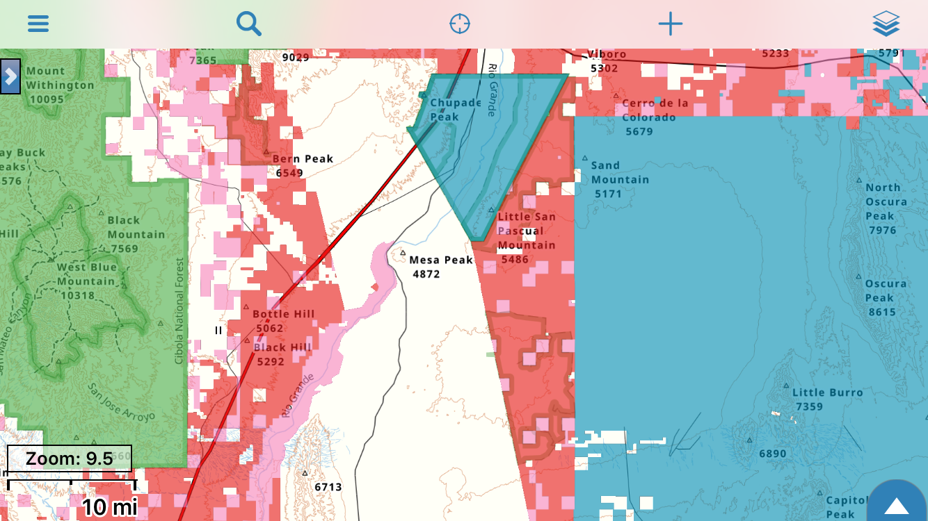
Motor Vehicle Use Maps layered with Gaia Topo

The overlay draws upon a new vector-based U.S. Forest Service dataset. The features within it are interactive. If you’re on iOS, just tap a road on the map to pull up information on use restrictions and access dates.

You can use a non-interactive version of the overlay on the web, on Android, and in Gaia GPS Classic. Consider layering the MVUMs with a USFS map source or Gaia Topo to see more Forest Service roads and additional context.

Help Us Improve the App

We’ve fielded many requests for motor vehicle use maps. Now that the overlay’s here, let us know what you think. You can post your thoughts on the MVUMs and other features you’d like to see to the Gaia GPS Community Forum, or email support@gaiagps.com with questions.

June 29, 2017
0 FacebookTwitterLinkedinRedditEmail
App UpdatesGaia GPSHow-ToiOSNew FeaturesNew Maps

Gaia GPS with USFS Motor Vehicle Use Maps

by Ashli Baldwin June 14, 2017
written by Ashli Baldwin

Interactive United States Forest Service’s popular Motor Vehicle Use Maps — now available in Gaia GPS version 1.1 for iOS.

Also in this update, two finger map rotation and course-up mode lock.

Read about the next generation Gaia GPS here and download it today.

Interactive Road Access Information

Available as an interactive Premium Member overlay within the iOS app, the MVUM overlay makes planning adventures and navigating in US National Forests simple.’

Tap roads on the map for USFS road usage restrictions and access dates.

Layer with Gaia Topo, one of the USFS map sources, or any other base map to get a comprehensive view.

Two Finger Map Rotation

Rotate the main map in any direction with a simple two finger motion. You can turn two finger rotate on or off from the settings menu.

Continuous Improvement

Other notable updates in Gaia GPS v1.1 for all iOS users include:

  • Course-up mode lock — Zooming in or out will not break the map lock on your current location
  • Improved Performance — Improvements to the Saved menu for accessing multiple years of data
  • Guidance — Offline guidance along trails found in Gaia Topo

Listening to You

Your feedback helps guide the development of Gaia GPS. This update includes highly requested features from users across the Gaia GPS Reddit page, Community forums, and from your emails.

Join the forums to get in on the conversation, or send an email to support@gaiagps.com.

June 14, 2017
0 FacebookTwitterLinkedinRedditEmail
App UpdatesGaia GPSiOSNew FeaturesNew Maps

NextGen Gaia GPS, with National Geographic

by Aileen May 22, 2017
written by Aileen

Today, we released the next generation Gaia GPS app for iOS. We’re also delighted to announce the inclusion of National Geographic Trails Illustrated maps, on iOS, Android, and gaiagps.com.

The new app is a huge leap for Gaia GPS, with tremendous technology, new maps and features, and a polished user interface. Since last September, eleven people have worked on the design, engineering, and cartography for the new Gaia GPS. The beta tester group of about 80 participants includes professional guides, long distance hikers, backcountry skiers, hunters, off-roaders, mountain-bikers, and others – a broad cross-section of the Gaia GPS community.

Try the new Gaia GPS for free:     

Beautiful Map Display

The new Gaia GPS includes a faster/smoother mapping engine. Gaia Topo and some other sources now display as ‘vector’ maps. This improvement means labels stay crisp as you zoom in/out and maps download in smaller sizes.

National Geographic Trails Illustrated

The new Gaia GPS includes an expanded map catalog, featuring National Geographic Trails Illustrated. These are the most trusted and highly-rated topographic maps available for the United States’ top outdoor destinations. They are produced and regularly updated in partnership with local land managers and experts. They include detailed topographic information, clearly marked trails, recreational points of interest, and navigational aids. We’re thrilled to include this layer with a Gaia GPS Premium Membership.

Additionally:

  • Premium Members also get access to another new source – Neotreks topo maps for the US
  • all users of the new Gaia GPS can now access MapBox Satellite, Outdoor, and Streets maps – previously restricted to premium subscribers.

Trail and Park Search

Search the map like never before in Gaia GPS.

Gaia GPS will now suggest results as you type, and the new search feature lets you find parks, trails, forests, POIs, coordinates, and addresses. You can use the same search when you discover and plan trips on gaiagps.com/map.

You can also now tap directly on map features to get more information. Get stats about trails, pictures of places, official websites for parks and trails, and more.

Slick Redesign

The new Gaia GPS app makes navigating the backcountry easier, with a streamlined interface and unified design. Every screen got some love – from login/signup, to the map, to saved data – and we polished all the little details.

The new app has tabs along the bottom for major functions, unified button icons, and refined colors/fonts/layout. You can find the controls to customize the main map view (pictured in the right screenshot) by long-pressing the fullscreen button on the map.

Free Usage Periods for Existing Users

Already have the old Gaia GPS? You get a 2-year free usage period with the new app. You can also continue to use the old app.

Additionally, existing users with “GaiaPro” subscriptions from the old app get access to the new app at no additional cost, including National Geographic and all other Premium maps.

Existing Gaia GPS users can read an FAQ about the new app here.

Try it For Free Today

Anyone can download the new iOS version of Gaia GPS today, and start a free 7 day trial. Experience the next generation of outdoor mapping.

May 22, 2017
0 FacebookTwitterLinkedinRedditEmail
Screenshot of USFS 2016.
Gaia GPSHuntingNew Maps

USFS 2016 Map Now Available in Gaia GPS

by Nathan Copeland December 19, 2016
written by Nathan Copeland

You can now access an updated version of the United States Forest Service (USFS) National Forests maps, called USFS 2016.

The USFS 2016 map source includes updated roads, road labels, and vegetation shading. We left the existing USFS Raster source, and renamed it USFS Classic, because the Classic source includes some private property boundaries not available in USFS 2016.

Both USFS sources show up in the United States section of the Gaia GPS map source collection, on iOS, Android, and gaiagps.com.

Updated roads in USFS 2016 vs USFS Classic

Updated roads in USFS 2016 vs USFS Classic

Anyone planning a backpacking, off-road vehicle, hunting, or fishing trip to any of the 154 national forests or 20 national grasslands will benefit from including the new USFS 2016 map in their list of map sources.

The USFS 2016 and USFS Classic map sources only cover national forests and grasslands, but Gaia GPS Premium Members have the option of layering either USFS map on top of Gaia Topo or USGS Topo to get a seamless nationwide map.

Layering USFS 2016 over Gaia Topo produces continuous map coverage across the US.

December 19, 2016
0 FacebookTwitterLinkedinRedditEmail
Contours-Meters overlaid on the Mapbox Aerial layer.
Gaia GPSNew Maps

Contour Line Overlays in GaiaPro

by Kate Dougherty October 5, 2016
written by Kate Dougherty
Contours-Meters overlaid on the Mapbox Aerial layer.

Contours-Meters overlaid on the Mapbox Aerial layer.

GaiaPro users can overlay base maps with worldwide contour lines in either feet or meters for additional context. You can layer the contours with any source, but will probably find them most useful when paired with satellite imagery.

Add the contour layers to the map by opening the More Layers menu, then the GaiaPro Overlays category. Read these Help Center articles for info about how to use layered maps on iOS and Android.

We also suggest you set the opacity of the contour layer to slightly less than 100% for best performance.

Optimized Contour Intervals

We styled the contours to work well across zoom levels. They first show up at zoom level 10, and render differently as you zoom in.

new-contour-source-menuContours-Feet

  • z10-11: 400 feet, no labels
  • z12-13: 200 feet, labels for every other contour
  • z14+: 40 feet, labels for every fifth contour

Contours-Meters

  • z10-11: 100 meters, no labels
  • z12-13: 50 meters, labels for every other contour
  • z14+: 10 meters, labels for every fifth contour

Use the Same Great Data in New Ways

We originally created the contours for the Gaia Topo project, then extracted them from that source to create two new, separate overlays with transparent backgrounds.

Both the feet and meters overlays use the same source data—digital elevation models (DEMs) including Shuttle Radar Topography Mission (SRTM) topo data, the Advanced Spaceborne Thermal Mission and Reflection Radiometer (ASTER)’s Global Digital Elevation Model, and the U.S. National Elevation Dataset (NED).

Help Improve the Layers

We plan to continue improving the contours over time. You can help by reporting errors like missing or incorrect data at https://tileslicing.gaiagps.com/preview/contours-meters/ or https://tileslicing.gaiagps.com/preview/contours-feet/.

As always, feel free to email support@gaiagps.com if you have any questions or feedback.


October 5, 2016
0 FacebookTwitterLinkedinRedditEmail
Gaia GPSHuntingNew Maps

New GaiaPro Map Layer—MapBox Satellite with No Labels

by Ruthie Irvin October 4, 2016
written by Ruthie Irvin

Now available to GaiaPro subscribers, MapBox Satellite Imagery with no labels offers a cleaner map view than the version with labels—perfect if you plan to layer the source with other maps in the app (iOS/Android), layer maps on gaiagps.com, or print your tracks on gaiagps.com.

img_6520

MapBox Aerial with no Labels

MapBox Aerial with Labels

MapBox Aerial with Labels

Add the source from the More Layers menu under the GaiaPro Base Maps category. For detailed instructions, check out the Add Map Sources articles (iOS/Android/Web).

gif-mapbox-no-labels

MapBox Aerial with no Labels beautifully displayed with topo layers

Try MapBox Aerial with No Labels, Free

Unsure if you’d benefit from a GaiaPro subscription? Read about the perks of GaiaPro here, and sign up for a free 1-month trial today: https://www.gaiagps.com/user/freetrial.

October 4, 2016
0 FacebookTwitterLinkedinRedditEmail
Gaia GPSNew Maps

SwissTopo Maps Now Available

by Ruthie Irvin September 27, 2016
written by Ruthie Irvin

Similar to USGS Topo maps, SwissTopo provides beautiful handmade cartography and fine detail. These maps of Switzerland are perfect for hiking, skiing, and planning trips in the Alps.

SwissTopo features heavy elevation shading and contour lines, and emphasizes peak and range names that display prominently.

Add the source from the More Layers menu under the GaiaPro Base Maps category. For detailed instructions, check out the Add Map Sources articles (iOS/Android/Web).

Unlike the USGS, SwissTopo requires license fees for these maps, so we have included them as part of a GaiaPro subscription.

swisstopo

Test Out the New Maps Today

Not a GaiaPro subscriber? Sign-up for a free 1-month trial here: https://www.gaiagps.com/user/freetrial

If you’d like to see additional sources added to Gaia GPS, post your ideas in the Maps section of the Gaia GPS Community Forums.

September 27, 2016
0 FacebookTwitterLinkedinRedditEmail
Updated public lands layer at zoom 9.5.
Gaia GPSHuntingNew Maps

Updated Public Lands in Gaia GPS

by Kate Dougherty September 26, 2016
written by Kate Dougherty

Updated public lands layer at zoom 9.5.

In addition to the new collection of hunting data we recently added, GaiaPro users can now access an improved public lands layer. Updated for 2016, the overlay gives you the most current and comprehensive data on government-managed areas. Hunters and anyone exploring areas of mixed land ownership may want to consider using this layer, which emphasizes:

  • National and state forests
  • Parks and monuments
  • Wildlife refuges
  • Conservation lands and game preserves
  • Bureau of Land Management areas

To add public lands to the map, open the More Layers menu and look for them under the GaiaPro Overlays category. Read these Help Center articles for info about how to use layered maps on iOS and Android.

A User-Friendly Design

Color-coded federal lands let you easily identify which agency manages an area. We represent data at the state, county, and local levels with a single color for each, so the map doesn’t become overwhelming. Note that we’ve updated the symbology associated with the various categories. Labels will appear at zoom level 14.

The updated public lands layer at zoom level 14. The image shows labels for Bureau of Land Management and State of New Mexico lands, as well as Gila National Forest.

The new public lands layer, superimposed over Gaia Topo. Labels appear at zoom level 14.

The Best Public Lands Data in Gaia GPS

The updated layer draws on the most comprehensive and precise datasets available to offer a high level of detail. It displays the privately-held inholdings in federal and state parks that may not appear elsewhere, and shows smaller public lands missing from many popular maps. Bear in mind that not all of the areas in the layer will be open to the public, and watch for any restricted zones within otherwise accessible lands.

Open Source Data in the OpenBounds Project

Just like the hunt boundary overlays, we based the public lands layer on data gathered for OpenBounds, an open source project we founded to aggregate boundary data and share it from a single location. Gaia GPS sources the most current and detailed public lands data available directly from government agencies, then manages data submission and review for the project through the OpenBounds project on GitHub. Anyone can contribute to the project, check out the code, or even copy the repository by visiting the project site.

You can also post your thoughts about the new layer or the OpenBounds project to the Gaia GPS Community Forum, or email support@gaiagps.com with questions.

September 26, 2016
0 FacebookTwitterLinkedinRedditEmail
Colorado bighorn sheep hunt districts, superimposed over US Topo.
Gaia GPSHuntingNew Maps

Updated: Hunting Map Boundaries in Gaia GPS

by Kate Dougherty September 21, 2016
written by Kate Dougherty
Colorado bighorn sheep hunt districts, superimposed over US Topo.

Colorado bighorn sheep hunt districts, layered over US Topo.

Gaia GPS Premium Membership users now have access to detailed hunting map boundaries for hunt districts in many states, just in time for the fall hunting season—a huge improvement on the previous collection in Gaia GPS.

These new maps use the fruits of OpenBounds, an open data project we created as the basis for these maps. This article describes the OpenBounds project, how the project aggregates data, and how you can contribute to this ongoing effort.

To add hunt districts to the map, open the More Layers menu and look for them under the US Hunting Boundaries category. Read these Help Center articles for info about how to use layered maps on iOS and Android.

Data and Coverage Overview

The OpenBounds initiative aims to collect data for U.S. hunt district boundaries and public lands in a single repository, and share it with the world. We’ve used the hunting boundaries as the basis of the new hunting layers, which show district name or number. Gaia GPS Premium Membership currently includes hunt district boundaries for the states in red on the map below.

Hunt district boundary coverage map of the US.

Map of Gaia GPS’s current hunt district boundary coverage.

Please note that Premium Membership currently offers partial species coverage for the following states.

  • North Dakota (fall turkey only)
  • Tennessee (huntable Tennessee Valley Authority lands only)
  • Washington (all available species except deer)

We will continue to integrate data for additional species and states in the coming weeks.

How the OpenBounds Project Works

Gaia GPS sources the most current and detailed hunting data available directly from state wildlife agencies—then manages data submission and review for the project through the crowdsourced, collaborative, open source OpenBounds project on GitHub. Anyone can browse the OpenBounds data sources and processing scripts by visiting the project site.

How You Can Use the Data and Code

If you’re a developer, we invite you to explore the code. You may even want to copy the repository to make your own map or app. Mappers can also check out OpenAddresses, an open repository of high-quality, consistently-referenced address data that businesses, organizations, and individuals can use to match more than 100 million addresses to geographic coordinates. The amazing work of the OpenAddresses project inspired the OpenBounds project.

The data in OpenBounds is important to conservationists, wildlife professionals, outdoor adventurers, and many other people. We hope that, by collecting it one place, the OpenBounds project will make it easier for them to work and play. And like many other open source efforts, we hope the data can support other great tech projects.

Continued Work – You Can Help

The hunt unit boundaries will get updated on an ongoing basis. If you’d like to contribute, consider reviewing GitHub issues to see how you can help with data collection, or even work on the code.

You can also post your thoughts about the project to the Gaia GPS Community Forum, or email support@gaiagps.com with questions.

September 21, 2016
0 FacebookTwitterLinkedinRedditEmail
Gaia Topo - The Map for Backpackers
Gaia GPSNew Maps

Gaia Topo – The Map for Backpackers

by Kate Dougherty September 9, 2016
written by Kate Dougherty

We’ve made Gaia Topo a default map source in Gaia GPS. It’s been out there for a while now, but today Gaia Topo is really an amazing map source. We wanted to take a moment now to tell you about the work behind this map, and summarize the big improvements we’ve been publishing through the turn of the seasons.

Mt. Rainier area

While Gaia GPS continues to offer a vast catalog of topo and other maps, we encourage you to check out Gaia Topo for your next backpacking trip. In many ways, Gaia Topo is the best global topo map, offering a functional and beautiful worldwide map with extraordinary detail at all scales, and built by a team of backpackers who relentlessly test and improve the map in a huge and ongoing effort.

Click here to view Gaia Topo live on gaiagps.com

Our Unique Take on a Global Topo

You’ll find many stylistic differences between Gaia Topo and other maps, but there are at least two areas that make Gaia Topo a unique and wonderful map source for backpacking.

View feet or meters in Gaia Topo

  • Feet or Meters, Your Choice, Worldwide – One thing we want to highlight about GaiaTopo is that it’s the only global topo map that will show you measurements in either feet or meters. Every other global hiking map – from OpenHikingMap to Mapbox Outdoors – limits you to seeing contour lines, peak measurements, and other numbers in meters only. American users will appreciate being able to work with imperial units.
  • USGS Style – In designing Gaia Topo at its 1:24K scale, we hew closely to the familiar USGS style and maximize functionality for a high-contrast, detail-packed map that you can easily read in outside lighting conditions, without being overwhelmed. With USGS maps showing their age, lacking a full road network, and covering the US only, Gaia Topo often shines as the better map. And compared to other outdoor topos like MapBox Outdoors or OpenHikingMap, Gaia Topo has an unflinching focus on actually being outside, on the trail – without allowance for glamor or website-oriented design that might hinder functionality.
Yosemite Village in Gaia Topo - Before and After

Before and after of Yosemite Village in Gaia Topo.

A Community Effort

It turns out that the Gaia GPS team, users, and the global OpenStreetMap community all contributed to this collaborative project. Gaia Topo pulls together several data sources, and OpenStreetMap.org forms its core.

OpenStreetMap is a global movement that many Gaia GPS users and team members already participate in, and you can too. Over a million people worldwide have contributed their edits to OpenStreetMap, including trails, campsites, and other data of keen interest to hikers and other outdoor adventurers.

People can contribute by recording GPS data and notes with programs like Gaia GPS, or even by tracing features in satellite imagery to add them to the map. So if you ever find trails that aren’t marked in your area, you can really go a good deed for the world by recording your travels, and adding data to the open map on OpenStreetMap.org.

On the Gaia GPS team, lead developer Jesse Crocker built the first Gaia Topo that we released last summer, and did a significant amount of work over the last six months to improve the map and roll it out across iOS, Android, and gaiagps.com. Intern Aashima Talwar and Map Specialist Kate Dougherty also spent several months refining the design. Gaia GPS developer Alex Thissen has also spent a great deal of time working on the contour line rendering for the map, as well as debugging various issues.

Jesse Crocker, Lead Developer
Aashima Talwar, Intern
Alex Thissen, Developer
Kate Dougherty, GIS Cartographer

Another Year of Work Unleashed

We decided to blog about Gaia Topo now because we’ve greatly expanded work on the map and improved it in numerous ways since we initially released it about 15 months ago.

The latest release applies unique styles to different categories of trails and paths, and shows the bridges over them. It also renders many new amenities, including:

  • campsites
  • restrooms
  • drinking water fountains
  • parking lots
  • viewpoints
  • lighthouses
  • information centers
Before and after of Curry Village, Yosemite National Park in Gaia Topo.

Before and after of Curry Village, Yosemite National Park in Gaia Topo.

The map replaces generic points with intuitive icons wherever possible, and outlines national and state parks, nature reserves, and protected areas in dark green to make them easier to spot and identify. Land cover data on wetlands, meadows, scree, glaciers, beaches, bare rock, and landfills also appears at higher zoom levels.

rainier-before-after

Before and after of Mt. Rainier National Park in Gaia Topo.

Gaia Topo also includes:

  • slipways and airstrips
  • intermittent streams
  • dams
  • reservoirs
  • labels for islands and islets
  • military installations (red hatches)

You may also notice that rivers, streams, and creeks appear wider at higher zoom levels.

Before and after of the Warrenton, Oregon area in Gaia Topo.

Before and after of the Warrenton, Oregon area in Gaia Topo.

Vector Versions Too

In addition to Gaia Topo, iOS users also have access to Gaia Topo (Vector), which makes downloads smaller and rendering crisper. You can find this additional layer in the app in the More Layers Menu.

Because of the challenges associated with vectors on mobile devices, this map isn’t as beautifully rendered as the “raster” version, but it has its advantages, and it will improve over time too.

Ideas for Map Enhancements?

Do you have ideas about how to improve the map? You can post your thoughts on the new design and enhancements you’d like to see in the Gaia GPS Community Forum. If you have any other questions or feedback, you can also email support@gaiagps.com.

September 9, 2016
0 FacebookTwitterLinkedinRedditEmail
Load More Posts

Categories

  • Adventures
  • Android
  • App Comparisons
  • App Updates
  • Backcountry Skiing
  • Boating
  • Company News
  • Emergency Response
  • Featured
  • Fishing
  • Gaia GPS
  • Gaia GPS Offroad Podcast
  • GaiaCloud
  • Hikes
  • How-To
  • Hunting
  • iOS
  • New Features
  • New Maps
  • Newsletter
  • Offroading
  • Out and Back Podcast
  • Overlanding
  • User Profiles

Recent Posts

  • Battling the Wind: Setting Your Shocks to Firm Helps on Overland Drives
  • The Hike Map That Broke Me: How Gaia GPS Turned an Overlander Into a Reluctant Hiker
  • A Fond Farewell to National Geographic Maps — And a Look at What’s Ahead
  • Introducing the Gaia Hike Map: Plan Your Hike, Your Way
    • Facebook
    • Twitter
    • Instagram
    • Youtube
    • RSS
    • Explore The Map
    • Get the App
    • Upgrade Today
    • Explore The Map Catalog
    • New Features
      • Gaia GPS

        The Hike Map That Broke Me: How Gaia…

        April 24, 2025

        Gaia GPS

        Introducing the Gaia Hike Map: Plan Your Hike,…

        March 18, 2025

        Gaia GPS

        Unlock a New Level of Personalization in Gaia…

        December 12, 2024

        Gaia GPS

        Goodbye Clutter, Hello Streamlined Maps: Introducing Sync to…

        November 26, 2024

        Gaia GPS

        Discover Prime Stargazing Locations with Our New Light…

        August 15, 2024

        Gaia GPS

        2023 Mapped: Our Best New Features of the…

        December 27, 2023

        Gaia GPS

        Discover Adventure Easier Than Ever with New Map…

        July 27, 2023

      • New Maps
        • Gaia GPS

          Introducing the Gaia Hike Map: Plan Your Hike,…

          March 18, 2025

          Gaia GPS

          Discover Prime Stargazing Locations with Our New Light…

          August 15, 2024

          Gaia GPS

          Find Prime Viewing for Total Solar Eclipse with…

          March 27, 2024

          Gaia GPS

          See the World More Clearly with New Gaia…

          May 18, 2023

          Gaia GPS

          Gaia Classic: The Only Map You’ll Ever Need?

          May 4, 2023

          Backcountry Skiing

          Find Backcountry Skiing in Gaia Winter Map

          January 11, 2023

          Gaia GPS

          Our Favorite New Maps and Features

          December 23, 2022

    • Activities
      • Backcountry Skiing
      • Boating
      • Emergency Response
      • Fishing
      • Offroading
    • Adventures
      • User Stories
    • Help

    @2024 - All Right Reserved. Gaia GPS


    Back To Top