Gaia GPS
  • Explore The Map
  • Get the App
  • Upgrade Today
  • Explore The Map Catalog
  • New Features
    • Gaia GPS

      The Hike Map That Broke Me: How Gaia…

      April 24, 2025

      Gaia GPS

      Introducing the Gaia Hike Map

      March 18, 2025

      Gaia GPS

      Unlock a New Level of Personalization in Gaia…

      December 12, 2024

      Gaia GPS

      Goodbye Clutter, Hello Streamlined Maps: Introducing Sync to…

      November 26, 2024

      Gaia GPS

      Discover Prime Stargazing Locations with Our New Light…

      August 15, 2024

      Gaia GPS

      2023 Mapped: Our Best New Features of the…

      December 27, 2023

      Gaia GPS

      Discover Adventure Easier Than Ever with New Map…

      July 27, 2023

    • New Maps
      • Gaia GPS

        Discover Prime Stargazing Locations with Our New Light…

        August 15, 2024

        Gaia GPS

        Find Prime Viewing for Total Solar Eclipse with…

        March 27, 2024

        Gaia GPS

        See the World More Clearly with New Gaia…

        May 18, 2023

        Gaia GPS

        Gaia Classic: The Only Map You’ll Ever Need?

        May 4, 2023

        Gaia GPS

        Why NatGeo Trails Illustrated are America’s Favorite Maps

        February 9, 2023

        Backcountry Skiing

        Find Backcountry Skiing in Gaia Winter Map

        January 11, 2023

        Gaia GPS

        Our Favorite New Maps and Features

        December 23, 2022

  • Activities
    • Backcountry Skiing
    • Boating
    • Emergency Response
    • Fishing
    • Offroading
  • Adventures
    • User Stories
  • Help
Top Posts
The Hike Map That Broke Me: How Gaia...
A Fond Farewell to National Geographic Maps —...
Introducing the Gaia Hike Map
Download the app and get a free 14-day...
Gaia GPS is Improving Satellite Imagery: Saying Goodbye...
How I Used Gaia GPS to Navigate Italy
Gaia GPS x Toyota: A New Way to...
Download Gaia GPS– iOS & Android App
Unlock a New Level of Personalization in Gaia...
Important Update: Changes to Esri World Imagery Offline...
Gaia GPS
  • Explore The Map
  • Get the App
  • Upgrade Today
  • Explore The Map Catalog
  • New Features
    • Gaia GPS

      The Hike Map That Broke Me: How Gaia…

      April 24, 2025

      Gaia GPS

      Introducing the Gaia Hike Map

      March 18, 2025

      Gaia GPS

      Unlock a New Level of Personalization in Gaia…

      December 12, 2024

      Gaia GPS

      Goodbye Clutter, Hello Streamlined Maps: Introducing Sync to…

      November 26, 2024

      Gaia GPS

      Discover Prime Stargazing Locations with Our New Light…

      August 15, 2024

      Gaia GPS

      2023 Mapped: Our Best New Features of the…

      December 27, 2023

      Gaia GPS

      Discover Adventure Easier Than Ever with New Map…

      July 27, 2023

    • New Maps
      • Gaia GPS

        Discover Prime Stargazing Locations with Our New Light…

        August 15, 2024

        Gaia GPS

        Find Prime Viewing for Total Solar Eclipse with…

        March 27, 2024

        Gaia GPS

        See the World More Clearly with New Gaia…

        May 18, 2023

        Gaia GPS

        Gaia Classic: The Only Map You’ll Ever Need?

        May 4, 2023

        Gaia GPS

        Why NatGeo Trails Illustrated are America’s Favorite Maps

        February 9, 2023

        Backcountry Skiing

        Find Backcountry Skiing in Gaia Winter Map

        January 11, 2023

        Gaia GPS

        Our Favorite New Maps and Features

        December 23, 2022

  • Activities
    • Backcountry Skiing
    • Boating
    • Emergency Response
    • Fishing
    • Offroading
  • Adventures
    • User Stories
  • Help

Hunting

How to go Hunting with Gaia GPS Map Sources
Hunting

How to Hunt with Gaia GPS

by Nathan Copeland October 19, 2022
written by Nathan Copeland

Stay safer and find legal ground while hunting across the United States. You just need that little app you already have on your phone – Gaia GPS.

With Gaia GPS Premium, you unlock our comprehensive catalog of maps for hunters, including private land parcels, public land boundaries, game management units (GMUs) for each State, combined with the best digital topo maps and vivid satellite imagery.

And with tools for scouting and navigation, Gaia GPS helps you find locations, plan, navigate, and mark important spots out in the field.

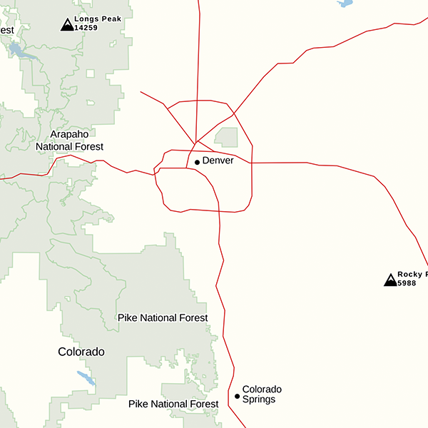
Use Gaia GPS Maps to Find that New Spot

Hunting Catalog

The Gaia GPS catalog tailored for hunting includes private and public land ownership overlays and state-specific game management units.

All hunters will find the Private Land overlay useful for viewing property lines and land ownership information.

When hunting a specific game management unit, add the corresponding Game Management Unit overlay to your favorite based map layer to easily view the boundaries of the unit as you hunt.

With nearly 640 million acres of public land available for use by hunters the Public Land overlay make quick work of showing the location of public land and the managing agency.

Combining the Private Land overlay, with the Public Land overlay and your state’s game management units produces the ultimate hunt map for any hunter not matter if you are chasing elusive bighorn sheep in the Montana backcountry or working bird dogs through the savannas of Georgia.

Montana Big Horn Sheep GMU, US Private Land, and Publlic Land overlays layered on top of Gaia Topo

Base Maps

Gaia GPS includes dozens of great base maps, however, hunters will benefit the most from these base maps:

Satellite Imagery

Choose from crisp satellite imagery with or without labels to get a bird’s eye view of the terrain. You can also use near-in-time satellite imagery to get a sense of real-time conditions on the ground. Check out our suite of Satellite maps here.
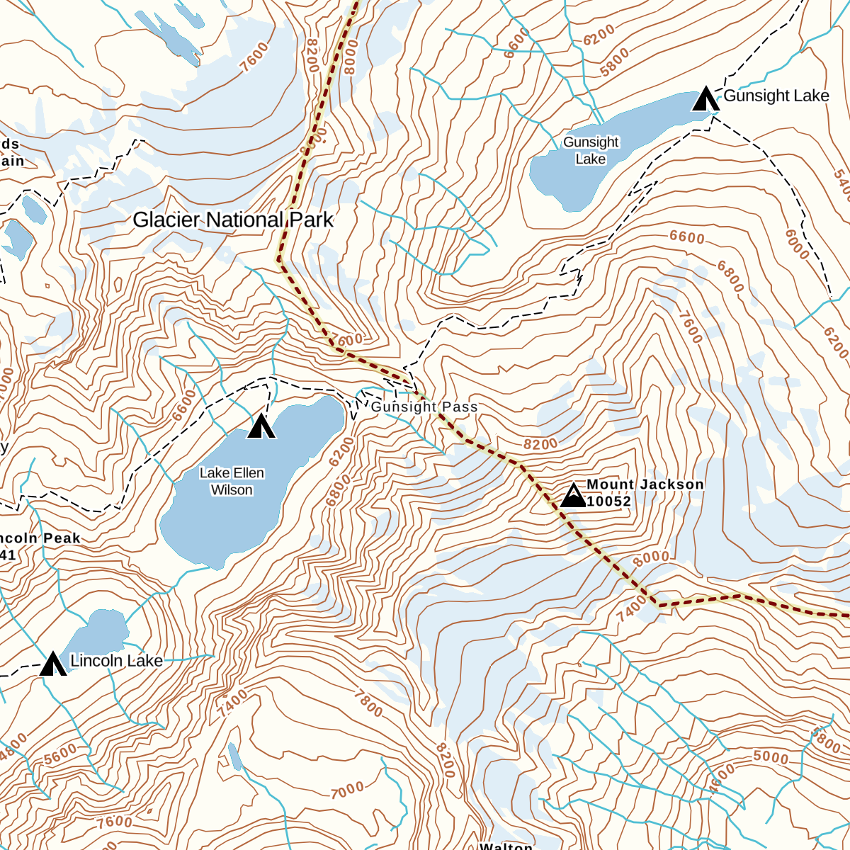
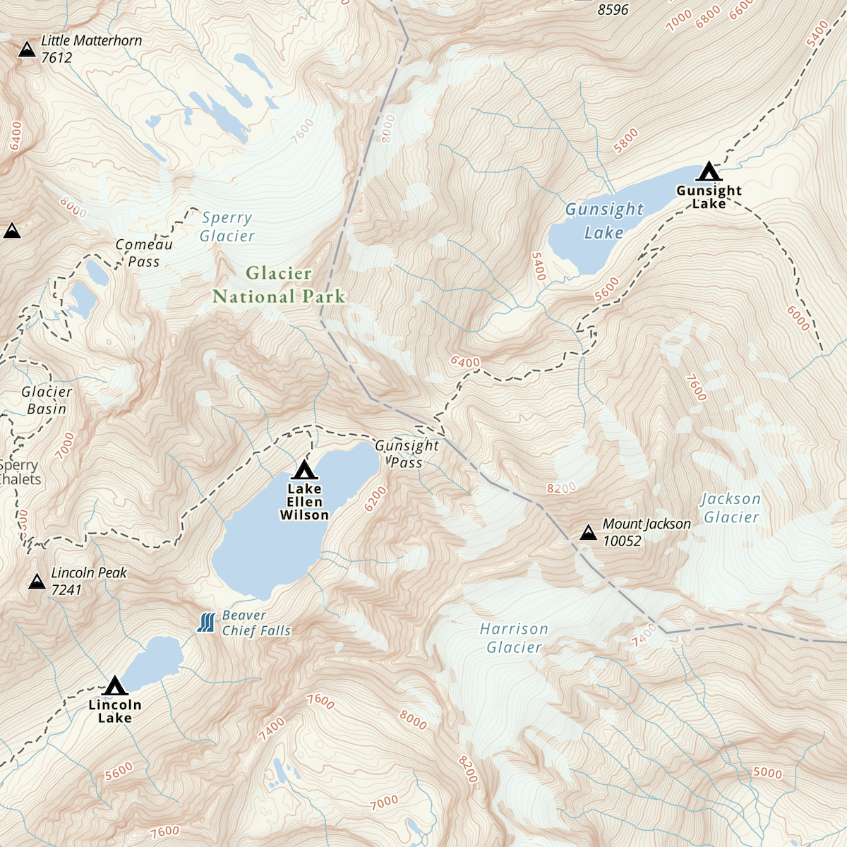
Gaia Topo

Gaia Topo not only makes a great map layer for discovering trails and access points; it also helps identify key land features like funnels, tucked away creek draws, and hidden meadows. Check out Gaia Topo here.

USFS Classic & USFS 2016

With a large portion of the West designated as national forest, the USFS maps provide great coverage for finding access points and undiscovered hunting spots on national forest and grasslands.

Scout from within the App or on gaiagps.com

When you scout with Gaia GPS, you should adjust your map layers to highlight the best data for your hunt. For the base map, try Gaia Topo, Satellite Imagery, or one of the USFS options. Then add any of the hunting overlays and adjust their transparency to create the prefect hunt map.

Gaia Topo & US Shaded Relief

Gaia Topo combined with the US Shaded Relief overlay

Produce a 3D base map for your hunt by layering the US Shaded Relief overlay at 50% transparency on top of Gaia Topo.

Satellite Imagery & Contour Lines

Contours overlay layered on to the Satellite with Labels base map

The combination of the Contour Overlay and the Satellite map can shed some light on the local flora and lay of the land.

USFS 2016 & USFS MVUM

USFS MVUM overlay and the USFS 2016 base map

The addition of the USFS MVUM overlay to the USFS map makes identifying access points straight forward when hunting national forests or grasslands. 

Land Ownership & Game Management Units

Colorado Big Game GMUs, Private Land, Public Land, and US Shaded Relief layered over Gaia Topo

After customizing your base map, add the relevant game management unit overlay for your hunt at 100% transparency to easily distinguish the borders of the game management unit.

Then go ahead and add the Private and Public Land overlays as the top two layers. Organizing the layers in this way allows you to quickly adjust the transparency of these land ownership overlays so you can know whether you have open access to hunt an area or contact the listed owner for access.

Scouting

Now start locating possible glassing spots, bedding areas, travel corridors, trail camera and tree stand sites with custom waypoint icons.

NeoTreks Land Use base map with custom waypoints

After you have finished scouting, use the app to download an offline copy of your custom hunt map and sync your custom waypoints to the app if you used gaiagps.com to scout.

Hunting with Gaia GPS

While in the field, use Gaia GPS to make quick work of finding down game by recording a track and saving waypoints along the blood trail.

Using the Guide Me feature can also help shaves minutes off your pre-dawn hike to your new hunting spot or review your trip stats to estimate just how long it will take to pack out your harvest.

Organizing your hunting waypoints, tracks, and offline maps into separate folders for each management unit or state you hunt, can create an easily accessible digital hunting journal.

Whether planning a solo hunt or a group hunt, Gaia GPS can assist everyone prepare for opening day, no matter if your spot is 1,500 miles away or just a mile from the house.

Spend more time in the field creating memories than stressing over what lies beyond the next ridge.

Join the conversation on the Gaia GPS Community Forums and share how you use Gaia GPS on your hunting adventures.

October 19, 2022
0 FacebookTwitterLinkedinRedditEmail
AndroidApp UpdatesGaia GPSHuntingiOSNew Maps

Easy to Read, Tiny to Download: The All New Gaia Topo

by Julien Friedland January 28, 2020
written by Julien Friedland

Today, we’re proud to announce the launch of one of our biggest projects yet. A combination of under-the-hood tech and visual design work, the all-new Gaia Topo combines world-class cartography with industry-leading download speeds and sizes.

Click here for instructions to access this map on iOS, the web, or in Android via the public beta.

  • Gaia Topo before
  • Gaia Topo after

World-Class Cartography

This project was driven by map-maker Lee France, who joined the Gaia GPS team this spring as the company’s first full-time cartographer. He brings over a decade of mapping experience to the new Gaia Topo, and early in his career, worked on some of the National Geographic Trails Illustrated Maps you can also access in Gaia GPS. You can read more about Lee’s background on the Gaia GPS team page.

The new Gaia Topo features a cleaner look and smarter labeling. That means it’s both easier to use and more beautiful to look at than ever before. We’ve tuned the map to the needs of many stripes of the outdoor adventurer. A new visual hierarchy system causes national and state parks, peaks, and campgrounds to appear first as you zoom in. We’ve also curated features and polished up the labeling system to improve information density. The result is a map that’s both more aesthetically pleasing and more efficient: It shows you exactly what you need at each zoom level without cluttering up your screen.

  • Water labels and contour line styling (before)
  • Water labels and contour line styling (now)
  • Road networks (before)
  • Road networks (after)

Road networks and main trails are now easier to find on the map. You’ll also find better hill-shading and toned-down landcover colors that don’t inhibit visibility.

Finally, we’ve improved contour line styling worldwide. Contour lines also appear sooner, making it easier to picture the terrain during large-scale route planning at low zoom levels. We also corrected a number of user-reported issues with the contour lines in various locations around the world.

Faster Downloads, Beautiful Rendering

With the new Gaia Topo, map downloads are faster and take up far less storage space, even though the new map has better data and styling.

To achieve that difference, we combed through all the data contained in Gaia Topo and eliminated redundant information, and did a neat trick to optimize how we packed each little map tile to be stored for offline use. This sort of optimization is something that defines R&D at Gaia GPS, and it’s what keeps our maps on the cutting edge of quality and download speed.

Download sizeDownload speed
AreaBefore updateAfter updateBefore updateAfter update
Yellowstone National Park63.8 MB28.8 MB1 min, 33 s33 s
Washington State1.34 GB470.8 MB28 min, 20 s9 min, 21 s
Great Smoky Mountains
National Park
42.2MB22.8 MB33 s24 s
Adirondack Park112.8 MB45.2 MB3 min, 19 s1 min, 8 s
Texas1.28 GB538.2 MB1 hr, 2 min20 min, 14 s

Comprehensive Geographic Information

The new Gaia Topo is more thorough and information-rich than ever before, thanks to an expanded roster of data sources. Gaia Topo pulls official government records, crowd-sourced OpenStreetMap information, and existing Gaia GPS data into a living map that constantly updates as new information becomes available.

In addition to comprehensive hiking and camping information, the new Gaia Topo highlights features specific to cyclists, thru-hikers, skiers, anglers, and other more niche categories of adventurer. You’ll find new icons for bicycle parking, ferry routes, beaches, dog parks, hot springs, forest service gates, fishing access points, and backcountry ski huts, to name a few. You can see all new icons in the Gaia Topo map legend.

We’ve also added more ski runs and cross country ski trails, styled to indicate trail difficulty. One-way trails are now marked with small arrow icons.

POI interest icons before the update(left) and after the update (right) ; Map data © OpenStreetMap contributors

How to Get the New Gaia Topo

Gaia Topo is the main map source in Gaia GPS, available to all Gaia GPS users—with or without a paid membership.

The new Gaia Topo is now available on iOS, the web, and in the latest beta test version of Gaia GPS for Android. To access it:

  • iOS: download the latest version of the Gaia GPS app for iOS
  • Android: download the latest version of the Gaia GPS app on Google Play
  • gaiagps.com – visit gaiagps.com/map.

If you had previously downloaded maps, you’ll see a notification offering to let you update your downloads.

Map data © OpenStreetMap contributors

January 28, 2020
4 FacebookTwitterLinkedinRedditEmail
AndroidApp UpdatesGaia GPSHow-ToHuntingiOSNew FeaturesNewsletter

Customize Paper Maps with Gaia GPS

by Julien Friedland October 15, 2019
written by Julien Friedland

Customize paper maps using the new print preview screen on gaiagps.com. Now you can quickly create and adjust selections before printing and be sure that your entire route is captured and easy to read. Additionally, maps can be exported as PDFs and will print in a higher resolution with a more reliable magnetic declination indicator.

Easily Adjust Map Orientation and Size

The new printing interface allows you to see an exact mock-up of the printed map, making it easy to fine-tune your preferred orientation, and size. New border parameters enable you to click and drag the map and zoom in and out to fit the selection of your customized paper map.

Orientation: Toggle between landscape and portrait to view which orientation best fits the map selection. Swapping between different views requires fewer adjustments and makes it easy to see which orientation will be easiest to read when you’re holding the map on route.

Sizing: Choose from six printing size options ranging from letter size (8.5×11) to A2 (16.5×24). Measurements for each map size appear when making a selection, for quick reference.

New Magnetic Declination Indicator

The magnetic declination indicator has been updated to consistently appear on printed maps, no matter how close to zero your magnetic declination is. This means you can always adjust your compass to increase your accuracy while navigating.

Better Resolution and Attribution

Printed maps will now print at a higher DPI and slightly better resolution. Attribution also appears in the bottom left corner of every map, clearly defining the source of the maps data.

Learn More

To access the new print preview screen, head over to the main map at gaiagps.com. To learn more about how to print your maps –including tips on layering and adding gridlines— visit the print maps online blog post or the help center.

October 15, 2019
0 FacebookTwitterLinkedinRedditEmail
Gaia GPSHuntingNew Maps

Meet the New and Improved Public Land Survey System (PLSS) Map Layer

by Corey Buhay May 16, 2019
written by Corey Buhay

Get vastly expanded coverage, new subsection detail, and clearer township and range labels with the updated Public Land Survey System (PLSS) grid layer in Gaia GPS. With more than double the previous coverage, this edition of the map now contains all available PLSS data for the United States.

Earlier versions of the map displayed township and range lines at higher zoom levels, then revealed sections as you zoomed. Now, zoom in even further, and you can see subsections as well. This level of detail makes it easier than ever to find your precise location within a given section.

We’ve also improved the map styling, cleaning up the labels and adjusting the colors to improve visibility across a variety of base maps.

The PLSS grid layer, before and after the update. Coverage in Alaska (not pictured) has also been expanded.

About the Public Land Survey System

The Public Land Survey System, or PLSS for short, is a system of boundary lines used for apportioning and describing land areas in the western United States. It was devised in the 1780s, after the Revolutionary War, as a system for dividing land into plots, which could then be given to war veterans and prospective settlers of the then-wild West.

Today, PLSS boundaries are still used to delineate property boundaries, and natural resource managers, surveyors, and hunters use range and township lines to talk about geographic location. Many boundaries are still labeled with physical markers, like disc-shaped metal “monuments” or wooden posts.

PLSS markings carved into a tree in the Beaverhead Mountains. Photo courtesy of Jesse Crocker.

How to Use Township and Range Boundaries

The vertical lines of the PLSS grid are called range lines, and the horizontals are called township lines. Range lines are measured in 6-mile increments east and west of lines of longitude, called principal meridians. Likewise, township lines are measured in 6-mile increments north and south of lines of latitude, called baselines.

Each resulting 6-by-6-mile square is called a township. Labels include numbers to indicate the township’s distance from the relevant baseline and principle meridian, as well as letters to show its spatial relationship (whether it’s north, east, south, or west) from the central intersection of those two lines.

Each square mile within a township is called a section, which is numbered 1 through 36. And, finally, each section is divided into 16 40-acre subsections. Each subsection is described in terms of its cardinal direction from the center of the section. For example, the far southeast subsection would be called SESE, and the far northwest subsection would be NWNW. (See an example in the screenshots below).

How to use the Public Land Survey System Layer

The updated PLSS grid is available to Gaia GPS users with a Premium Membership. Android users can find it in the Premium Overlays Category. iOS and web users will be able to access it through the Weather & Feature Overlays category of the map manager.

Simply add the layer atop any base map in Gaia GPS, and zoom to view increasing levels of detail. The map styling will adjust as you zoom to preserve readability, regardless of background.

In iOS, you can tap a subsection to learn its exact acreage.

May 16, 2019
0 FacebookTwitterLinkedinRedditEmail
Gaia GPSHuntingNew Maps

New! Colorado Fishing and River Maps

by Corey Buhay April 24, 2019
written by Corey Buhay

Whether your ideal afternoon involves casting in riffles or riding rapids, the NatGeo Colorado Fishing & Rivers map layer has everything you need to get out on the water in the state of Colorado.

NatGeo Colorado Fishing & Rivers contains complete coverage of all the wild banks, backcountry access spots, and adjacent lakes and ponds for the Roaring Fork, South Platte, and Blue Rivers. It also covers large sections of the Arkansas, Colorado, and Fryingpan Rivers.

Built with National Geographic’s characteristic attention to detail, accuracy, and smart map design, this layer is a complete picture of not only the river courses themselves, but their banks, recreation areas, access points, and adjacent ponds and lakes. The result is a complete picture of each river ecosystem, and the boating routes within it.

Colorado: A Boater and Angler’s Paradise

In Colorado, Rocky Mountain snowmelt and steep slopes have worked together to forge some of the mightiest rivers in the United States: Seven major rivers, including the Rio Grande, Arkansas and Colorado, all have their headwaters in the Centennial State.

The sheer number and variety of waterways makes Colorado ideal for boaters of all experience levels. Visit river towns like Salida or Buena Vista for a family rafting trip with an experienced guide, or head into Colorado’s deeper canyons and rougher rapids in a kayak or packraft for higher-level adventure.

Colorado’s abundant wilderness areas and protected lands mean all its mighty rivers and fast-flowing mountain streams are not only beautiful to float, but teeming with trout as well. Cast a line, and you’ll find rainbows, browns, brook, cutthroat, and steelhead, as well as kokanee salmon and lake trout.

Brooke trout coming in for a bite. Photo courtesy of Heath Alseike, via Flickr.

Map Features for Fishing, Kayaking, Rafting, and Boating Trips

The NatGeo Colorado Fishing & Rivers map includes clearly marked river miles, access points, put-ins, and the names and ratings of rapids, making it easy to locate yourself on the river, share route information, and plan trips. You’ll also find labeled stream gage sites to reference when researching flow rates at potential fishing or boating spots. Land ownership boundaries and recreation sites also make it easy to scout out campsites along the way.

How to Use the NatGeo Colorado Fishing + Rivers Map

The NatGeo Colorado Fishing & Rivers layer is available to web, iOS, and Android users with a Premium Membership. You’ll find the map in the United States category of the map manager. Tap to add it to your Layers menu, and use it as a robust, stand-alone base map for any of the waterways it covers.

Before hitting the water, be sure to review local regulations and guidelines, especially those for decontaminating watercraft. Do your part to protect riparian habitat and help prevent the spread of invasive species in Colorado.

Rafters navigating the Arkansas River, Colorado. Photo courtesy of Kari, via Flickr.

Feature photo courtesy of the Bureau of Land Management, via Flickr, of the Arkansas River outside Buena Vista, Colorado

April 24, 2019
1 FacebookTwitterLinkedinRedditEmail
FeaturedGaia GPSHuntingNew Maps

Seek Out the Wild with the New Wilderness Areas Map Overlay

by Corey Buhay February 28, 2019
written by Corey Buhay

In the U.S., a wilderness area is officially defined as a place “retaining its primeval character and influence,” a place “untrammeled by man, where man himself is a visitor who does not remain.” As such, wilderness areas are the gold standard for conservation, preservation, and experiencing nature in its rawest form.

But in the developed American landscape, true wilderness can be hard to find. That’s why Gaia GPS created the new Wilderness Areas Map Overlay. Now, getting your next dose of deep-woods solitude is a whole lot easier.

https://blog.gaiagps.com/wp-content/uploads/2019/02/TEmplate_1-1.mp4

Why Find Wilderness?

Research has proven time and time again that nature is good for human health. But not all nature is created equal. In fact, some newer studies suggest that the deeper you go, the stronger the effect of nature on stress reduction. That means that out of every land management type, wilderness is the most effective medicine.

Plus, wilderness areas come with their own rules and restrictions, so whether you’re looking for guaranteed primitive experience or just trying to make sure you’re using a drone, 4×4 vehicle, or snowmobile legally, it’s a good idea to know where the boundaries are. With the Wilderness Areas Overlay, you can pinpoint those spots with ease.

How to Use the Wilderness Areas Overlay

The Wilderness Areas map overlay is currently available to Premium Members on Android and iOS platforms, as well as on gaiagps.com. Go to the Feature/Weather Overlay category of the map manager, and add the Wilderness Areas Overlay atop any of your favorite base maps. We recommend using the layer in conjunction with the Roadless Areas Overlay to find even deeper solitude, or adding the Snowfall Forecast or Precipitation Forecast Overlays to help you plan your trip.

In iOS, the layer is interactive. Tap on any wilderness to view the area’s land manager, acreage, and the year it was established, or to discover the best hikes within that zone

All boundary, land area, and land management information is sourced from the nationwide database of www.wilderness.net, a public information hub dedicated to United States wilderness areas.

February 28, 2019
0 FacebookTwitterLinkedinRedditEmail
FeaturedGaia GPSHuntingNew Maps

Unlock New Routes with the USFS Roads and Trails Overlay

by Corey Buhay January 14, 2019
written by Corey Buhay

An overlay featuring backroads, forgotten trails, and brand-new routes currently unavailable on any other Gaia GPS map, USFS Roads and Trails expands your possibilities. Use it to explore the backcountry, and add it to your repertoire of tools for building the ultimate customized map.

The USFS Roads and Trails overlay displays a web of roads and trails sourced from official U.S. Forest Service data, and uses a color-coded scale to indicate how developed each road or trail is. In iOS, it’s also interactive: Tap a pathway in the app to get information on its width, surface type, and vehicle clearance requirements.

Because this layer is updated more frequently than the more expansive USFS topo maps, it’s a useful resource for discovering new trails that don’t yet exist on those maps, as well as for checking the status of old ones.

This new overlay is designed to supplement Open Street Map data with government-verified information. It’s an ideal supplement for existing Gaia GPS topo maps in addition to the USFS Motor Vehicle Use Map (MVUM) overlay, as the USFS Roads and Trails layer is derived from a separate dataset. It therefore covers some areas unavailable on the MVUM overlay, and vice versa.

How to Use the USFS Roads and Trails Overlay

The USFS Roads and Trails overlay is available for iOS and Android users as well as on gaiagps.com. It will be updated four times per year as the USFS releases new information.

To access the layer, find it in the Feature/Weather Overlays category of the map manager. Then, add it atop any of your favorite base maps to see available routes clearly picked out against the background of your choosing. This and other detailed map layers are currently available to those with a Premium Membership.

You can find the legend below as well as on the Gaia GPS Map Legends page.

January 14, 2019
0 FacebookTwitterLinkedinRedditEmail
AndroidApp UpdatesFeaturedGaia GPSHuntingiOSNew FeaturesNew Maps

Streamline Your Navigation with the Satellite Topo Base Map

by Corey Buhay December 13, 2018
written by Corey Buhay

Combine the best features of the Gaia Topo base map with ESRI world satellite imagery on a single, easy-to-use layer. Ideal for everything from planning backcountry ski tours to scouting off-trail routes up desert washes, the new Satellite Topo map promises to become Gaia GPS’s most versatile base map yet.

The seamless marriage of satellite imagery and clear contour lines gives backcountry skiers an accurate picture of avalanche slide paths, and lets backpackers and overlanders view tree cover and slope steepness for easier campsite scouting. The combination also illuminates terrain obstacles for both climbers and hikers, making it easier to find descents and reroutes, devise new linkups, and formulate emergency exit strategies on the fly. No matter what you do, the Satellite Topo map will leave you better informed and better prepared.

https://blog.gaiagps.com/wp-content/uploads/2018/12/SATTopo.mp4

What is the Satellite Topo Map?

Satellite Topo is a base map designed to combine the popular way-finding features of Gaia Topo with a high-resolution picture of the landscape. To achieve that, Gaia GPS removed the plain background from Gaia Topo. We then replaced it with high-resolution imagery from ESRI, an international supplier of geographical information and satellite photography.

The result is a network of clearly marked roads and trails, labeled terrain features, and distinct contour lines (all sourced from OpenStreetMap data) on a background that perfectly resembles the world around you. Essentially, the combination streamlines your navigational workflow by bringing the map one step closer to your reality.

How to Use it

The Satellite Topo base map is available in two versions: meters and feet. It’s accessible to Premium Members on iOS and Android platforms as well as on gaiagps.com. To use it, follow these steps:

  1. Open the Layers Menu and navigate to the Satellite Imagery catgory.
  2. Click the plus sign next to the Satellite Topo map in your preferred unit of measurement to turn it on.
  3. Slip the map beneath any of your favorite overlays in place of your existing base map.
December 13, 2018
0 FacebookTwitterLinkedinRedditEmail
App UpdatesGaia GPSHow-ToHuntingiOSNew FeaturesNew Maps

Plan Your Winter Adventure with the Snowfall Forecast Overlay

by Corey Buhay November 30, 2018
written by Corey Buhay

Whether you’re chasing powder or just trying to avoid a day of postholing in two feet of fresh, the new 24-, 48-, and 72-hour Snowfall Forecast overlays make it easy to dial in your winter trip prep.

Available for both iOS users as well as on gaiagps.com, the Snowfall Forecast overlays use color-coded shading to show the expected snow accumulation. That makes it easy to plan ski trips, pick the right traction and flotation for winter hikes, and assess avalanche conditions. Just combine the Snowfall Forecast overlay with your base map of choice (and, if you’re doing avy analysis, the slope-angle shading overlay.)

https://blog.gaiagps.com/wp-content/uploads/2018/11/Snow-Overlay.mp4

Snowfall Predictions Updated Every 6 Hours

The Snowfall Forecast overlays draw data directly from the Winter Weather Desk of the National Oceanic and Atmospheric Administration (NOAA)’s Weather Prediction Center. The Winter Weather Desk uses a combination of predictive models to create its forecasts, which the National Weather Service then reviews and refines. The collaborating teams constantly refresh their models, providing updated reports every six hours.

The forecasts can accurately predict snow accumulation as far as three days (72 hours) in advance, and they cover all of the continental U.S. as well as parts of southern Canada.

How to Use the Snowfall Forecast Overlay

These overlays derive their predictions from NOAA’s probabilistic weather forecasts, which calculate the percent likelihood that a certain amount of snow will accumulate over a given time period. Gaia GPS uses NOAA’s 50th percentile forecasts. That means there’s a 50-percent chance that each shaded area will receive the indicated amount of snow accumulation during the forecast period. (This may seem low, but it gives the user the best estimate of land area likely to be affected by snow. For that reason, it’s the percentile most commonly shown on other popular forecasting sites.)

Add the Snowfall Forecast Overlay to Any Map in Gaia GPS

Available for gaiagps.com and iOS users with Premium Memberships, the Snowfall Forecast overlays can be viewed with an internet connection. Since the forecasts are always changing, they can’t be downloaded for offline use. However, when you look at the snowfall forecast in the app, your device will cache snapshots of the areas you viewed. The cached data will remain available on your device for 24 hours.

From the Map Sources menu, navigate to the Feature/Weather Overlays category. Pick the forecast overlay that suits your planning needs, and add it atop any base map. Set the transparency to between 30 and 40 percent for optimal visibility.

Check out this video for more tips on adding new map sources in the app:

A Note on Safety

Weather forecasts make great planning tools, but you should always research the terrain and alternate routes ahead of time, and cross-reference any forecast you use with several others for the most accurate predictions. And no matter what the reports say, plan for inclement weather, just in case.

November 30, 2018
1 FacebookTwitterLinkedinRedditEmail
Gaia GPSHuntingNew Maps

Use the Roadless and Trailless Areas Overlays to Find Solitude at a Glance

by Corey Buhay November 19, 2018
written by Corey Buhay

Next time you need to get away from it all, really get away with Gaia GPS’s new Roadless Areas overlay. Or, go even deeper with the Roadless and Trailless Areas overlay.

Maybe you’re looking for a high mountain stream that hasn’t been fished out, a piece of the whitetail season opener you can call your own, or backcountry water ice begging for a first ascent. Or maybe you’re just after deep-woods quiet and down-valley views uncrossed by asphalt.

Whatever the reason, use these overlays to leave the crowds behind. Apply the Roadless Areas overlay to your favorite base map to chart an on-trail course far from roads of any kind, and use Roadless and Trailless Areas overlay to find land trafficked only by wildlife.

https://blog.gaiagps.com/wp-content/uploads/2018/11/Roadless_cut-1.mp4

How It Works

Based on trail and road data from the Gaia GPS Topo base map, the Roadless Areas Overlay uses gradient shading to indicate how far any given spot is from the nearest road, and the Roadless and Trailless Areas further bounds that data by limiting more darkly shaded areas to places that are far from footpaths as well.

How to Use It

Available for both iOS and Android users with Premium Memberships, and on gaiagps.com, both the Roadless Areas overlay and the Roadless and Trailless Areas overlay can be viewed while connected to the internet or while you’re off the grid and out of service.

From the Map Sources menu, navigate to the Feature/Weather Overlays category. Add either the Roadless Areas overlay or the Roadless and Trailless Areas overlay atop your basemap of choice.

The transparency is completely adjustable, but starting with 100% opacity makes it easiest to visualize distances. At that setting, opaque orange indicates that an area is two miles or more from the nearest road and/or trail. Lighter orange shading indicates areas that are at least 0.25 mile or more from those features.

Then, reduce transparency to around 50% (as shown above) for the best visibility while route planning.

A Note on Off-Trail Hiking 

Before you venture off-trail, make sure you’re exploring on public land where off-trail hiking is permitted. Pro tip: Add the Public Land layer (in the Premium Overlays category of the Map Manager) for quick reference, and double-check regulations with your local land manager.

A Note on Safety

Use these maps to seek out your next dose of true wilderness, but use the same caution you would in any backcountry situation. The farther you wander from roads and trails, the more difficult it is to reach help in case of an emergency. Brush up on your first-aid and wilderness self-sufficiency skills before you head out, and consider taking an emergency communication device if you’re wandering deep into unknown terrain. No matter how far you want to go, Gaia GPS provides the maps to get there. It’s up to you, however, to get yourself out.

November 19, 2018
1 FacebookTwitterLinkedinRedditEmail
Load More Posts

Categories

  • Adventures
  • Android
  • App Comparisons
  • App Updates
  • Backcountry Skiing
  • Boating
  • Company News
  • Emergency Response
  • Featured
  • Fishing
  • Gaia GPS
  • Gaia GPS Offroad Podcast
  • GaiaCloud
  • Hikes
  • How-To
  • Hunting
  • iOS
  • New Features
  • New Maps
  • Newsletter
  • Offroading
  • Out and Back Podcast
  • User Profiles

Recent Posts

  • The Hike Map That Broke Me: How Gaia GPS Turned an Overlander Into a Reluctant Hiker
  • A Fond Farewell to National Geographic Maps — And a Look at What’s Ahead
  • Introducing the Gaia Hike Map
  • Download the app and get a free 14-day trial of Gaia GPS Premium
    • Facebook
    • Twitter
    • Instagram
    • Youtube
    • RSS
    • Explore The Map
    • Get the App
    • Upgrade Today
    • Explore The Map Catalog
    • New Features
      • Gaia GPS

        The Hike Map That Broke Me: How Gaia…

        April 24, 2025

        Gaia GPS

        Introducing the Gaia Hike Map

        March 18, 2025

        Gaia GPS

        Unlock a New Level of Personalization in Gaia…

        December 12, 2024

        Gaia GPS

        Goodbye Clutter, Hello Streamlined Maps: Introducing Sync to…

        November 26, 2024

        Gaia GPS

        Discover Prime Stargazing Locations with Our New Light…

        August 15, 2024

        Gaia GPS

        2023 Mapped: Our Best New Features of the…

        December 27, 2023

        Gaia GPS

        Discover Adventure Easier Than Ever with New Map…

        July 27, 2023

      • New Maps
        • Gaia GPS

          Discover Prime Stargazing Locations with Our New Light…

          August 15, 2024

          Gaia GPS

          Find Prime Viewing for Total Solar Eclipse with…

          March 27, 2024

          Gaia GPS

          See the World More Clearly with New Gaia…

          May 18, 2023

          Gaia GPS

          Gaia Classic: The Only Map You’ll Ever Need?

          May 4, 2023

          Gaia GPS

          Why NatGeo Trails Illustrated are America’s Favorite Maps

          February 9, 2023

          Backcountry Skiing

          Find Backcountry Skiing in Gaia Winter Map

          January 11, 2023

          Gaia GPS

          Our Favorite New Maps and Features

          December 23, 2022

    • Activities
      • Backcountry Skiing
      • Boating
      • Emergency Response
      • Fishing
      • Offroading
    • Adventures
      • User Stories
    • Help

    @2024 - All Right Reserved. Gaia GPS


    Back To Top