Every year, I love reflecting on the adventures life has taken me on. For me, 2023 led to a different kind of adventure – traveling abroad to Italy. Typically, my adventures consist of a mix of Colorado hikes with my dog, the occasional local road trip to explore new trails and an annual trip within the US for a break when my budget allows for it. Then, in November 2023, my mom invited me on a trip to Italy, marking an exciting new chapter in my travel book as it would be my first time venturing outside of the United States.
Now, you may be reading this as a seasoned traveler who has explored a variety of places internationally (jealous!). But for me, as a midwestern-rooted girl now living in Colorado, the initial thought of traveling abroad was a little intimidating. My mom and I felt a mix of emotions as we planned our trip: excitement, wonder, nervousness, and curiosity, to name a few. What if we got lost? How would we know where to go?
While we had done the usual trip planning of plotting out our days and activities with the help of a travel agent, I also knew that Gaia GPS would be there to help me navigate this new type of adventure.
To be honest, I didn’t realize how much Gaia GPS would come in handy during my Italy trip. I typically use it for hiking and local adventures in the woods of Colorado, but it turns out that Gaia GPS is great for any type of adventure—even navigating the cities and streets of Italy. The app gave me peace of mind knowing that I’d have reliable navigation in my pocket every step of the way. So, here are my tips and tricks on how you can use Gaia GPS when traveling internationally (or anywhere, really)!

Download Maps Before You Go
When traveling, there’s one thing you can count on—you’ll need to know where you’re going and how to get back. This is especially true if you’re in a foreign country where the local language may not be the same as your own.

Before we left for Italy, I made sure to download offline maps of the cities we would be visiting because I wasn’t sure what cell service would be like in places like Rome and Florence. Even with cell service available, you might not have a cellular data plan that covers international usage. While cell service is usually fine in larger cities, I believe it’s always a good idea to be prepared and download maps ahead of time for any adventure. For this trip, I used Gaia Topo and Gaia Topo Black and White, as they provided the clearest streets and landmarks, along with the bonus of major points of interest marked nearby.
Once I downloaded the maps, I spent a bit of time exploring the areas where we’d be staying and added waypoints for our hotels.
Pro tip: Utilize the notes feature when creating a Waypoint and include the hotel address—just in case you need it for a taxi or if you get lost!
Waypoints: Your Next Best Friend
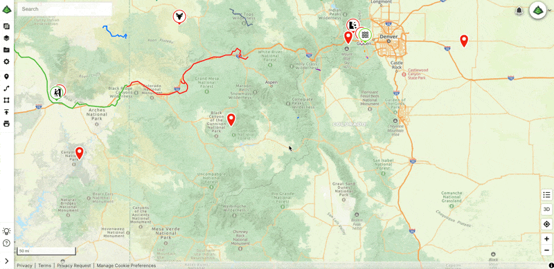
If you’re not familiar with waypoints, they’re essentially location markers that help you remember important spots. In addition to marking our hotel and major landmarks, I used waypoints to keep track of memorable restaurants we visited and places that stood out to me. Sometimes when traveling, locations can blend together, but with waypoints, I could quickly pinpoint where we were and what we saw to reference it at any time.

A great bonus feature of Gaia GPS is that you can add notes and photos to each waypoint. This came in handy when we came across memorable locations and restaurants I wanted to revisit someday.
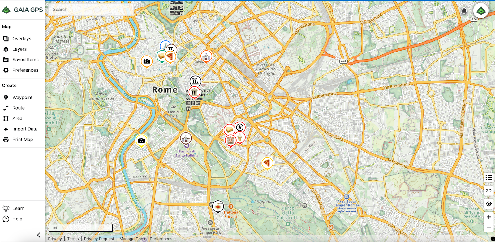
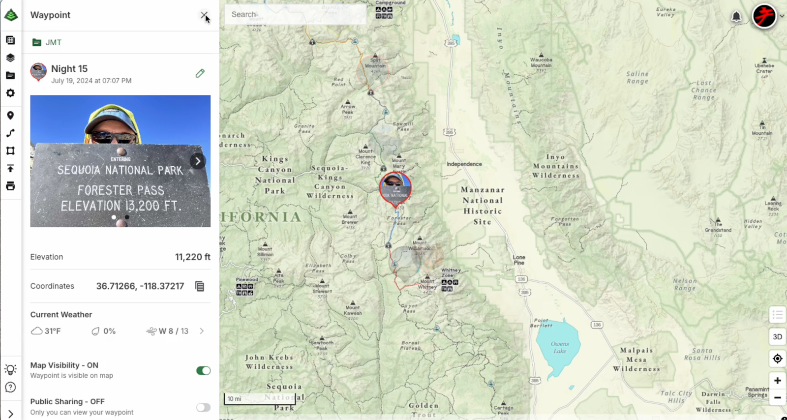
Personalize Your Map With the New Photo Waypoint Feature
With the new Photo Waypoint feature, Premium members can now enhance their map experience by adding images to their waypoint icons on the web! Since this feature launched after my trip, I’ve been having a blast revisiting my waypoints and customizing them with my favorite photos. It’s a fun way to make my maps more personal and relive my adventures in a completely new way. Ready to take your own maps to the next level? You can start adding Photo Waypoints to your adventures by following the steps here!
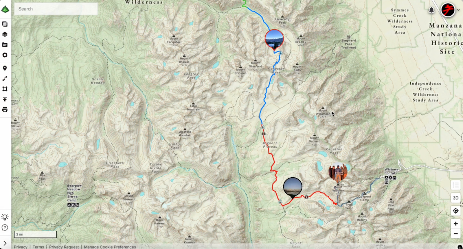
Plot Routes to Estimate Your Walking Distance to Each Destination
One of the best parts about traveling to cities like Rome and Florence is exploring on foot. The streets are filled with rich history, culture, and charm—but they can also be a maze of narrow alleyways and winding paths. With Gaia GPS, I was able to plan out our walking routes between destinations before we even stepped out the door. Whether we were heading to the Colosseum in Rome or the Duomo in Florence, I used the route-planning feature to estimate the walking distance and pick the best path. This helped me estimate how long each excursion would take, allowing for some flexibility to stop for gelato or enjoy an impromptu café break along the way since our days were jam-packed with places to see.

Navigate to Your Destination
Although I had pre-plotted most of our routes, there were many times (if not most of the time) we found ourselves wandering off the beaten path. It’s easy to get turned around in new cities, especially when you’re exploring with no specific plan. Gaia GPS offers a Driving Directions feature that was a total lifesaver when we found ourselves walking through Rome and the maze of Florence’s narrow streets. With just a few taps, you can quickly select a waypoint and get turn-by-turn walking or driving directions to your destination.
While the Guide Me feature is useful for plotted routes, I ended up relying on the Driving Directions feature much more often throughout the trip. It was perfect for those spontaneous detours when we found ourselves wandering to unplanned destinations and I didn’t want to bother plotting a new route every time we stopped. While it’s labeled as “Driving Directions,” this feature also works great for walking directions to any chosen waypoint. Click here to discover more about how to use it!
Record Your Tracks

One feature I didn’t use on this trip, but would definitely recommend for future adventures, is the track recording option. If you’re a fitness enthusiast or just want to track how much ground you’ve covered, Gaia GPS allows you to record your movements throughout the day. Since we averaged about 20,000 steps per day, it would have been fun to visually track our progress as we explored different parts of the cities. In the future, I’ll definitely use this feature to get a detailed record of all the places we visited. Plus, it’d be cool to look back and relive our exact routes.
Pro tip: When recording your tracks for longer adventures, stop and save the track recording when you stop for a break so that you have different sections of track recordings versus one continuous track. This allows for optimal app performance and also gives you the flexibility to organize your adventures afterward.
That’s a Wrap!

At the end of the trip, I decided to create a folder in Gaia GPS to organize all the waypoints and routes from our adventure. This made it easy to reference the information later, whether I wanted to relive a specific day or share recommendations with friends. Bonus tip: I used the shared folder feature so that my mom could have access to our adventure data, too!
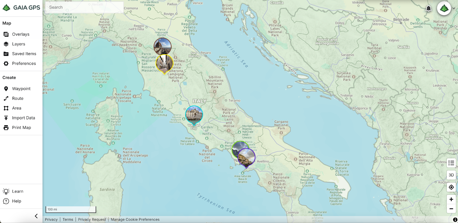
For a more tangible keepsake, I created a photo book of our trip, including a screenshot of the map of Italy, using waypoints to mark the cities we visited. It was a fun way to reminisce about the places we explored and the memories we made. I did this by using the Print Map feature and exporting a PDF map file of Italy. I then imported the PDF file into the photo book platform I used.
Traveling through Italy was truly a dream come true, and I’m so glad I had Gaia GPS to guide me along the way. Whether you’re planning an international adventure or a road trip closer to home, Gaia GPS is the perfect tool to help you navigate and document your journey, ensuring you never lose your way—no matter where your adventure takes you. Safe travels and happy exploring!


")


")
")