Gaia GPS
  • Explore The Map
  • Get the App
  • Upgrade Today
  • Explore The Map Catalog
  • New Features
    • Gaia GPS

      The Hike Map That Broke Me: How Gaia…

      April 24, 2025

      Gaia GPS

      Introducing the Gaia Hike Map

      March 18, 2025

      Gaia GPS

      Unlock a New Level of Personalization in Gaia…

      December 12, 2024

      Gaia GPS

      Goodbye Clutter, Hello Streamlined Maps: Introducing Sync to…

      November 26, 2024

      Gaia GPS

      Discover Prime Stargazing Locations with Our New Light…

      August 15, 2024

      Gaia GPS

      2023 Mapped: Our Best New Features of the…

      December 27, 2023

      Gaia GPS

      Discover Adventure Easier Than Ever with New Map…

      July 27, 2023

    • New Maps
      • Gaia GPS

        Discover Prime Stargazing Locations with Our New Light…

        August 15, 2024

        Gaia GPS

        Find Prime Viewing for Total Solar Eclipse with…

        March 27, 2024

        Gaia GPS

        See the World More Clearly with New Gaia…

        May 18, 2023

        Gaia GPS

        Gaia Classic: The Only Map You’ll Ever Need?

        May 4, 2023

        Gaia GPS

        Why NatGeo Trails Illustrated are America’s Favorite Maps

        February 9, 2023

        Backcountry Skiing

        Find Backcountry Skiing in Gaia Winter Map

        January 11, 2023

        Gaia GPS

        Our Favorite New Maps and Features

        December 23, 2022

  • Activities
    • Backcountry Skiing
    • Boating
    • Emergency Response
    • Fishing
    • Offroading
  • Adventures
    • User Stories
  • Help
Top Posts
The Hike Map That Broke Me: How Gaia...
A Fond Farewell to National Geographic Maps —...
Introducing the Gaia Hike Map
Download the app and get a free 14-day...
Gaia GPS is Improving Satellite Imagery: Saying Goodbye...
How I Used Gaia GPS to Navigate Italy
Gaia GPS x Toyota: A New Way to...
Download Gaia GPS– iOS & Android App
Unlock a New Level of Personalization in Gaia...
Important Update: Changes to Esri World Imagery Offline...
Gaia GPS
  • Explore The Map
  • Get the App
  • Upgrade Today
  • Explore The Map Catalog
  • New Features
    • Gaia GPS

      The Hike Map That Broke Me: How Gaia…

      April 24, 2025

      Gaia GPS

      Introducing the Gaia Hike Map

      March 18, 2025

      Gaia GPS

      Unlock a New Level of Personalization in Gaia…

      December 12, 2024

      Gaia GPS

      Goodbye Clutter, Hello Streamlined Maps: Introducing Sync to…

      November 26, 2024

      Gaia GPS

      Discover Prime Stargazing Locations with Our New Light…

      August 15, 2024

      Gaia GPS

      2023 Mapped: Our Best New Features of the…

      December 27, 2023

      Gaia GPS

      Discover Adventure Easier Than Ever with New Map…

      July 27, 2023

    • New Maps
      • Gaia GPS

        Discover Prime Stargazing Locations with Our New Light…

        August 15, 2024

        Gaia GPS

        Find Prime Viewing for Total Solar Eclipse with…

        March 27, 2024

        Gaia GPS

        See the World More Clearly with New Gaia…

        May 18, 2023

        Gaia GPS

        Gaia Classic: The Only Map You’ll Ever Need?

        May 4, 2023

        Gaia GPS

        Why NatGeo Trails Illustrated are America’s Favorite Maps

        February 9, 2023

        Backcountry Skiing

        Find Backcountry Skiing in Gaia Winter Map

        January 11, 2023

        Gaia GPS

        Our Favorite New Maps and Features

        December 23, 2022

  • Activities
    • Backcountry Skiing
    • Boating
    • Emergency Response
    • Fishing
    • Offroading
  • Adventures
    • User Stories
  • Help
Tag:

search and rescue

Two members of search and rescue wait on a mountain summit. A helicopter is flying behind them.
Backcountry SkiingEmergency ResponseGaia GPSOut and Back Podcast

The Best Winter Backcountry Tips from Search and Rescue

by Mary Cochenour November 23, 2020
written by Mary Cochenour

How to listen: iTunes | Google Play | Spotify | Stitcher | Pocket Casts | RadioPublic | Breaker | Castbox

Get up to 50% off
Gaia GPS

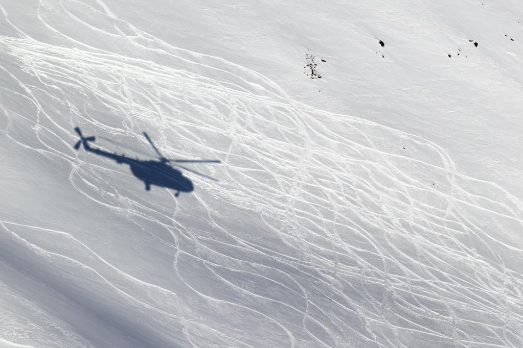
Winter looms with promises of bluebird skies, powder stashes, and possibly record crowds in the backcountry this season. We’re excited to kick off the first episode of our winter backcountry series on the Out and Back podcast with Colorado’s Summit County Rescue Group Mission Coordinator Charles Pitman. In this episode, Pitman runs through some of his best winter safety tips. He also gives us the temperature of what the upcoming backcountry ski season looks like from a search-and-rescue perspective. Pitman says it might not be pretty.

“The backcountry retailers are selling out of gear already. There are some who said they have sold out for the year, both retailers and manufacturers. So that tells me this could be a rather interesting year for people going into the backcountry who really are probably not too prepared to do it.” Pitman says. “We want to try to get the message out on what they need to consider.”

Two rescue crew members rappel down a steep snow filled couloir in Colorado.

Pitman recaps the strain his organization felt when the ski areas shut down last spring due to the pandemic. He recalls jammed trailheads and skiers and snowboarders leaving the parking lots without crucial avalanche safety equipment. The backcountry continued to draw massive crowds through the summer and into fall, bringing with it an unprecedented number of rescues this year.

During one week in October alone, the Summit County Rescue Group assisted a lost mountain biker, an injured hiker, and a technical body recovery mission from one of the area’s 14,000-foot peaks. Pitman says the number of rescues are at an all-time high and far surpassing the 150 calls for service the team received last year.

“Certainly my antennas are going up about how we need to prepare. We’re starting to do our preparations as a team earlier. Of course, that’s more difficult now. We don’t have the same types of meetings we had before because we have to cope with the Covid restrictions and considerations that we take very, very seriously here,” Pitman says. “I’m a bit concerned about what’s going to happen this winter.”

Tune in to Learn Winter Safety Tips

Pitman enlightens us on what backcountry enthusiasts can do to stay safer this winter. He delivers practical advice, including how to recognize and avoid avalanche danger in backcountry travel, what to do if you need help, and what you should put in your backpack to be prepared in case something goes wrong. Backcountry skiers, winter hikers, climbers, and snowmobilers will not want to miss this behind-the-scenes look at the upcoming snow season and what rescue professionals are doing to prepare for the busy season ahead. Plus, hear a few of Pitman’s most harrowing rescue stories.

Make sure you are prepared this winter season. Learn more about avalanche safety at avalanche.org. Find and sign up for an avalanche education class with the American Institute for Avalanche Research and Education. Learn more about Summit Country Rescue Group and donate to your local search and rescue organization.

A helicopter hovers over a high mountain peak in Colorado and a search and rescue crew member waits on the mountain for pick up.
Summit County Search and Rescue crews carry out a mission earlier this year on one of Colorado’s high-altitude peaks.

Episode Highlights:

4:30: The pandemic made the backcountry around Denver busy this year and many skiers, snowboarders, and snowmobilers were ill-equipped for safety.
8:15: This year has been a record-setting rescue season in Summit County, Colorado.
12:00: Search and Rescue is preparing for a busy winter season.
13:15: Here’s how COVID 19 has changed search and rescue missions in Summit County.
17:00: Practice your avalanche transceiver skills at a beacon park.
18:15: More people are taking avalanche classes, but these classes are limited and filling up quickly this year.
19:00: Get search and rescue’s tips to avoid avalanches: get the avalanche forecast, check the weather, and stick to low-angle slopes if you aren’t sure about the danger.
25:25: Avalanche forecasting is not an exact science and sometimes you can do all the right things and still get into trouble.
26:15: A case study about five people who died in an avalanche: what went wrong?
27:00: Is technology giving people a false sense of security and too much confidence?
32:00: Colorado typically has a weaker snowpack and experiences more avalanches than other areas of the country.
36:00: A GPS mapping app on your phone, like Gaia GPS, would reduce the number of rescue calls because people could see exactly where they are on the map and easily find the trail if they get lost.
39:00: Two-way satellite communication devices help search and rescue crews to understand the help you need, plus Pitman tells us what happens when you press the SOS button.
42:00: Pitman says call for help sooner rather than later, it could save a life.
48:40: Make a plan for your backcountry adventure but don’t succumb to summit fever, be flexible and willing to adjust plans when you get out on the mountain because conditions may change rapidly.
53:00: Most search and rescue crews are volunteers and they do it for the heartwarming stories with uplifting endings.

Next Episode: Snow Safety Tips with Avalanche Expert and Author Bruce Tremper

Avalanche expert Bruce Tremper is standing in a snow pit and writing down his observation in a booklet.  He is wearing a yellow jacket and snow hat.

If the solitude of the backcountry beckons to you this winter, you won’t want to miss the next episode of the Out and Back podcast with avalanche expert and author Bruce Tremper. Winter hikers, skiers, splitboarders, and snowmobilers will appreciate how Tremper breaks down his “low-risk travel ritual” to minimize avalanche exposure in the backcountry. Learn how to use his tips on your own trips to stay safer in the backcountry this winter season.

Tremper begins this conversation with a story from 1978 — a time when he wasn’t an expert at all. Tremper was working for Bridger Bowl Ski Area in Montana, installing the resort’s Pierre’s Knob lift. He ignored his supervisor’s warning to avoid crossing a slide path under the lift line. But Tremper thought hiking around the slide path was too much work. He skied across the steep starting zone, triggered an avalanche, and was swept away in a pre-season slide. This scene is the opener to Tremper’s critically acclaimed book on snow safety: Staying Alive in Avalanche Terrain. In this interview, Tremper reflects on how surviving that avalanche sent him on a life-long trajectory to study snow science.

The cover of Tremper's snow safety book Staying Alive in Avalanche Terrain. The cover shows a skier catching air off a cliff in steep terrain.

“That was a huge wake-up call for me … I should have died in that thing,“ Tremper said. “It changed my life and I went ‘whoa, I want to learn as much as I can about avalanches.’”

After the Bridger Bowl incident, Tremper earned a Master’s degree in geology and meteorology from the University of Montana, Bozeman. He studied under famed avalanche experts of the time, eventually becoming one himself. Tremper worked on snow safety teams for two Montana resorts before landing his “dream job” as an avalanche forecaster for the Alaska Avalanche Center. When the funding dried up in Alaska, Tremper took on the director role at Utah’s Avalanche Center. Then he literally wrote the book — actually three books — about avalanche safety.

Now enjoying the first years of retirement, Tremper gives us his insights into all he’s learned in his 40-year career in snow safety. Tune in to learn about Tremper’s personal routine for avalanche safety. Tremper emphasizes that his safety plan begins at home with gathering the right gear, checking the local avalanche forecast, and plotting out a safe route on the maps. He talks about the importance of picking the right partner for winter backcountry travel, watching for clues and observations on the way to the mountain, and guarding against the human factors that lead people to make mistakes in the backcountry.

To reap more of Tremper’s wisdom, check out his books Staying Alive in Avalanche Terrain, Avalanche Essentials, and Avalanche Pocket Guide (Mountaineers Books). And listen to the podcast to hear Tremper explain how to use each book in your progression about avalanche safety and snow science.

Last Episode: Endurance Superstar Courtney Dauwalter

image.png

Check back on our last episode to find out what drives the queen of ultra running Courtney Dauwalter to set seemingly impossible goals and what fuels her to succeed. Dauwalter is renowned in the ultra running community and beyond for her definitive wins at everything from the Moab 240-mile trail race, to the Western States 100 Endurance Run, to the 100-mile Ultra Trail de Mont Blanc.

In this episode, Shanty and Gaia GPS writer and professional ultra runner Abby Levene catch up with Dauwalter fresh off her win at Big’s Back Yard Ultra, perhaps the strangest running event of all. The ultimate test of the mind, athletes run 4.16-mile loops on the hour every hour until only one person remains. This year, that person was Dauwalter — 68 hours and 283 miles later.

A self-proclaimed lover of long-inseams (she exclusively runs in baggy, basketball-style shorts), candy, nachos, and beer, Dauwalter does not fit the mold of your typical spreadsheet-obsessed ultra runner. She shares how her unbridled passion for running outside for as long as possible allowed her to quit her day job as a high school science teacher and enter the world of professional endurance running. She also dives into the role her analytical-minded husband Kevin plays in her success, and how the duo’s strengths complement each other to form a fun, focused, and formidable team. Also, hear about how Dauwalter’s Colorado Trail FKT attempt this summer ended in the hospital.

Runners and non-runners alike won’t want to miss this episode to catch Dauwalter’s infectious optimism, learn what drives her to push barriers, and to pick up some tips on training your brain to endure when your body tells you to stop. Follow Dauwalter on Instagram and Facebook to keep up with her physical, phycological, and gustatory adventures.

Meet the Hosts

Andrew “Shanty” Baldwin

In 2019, host Andrew Baldwin completed a southbound thru-hike of the Appalachian Trail. After five months on the trail, Baldwin returned home to pursue a career in voice acting. A friend of the Gaia GPS company, Baldwin was a natural choice for hosting the Out and Back podcast.

In each Out and Back episode, Shanty strives to bring you conversations with people who spend an extraordinary amount of time outdoors. Listen in as Shanty taps into each backcountry expert’s superpower so that you can take their knowledge and experience with you on your next adventure.

Mary smiles while lying down and resting her head on a rock. She's wearing a purple jacket, gloves, and a black buff around her ears.

Mary “Hiker Midnight” Cochenour

Mary is the Out and Back podcast producer and a writer and editor at Gaia GPS. Before joining Gaia GPS, Mary worked as a lawyer, newspaper journalist, ski patroller, Grand Canyon river guide, and USFS wilderness ranger.

When she is not in the office, Mary works as a guide for Andrew Skurka Adventures in wild places around the west, like Rocky Mountain National Park, Yosemite, and the Brooks Range in Alaska. Follow Mary’s adventures on Instagram. Also, read her tips on how to plan your first solo backpacking trip and how to read a topo map.

November 23, 2020
0 FacebookTwitterLinkedinRedditEmail
A closed area sign at Big Sky ski resort in Montana.
Emergency ResponseGaia GPS

Search and Rescue Efforts Stressed During COVID-19 Pandemic

by Mary Cochenour April 9, 2020
written by Mary Cochenour

This week, we took an on-the-ground look through the eyes of search and rescue (SAR) personnel at how the COVID-19 pandemic is affecting some popular outdoor destinations. We spoke with first responder groups in the Colorado Rockies, Lake Tahoe Basin, and Joshua Tree National Park.

There have been a variety of state, local, and park/forest-level restrictions that have impacted how people get out there, but people have still sought the wild as a refuge from quarantine. SAR personnel we spoke to said people need a way to get outside, but a common theme we heard was urging people to stay closer to home and be safer. Because of the pandemic, rescue is complicated and outcomes can be worse due to the over-taxed medical and other facilities of the country.

Joshua Tree National Park: Now Closed

Just a three-hour drive from the greater Los Angeles area, Joshua Tree National Park is one of California’s most accessible outdoor playgrounds. When California instituted its stay-at-home order on March 19, the park and its tiny gateway towns instantly became an escape for city residents looking for fresh air and room to roam.

But the increasing crowds caused concerns about the spread of Coronavirus and Joshua Tree quickly responded by closing its entrance gates on March 21, while still allowing non-motorized access inside the park’s boundaries. The partial closure didn’t deter visitors, who continued hiking and biking on park roads and trails.

John Lauretig, Executive Director of Friends of Joshua Tree, the non-profit funding partner to the Joshua Tree National Park Search and Rescue Unit, said the limited access was causing a pile-up of cars — and people — at the park’s entrance gates.

Hundreds of vehicles parked along the road along the West entrance to Joshua Tree National Park. Video provided by John Lauretig, executive director of the Friends of Joshua Tree, the main funding partner and volunteer source for Joshua Tree National Park Search and Rescue team.

Springtime visitors to the park have kept Lauretig’s team on its toes. In March alone, Joshua Tree Search and Rescue, along with park service rangers and San Bernardino County medics, responded to four separate climbing rescues: one that required a helicopter transport and three others that resulted in ambulance rides to the local hospital.

On April 1, Joshua Tree National Park officially shut down all public access, which will hopefully quiet search and rescue calls for Lauretig’s crew.

“This is definitely not the time to be doing risky things and end up in the emergency room with a broken leg, using up valuable emergency medical resources,” Lauretig said.

An open hatchback on a sport utility vehicle showing ropes and rescue gear inside.
Emergency crews are ready for rescue in the Joshua Tree National Park area.
Photo courtesy of Friends of Joshua Tree

With the park completely shut down, Lauretig said he hopes visitor traffic in the park’s gateway towns of Twentynine Palms, Yucca Valley, and Joshua Tree dissipates. And so far it has. Lauretig said the days following the park’s total closure were quiet.

“We really want people to just stay at home now because we don’t want our small town to be affected by COVID-19,” Lauretig said, adding concern that an increased visitor population would strain local medical resources.

Lauretig said he understands the need to get outside but urges people to stick close to home, pick the less popular paths, and go outside at the least popular times of the day.

“Try getting outside in the hours right after dawn and just before dusk when there are less people out,” Lauretig said.

Colorado – Backcountry Skiers Out in Force

A similar situation has unfolded in Colorado, where skiers and snowboarders have been pouring into the state’s mountain zones ever since Colorado’s governor ordered all ski resorts to stop lift service on March 15.

Summit County’s high-elevation peaks, including several of Colorado’s most famous 14ers, are easy access to Denver’s population at only an hour or so drive from downtown. Consequently, trailheads in the area are packed and those crowds are keeping the Summit County Rescue Group, the area’s local search and rescue volunteer organization, at the ready.

Charles Pitman, Mission Coordinator of the Summit County Rescue Group in Colorado said his crew conducted an unofficial survey in late March at one of the busiest trailheads in the county — Quandary Peak. He discovered that half the cars parked at the trailhead were local, from Summit County, and the other half were from the front range, more than an hour’s drive away in the Denver area.

“There have been long discussions about whether this is an appropriate thing to be doing given the order to stay closer to home,” Pitman said. “People should be staying close to their homes, and if there’s no skiing nearby, then they should find something else to do.”

Pitman is also concerned about the lack of space at these crowded trailheads.

“There are 20 to 30 cars in the parking lot and everyone is standing around talking to each other,” he said. “The social distancing aspect is not there.”

A "area closed" sign at a ski resort with a big snow-covered mountain in background.
Ski resorts nationwide stopped lift service in mid-to-late March in an effort to help stop the spread of COVID-19. Here, Big Sky Resort in Montana closed on March 15.

Pitman said they’ve had to change response protocols to comply with social distancing practices to keep their team safe from exposure to the virus. Group briefings at the command center have been nixed and turned into individual briefings conducted outside in the parking lot. Situations in the past where the entire search and rescue team would have been called upon have now been pared down to teams of four-to-eight crew members.

These measures can slow response time, Pitman said.

Pitman said the fewer calls the better right now. Every time search and rescue gets called out, during the pandemic or not, the responders risk injury. Crews being called out during the pandemic now face the added risk of exposure to the Coronavirus. Pitman said he hopes people are willing to self-regulate their conduct and be less risky in the outdoors.

“I’d ask people to pick a more conservative line right now,” Pitman said. “There is no ski patrol out there — we’re the ski patrol.”

Come on folks. Let’s be smart. This is not social distancing. #MayorParker pic.twitter.com/on4ygQauRY

— Mayor Parker The Snow Dog (@officialsnowdog) March 21, 2020
This video is shared with permission by Mayor Parker The Snow Dog @officialsnowdog

Pitman added that in easy-access areas, like Loveland pass, he’s noticing a lot of novice backcountry users. On a recent weekend day, Pitman checked in with dozens of skiers and snowboards at the parking areas at Loveland Pass and discovered that only one was wearing an avalanche beacon.

“Maybe it’s better that people do a little introspection and recognize that these are different times right now, perhaps they need to hang up the snowshoes and the skis and do what the governor said to do, which is stay close to home and don’t get too close to other people,” Pitman said.

Lake Tahoe – Fewer Search and Rescue Volunteers

In some places, COVID-19 has put a strain on the number of volunteers available to respond to search and rescue missions. That has been the case in El Dorado County, California, where the Sheriff’s Office is tasked with responding to search and rescue missions from South Lake Tahoe, over the Sierra crest, and down to the gold rush towns surrounding Placerville, California.

Like most other search and rescue teams in the nation, El Dorado County relies on volunteers to carry out rescue missions. Some volunteer members have become unavailable for call out, El Dorado County Sheriff’s Sgt. Anthony Prencipe said.

“The reality is that there are so many people that are in self-quarantine and that’s affecting how many volunteers we have available,” Prencipe said. “We have less volunteers that are able to respond and go out to calls.“

A shadow of a helicopter on a snow field with ski tracks

Navigating the Line Between Access and Stay-at-Home Orders

When drafting its shelter-in-place orders, many states seem to recognize the benefit that the expanses of public lands bring to its residents.

For example, Colorado’s shelter-in-place order, which took effect on March 26, 2020, mandates that Coloradans take extreme measures to avoid COVID-19 and stay at home with the exception of essential activity, such as buying food or seeking medical care. In a separate document, Colorado’s governor clarified that outdoor activity would be permitted for the health and well being of Colorado residents, including “walking, hiking, nordic skiing, snowshoeing, biking or running” provided such activities adhered to social distance protocols.

Other states, like California and Washington, have signed similar shelter-in-place orders, permitting outdoor access close to home and with social distancing practices. Montana went a step further and permitted access to public lands provided that Montanans refrain from high-risk activities such as backcountry skiing “in a manner inconsistent with avalanche recommendations or in closed terrain.”

Hikers, bikers, climbers, and sightseers seem to face a conundrum as they attempt to navigate the line between complying with government orders and maintaining their physical and mental health by visiting the fresh air and expanses of public land.

All three search and rescue leaders advised that people should still seek to get outside, but they ask that people dial back risky behaviors to reduce the chances of needing rescue in the backcountry.

“No one ever plans to get injured or lost. They don’t expect it to happen, but then it does and we get called out,” Prencipe said. “Maybe now is a good time to avoid backcountry places with a higher danger element for now, and maybe stick to the walking trails by your house.”

April 9, 2020
5 FacebookTwitterLinkedinRedditEmail
Gaia GPSNew Features

Use Coordinates to Save Waypoints on gaiagps.com

by Julien Friedland September 16, 2019
written by Julien Friedland

Search and save coordinates as waypoints on gaiagps.com. If you need to paste in coordinates from another website or type in coordinates from one of your paper maps, gaiagps.com now has you covered.

This feature is useful for all sorts of Gaia GPS users, from casual hikers to search & rescue personnel.

Now, if you paste or type in coordinates in the search box, that will both center the map, and let you save the location as a waypoint if you wish. Coordinates are recognized in many formats allowing you to easily plug in your desired locations.

The mobile app (for iOS/Android) has always allowed you to both tap the map and manually enter coordinates, and now you can do the same on the website.

Here’s an example of how to save a waypoint using UTM coordinates.

Using coordinates to make waypoints was one of the most requested features on our forums. After launching an improved version of the main map, building this feature was the next update we wanted to make. Thank you for helping us improve Gaia GPS with your feedback.

Test out the new feature and overall map page and let us know what you think.

Try it Now

For more detailed instructions and the most up-to-date information on using coordinates to save waypoints with Gaia GPS, read this help article.

September 16, 2019
0 FacebookTwitterLinkedinRedditEmail
FeaturedGaia GPSUser Profiles

Gaia GPS User Profile – Jonathan Preuss

by Maggie Wallace November 16, 2016
written by Maggie Wallace

As he drove home from a rock climbing adventure earlier this year, backcountry guide and SAR volunteer Jonathan Preuss received an emergency call for a hiker lost on Devil’s Bedstead East. “I … saw the search come in, pulled up my Gaia app, made sure I had that map saved, and turned around and went back to the trailhead.”

A helicopter flew by shortly after the call and spotted the missing hiker, but by that point, Preuss had already started up the trail. The ability to quickly access digital maps from a mobile device allows Search and Rescue volunteers like Preuss to respond quickly and more accurately than ever before.

All in a Day

Preuss works as a ski, alpine, and rock-climbing guide for Sun Valley Trekking and Sawtooth Mountain Guides in Idaho’s Sawtooth National Forest. “It’s not the typical Monday through Friday job,” said Preuss, in which a day of work can mean 4 hours of setting up ropes on a rock wall, or guiding a 10 to 15 hour trip over 12,662-foot Mount Borah, the “Everest of Idaho.” Facing everything from altitude sickness to shifting weather patterns, an Idaho mountain guide’s ability to change plans quickly can make all the difference.

“With ski guiding, you could go out there and have a plan to go to a certain run or two,” Preuss said, but when conditions change, “You gotta make a change on the go.” For this reason, Preuss keeps multiple overlays and maps loaded on Gaia for the area he’s touring that day.
profilepicPreuss approaching the CMC face of Mt. Moran in Grand Teton National Park, Wyoming.

Technology’s New Role in Risk Management

For those working in the backcountry without access to phone service, solid preparation allows for flexible decision making. “Being a guide also means a lot of research… we have to have a tour plan for everything,” said Preuss, who downloads and studies maps on Gaia GPS to prepare for his day. Ski guiding, he uses the satellite imagery to get an overhead view of the terrain above tree line. Hiking and trail running, he maps his routes ahead of time. “I’m constantly selling Gaia to clients because they just don’t realize it exists. They think you have to go out and buy a GPS,” Preuss said, referring to a recent shift in navigation preferences in the outdoor industry.
shortropingupmountsneffelsPreuss short-roping a client during an American Mountain Guide Association Ski Guide Course going up Mount Sneffels (14,157′) in the San Juan mountain range of Colorado.

“It’s always good to have a hard copy of a map anyways in case your phone doesn’t work or runs out of battery, but it kind of takes a short cut to be able to load it in your phone and just go with it,” Preuss said, adding that new technology can help with risk assessment and avalanche prediction, “There’s some people out there, they’re just using very old knowledge and it is very important for the ski industry because the avalanche studies every year change.”

Avalanches can occur on ski slopes from 30 to 55 degrees. Preuss explains, “38 degrees is the most triggered slope – which is black diamond terrain, so it’s the terrain everyone wants to go ski.” For this, Gaia offers the Caltopo slope angle overlay – a color-coded guide for the angle of a slope – so skiers know where they need to be more cautious.

After three years of working with the Idaho SAR team, Preuss has personally witnessed the life-and-death repercussions of backcountry mistakes. Last year, Preuss participated in a month-long SAR for another hiker who went missing on Devil’s Bedstead East. “He went up this ridge line that’s not the usual way to get up. It has some fifth class climbing and he was by himself,” said Preuss. With his SAR team, Preuss later located the body and sent GPS coordinates to the sheriff’s office.

diggingsnowpitPreuss digging a snow cave and reading the snowpack for avalanche hazard in the Smoky Mountains of the Sawtooth National Forest, Idaho.

The Takeaway: Preparation

Whether he’s searching for a lost hiker, guiding clients, or backcountry skiing with friends, Preuss stays prepared with the right equipment, maps, and planning. “You never leave without an avalanche beacon, your shovel to dig someone out, and a probe to find them,” Preuss explains, adding “And if I didn’t have my Gaia app … I would feel naked. It’s that important to me.”

Learn more about Jonathan Preuss and support his American Mountain Guide Association Certification through his website, http://www.jpadventures.com/

November 16, 2016
0 FacebookTwitterLinkedinRedditEmail
Load More Posts

Categories

  • Adventures
  • Android
  • App Comparisons
  • App Updates
  • Backcountry Skiing
  • Boating
  • Company News
  • Emergency Response
  • Featured
  • Fishing
  • Gaia GPS
  • Gaia GPS Offroad Podcast
  • GaiaCloud
  • Hikes
  • How-To
  • Hunting
  • iOS
  • New Features
  • New Maps
  • Newsletter
  • Offroading
  • Out and Back Podcast
  • User Profiles

Recent Posts

  • The Hike Map That Broke Me: How Gaia GPS Turned an Overlander Into a Reluctant Hiker
  • A Fond Farewell to National Geographic Maps — And a Look at What’s Ahead
  • Introducing the Gaia Hike Map
  • Download the app and get a free 14-day trial of Gaia GPS Premium
    • Facebook
    • Twitter
    • Instagram
    • Youtube
    • RSS
    • Explore The Map
    • Get the App
    • Upgrade Today
    • Explore The Map Catalog
    • New Features
      • Gaia GPS

        The Hike Map That Broke Me: How Gaia…

        April 24, 2025

        Gaia GPS

        Introducing the Gaia Hike Map

        March 18, 2025

        Gaia GPS

        Unlock a New Level of Personalization in Gaia…

        December 12, 2024

        Gaia GPS

        Goodbye Clutter, Hello Streamlined Maps: Introducing Sync to…

        November 26, 2024

        Gaia GPS

        Discover Prime Stargazing Locations with Our New Light…

        August 15, 2024

        Gaia GPS

        2023 Mapped: Our Best New Features of the…

        December 27, 2023

        Gaia GPS

        Discover Adventure Easier Than Ever with New Map…

        July 27, 2023

      • New Maps
        • Gaia GPS

          Discover Prime Stargazing Locations with Our New Light…

          August 15, 2024

          Gaia GPS

          Find Prime Viewing for Total Solar Eclipse with…

          March 27, 2024

          Gaia GPS

          See the World More Clearly with New Gaia…

          May 18, 2023

          Gaia GPS

          Gaia Classic: The Only Map You’ll Ever Need?

          May 4, 2023

          Gaia GPS

          Why NatGeo Trails Illustrated are America’s Favorite Maps

          February 9, 2023

          Backcountry Skiing

          Find Backcountry Skiing in Gaia Winter Map

          January 11, 2023

          Gaia GPS

          Our Favorite New Maps and Features

          December 23, 2022

    • Activities
      • Backcountry Skiing
      • Boating
      • Emergency Response
      • Fishing
      • Offroading
    • Adventures
      • User Stories
    • Help

    @2024 - All Right Reserved. Gaia GPS


    Back To Top