Gaia GPS
  • Explore The Map
  • Get the App
  • Upgrade Today
  • Explore The Map Catalog
  • New Features
    • Gaia GPS

      The Hike Map That Broke Me: How Gaia…

      April 24, 2025

      Gaia GPS

      Introducing the Gaia Hike Map: Your Trail-Ready Adventure…

      March 18, 2025

      Gaia GPS

      Unlock a New Level of Personalization in Gaia…

      December 12, 2024

      Gaia GPS

      Goodbye Clutter, Hello Streamlined Maps: Introducing Sync to…

      November 26, 2024

      Gaia GPS

      Discover Prime Stargazing Locations with Our New Light…

      August 15, 2024

      Gaia GPS

      2023 Mapped: Our Best New Features of the…

      December 27, 2023

      Gaia GPS

      Discover Adventure Easier Than Ever with New Map…

      July 27, 2023

    • New Maps
      • Gaia GPS

        Discover Prime Stargazing Locations with Our New Light…

        August 15, 2024

        Gaia GPS

        Find Prime Viewing for Total Solar Eclipse with…

        March 27, 2024

        Gaia GPS

        See the World More Clearly with New Gaia…

        May 18, 2023

        Gaia GPS

        Gaia Classic: The Only Map You’ll Ever Need?

        May 4, 2023

        Gaia GPS

        Why NatGeo Trails Illustrated are America’s Favorite Maps

        February 9, 2023

        Backcountry Skiing

        Find Backcountry Skiing in Gaia Winter Map

        January 11, 2023

        Gaia GPS

        Our Favorite New Maps and Features

        December 23, 2022

  • Activities
    • Backcountry Skiing
    • Boating
    • Emergency Response
    • Fishing
    • Offroading
  • Adventures
    • User Stories
  • Help
Top Posts
The Hike Map That Broke Me: How Gaia...
A Fond Farewell to National Geographic Maps —...
Introducing the Gaia Hike Map: Your Trail-Ready Adventure...
Download the app and get a free 14-day...
Gaia GPS is Improving Satellite Imagery: Saying Goodbye...
How I Used Gaia GPS to Navigate Italy
Gaia GPS x Toyota: A New Way to...
Download Gaia GPS– iOS & Android App
Unlock a New Level of Personalization in Gaia...
Important Update: Changes to Esri World Imagery Offline...
Gaia GPS
  • Explore The Map
  • Get the App
  • Upgrade Today
  • Explore The Map Catalog
  • New Features
    • Gaia GPS

      The Hike Map That Broke Me: How Gaia…

      April 24, 2025

      Gaia GPS

      Introducing the Gaia Hike Map: Your Trail-Ready Adventure…

      March 18, 2025

      Gaia GPS

      Unlock a New Level of Personalization in Gaia…

      December 12, 2024

      Gaia GPS

      Goodbye Clutter, Hello Streamlined Maps: Introducing Sync to…

      November 26, 2024

      Gaia GPS

      Discover Prime Stargazing Locations with Our New Light…

      August 15, 2024

      Gaia GPS

      2023 Mapped: Our Best New Features of the…

      December 27, 2023

      Gaia GPS

      Discover Adventure Easier Than Ever with New Map…

      July 27, 2023

    • New Maps
      • Gaia GPS

        Discover Prime Stargazing Locations with Our New Light…

        August 15, 2024

        Gaia GPS

        Find Prime Viewing for Total Solar Eclipse with…

        March 27, 2024

        Gaia GPS

        See the World More Clearly with New Gaia…

        May 18, 2023

        Gaia GPS

        Gaia Classic: The Only Map You’ll Ever Need?

        May 4, 2023

        Gaia GPS

        Why NatGeo Trails Illustrated are America’s Favorite Maps

        February 9, 2023

        Backcountry Skiing

        Find Backcountry Skiing in Gaia Winter Map

        January 11, 2023

        Gaia GPS

        Our Favorite New Maps and Features

        December 23, 2022

  • Activities
    • Backcountry Skiing
    • Boating
    • Emergency Response
    • Fishing
    • Offroading
  • Adventures
    • User Stories
  • Help

App Updates

two mobile phones showing public tracks on the Gaia GPS map on the screen
AndroidApp UpdatesGaia GPSiOSNew FeaturesNew Maps

Discover Millions of Routes with the New Public Tracks Overlay

by Mary Cochenour March 24, 2021
written by Mary Cochenour

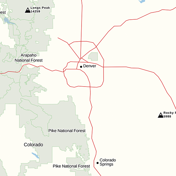
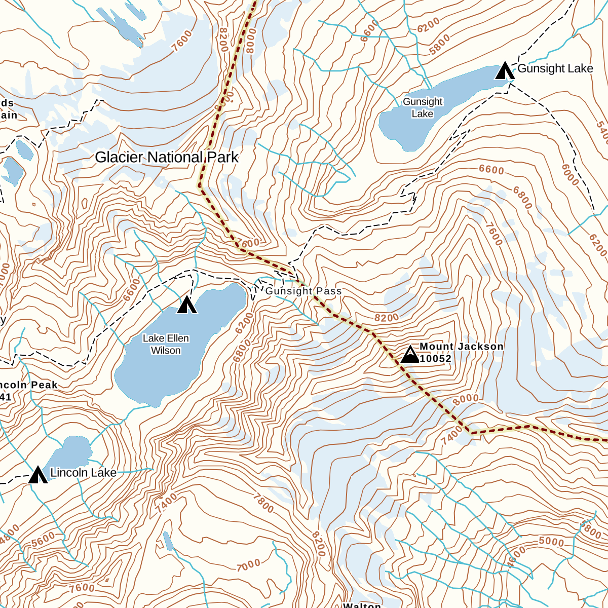
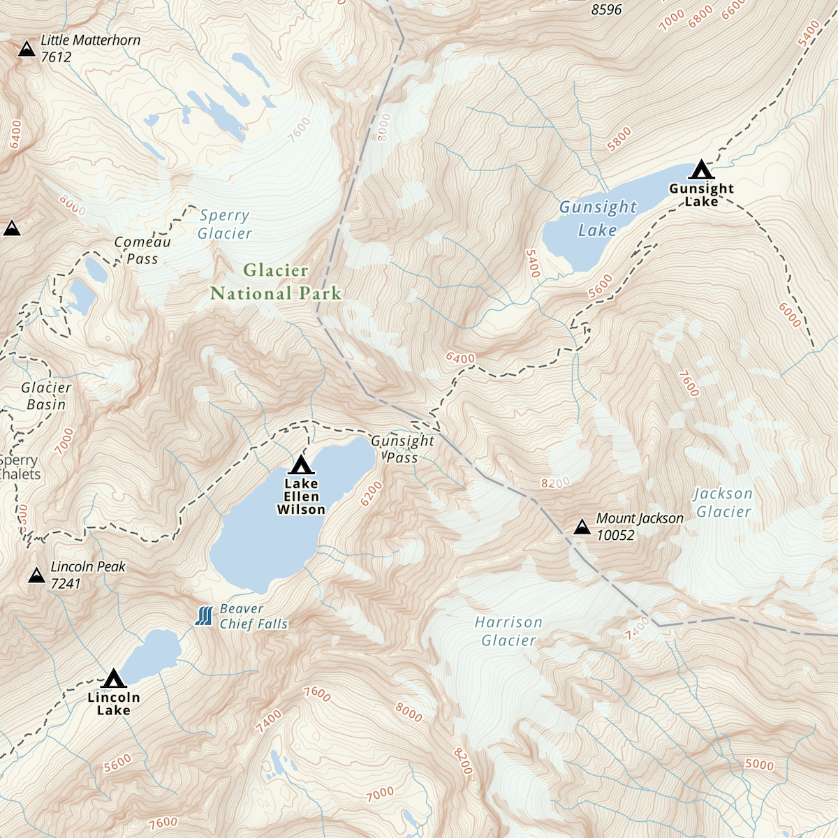
Wondering if a route goes? See if anyone’s blazed the trail before you with the Public Tracks layer in Gaia GPS. Available on both gaiagps.com and in the app, the Public Tracks layer shows the two million public tracks Gaia GPS users have recorded all over the world. You can choose to make your tracks public and make them available for others to access, too. Turn on this layer to discover new hiking routes, connect 4×4 roads, and plan backcountry trips with information from people who made the journey before you.

Use public tracks to enhance your own creative route planning. Whether linking up remote roads for your next overlanding adventure or connecting trails for a new loop to hike, the new public tracks overlay offers deep insights on what’s humanly possible in the outdoors.

Public tracks can be viewed online in any Gaia GPS map, including Gaia Topo, USGS quad maps, MVUMS, satellite maps, and more. Click on any public track on the map to see the distance traveled, elevation gain and loss during the trip, and the total time it took that user to complete the journey. When you’ve found the track you want to explore, save it to your account and follow it in the field — even when you are miles away from cell service.

delicate-arch.png

Get Detailed Trip Stats from Any Public Track

Public Tracks give you all the information you need to get ideas for new routes and to plan a successful backcountry trip. Click on any track on the map to see the total distance traveled. Check the track’s time so you can estimate how long it will take you to complete the same journey. See the total elevation gain and loss on a track to know how much climbing to expect if you follow the same path.

Trip stats also show the date and time the track was recorded so you can account for varying weather conditions when viewing the track. For example, if someone recorded the track in the winter months, you can consider whether the track was likely recorded in snowy conditions. If the user selected the mode of travel, you will be able to see whether they recorded their track on foot, bike, skis, or motorized vehicle. Also, keep an eye out for trip notes, giving you personalized, first-hand information from the user who recorded the track.

track example .png

Save, Share, Follow, and Get Turn-by-Turn Directions to Any Public Track

Once you find the perfect public track for your next adventure, you can save it to your account and pull it up on your map even when you’re offline. Share the track with your adventure partners and the people who are staying home so they know your backcountry plan. Use the “Get Directions” button within the app to get turn-by-turn directions to the beginning of the track. When you’re set to begin the journey, press the “Guide Me” button to stay on course.

To access these features, click on the public track and tap the “i” icon to get more information. A new screen will open, showing all the stats of the track and all the buttons to save, share, follow, and get directions to the track.

How to Turn On Public Tracks in the App

Public tracks have always been a key planning tool on the web. Now you can access the same public tracks layer in the field on your iOS and Android devices online. To add public tracks in the app, tap the layers icon on the top right of your screen and select “Map Overlay” at the top of the list of options. Toggle on “Public Tracks” and public tracks will appear on the map in light green.

Make Your Own Public Tracks to Contribute to the Map

You can contribute to the bank of information on the map by simply recording tracks on your own adventures and sharing them with the public. When you record a track on Gaia GPS, your track is set, by default, as a private track. You can choose to manually set your track to public to share it to the map. Making your track public allows other outdoor enthusiasts to access your trip data to enhance their own trip planning.

The Public Tracks Overlay is Available to Everyone on Gaia GPS

Everyone can view public tracks in the app on iOS and Android and on the web at www.gaiagps.com/map/. However, you will need an account to save public tracks for use offline. Visit www.gaiagps.com to create a free account or purchase the premium membership to see all the public tracks on your favorite maps in Gaia GPS’s expansive catalog.

March 24, 2021
4 FacebookTwitterLinkedinRedditEmail
An Apple Watch is visible on a backcountry skier's wrist. It shows how far they are into a route (0.9 miles), pace (4'53'') and total time (1:02). Snowy trees and mountains are visible in the background.
App UpdatesGaia GPS

Gaia GPS Brings Backcountry Navigation to your Apple Watch

by Mary Cochenour March 2, 2021
written by Mary Cochenour

Record a track, drop waypoints, and get turn-by-turn directions using Gaia GPS on your Apple Watch. The totally redesigned Gaia GPS Apple Watch app turns your watch into a convenient backcountry navigation tool that works offline and independently of your phone. Use your Apple Watch to experience Gaia GPS’s signature navigation features even when you’re off the grid and far beyond the reach of cell service.

With Gaia GPS on your Apple Watch you can also collect trip details and health stats without having to interact with your phone. The watch will record your moving speed, elevation gain, distance travelled, and more when you use Gaia GPS to record your track. Gaia GPS also integrates with Apple Health to keep tabs on your heart rate, steps, and how many calories you burned on your latest adventure.

Whether heading out on a long trek or squeezing in an afternoon trail run, use your Apple Watch to navigate and record your adventure with Gaia GPS conveniently on your wrist.

Get Turn-by-Turn Navigation on Saved Routes in Apple Watch

No more constantly checking in on your phone to see if you’re staying on-route during your trail runs. Keep your phone tucked away in a pocket or inside your hydration pack and let the watch guide you along the trail. The watch will give you turn-by-turn directions anywhere in the world when you follow a saved route.

Saved routes will automatically download and display Gaia Topo on the watch face, so you can navigate with the map even when you are offline. The watch will vibrate to notify you of upcoming turns on your route or, more importantly, if you’ve strayed off your planned course. The vibrations grab your attention to let you know when you need to check in with the watch, helping you stay focused on the trail instead of always looking at the watch to see if you’re on track.

When you follow a route, the watch will record a track too. Save the track at the end of the trip to see how fast and how far you travelled. Link it all up with Apple Health to see your fitness metrics. Learn more about how to get started with turn-by-turn directions in this article from the Gaia GPS help center.

View Gaia Topo on Apple Watch with Saved Routes

Gaia Topo automatically downloads to your Apple Watch when you send a saved route from the Gaia GPS app to the watch. This automatic download lets you see your exact location on the map on the watch screen — even when you are out of range of cell service. Zoom in on Gaia Topo to see terrain features in more detail or zoom out to get a bigger picture of the landscape around you. Follow your progress on the map as you travel along your saved route.

Person in red flannel holds up Apple Watch with Gaia GPS displaying position on watch route.

Record a Gaia GPS Track on Apple Watch

On your next hike or ski up the mountain, use the Apple Watch to record your trip stats in Gaia GPS. The watch will record a track, showing you how many feet of elevation you climbed on your trip, your average speed, the total distance, and the time you spent moving along the track.

When you save the track from your watch, the track will automatically sync with your phone. View your track on any basemap within the Gaia GPS app on your phone or in your account on the web. Click on the track to see trip details and share the track with friends to give them beta on the trail you just hiked.

Get step-by-step instruction on how to record a track on the Apple Watch in this article.

A screenshot of the Gaia GPS Apple Watch app shows the time of day in the top right corner of the screen; distance covered in the middle, pace in the bottom left corner, and total time in the bottom right corner.

Drop Waypoints on Tracks and Routes on the Apple Watch

Every adventure outside seems to reveal those special spots that you’ll want to remember forever. Now you can drop waypoints directly from your Apple Watch to mark these locations on your saved routes and tracks. Add waypoints to flag places like trail junctions, must-see view points, or hazards like terrain traps or sketchy water crossings that you’ll want to reference for later trips.

Waypoints can be added at anytime from the launch screen on the watch, even as you record a track or navigate along a saved route. You can also customize your waypoints by changing the title and icon color when you add and save the waypoint from the Apple Watch screen.

Learn more about adding waypoints to your Gaia GPS routes and tracks on the Apple Watch here.

A Gaia GPS Apple Watch app screenshot shows how to drop a way point on the map: choose an icon, write a title, and press the save button.

Customize Notifications within the App

Select when you want your Apple Watch to notify you of upcoming features when navigating a route on Gaia GPS. Turn on notifications to alert you when you’re approaching turns and waypoints along the route. Set the watch to vibrate any time you’ve ventured off your planned route. You can also be notified for every mile or kilometer travelled along a saved route or a recorded track.

Of course, if you don’t want to be bothered during your adventure, you can always toggle off to stop notifications. Learn more about how to adjust your notifications in the article here.

How to Get Started with the New Gaia GPS Apple Watch App

To get started with the Gaia GPS Apple Watch app, you’ll need an Apple Watch and an iPhone. On your iPhone, install the Gaia GPS Apple Watch app. To do so, enter the Watch app on your iPhone’s home screen. In the Watch app on your phone, scroll down to “Available Apps” and locate Gaia GPS. Tap “Install.” Once the installation is complete, the Gaia GPS app will appear on your Apple Watch. If you already have the Gaia GPS Apple Watch app, you’ll have to update it to get the newest version.

Make sure you set your “Location Services” to “Always” or “While Using the App” for Gaia GPS to work on your Apple Watch. On your iPhone, open the Settings app, select “Privacy” and “Location Services.” Find “Gaia GPS” and select “Always.” On iOS 14, make sure “Precise Location“ is also toggled on.

After you’ve installed Gaia GPS on your Apple Watch, you’re ready to record a track and follow your saved routes. Learn more about how to navigate with your Apple Watch here.

March 2, 2021
7 FacebookTwitterLinkedinRedditEmail
AndroidApp UpdatesBackcountry SkiingGaia GPSiOSNew Features

Know Before You Go with the Avalanche Forecast Layer

by Mary Cochenour January 20, 2021
written by Mary Cochenour

Gaia GPS is proud to partner with the experts at Avalanche.org to bring you the Avalanche Forecast layer. Now, you can get official, up-to-date avalanche forecasts for mountain zones in the U.S. directly from the map on your phone.

Plan safer winter backcountry travel with quick and easy access to avalanche danger ratings from the National Avalanche Center and the American Avalanche Association. Link to complete avalanche reports from professional snow safety scientists in your region.

Whether you’re backcountry skiing the couloirs or snowmobiling into the back bowls, add this must-have feature to your avalanche safety toolkit. Updated every 30 minutes, this map is available online only. Be sure to check the map before you head out the door or leave cell service.

Avalanche Danger Ratings and Daily Forecasts

The Avalanche Forecast overlays on top of your favorite backcountry map to show you the color-coded North American Avalanche Danger Scale for your region. Crafted by avalanche forecasting experts, the danger scale spans five categories, from low to moderate and all the way through extreme danger, letting you know the risk of potential avalanches on your planned route.

Look for a time and date stamp on the map, showing exactly when the region’s danger rating expires. Tap the shaded areas on the map to access more information, including travel advice and a link to the official forecast from the snow safety scientists at the local avalanche center.

Regions with a daily forecast will show “no rating” until the forecasting center issues the rating for the day. Because winter backcountry conditions change constantly, this layer updates every 30 minutes and is available for online use only. This layer is only active during the avalanche forecast reporting season set by the avalanche centers in the mountain west.

Use the Avalanche Forecast Layer with your Favorite Maps

I computer monitor displaying the avalanche danger rating for an area on the topo map.

Add the Avalanche Forecast layer to your quiver of backcountry ski maps for a more complete picture of winter conditions in the backcountry. Use the layer in conjunction with the newly updated Gaia Topo, the USGS topo map, satellite imagery, Snow Stations (Daily), Snow Depth, and Snow Forecast layers to gather more information and make safer decisions in avalanche terrain.

How to Get the Avalanche Forecast Layer

The new Avalanche Forecast layer is available with a premium membership. To add the layer to your maps, open the Gaia GPS app, tap the layers icon, and select “Add map layers.” Go to “Feature/Weather Overlays” and select Avalanche Forecast.

This feature is available on the Gaia GPS website and both Android and iOS. Download the Gaia GPS app today and start planning your next winter trip to the backcountry.

January 20, 2021
5 FacebookTwitterLinkedinRedditEmail
AndroidApp UpdatesGaia GPSNew Features

Android 2020.11: Improved Map Navigation on Your Phone and Tablet

by Julien Friedland December 9, 2020
written by Julien Friedland

The release of Android 2020.11 includes fresh updates to improve map viewing and navigation on your tablet and phone. Now you can navigate with all your trip details visible on your tablet, quickly view map legends across devices, and save photos from the app to your phone.

Learn about these new updates below and make sure you have the newest version of Gaia GPS by updating to 2020.11 in the Google Play Store.

Tablet Update: View Trip Details Right on the Map While You Navigate

Now you can view your trip, routes, and saved data on your Android tablet without losing your place on the map. When you’re headed offroad, view your distance, average speed, elevation and more alongside the map while you drive. Planning at home? You can also browse local trails and revisit old routes, all while viewing the map.

Try out this new map experience by holding your Android tablet in landscape mode (horizontally) to see the new sidebar on the left. This is where your trips, discover, saved and setting tabs now live. Navigate between the tabs to select a public track, view a saved route, check on your current trip details, or change your settings while you look at the map.

USGS map image on tablet with route and route stats showing

Easy to Use, Clutter-Free Map View

View Map Legends With a Few Taps

Now you can quickly identify a symbol, trail or any other icon on the map by viewing the map legend. Just tap the “i” icon on the bottom right corner of your screen then tap “view legend” for any active map source.

View Waypoint Clusters

Get a cleaner view of your map with new waypoint clusters. This new update gives you the option to group waypoints together, so you don’t have a mess of icons scattered across the map. Groups of waypoints appear as one waypoint as you zoom out to keep your map view clutter-free. Zoom in again to discover the individual waypoints in each area.

To turn on clustered waypoints, tap the settings icon in the bottom right corner of your device, select “map controls,” and then toggle on “clustered waypoints.”

Save Your Photos on the Trail Right to Your Phone

Gaia GPS for Android allows you to take photos in the app while you follow a route or record a track. Find a great spot for a campsite? Drop a waypoint, snap a photo, and remember it for your next visit. Now, Gaia GPS will automatically save the image to your phone’s photo gallery and in the app. This makes it easier to store, edit, and share your photos outside of the app so you can have a safe backup of any images you snap along your journey.

person holding there arms up to take a phone picture of a mountain range

How to Update to Version 2020.11

To update to version 2020.11, search for Gaia GPS in the Google Play Store. Tap the update button next to the app listing. If your app is up to date, you can open the app from here and explore by following along with the videos above.

December 9, 2020
3 FacebookTwitterLinkedinRedditEmail
A Gaia GPS map shows points of interest, restaurants, and amenities near Tibbetts Valley Park in Issaquah, WA.
App UpdatesGaia GPSNew Features

Find 4×4 Roads and Points of Interest Quicker with Latest Updates to Gaia Topo

by Mary Cochenour July 14, 2020
written by Mary Cochenour

Gaia Topo now displays color-coded points of interest, more 4×4 roads when the map is zoomed out, and larger labels, badges, and contour markers when the map is zoomed in. Whether traveling through a city or on the hunt for a campsite on a rugged dirt road, these new improvements make the map easier to read, helping you find features and services quicker than ever. Plus, seeing more 4×4 roads on a larger viewing field of the map makes planning out the details of your trip a snap.

Color-Coded Points of Interest

Quickly find urban features and attractions with new color-coded amenity labels on Gaia Topo. Hotels and lodging labels now appear in bright blue, museums in purple, hospitals and medical clinics in red, and stores, gas stations, and other town amenities in orange. The colors allow you to scan the map and easily find the services you need.

When rolling into town after a long adventure, you can now pull up Gaia Topo and look for the exact type of business or service offered around you. Simply scan the map for color-coded gas stations to fill up your tank, search for stores for a quick resupply of food, or hit up the museum for a bit of culture before your next outing to nature.

View More 4×4 Roads and Larger Map Labels, Badges, and Contour Markers

The new updates to Gaia Topo make dirt roads visible when you zoom out on the map. That means when you are viewing a large area of the landscape, you’ll see more 4×4 roads without having to zoom into the map to see if those roads exist.

Also, when you zoom further in, the map’s labels, badges, and contour markers get larger. These makers become easier to read as you zero in on a specific spot on the map.

Gaia Topo Improvements Automatically Updated

Completely redesigned in early 2020, the new Gaia Topo combines world-class cartography with industry-leading download speeds and size. Hand-curated and rich with details, Gaia Topo is constantly updated as technology and information from map sources evolve. These latest updates will appear automatically when you open up the map in the Gaia GPS app or on a desktop computer. Any portion of the Gaia Topo map that had been downloaded earlier will need to be downloaded again for the updated changes to appear.

Access to Gaia Topo is available for free on gaiagps.com or in the app on Android or iOS. Purchase a membership to download and take the map offline. A Premium Membership includes all the maps from the Gaia GPS catalog, from USGS Topo to USFS Recreation Maps and hundreds of National Geographic Trails Illustrated titles, as well as satellite imagery and weather layers. With a premium membership, you can download these maps to your device and use them in the field, far away from cell service.

July 14, 2020
4 FacebookTwitterLinkedinRedditEmail
AdventuresAndroidGaia GPSiOS

Discover the Best Trails and Find Public Lands with Gaia Topo Updates

by Julien Friedland May 15, 2020
written by Julien Friedland

Discover new trails and routes and find campsites off the beaten path with two new updates on Gaia Topo. The first update lets you plan ahead at home and save known hikes and other routes for the field on gaiagps.com. Additionally, now you can find national forests, state parks, national parks, and any other public lands quickly with new color-coded public land shading.

Each new improvement on Gaia Topo makes this map a better one-stop shop for all of your planning and traveling needs.

Find Routes Near Your Campsite or Any Point of Interest on gaiagps.com

New nearby route suggestions make it easy to find hikes, offroading routes, bike trails, or other public tracks close to the places you want to visit. While you plan on gaiagps.com, select a trail, campsite, or any natural feature to see a quick list of nearby routes.

How to Use Nearby Route Suggestions

Start by selecting a trailhead, campsite, viewpoint or natural feature, to see nearby routes. A list of routes will appear, including the distance and difficulty rating of each route so you can quickly assess which ones fit your needs. The list includes routes within 500 meters of the selected point of interest and 1000 meters of selected trails. While you browse the list of routes, hover over them to see the tracks appear on the map.

Once you find a route you’d like to explore, you can either select the route name to view even more details or quickly save it by clicking the green “plus” button. If you want to save multiple routes, click the “plus” buttons for all your favorites. Unsave any route by clicking the red “-” button. Find all of your saved routes in the saved folder on your iOS or Android device.

Nearby route suggestions are now available on gaiagps.com. To access your saved routes open the Gaia GPS app on your iOS or Android device, and visit the saved folder. Download any saved route to your device for the field with a Premium membership.

Identify Public Lands With New Map Shading

New color-coded public land ownership on Gaia Topo helps you discover areas to hike, camp, and explore. Now you can identify all of America’s public lands by designated colors on the map. Use this new feature to seek out campsites on BLM land (yellow) or National Forest land (light green), view nearby state parks (red), or safely travel through any public land across the United States.

Color designations appear for National Forests, National Parks/Recreation Areas, State Parks, Bureau of Land Management (BLM), Wildlife Areas, Marine Protection Areas, Wilderness/Wilderness Study Areas and Other Parks/Protected areas. You can find each designation under the Gaia Topo map legend by clicking the layer on gaiagps.com or tapping the “i” icon on the lower righthand corner of your map on iOS and Android.

Map legend for Gaia Topo showing color-coded public lands

With fast map downloads that take up a small amount of space, Gaia Topo is easy to save and take with you on the road. Download National Parks and State Parks in seconds or entire states in minutes, and always have the information you need about the wild spaces you plan to visit.

May 15, 2020
1 FacebookTwitterLinkedinRedditEmail
AndroidApp UpdatesGaia GPS

Android 2020.5: Faster Deletion and Smoother Planning

by Julien Friedland May 9, 2020
written by Julien Friedland

The latest Android 2020.5 release includes a number of usability updates, making actions in the app more efficient and visuals more detailed. A refreshed stats bar and a number of fixes, like better deletion, add up to a smoother experience when using your Android device. After listening to your feedback, we’re excited to deliver Android 2020.5.

Update to version 2020.5 in the Play Store. Open the Play Store and check Gaia GPS has updated on your phone.

Save Time with Improved Deletion

After deleting an item, move on to your next task or close out of the app completely while the app works to delete the item. You’ll no longer have to wait for your item to delete or wonder if it deleted. Just tap delete and move on to your next task.

Completely Customize Your Stats Bar

The recently improved Stats Bar gives you the power to completely customize your map home screen. With a cleaner design and more versatility, the stats bar lets you decide exactly what trip details you want to see when you pull up the app. Choose from elevation, current speed, moving speed, average speed, ascent, sunrise/sunset, and more.

Quickly Find Campsites and Trails

Android users now have access to ‘tap to zoom’ so you can quickly zoom in on a recreation area of interest. Tap any group of amenities on Gaia Topo and discover campsites, trails, viewpoints, and other places you don’t want to miss.

View More Details for Your Saved Items and National Parks

Detail pages for saved items and national parks include more information with updated visuals. National parks and forests now display boundary lines so you can easily see where the parks begin and end. The newly designed waypoints and track detail pages provide more detail about the item, including coordinate points, elevation, and a view of your current map layer.

Android display of Yosemite National Park on Gaia GPS

Next Up for Gaia GPS on Android

Coming soon, Android users will be able to draw and measure areas on the map, by creating polygons. The polygon tool allows you to outline and save irregular shaped items on the map, and measure the perimeter. For example, you could trace the park boundaries pictured above and save the map data from just Yosemite National Park.

May 9, 2020
1 FacebookTwitterLinkedinRedditEmail
App UpdatesGaia GPSiOSNew Features

Gaia GPS and Apple CarPlay Bring Outdoor Maps to Your Dashboard

by Mary Cochenour February 24, 2020
written by Mary Cochenour

Gaia GPS now connects with Apple CarPlay, bringing the best outdoor maps directly to your vehicle’s dashboard navigation screen. View all of your favorite Gaia GPS maps, from USFS topo to National Geographic Trails Illustrated, with or without cell phone service, and get turn-by-turn directions on off-grid adventures for any drivable saved route.

Whether you’re headed out on a multi-day overland route or searching for that hard-to-find trailhead for your next backpacking trip, CarPlay connectivity assists you with hands-free navigation that will keep your eyes on the dusty road ahead.

Display Your Favorite Gaia GPS Map Source

Dashboard navigation screen displaying the Gaia Topo map.
Gaia Topo displayed on the CarPlay navigation screen.

Download the Gaia GPS app from the App Store and get access to hundreds of outdoor map sources on your vehicle’s dashboard touchscreen. When you open Gaia GPS from your CarPlay enabled display, the newly redesigned Gaia Topo map will appear and pinpoint your exact location on the map. Hand curated and beautiful to pore over, the new Gaia Topo is free to use.

Dashboard navigation screen displaying  a satellite imagery map.
Satellite imagery displayed on the CarPlay navigation screen.

To customize the map source, open Gaia GPS on your iPhone to choose from the hundreds of maps available with a premium membership. When in a national forest, try out the 2016 USFS map — a favorite with overlanders. Bring up National Geographic Trails Illustrated maps in most of America’s national parks for indispensable park information, or catch a birds-eye view of the terrain ahead with satellite imagery. Any available Gaia GPS map can be viewed on your dashboard screen … yes really.

Dashboard navigation screen displaying the National Geographic Trails illustrated map.
National Geographic Trails Illustrated displayed on the CarPlay navigation screen.

With your favorite map on display, use the touchscreen to zoom in and out on the map, pan or scroll the map in any direction, select and preview saved routes, and cancel navigation. Once you start driving, the map’s location marker pinpoints your progress as you blaze down a lonely dirt road or cruise a well-traveled scenic highway.

Turn-by-turn Directions on Saved Routes

Get turn-by-turn directions on your saved routes in the Gaia GPS app and let voice commands guide you to your destination, no matter how far off-grid you plan to go. Turn-by-turn directions work even when you’re out of cell range or operating on airplane mode to conserve phone battery, making it that much easier to leave the pavement behind.

A National Geographic map displayed on a vehicle dashboard screen, showing directions to Zion Scenic Drive.
Turn-by-turn directions are available for driveable, saved routes within the Gaia GPS app.

Turn-by-turn directions are optimal for front country adventures too. You can create and save a sightseeing tour on park roads using a National Park Service Visitor map. Plan to hit all the park’s main attractions and never miss the turnout to that obscure viewpoint again.

How to Connect Gaia GPS with Apple CarPlay

To connect Gaia GPS with CarPlay, you will need a Gaia GPS account, an iPhone (iPhone 5 or newer) with the Gaia GPS app installed, and an Apple CarPlay-supported vehicle. CarPlay is becoming more prevalent as more than 500 vehicle models are now CarPlay equipped.

Hop inside the vehicle and synch your iPhone to CarPlay. Select the Gaia GPS app from the dashboard screen and tap the “Go” button. It’s really that simple.

February 24, 2020
37 FacebookTwitterLinkedinRedditEmail
AndroidApp UpdatesGaia GPS

The Next Generation of Gaia GPS for Android

by Ashli Baldwin January 29, 2020
written by Ashli Baldwin

We built the Android release everyone has been waiting for, and it’s been a year in the making. The next generation of Gaia GPS for Android features crisp maps, fast downloads, smooth panning/scrolling, and the ability to interact with features on the map.

We consider this release foundational. It’s both a dramatic improvement the community will feel to the bones of the app, and it sets the stage for a longer laundry list of accumulated UX improvements, bugs, and new features that we’re going to deliver in 2020.

Thank you to everyone who participated in the huge round of beta testing leading up to this release. If you’d like to participate in future beta testing, sign up to be a beta tester.

Beautiful Map Display, Faster Downloads

Gaia Topo and several other sources now display as ‘vector’ maps. This improvement means labels stay crisp as you zoom in/out and enables faster scrolling, panning, zooming, and tilting.

The switch to vector maps also allows for drastically smaller map download sizes at impressive speeds. In testing Gaia Topo, we found that the state of Washington can be downloaded in fewer than 1000MB (perhaps as small as 500MB) and completes in less than 10 minutes — 10x smaller and faster than some other non-vector maps.

Interactive Map Icons

Tap icons directly on the map to get information about them. Learn about hikes, natural features, property boundaries, and other important landmarks.

Gaia Topo Gets a Slick Redesign

Perhaps the most visual change you’ll notice, the new Gaia Topo features a cleaner look and smarter labeling. You can read all about the newly updated Gaia Topo here.

tablet featuring new Gaia GPS map

Automatic Map Updates

Now, you’ll have the option to automatically update all of your map downloads for a particular source when it receives an update. No more deleting and re-downloading your public land maps every year. Anytime a map update is available, you’ll get a notification as soon as it’s live.

What’s Next for Gaia GPS Android

We’re excited about this update not only for the new maps, but also because it sets the stage for faster feature development in the future.

The Gaia GPS Android developer team remains small, but we’re still on the hunt for great software developers to join Gaia GPS. Check out our open job listings here: gaiagps.com/company/jobs

January 29, 2020
4 FacebookTwitterLinkedinRedditEmail
AndroidApp UpdatesGaia GPSHuntingiOSNew Maps

Easy to Read, Tiny to Download: The All New Gaia Topo

by Julien Friedland January 28, 2020
written by Julien Friedland

Today, we’re proud to announce the launch of one of our biggest projects yet. A combination of under-the-hood tech and visual design work, the all-new Gaia Topo combines world-class cartography with industry-leading download speeds and sizes.

Click here for instructions to access this map on iOS, the web, or in Android via the public beta.

  • Gaia Topo before
  • Gaia Topo after

World-Class Cartography

This project was driven by map-maker Lee France, who joined the Gaia GPS team this spring as the company’s first full-time cartographer. He brings over a decade of mapping experience to the new Gaia Topo, and early in his career, worked on some of the National Geographic Trails Illustrated Maps you can also access in Gaia GPS. You can read more about Lee’s background on the Gaia GPS team page.

The new Gaia Topo features a cleaner look and smarter labeling. That means it’s both easier to use and more beautiful to look at than ever before. We’ve tuned the map to the needs of many stripes of the outdoor adventurer. A new visual hierarchy system causes national and state parks, peaks, and campgrounds to appear first as you zoom in. We’ve also curated features and polished up the labeling system to improve information density. The result is a map that’s both more aesthetically pleasing and more efficient: It shows you exactly what you need at each zoom level without cluttering up your screen.

  • Water labels and contour line styling (before)
  • Water labels and contour line styling (now)
  • Road networks (before)
  • Road networks (after)

Road networks and main trails are now easier to find on the map. You’ll also find better hill-shading and toned-down landcover colors that don’t inhibit visibility.

Finally, we’ve improved contour line styling worldwide. Contour lines also appear sooner, making it easier to picture the terrain during large-scale route planning at low zoom levels. We also corrected a number of user-reported issues with the contour lines in various locations around the world.

Faster Downloads, Beautiful Rendering

With the new Gaia Topo, map downloads are faster and take up far less storage space, even though the new map has better data and styling.

To achieve that difference, we combed through all the data contained in Gaia Topo and eliminated redundant information, and did a neat trick to optimize how we packed each little map tile to be stored for offline use. This sort of optimization is something that defines R&D at Gaia GPS, and it’s what keeps our maps on the cutting edge of quality and download speed.

Download sizeDownload speed
AreaBefore updateAfter updateBefore updateAfter update
Yellowstone National Park63.8 MB28.8 MB1 min, 33 s33 s
Washington State1.34 GB470.8 MB28 min, 20 s9 min, 21 s
Great Smoky Mountains
National Park
42.2MB22.8 MB33 s24 s
Adirondack Park112.8 MB45.2 MB3 min, 19 s1 min, 8 s
Texas1.28 GB538.2 MB1 hr, 2 min20 min, 14 s

Comprehensive Geographic Information

The new Gaia Topo is more thorough and information-rich than ever before, thanks to an expanded roster of data sources. Gaia Topo pulls official government records, crowd-sourced OpenStreetMap information, and existing Gaia GPS data into a living map that constantly updates as new information becomes available.

In addition to comprehensive hiking and camping information, the new Gaia Topo highlights features specific to cyclists, thru-hikers, skiers, anglers, and other more niche categories of adventurer. You’ll find new icons for bicycle parking, ferry routes, beaches, dog parks, hot springs, forest service gates, fishing access points, and backcountry ski huts, to name a few. You can see all new icons in the Gaia Topo map legend.

We’ve also added more ski runs and cross country ski trails, styled to indicate trail difficulty. One-way trails are now marked with small arrow icons.

POI interest icons before the update(left) and after the update (right) ; Map data © OpenStreetMap contributors

How to Get the New Gaia Topo

Gaia Topo is the main map source in Gaia GPS, available to all Gaia GPS users—with or without a paid membership.

The new Gaia Topo is now available on iOS, the web, and in the latest beta test version of Gaia GPS for Android. To access it:

  • iOS: download the latest version of the Gaia GPS app for iOS
  • Android: download the latest version of the Gaia GPS app on Google Play
  • gaiagps.com – visit gaiagps.com/map.

If you had previously downloaded maps, you’ll see a notification offering to let you update your downloads.

Map data © OpenStreetMap contributors

January 28, 2020
4 FacebookTwitterLinkedinRedditEmail
Load More Posts

Categories

  • Adventures
  • Android
  • App Comparisons
  • App Updates
  • Backcountry Skiing
  • Boating
  • Company News
  • Emergency Response
  • Featured
  • Fishing
  • Gaia GPS
  • Gaia GPS Offroad Podcast
  • GaiaCloud
  • Hikes
  • How-To
  • Hunting
  • iOS
  • New Features
  • New Maps
  • Newsletter
  • Offroading
  • Out and Back Podcast
  • User Profiles

Recent Posts

  • The Hike Map That Broke Me: How Gaia GPS Turned an Overlander Into a Reluctant Hiker
  • A Fond Farewell to National Geographic Maps — And a Look at What’s Ahead
  • Introducing the Gaia Hike Map: Your Trail-Ready Adventure Buddy
  • Download the app and get a free 14-day trial of Gaia GPS Premium
    • Facebook
    • Twitter
    • Instagram
    • Youtube
    • RSS
    • Explore The Map
    • Get the App
    • Upgrade Today
    • Explore The Map Catalog
    • New Features
      • Gaia GPS

        The Hike Map That Broke Me: How Gaia…

        April 24, 2025

        Gaia GPS

        Introducing the Gaia Hike Map: Your Trail-Ready Adventure…

        March 18, 2025

        Gaia GPS

        Unlock a New Level of Personalization in Gaia…

        December 12, 2024

        Gaia GPS

        Goodbye Clutter, Hello Streamlined Maps: Introducing Sync to…

        November 26, 2024

        Gaia GPS

        Discover Prime Stargazing Locations with Our New Light…

        August 15, 2024

        Gaia GPS

        2023 Mapped: Our Best New Features of the…

        December 27, 2023

        Gaia GPS

        Discover Adventure Easier Than Ever with New Map…

        July 27, 2023

      • New Maps
        • Gaia GPS

          Discover Prime Stargazing Locations with Our New Light…

          August 15, 2024

          Gaia GPS

          Find Prime Viewing for Total Solar Eclipse with…

          March 27, 2024

          Gaia GPS

          See the World More Clearly with New Gaia…

          May 18, 2023

          Gaia GPS

          Gaia Classic: The Only Map You’ll Ever Need?

          May 4, 2023

          Gaia GPS

          Why NatGeo Trails Illustrated are America’s Favorite Maps

          February 9, 2023

          Backcountry Skiing

          Find Backcountry Skiing in Gaia Winter Map

          January 11, 2023

          Gaia GPS

          Our Favorite New Maps and Features

          December 23, 2022

    • Activities
      • Backcountry Skiing
      • Boating
      • Emergency Response
      • Fishing
      • Offroading
    • Adventures
      • User Stories
    • Help

    @2024 - All Right Reserved. Gaia GPS


    Back To Top