Gaia GPS
  • Explore The Map
  • Get the App
  • Upgrade Today
  • Explore The Map Catalog
  • New Features
    • Gaia GPS

      The Hike Map That Broke Me: How Gaia…

      April 24, 2025

      Gaia GPS

      Introducing the Gaia Hike Map: Plan Your Hike,…

      March 18, 2025

      Gaia GPS

      Unlock a New Level of Personalization in Gaia…

      December 12, 2024

      Gaia GPS

      Goodbye Clutter, Hello Streamlined Maps: Introducing Sync to…

      November 26, 2024

      Gaia GPS

      Discover Prime Stargazing Locations with Our New Light…

      August 15, 2024

      Gaia GPS

      2023 Mapped: Our Best New Features of the…

      December 27, 2023

      Gaia GPS

      Discover Adventure Easier Than Ever with New Map…

      July 27, 2023

    • New Maps
      • Gaia GPS

        Introducing the Gaia Hike Map: Plan Your Hike,…

        March 18, 2025

        Gaia GPS

        Discover Prime Stargazing Locations with Our New Light…

        August 15, 2024

        Gaia GPS

        Find Prime Viewing for Total Solar Eclipse with…

        March 27, 2024

        Gaia GPS

        See the World More Clearly with New Gaia…

        May 18, 2023

        Gaia GPS

        Gaia Classic: The Only Map You’ll Ever Need?

        May 4, 2023

        Backcountry Skiing

        Find Backcountry Skiing in Gaia Winter Map

        January 11, 2023

        Gaia GPS

        Our Favorite New Maps and Features

        December 23, 2022

  • Activities
    • Backcountry Skiing
    • Boating
    • Emergency Response
    • Fishing
    • Offroading
  • Adventures
    • User Stories
  • Help
Top Posts
Trip Report: A Rider’s Guide to Bikepacking in...
How to Hike a Colorado 14er: A Step-by-Step...
Trip Report: A Rider’s Guide to link Boulder...
Trip Report: A Rider’s Guide to the South...
Battling the Wind: Setting Your Shocks to Firm...
The Hike Map That Broke Me: How Gaia...
A Fond Farewell to National Geographic Maps —...
Introducing the Gaia Hike Map: Plan Your Hike,...
Download the app and get a free 14-day...
Gaia GPS is Improving Satellite Imagery: Saying Goodbye...
Gaia GPS
  • Explore The Map
  • Get the App
  • Upgrade Today
  • Explore The Map Catalog
  • New Features
    • Gaia GPS

      The Hike Map That Broke Me: How Gaia…

      April 24, 2025

      Gaia GPS

      Introducing the Gaia Hike Map: Plan Your Hike,…

      March 18, 2025

      Gaia GPS

      Unlock a New Level of Personalization in Gaia…

      December 12, 2024

      Gaia GPS

      Goodbye Clutter, Hello Streamlined Maps: Introducing Sync to…

      November 26, 2024

      Gaia GPS

      Discover Prime Stargazing Locations with Our New Light…

      August 15, 2024

      Gaia GPS

      2023 Mapped: Our Best New Features of the…

      December 27, 2023

      Gaia GPS

      Discover Adventure Easier Than Ever with New Map…

      July 27, 2023

    • New Maps
      • Gaia GPS

        Introducing the Gaia Hike Map: Plan Your Hike,…

        March 18, 2025

        Gaia GPS

        Discover Prime Stargazing Locations with Our New Light…

        August 15, 2024

        Gaia GPS

        Find Prime Viewing for Total Solar Eclipse with…

        March 27, 2024

        Gaia GPS

        See the World More Clearly with New Gaia…

        May 18, 2023

        Gaia GPS

        Gaia Classic: The Only Map You’ll Ever Need?

        May 4, 2023

        Backcountry Skiing

        Find Backcountry Skiing in Gaia Winter Map

        January 11, 2023

        Gaia GPS

        Our Favorite New Maps and Features

        December 23, 2022

  • Activities
    • Backcountry Skiing
    • Boating
    • Emergency Response
    • Fishing
    • Offroading
  • Adventures
    • User Stories
  • Help
Tag:

Gaia GPS

Gaia GPS

Gaia GPS x Toyota: A New Way to Give Back to the Trails We Love

by Eric Evans February 4, 2025
written by Eric Evans

Alright folks, this is a big one.

We all have that one trail—the one with the unbeatable views, the one that pushed us to our limits, the one that led to the best campsite we’ve ever found. And if you’ve been around the block, you also know that trails don’t maintain themselves. Closures happen. Erosion takes over. Signs disappear.

So, we’re doing something about it.

How It Works

For the first time ever, you can now donate directly to trail organizations with the Trail Karma program in Gaia GPS, and Toyota has already put $100,000 into the pot to make an impact.

Toyota kicked things off with a $100,000 upfront donation. Each of the 20 sponsored trails already received $1,000, meaning $80,000 is left to match donations from you, our Gaia GPS members.

That means if you donate $10, your trail gets $20. Donate $50? Boom—$100 toward keeping your favorite routes open. And the best part? Gaia GPS, Trail Karma, and Outside take exactly $0. Every cent goes straight to the folks out there doing the hard work.

How to Donate in Gaia GPS

We made this as simple as possible:

  1. Open Gaia GPS on Android, iOS, or the web.
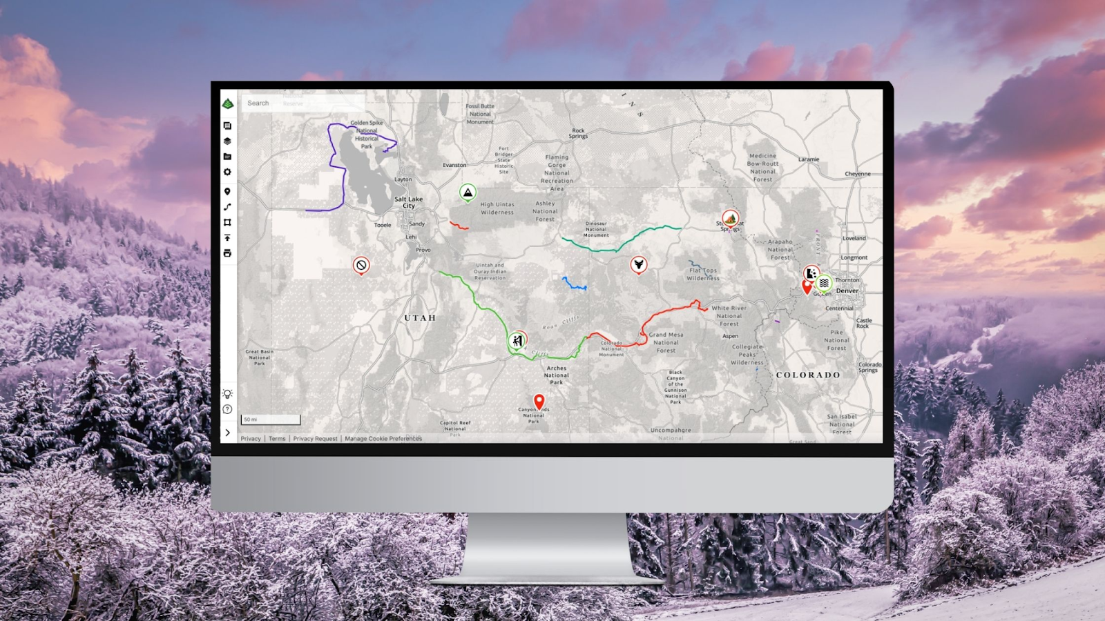
  2. Select the “Gaia Overland” map to browse overland routes.
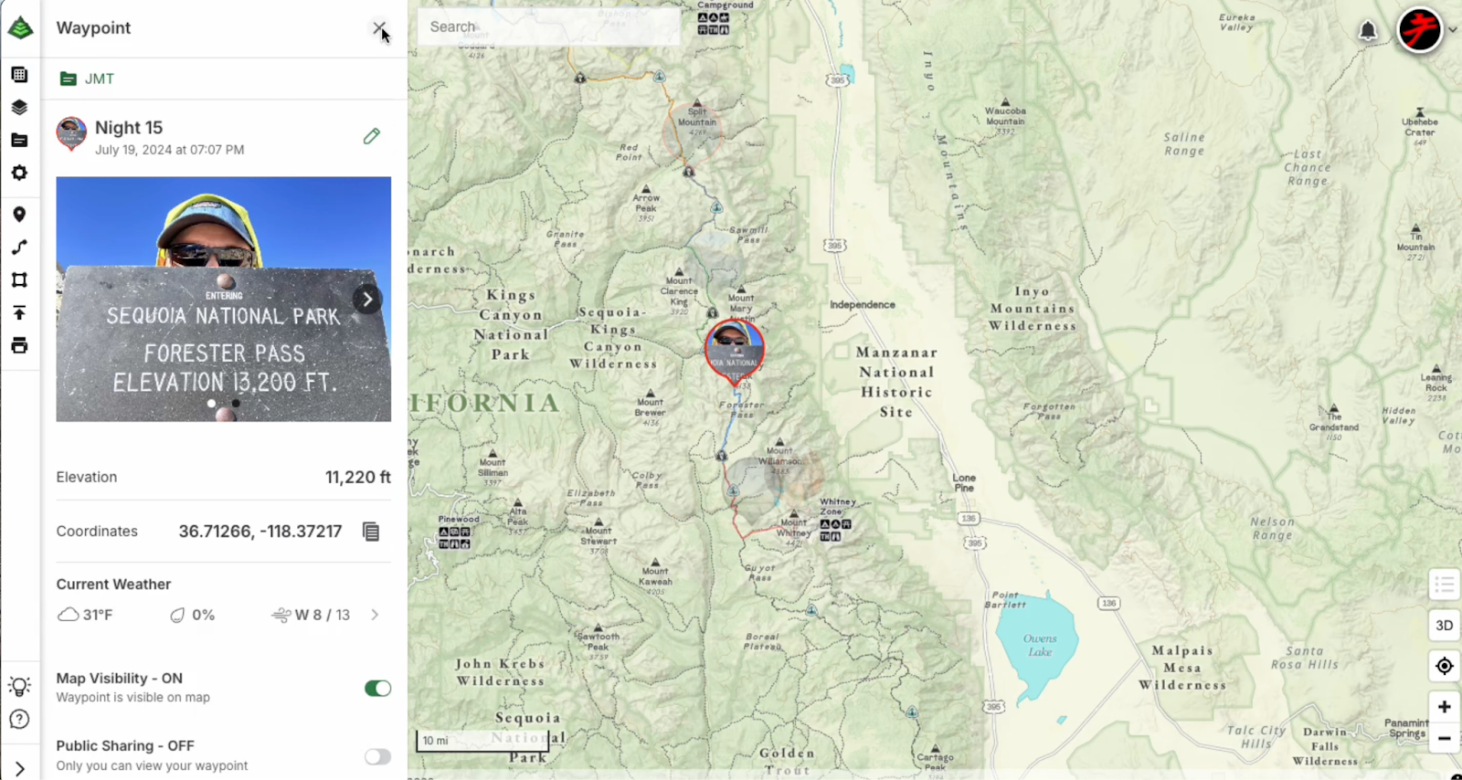
  3. Tap on a trail to check out photos, difficulty ratings, and detailed descriptions.
  4. Tap “Donate” to contribute funds directly to the trail association.

And Toyota will match every dollar up to $80,000.

The Gaia Overland Map Layer is Free for Everyone

Because we want more people to experience these trails (and understand why they matter), we’re unlocking the Gaia Overland Map Layer for FREE from February 3 to May 3, 2025.

For three months, everyone—free and paid members—can access:

  • Curated overland routes across the U.S.
  • Photos so you know what you’re getting into
  • Difficulty ratings so you can plan accordingly
  • Detailed descriptions to help you prep like a pro

Why This Matters

We all talk about protecting access to the outdoors, but let’s be honest—it’s hard to know where to start. We’ve all seen trails get shut down or driven miles only to hit a locked gate. And we’ve all wished there was a way to actually help keep these places open.

Well, now there is. And Toyota is backing the effort in a huge way.

This is just the beginning. If you’re part of a trail association, club, or group and want to enable donations for your lands, reach out. We’d love to grow this initiative and support more trails.

If a trail has ever given you an incredible adventure, now’s your chance to give back. Let’s keep these places open—for us, and for the next folks rolling up to explore.

See you out there.

February 4, 2025
0 FacebookTwitterLinkedinRedditEmail
Gaia GPSNew Features

Unlock a New Level of Personalization in Gaia GPS with Photo Waypoints

by Jules Semotuk December 12, 2024
written by Jules Semotuk

Get ready to elevate your Gaia GPS adventures with the brand-new photo waypoint feature! While emoji icons are fun for marking locations, this exciting update lets you add images to your waypoint icons, taking your map personalization to the next level. With Photo Waypoints, you can make your maps more personal and visually rich, helping you navigate with greater ease and relive your experiences in a whole new way. Whether you’re out exploring, planning your next pursuits, or perhaps revisiting previous journeys, this upgrade transforms your maps into a truly personal and visually stunning experience. 

Photo Waypoints Are Available on the Web with Gaia GPS Premium

Photo Waypoints are a premium feature exclusively available on the Web with a Gaia GPS Premium or an Outside+ membership. With a subscription, you’ll unlock Photo Waypoints along with an array of other premium features to enhance your outdoor experience, including our 300-plus map catalog, offline navigation, and more.

How It Works

Creating Photo Waypoints on the web as a Gaia GPS Premium user is easy and just takes a few steps. Here’s how: 

  1. Visit gaiagps.com on your desktop. Log in or create an account. 
  2. Select a waypoint you would like to edit from the Saved Items sidebar.
  3. Click the pencil icon to the right of the waypoint title to edit the waypoint.
  4. If not already selected, click the Photos tab and then click ‘Upload Photos.’ 
  5. Once your photo(s) are uploaded, choose a photo to use as the waypoint icon photo, then click save!

That’s it! Now your waypoint has a personalized touch, adding a new layer of meaning to your adventure.

Personalize Your Adventure with Gaia GPS

Gaia GPS empowers you to create personalized, detailed, and memorable maps that enhance your preparation and documentation of your outdoor experiences. With the new Photo Waypoint feature, you can use images to capture and recall key locations along your journey. Whether you are an outdoor enthusiast documenting new hikes and viewpoints, a traveler looking to mark destinations and favorite spots on the road, or a photographer creating a photo journal of your outdoor excursions, the Photo Waypoint feature is here to help you transform your maps into visual representations of your unique experiences. 

Begin Customizing Your Maps Today

Ready to make your next adventure even more memorable? Dive into our easy Help Center guide on creating and editing waypoints, and start customizing your maps today! Learn more here: Edit Waypoints on gaiagps.com

December 12, 2024
0 FacebookTwitterLinkedinRedditEmail
App UpdatesGaia GPS

Important Update: Changes to Esri World Imagery Offline Maps in Gaia GPS

by Eric Evans December 10, 2024
written by Eric Evans

At Gaia GPS, our priority is to provide reliable mapping tools that empower you to explore the backcountry safely, whether you’re hiking, overlanding, camping, or engaging in any adventure off the grid. That’s why we’re writing to let you know about a recent change to the Esri World Imagery layer and share some great alternatives for those who use this layer offline.

What’s changed?

Recently, Esri, the provider of the World Imagery layer, has made a significant policy change regarding the use of offline map tiles. They now require all apps to automatically delete downloaded map tiles after just 3 days of being stored on a device. While this policy may work for apps in urban or connected environments, it presents serious challenges for backcountry explorers like you, who can have limited or nonexistent access to data or cell service for extended periods.

What are we doing about it?

The reality is that Gaia GPS users often rely on maps stored offline for much longer than 3 days. We believe that staying safe outdoors shouldn’t depend on when or where you can access the internet. We recognize that World Imagery is one of our best satellite sources, but due to circumstances beyond our control, we’ve made the difficult decision to disable the option to download Esri World Imagery maps for offline use in Gaia GPS.

This change ensures that you won’t be left without critical map data when you need it most. However, Esri World Imagery will still be available for online use in the app and on the website. You can view and plan routes with this rich satellite imagery when connected to the internet, but the download limit for offline use will now be set to 0 tiles.

What are your options?

We understand that the Esri World Imagery layer has been an important resource for many of you. While we’re unable to offer it for offline use, Gaia GPS offers a wide range of alternative satellite imagery and topographic map layers that you can continue to download for offline use on your adventures. Another option to consider is Mapbox Satellite which is an excellent satellite imagery layer that can be used both online and offline.

We encourage you to explore this option and download the maps you need well in advance of your next adventure to ensure uninterrupted access in the backcountry.

What happens to my saved ESRI World Imagery maps? 

Q: Are they deleted from my phone? 

A: No. We are only removing the ability to download new Esri World Imagery Tiles. Your existing downloads won’t be affected. 

When is this happening? 

Q: How long do I have to redownload my maps using a different source if I want to?

A: The ability to download Esri offline map tiles will be disabled on January 1, 2025.

Moving Forward Together

We understand that changes like this can be frustrating, but rest assured, our commitment to supporting your outdoor journeys remains stronger than ever. We will continue to improve Gaia GPS and offer the tools you need to safely and confidently explore off the beaten path.

Thank you for your understanding and for being part of the Gaia GPS community. If you have any questions or need assistance finding the right map layers for your trips, don’t hesitate to reach out to our support team.

Stay safe, and happy adventuring!

The Gaia GPS Team

December 10, 2024
0 FacebookTwitterLinkedinRedditEmail
Backcountry SkiingGaia GPSHow-To

Make the Most of Your Early Season Backcountry Ski Turns With Gaia GPS

by Tyler Jackson December 3, 2024
written by Tyler Jackson
The ridge line I hiked up; a prime example of why rock
skis should be considered essential equipment for early
season tours.

For many backcountry skiers with sticks to spare, early season ski tours mark the start of a months-long pursuit of fresh lines and high adventure. However, these outings come with their own unique challenges: thin snowpacks, unpredictable conditions, and a whole lot of rocks. That’s why proper planning and on-the-ground navigation are essential—and Gaia GPS is one of the best tools to make this process as efficient and safe as possible.

This is the second post in my series about using Gaia GPS in real-world situations. In part one, I focused on how to use Gaia GPS’s web browser interface to plan trips before heading out. This time, I’ll look at how to use Gaia GPS during the adventure itself—navigating your route, adapting to conditions on-the-ground, and using the app’s features to stay safe and maximize your ski day.

This past Friday, I set out on my first ski tour of the 2024 season: a pre-work dawn patrol at Berthoud Pass, hunting down cool lines for the winter. I’ll walk you through my preparation and navigation on this trip, dishing out practical tips to get the most out of Gaia GPS.

What to do Before Leaving the House

Although this post focuses on the real-time use of Gaia GPS, it’s worth briefly revisiting the pre-trip steps that set the foundation for a successful day in the backcountry.

I planned my route on the Gaia GPS web browser. This process allows for precise route creation and layering of important information, all of which syncs seamlessly to the mobile app. Here are the key steps I took:

Note how I have Gaia Topo active as my base map, with Slope Angle overlayed atop it for quick reference.

1. Cleaning Up the Mobile App with Toggle Mobile Sync
Gaia’s “Toggle Mobile Sync” feature is a great tool, and it’s also brand new. This feature lets you remove unnecessary data from your mobile device while keeping it accessible on the web browser. For ski tours, this means I can focus on the route and waypoints relevant to that specific outing, ensuring my interface is clean and easy to use for quick reference when I’m on the move. To get the full scoop, check out this article: Goodbye Clutter, Hello Streamlined Maps: Introducing Sync to Mobile

2. Selecting the Right Layers
For early season tours, I rely on two layers:

  • Slope Angle Layer: This is essential for evaluating avalanche risk. Using this in conjunction with avalanche forecasts from the Colorado Avalanche Information Center (CAIC) helps me to identify safe routes at a glance.
  • Gaia Topo: This detailed topographic map is ideal for backcountry navigation. I use this layer to plan ascents and minimize exposure to steeper, avalanche-prone slopes and terrain traps.

Pro Tip: Early in the season, avoid snow depth layers, as they’re often inaccurate for sun-exposed aspects. Instead, focus on slope angle and terrain features to assess conditions.

3. Planning an Efficient Route
My goal for this outing was a quick, safe tour that I could wrap up before heading home to clock in for work. I used the web browser to create a route that followed a wide ridge line and minimized steep sections. This had the dual effect of keeping the hike up easy and minimizing avalanche risk. Once the route was finalized, I synced it to my phone for use in the field and checked to make sure that I had maps for the region downloaded.

Navigating the Route in Real Time

Once I arrived at Berthoud Pass and clicked into my rock skis, Gaia GPS became my primary navigation tool. Here’s how I used the app during the tour:

Waypoints I placed for my tour, marking spots to check out in the future or places I wanted to make note of.

1. Following the Pre-Planned Route
My route served as a reliable guide throughout the tour. By referencing the route on my phone, I could stay on track without constantly second-guessing my path.

2. Use Waypoints!
During the hike, I used waypoints to mark cool spots or lines for future reference. This is a critical habit for anyone exploring the backcountry, as it helps build a mental and digital map of the terrain. Here are the types of waypoints I added:

  • Future Objectives: I pin interesting ski lines that looked promising for later in the season.
  • Avalanches: I drop waypoints wherever I see avalanches or signs that one might happen.
  • Reference Points: Landmarks like prominent trees or rock outcroppings (or in this case, large metal towers) to make it easier to orient myself, both on the way down, or on future occasions. Most critically, once I’m getting ready to transition and ski down, I almost always drop a waypoint or two at the topographic lines that indicate my point of no return: the minimum elevation I can ski to without having to hike back up to my truck.

3. Recording Tracks
I also used the app to record my track. In the moment, the recording is not necessarily critical, but I find that recordings are incredibly handy to use for reference when I am making repeated trips to an area.I can drop waypoints along the track, and I can refer back to the old tracks whenever I’m building a new route. 

Pro Tip: I like to look back and see where my actual track differs from my planned route, which helps me to plan more efficiently in the future, or make note of hazards (like the wind slab).

Safety First!

Safety is always the top priority in the backcountry when I’m out alone, especially during the early season when rocks and thin snowpacks combine with avalanche danger to create unpredictable, often risky conditions. As one of my favorite guidebooks states: “They’re called the Rocky Mountains, not the Snowy Mountains.”

Here’s how I use the app as part of my safety toolkit:

Early season does not mean avalanche free. Anytime there is snow on the ground, an avalanche can release!

1. Slope Angle and Avalanche Forecasts
Before heading out, I review the CAIC avalanche forecast to get an idea of the snow conditions and what to watch out for. On the way up, I use the slope angle layer to maintain awareness of the terrain I’m in and the avalanche risk, especially when I venture off of the route I had planned out. It’s also important to note that this layer provides a broad overview of slope angles but doesn’t account for localized terrain features, so you’ll still need to use your best judgement when assessing slope steepness.

2. On the Fly Adjustments
Gaia GPS is an excellent planning tool, but it’s no substitute for real-time decision making. You’ll need to detour around hazards and obstacles, adjust your ski plan on the move, and stay on track to reach your destination. This is a huge reason that I always try to have a route built and available in Gaia GPS. While tracking myself, I can easily check my location against the route, and work my way back over to the intended path.

3. Avoiding Terrain Traps
This becomes especially important on the way down, doubly so when I’m exploring new areas. When I’m somewhere new, I’ll stop and check the topo layer or map layer periodically to make sure that I’m not running myself toward a drainage or terrain hazard like cliffs or gullies.

Wrapping Up the Tour

The final phase of any ski tour is returning safely to the trailhead. Here’s how I used Gaia GPS to finish my day on a high note:

1. Navigating Back to the Trailhead
After completing my descent, I used the app to navigate back to the parking area. By following my recorded track and the waypoints I dropped along the way, I avoided my most common mistakes like veering off course or ending up on the wrong side of a drainage. Nothing saddens me more than putting the skins back on for a hike up to the truck after a beautiful run.

2. Post Tour Beers and Review
Back at home (or a conveniently placed brewery), I reviewed my recorded track to evaluate the day’s route. This process is incredibly useful for identifying areas where I can improve, such as finding new routes, or making note of hazards I ran into on the way up. Whenever I come across something particularly cool, I like to export it and share it with my skiing partners for future consideration.

Early season ski tours come with lots of challenges, but with the right tools (a good pair of  rock skis) and preparation, these adventures can be almost as much fun as powder days, and every day on skis is a good day. Gaia GPS is an invaluable resource for both planning and pursuing backcountry trips, providing the information and flexibility needed to stay safe and make the most of your time in the mountains.

December 3, 2024
0 FacebookTwitterLinkedinRedditEmail
Gaia GPSNew Features

Goodbye Clutter, Hello Streamlined Maps: Introducing Sync to Mobile

by Jules Semotuk November 26, 2024
written by Jules Semotuk

Have you ever found yourself scrolling through your Gaia GPS app, searching for that one piece of data you need, only to get lost in a sea of old adventures you’ve already completed? It’s time to put that behind you! Say goodbye to clutter in the app, and hello to a more streamlined mapping experience. 

Meet Sync to Mobile – a new feature that lets you tailor your sync preferences to decide what data you want on your mobile device, all while keeping all your data viewable on gaiagps.com. This new feature makes managing your data in Gaia GPS easier than ever and ultimately completes the lifecycle of your adventures.

Sync Only What You Need 

As the new year approaches, it’s a great time to declutter, both physically and digitally. If you’ve been using Gaia GPS for a while, you’ve probably noticed an accumulation of old data on your device. Maybe it’s a swarm of waypoints from a long-forgotten trip or a track you recorded years ago. It’s great to have memories of your adventures, but let’s be honest—do you need every old route and track synced to your mobile device when you’re heading out on a new adventure? 

Gone are the days of having to sync all of your data to the app. Now, Sync to Mobile allows you to focus on what you currently need in the app, while still preserving your memories and data on the web. Think of the web platform as hanging a paper map on your wall to plan and remember your life’s adventures, and let the app be focused on data for your current endeavor. Here’s how to use the new Sync to Mobile feature: Organize Your Data with the Sync to Mobile Feature on Gaiagps.com.

From Planning to Reflection

Gaia GPS has always been a powerful tool for both planning and navigating your outdoor excursions. The new Sync to Mobile feature takes it a step further by allowing you to manage your data across devices with greater control. Imagine Gaia GPS as the ultimate command center for your adventures—the web interface is your mission control, where you can plan and organize your trips, while your mobile device is your trusty companion in the field.

Sync to Mobile enables you to select exactly which data (tracks, routes, waypoints, etc.) you need on the app for a particular trip—whether you’re heading out on a multi-day overlanding adventure or just going for a day hike. By utilizing this feature, you not only reduce the clutter on your mobile device, but less data on the app also decreases loading times, ultimately upgrading the Gaia GPS app’s performance and efficiency. 

Once you’ve finished your trip, turn Sync to Mobile off on the data you no longer wish to sync to your device. You’ll still be able to see your saved data on the web—so don’t worry, your past trips will be there for reminiscing. However, by turning off Mobile Sync for completed trips, you can decrease loading times and improve the performance of the Gaia GPS app. A win-win, if you ask me!

A Smarter Way to Archive

With Sync to Mobile, the archiving feature takes on a new role. In the past, archiving was your way of managing what data you didn’t want synced to your device, but this had the side effect of removing that data from the web map as well. Now, you can selectively choose which data you want synced to mobile without the hassle of archiving. This is a game-changer for anyone who likes to keep a record of their adventures without being weighed down by unnecessary data while you’re on the go. Moving forward, you can think of archiving as a soft delete, rather than a sync management tool. Items can still be restored from an archived state (or deleted permanently), similar to how the trash can works on a computer’s operating system.   

How to Get Sync to Mobile

Anyone with a Gaia GPS account can take advantage of this new feature on the web at gaiagps.com. If you also want access to premium maps and features, you can upgrade to a Gaia GPS Premium or an Outside+ membership. 

Gaia GPS Premium or Gaia GPS with Outside+ gives you access to the entire 300+ map catalog. With Premium, you can also download maps for offline use so you can find your way—even without cell service. You can layer maps together to reveal even more terrain, weather, and safety features. And you can print custom maps.

With Outside+, you’ll also receive unlimited access to digital content from Outside and 15 other brands—think recipes, meal plans, and training tips from Backpacker, RUN, and more. Explore new routes with Trailforks Pro, and stream 600+ hours of ski and climbing action, survival challenges, travel documentaries, and more with Outside TV.

So, what are you waiting for? Try Sync to Mobile today for your next adventure with Gaia GPS!

November 26, 2024
0 FacebookTwitterLinkedinRedditEmail
Gaia GPS affiliate header image of an overlanding truck
Gaia GPS

Earn with the Gaia GPS Affiliate Program: Inspire Adventures and Boost Your Income

by Staff Reports November 22, 2024
written by Staff Reports

At Gaia GPS, we know that adventure calls, and now, with our newly enhanced affiliate program, you can inspire your audience to answer that call while earning a substantial commission. Whether your followers are hikers, backpackers, or overlanders, Gaia GPS provides the tools they need to plan, navigate, and document their journeys like pros. With a huge library of detailed maps and powerful route planning features, your audience will love the quality, reliability, and adventure-enhancing capabilities of Gaia GPS.

As an affiliate, you’ll be joining a thriving community, plus you’ll earn a commission for spreading the word. Here’s everything you need to know about the updated program!

Why Join the Gaia GPS Affiliate Program?

1. A Highly Engaged Outdoor Audience. Gaia GPS is the best hiking, backpacking, and overlanding app available, trusted by a strong following of loyal customers and ambassadors. With the app’s deep integration into the active outdoor community, including a rapidly growing awareness among adventurers worldwide, your recommendations will be met with enthusiasm.

2. Premium Maps and Navigation Tools. Your audience can access over 300 high-quality maps, ranging from light pollution maps and detailed satellite imagery to classic topographic maps like USGS and USFS. Gaia GPS offers unmatched navigation features that empower outdoor lovers to explore with confidence, whether they’re on a multi-day backpacking trip or an off-road overlanding expedition.

3. Robust Affiliate Commissions. We’re offering 20% commission on every Gaia GPS Premium or Outside+ subscription that your audience purchases using your unique referral link. With a 30-day cookie window, you have plenty of opportunities to earn as your followers explore our comprehensive mapping solutions and subscription plans.

4. Exclusive Benefits for Your Audience. Not only will you earn a commission, but your followers will benefit too! New subscribers can enjoy 10% off when they sign up for either Gaia GPS Premium or Outside+, adding extra value to your recommendations.

Program Highlights

  • 20% commission on all Gaia GPS Premium and Outside+ subscriptions
  • 10% discount for new subscribers on both Premium and Outside+
  • 30-day cookie window, giving you ample time to convert leads
  • Outside+ members receive perks and access to other products and brands, including Backpacker, Climbing, SKI, and many other leading outdoor publications.

Fully-Featured Outdoor Navigation at Their Fingertips

Gaia GPS doesn’t just provide maps; it’s a fully-featured app for exploring the outdoors. From discovering new trails to tracking progress in real time, Gaia GPS equips adventurers with all the tools they need for a safe and successful trip.

Key Features:

  • Navigate like a pro: Access over 300 maps, including detailed guides, public/private land overlays, satellite views, and more.
  • Route planning: Snap-to-trail modes and point-to-point distance measurement make route creation easy.
  • Terrain and weather insights: Be prepared for anything with layers showing weather, wildfire alerts, snow depth, and more.
  • Multiple subscription options: From the free plan to Premium or even Outside+, there’s a package for every explorer.

A Perfect Match for Outdoor Creators

If your content is about getting outside and exploring, Gaia GPS fits seamlessly into your recommendations. Whether you’re a hiker, overlander, or adventurer yourself, or you connect with an audience eager to explore the outdoors, Gaia GPS offers the right tools for any adventure.

Start Earning Today

Becoming a Gaia GPS affiliate is a simple, straightforward way to monetize your content while sharing a powerful tool that will genuinely help your followers explore the great outdoors with confidence. With a trusted name in adventure navigation and support from the extensive Outside family of products, including Trailforks, Outside TV, and expert-led outdoor courses, you’ll have all the resources needed to succeed.

Ready to start earning? Join the Gaia GPS Affiliate Program today, and let’s inspire more people to embark on their next adventure!

November 22, 2024
2 FacebookTwitterLinkedinRedditEmail
Sawatch Range, CO
AdventuresGaia GPSHow-To

Planning a Weekend Car Camping Trip with Gaia GPS: A Step-by-Step Guide

by Tyler Jackson November 12, 2024
written by Tyler Jackson

We’ve been looking at ways to make the huge array of features offered by Gaia GPS easier to use and understand. To do that, I’m going to offer a set of real-world “case studies” on the best practices for using Gaia GPS. We’ll post these studies as a series on our blog, and we’d love to have you join us on the adventure! Join me this week as I plan a weekend car camping trip and dive into some pro tips along the way.

This weekend I set out on an adventure in the Sawatch Range in my “trusty” pickup truck, scouting out campsites for the fast-approaching ski season. 

Step 1: Exploring Layers for Road Access (MVUM Layer)

Thursday evening rolls in, chilly with blue skies—perfect for a planning sesh. I fire up Gaia GPS on my laptop and switch to the MVUM (Motor Vehicle Use Map) layer, courtesy of the US Forest Service. This layer shows different forest service roads/trails and their level of access, ideal for scouting the best routes to potential campsites. The MVUM layer includes info on seasonal access, road type, and some limited info on the type of vehicles the route is open to and appropriate for. 

  • Pro Tip: Use the map legend to interpret different road access levels. It’s a quick way to identify vehicle access types for specific trails or roads.

Step 2: Checking Cell Coverage

Next, I want to know if I can expect to have cell service where I’m going. Gaia GPS offers five cell coverage maps to choose from, covering AT&T, T-Mobile, Verizon, US Cellular, and All Carriers. I selected Verizon, my provider, to assess signal strength in the area. This helps me prepare to either bring my Starlink or to let my friends know that I’ll be out of contact for a while.

Choose your cell coverage map by clicking on the map layers icon, searching for ‘cell coverage, & choosing your preferred cell provider map.

  • Pro Tip: Use cell coverage layers as a quick reference. Once you’ve checked your coverage, remove the layer to reduce clutter in the app.

Step 3: Downloading Offline Maps

After planning my route and scoping out campsites, I download the essential offline maps for the region. Gaia Topo is my go-to layer—it offers rich detail and manageable file sizes for downloading. This ensures I’m never stuck without navigation, even in areas without cell service.

  • Pro Tip: Balance your map download area to cover essential regions while conserving storage space. Consider breaking up larger regions into a series of smaller areas for a more modular approach and to decrease download times.

Step 4: Setting Waypoints and Navigation

With my maps ready, I drop a waypoint in the Twin Lakes area as my destination. Gaia GPS allows you to tap a waypoint and get driving directions to the location through your preferred navigation app, making it easy to switch from highway to trail navigation. 

  • Pro Tip: Save frequent destinations as waypoints for quick access. Re-use these waypoints to streamline your trip setup.

With these steps, my initial planning stage is complete. Gaia GPS on the web makes it easy to set up your adventure and avoid unexpected hurdles. In the next post, we’ll switch gears to explore Gaia GPS’s mobile app features for navigation on the go. 

November 12, 2024
2 FacebookTwitterLinkedinRedditEmail
two people look at a phone while pointing to mountains in the distance.
Gaia GPSNew Features

2023 Mapped: Our Best New Features of the Year

by Abby Levene December 27, 2023
written by Abby Levene

As the world opened back up in 2023, the Gaia GPS community adventured further, deeper, and higher than ever. As you climbed new peaks, skied new trails, and camped in new spots, our team back at home worked tirelessly to make Gaia GPS even better for your adventures. 

From shiny new features to the invisible work behind the scenes that keeps Gaia GPS running smoothly and reliably while you’re out in the backcountry, here are the top new features and maps from 2023. Thank you for being part of our community, and cheers to another year outside!

Get the Best Off-Pavement Routes with BDR Integration

Photo: Backcountry Discovery Routes

Sometimes, it’s a relief—even a delight—to follow a trusted off-pavement route you know will go. Especially when you know it will go past breathtaking views, across challenging terrain, and to memorable watering holes. That’s why we partnered with Backcountry Discovery Routes to bring you premier long-distance off-pavement routes with a leading navigation experience.

Thanks to this partnership, you can take any iconic long-distance Backcountry Discovery Route offline in the Gaia GPS app with just one click. We’re also honored to promote BDR’s mission of promoting responsible travel and fostering sustainable adventuring and economic growth.

Spy Points of Interest Easier Than Ever with New Map Spotlight

Our proprietary Gaia Topo, Gaia Overland, and Gaia Winter maps equip backcountry travelers on foot, wheels, and skis with the information they need to adventure safely and confidently From trails color-coded by activity type to lands shaded by ownership, to amenities to points of interest, these maps have a lot of information packed in them. Honestly, it’s a lot to take in. (In the best way.) That’s where the map legend comes in. The map legend cracks the code. And now the map legend is even easier to find, decipher, and use. 

Meet our brand new interactive map spotlight on gaiagps.com. Simply click on a symbol and the map lights up, showing you the trails, amenities, or points of interest you’re looking for. Whether you’re searching for a waterfall, an ice cream shop, or a horseback riding trail, the spotlight puts the world at your fingertips.

Draw Routes in Android

In addition to our gold-standard snap-to-trail route planning, which is available across iOS, Android, and gaiagps.com, this year we unveiled route drawing on the Android version of our app. 

Simply click the finger icon on the bottom of the screen and draw on the map to create your route. This route planning mode is particularly useful when you’re going off-trail, where snap-to-trail route planning isn’t available. iOS users: Don’t worry we’re coming for you too!

See the World More Clearly with Gaia Black and White Map

Move over technicolor, black and white is back in style. Meet Gaia Black and White, our very first all-black-and-white topo map. Whether you’re color vision deficient or want a crystal-clear paper map printout on hand, Gaia Black and White is for you.

Styled in the same manner as our other proprietary topo maps designed in-house, Gaia Black and White brings you industry-leading clarity, accuracy, and file-efficiency. Like our other Gaia Series maps, Gaia Black and White provides world-wide coverage. Download the map to use offline for your entire state so you can always find your way—even without cell service. 

Reap the Rewards of Our Type 2 Engineering™

As our software has increased in complexity, our number of users has grown, and the app is utilized in unexpected ways (we’re looking at you, users who record their flights in the app), the proclivity of systems to fail in remarkable fashion skyrockets. 

Our engineers bushwhacked through the code base in an endeavor they called type 2 engineering. Like type 2 fun, it was hard but rewarding work that we enjoyed…once we were done. Along the way, we squashed bugs, improved our design, and cleaned up shared folders. And the outcome is that moving forward, we’ll be able to bring you new features and improvements faster than ever. 

Adventure Intuitively with Our Redesigned App

We take your feedback seriously over here at Gaia GPS, and that’s why we’ve worked tirelessly to make our iOS and Android apps more intuitive and easier to use. This year, we simplified the top five features in the app so you can spend less time looking at your phone and more time exploring. Waypoints, locating yourself on the map, taking a geotagged photo, recording an activity, and downloading maps for offline use are easier to access than ever.

Think of this update like reorganizing the gear shed. All the tools you know and love are still there. We’ve simply moved them to more convenient locations and gave them a fresh coat of paint. 

December 27, 2023
0 FacebookTwitterLinkedinRedditEmail
White Mountains National Forest- Dummer, New Hampshire
Gaia GPSHow-To

How to Find the Best Fall Foliage

by Fred Dreier September 14, 2023
written by Fred Dreier

Our tried-and-trust method for finding peak fall colors could help you decide whether or not to trek to your favorite grove of trees. 

You reach the trailhead after a long drive and begin marching into the woods in search of those brilliant fall colors that arrive each year with the first chill. Then, a depressing reality greets you: the trees are already skeletal, their leaves crumpled on the ground. Yep, you mistimed your fall foliage adventure. There’s a new method to find peak fall colors, and it could help you decide whether or not to trek to your favorite grove of trees. Our Outside Inc. colleagues at Gaia GPS now have access to satellite images from the United States Geological Survey and the European Space Agency, and the pictures capture the reds, oranges, and yellows of fall foliage. Here’s how these recent satellite images can help you plan your next leaf-peeping adventure.

Where to Start: the Fall Foliage Prediction Map

Fall foliage prediction map of the United States
(Photo: Courtesy SmokyMountains.com)

Start your planning with the fall colors prediction tool on SmokyMountains.com. Created by David Angotti and Wes Melton, this map uses meteorological data to forecast when the colors will build, peak, and then drop. The page will give you a general idea of when the leaves in your area will be turning. You can use the scroll bar at the bottom of the map to see when colors are slated to peak in the region you plan to visit.

Next: Find Your Location on Gaia GPS

To plan your route, either visit Gaia GPS online or open the smartphone app. You will need a Premium Membership to access the satellite imagery. Gaia GPS’s default is the worldwide topographic map, and you can scroll across the screen to find the region you plan to visit. Once you’ve honed in on your destination, click on the Layers tab on the left side of the screen. You can search through a variety of imaging layers offered by Gaia GPS in the Layers tab. Add the “Fresh Sat – Recent” and “Fresh Sat- Cloudfree” options to your active layers. Both layers are composed of images taken from as recently as today or over the past two weeks by the two satellites.

Look for Colors

Gaia GPS' Fresh Sat - Recent map layer showing fall colors in the foliage

The images provided by the two satellites have a lower resolution than those from Gaia GPS’s normal satellite imagery—approximately 10 to 15 meters per pixel. So you won’t be able to zoom in to see minute details like road surface or individual clumps of trees. But the images will clearly show swaths of yellow, orange, and brown on the screen. For even higher quality sat imagery, check out the app’s World Imagery layer. Make sure to look at the date stamp on the image—it will be in red block text in the bottom left-hand corner of the tile. This is when the image was snapped. Some images are as recent as the same day, others may be a few days older. If the area is obscured by cloud cover, search the Fresh Sat – Cloudfree layer. While this layer may not be as up to date as the Fresh Sat – Recent layer, it will have cloudless images of the area.

Drop a Waypoint and Plot a Route

Gaia GPS' Fresh Sat - Recent map layer showing fall colors in the foliage and a newly created waypoint

Locate the best colors on the map. Then, click on the “waypoint” icon in the right-hand toolbar, and drag the red icon to the specific point on the map. Drop the icon and then customize your waypoint with a name and an emoji symbol. Don’t forget to save your waypoints. Then, back in the layers tab, click on the Fresh Sat – Recent scroll bar and move it all the way to the left. This action will make Gaia GPS’s worldwide topo map appear. You can now use the route tool in the right toolbar to plot a hiking, biking, or driving route to your waypoint. No matter your transportation choice, the route tool will automatically snap to the optimum roadway or network of trails.

Download Your Route

Route creation on gaiagps.com

If you’re heading to an area with poor or no cell service, be sure to download your map in the Gaia GPS app before you depart. That way, you can navigate to and from your waypoint, even if you are off the grid. Downloading a map requires a Gaia GPS Premium Membership.

Allow for Some Flexibility

Because some of the satellite images may be a few days old, take note of the timestamp on each image and use your own judgement on the progression of the leaf colors. If the trees in your area go from green to orange to red, and the image is a few days old, then prioritize orange areas over the red ones. If the leaves are already brown, save yourself the drive—and start plotting next year’s leaf adventure.

This article was originally published by Outside. Gaia GPS is a part of Outside Inc., the same company that owns Outside.

September 14, 2023
1 FacebookTwitterLinkedinRedditEmail
Gaia GPSNew Features

Discover Adventure Easier Than Ever with New Map Spotlight

by Abby Levene July 27, 2023
written by Abby Levene

Gaia GPS provides the best backcountry maps in the world. (We’re not biased or anything.) Our proprietary Gaia Topo, Gaia Overland, and Gaia Winter maps equip backcountry travelers on foot, wheels, and skis with the information they need to adventure safely and confidently From trails color-coded by activity type to lands shaded by ownership, to amenities to points of interest, these maps have a lot of information packed in them. Honestly, it’s a lot to take in. (In the best way.) That’s where the map legend comes in.

The map legend cracks the code. And now the map legend is even easier to find, decipher, and use. 

Meet our brand new interactive map spotlight on gaiagps.com. Simply click on a symbol and the map lights up, showing you the trails, amenities, or points of interest you’re looking for. Whether you’re searching for a waterfall, an ice cream shop, or a horseback riding trail, the spotlight puts the world at your fingertips.

Find Trails, Campsites, Amenities, and Much More

Gaia Topo, Gaia Overland, and Gaia Winter each contain over 100 icons, symbols, and trail types so you can find new trails, campgrounds, ski resorts, and beyond. Don’t worry, there’s no need to memorize them all! Whether you’re looking for hiking trails, peaks, or hot springs, backcountry skiing, viewpoints, or gas stations, the map legend spotlight will light them up on the map.

How to Use the Map Legend Spotlight

Just head over to gaiagps.com on your computer. (Trust us, the big screen is the optimal place for route planning.) Open up Gaia Topo, Gaia Overland, or Gaia Winter. And then click the map legend icon in the bottom right corner. The pop-out will automatically show you the symbols most prominently displayed in the region of the map on your screen. Hover over a symbol, and watch the map come to life.

RELATED: CREATE YOUR OWN ADVENTURE ON THE BIG SCREEN WITH GAIA GPS

Zoom in and out and pan around on the map to find other points of interest.

If you just want to look at the good old fashioned map legend, never fear. We have that too. View the entire map legend at once by clicking “View Layer Details” on the bottom of the map legend popout. 

Map Spotlight is Available for Everyone on the Web

Anyone with a Gaia GPS account can take advantage of this shiny new feature on their computers at gaiagps.com. To access our premium maps such as Gaia Overland and Gaia Winter, upgrade to a Gaia GPS Premium or an Outside+ membership. 

Gaia GPS Premium or Outside+ gives you access to the entire 300+ map catalog, including high-resolution, world-wide satellite imagery; our suite of National Geographic maps; and specialty maps ranging from historic topos to slope angle shading.With Premium, you can also download maps for offline use so you can find your way—even without cell service. You can layer maps together to reveal even more terrain, weather, and safety features. And you can print custom maps.

July 27, 2023
0 FacebookTwitterLinkedinRedditEmail
Load More Posts

Categories

  • Adventures
  • Android
  • App Comparisons
  • App Updates
  • Backcountry Skiing
  • Boating
  • Company News
  • Emergency Response
  • Featured
  • Fishing
  • Gaia GPS
  • Gaia GPS Offroad Podcast
  • GaiaCloud
  • Hikes
  • How-To
  • Hunting
  • iOS
  • New Features
  • New Maps
  • Newsletter
  • Offroading
  • Out and Back Podcast
  • Overlanding
  • User Profiles

Recent Posts

  • Trip Report: A Rider’s Guide to Bikepacking in Bears Ears National Monument
  • How to Hike a Colorado 14er: A Step-by-Step Guide with Gaia GPS
  • Trip Report: A Rider’s Guide to link Boulder and Steamboat Springs
  • Trip Report: A Rider’s Guide to the South Platte’s Best Trails and Roads
    • Facebook
    • Twitter
    • Instagram
    • Youtube
    • RSS
    • Explore The Map
    • Get the App
    • Upgrade Today
    • Explore The Map Catalog
    • New Features
      • Gaia GPS

        The Hike Map That Broke Me: How Gaia…

        April 24, 2025

        Gaia GPS

        Introducing the Gaia Hike Map: Plan Your Hike,…

        March 18, 2025

        Gaia GPS

        Unlock a New Level of Personalization in Gaia…

        December 12, 2024

        Gaia GPS

        Goodbye Clutter, Hello Streamlined Maps: Introducing Sync to…

        November 26, 2024

        Gaia GPS

        Discover Prime Stargazing Locations with Our New Light…

        August 15, 2024

        Gaia GPS

        2023 Mapped: Our Best New Features of the…

        December 27, 2023

        Gaia GPS

        Discover Adventure Easier Than Ever with New Map…

        July 27, 2023

      • New Maps
        • Gaia GPS

          Introducing the Gaia Hike Map: Plan Your Hike,…

          March 18, 2025

          Gaia GPS

          Discover Prime Stargazing Locations with Our New Light…

          August 15, 2024

          Gaia GPS

          Find Prime Viewing for Total Solar Eclipse with…

          March 27, 2024

          Gaia GPS

          See the World More Clearly with New Gaia…

          May 18, 2023

          Gaia GPS

          Gaia Classic: The Only Map You’ll Ever Need?

          May 4, 2023

          Backcountry Skiing

          Find Backcountry Skiing in Gaia Winter Map

          January 11, 2023

          Gaia GPS

          Our Favorite New Maps and Features

          December 23, 2022

    • Activities
      • Backcountry Skiing
      • Boating
      • Emergency Response
      • Fishing
      • Offroading
    • Adventures
      • User Stories
    • Help

    @2024 - All Right Reserved. Gaia GPS


    Back To Top