Gaia GPS
  • Explore The Map
  • Get the App
  • Upgrade Today
  • Explore The Map Catalog
  • New Features
    • Gaia GPS

      The Hike Map That Broke Me: How Gaia…

      April 24, 2025

      Gaia GPS

      Introducing the Gaia Hike Map

      March 18, 2025

      Gaia GPS

      Unlock a New Level of Personalization in Gaia…

      December 12, 2024

      Gaia GPS

      Goodbye Clutter, Hello Streamlined Maps: Introducing Sync to…

      November 26, 2024

      Gaia GPS

      Discover Prime Stargazing Locations with Our New Light…

      August 15, 2024

      Gaia GPS

      2023 Mapped: Our Best New Features of the…

      December 27, 2023

      Gaia GPS

      Discover Adventure Easier Than Ever with New Map…

      July 27, 2023

    • New Maps
      • Gaia GPS

        Discover Prime Stargazing Locations with Our New Light…

        August 15, 2024

        Gaia GPS

        Find Prime Viewing for Total Solar Eclipse with…

        March 27, 2024

        Gaia GPS

        See the World More Clearly with New Gaia…

        May 18, 2023

        Gaia GPS

        Gaia Classic: The Only Map You’ll Ever Need?

        May 4, 2023

        Gaia GPS

        Why NatGeo Trails Illustrated are America’s Favorite Maps

        February 9, 2023

        Backcountry Skiing

        Find Backcountry Skiing in Gaia Winter Map

        January 11, 2023

        Gaia GPS

        Our Favorite New Maps and Features

        December 23, 2022

  • Activities
    • Backcountry Skiing
    • Boating
    • Emergency Response
    • Fishing
    • Offroading
  • Adventures
    • User Stories
  • Help
Top Posts
The Hike Map That Broke Me: How Gaia...
A Fond Farewell to National Geographic Maps —...
Introducing the Gaia Hike Map
Download the app and get a free 14-day...
Gaia GPS is Improving Satellite Imagery: Saying Goodbye...
How I Used Gaia GPS to Navigate Italy
Gaia GPS x Toyota: A New Way to...
Download Gaia GPS– iOS & Android App
Unlock a New Level of Personalization in Gaia...
Important Update: Changes to Esri World Imagery Offline...
Gaia GPS
  • Explore The Map
  • Get the App
  • Upgrade Today
  • Explore The Map Catalog
  • New Features
    • Gaia GPS

      The Hike Map That Broke Me: How Gaia…

      April 24, 2025

      Gaia GPS

      Introducing the Gaia Hike Map

      March 18, 2025

      Gaia GPS

      Unlock a New Level of Personalization in Gaia…

      December 12, 2024

      Gaia GPS

      Goodbye Clutter, Hello Streamlined Maps: Introducing Sync to…

      November 26, 2024

      Gaia GPS

      Discover Prime Stargazing Locations with Our New Light…

      August 15, 2024

      Gaia GPS

      2023 Mapped: Our Best New Features of the…

      December 27, 2023

      Gaia GPS

      Discover Adventure Easier Than Ever with New Map…

      July 27, 2023

    • New Maps
      • Gaia GPS

        Discover Prime Stargazing Locations with Our New Light…

        August 15, 2024

        Gaia GPS

        Find Prime Viewing for Total Solar Eclipse with…

        March 27, 2024

        Gaia GPS

        See the World More Clearly with New Gaia…

        May 18, 2023

        Gaia GPS

        Gaia Classic: The Only Map You’ll Ever Need?

        May 4, 2023

        Gaia GPS

        Why NatGeo Trails Illustrated are America’s Favorite Maps

        February 9, 2023

        Backcountry Skiing

        Find Backcountry Skiing in Gaia Winter Map

        January 11, 2023

        Gaia GPS

        Our Favorite New Maps and Features

        December 23, 2022

  • Activities
    • Backcountry Skiing
    • Boating
    • Emergency Response
    • Fishing
    • Offroading
  • Adventures
    • User Stories
  • Help
Author

Mary Cochenour

Mary Cochenour

Mary Cochenour worked on the marketing team at Gaia GPS from 2020 to 2022. She enjoys backpacking, skiing, and mountain biking in the mountains near her home in Montana.

AdventuresGaia GPSOut and Back Podcast

The Out and Back Podcast, Episode 4 with Daniel “The Blackalachian” White

by Mary Cochenour June 23, 2020
written by Mary Cochenour

How to listen: iTunes | Google Play | Spotify | Stitcher | Pocket Casts | RadioPublic | Breaker | Castbox

Episode 4 of the Out and Back podcast drops today with Blue Ridge Outdoors 2020 Hiker of the Year Daniel White. Known as the Blackalachian in the outdoor community, White tackled his first thru-hike in 2017 when he turned to the Appalachian Trail to get away from a bad break up and burn out at his job. Having never been hiking or camping before, White planned to walk for two months and return home to North Carolina. But when the time came to quit, White felt compelled to move forward and he finished the 2,190-mile trail in six months.

Along the way, White found peace and friendship. But as one of only two Black thru-hikers he saw on the trail that year, White also endured racism. In the end, the AT left White searching for a more culturally infused experience. The next year he learned everything about bike touring and set off on the Underground Railroad Trail — a 2,000-plus-mile journey retracing the secret route that led Black slaves to freedom in the early-to-mid 19th century.

In this episode, White recounts the ups and downs of his AT completion, opening up about a racist encounter at his camp near the Mason-Dixon line on the AT. He takes us through his “powerful” ride on the Underground Railroad Trail, and his trips to Europe last year, where he hiked across Scotland and completed the Camino Del Norte in Spain. Fueled by both adversity and kindness from the people he met along the way, White’s drive for solo adventure shines through in this interview.

IMG_2810.jpg

Episode 4: Blue Ridge Outdoors Hiker of the Year, the Blackalachian

The first night Daniel White ever spent in his tent was on the first night of his 2,190-mile thru-hike of Appalachian Trail.

With brand new gear, heaps of YouTube knowledge and his new trail name, the Blackalachian, White steadily pushed north on the AT. The miles came easy. He learned that he could rely on his gear, hike farther each day than he planned, and that he was terrified of owls. Meeting all kinds of people along the way, White found a group of hikers that he clicked with and his trail family formed within days of starting the hike.

“It was love — instant,” White said of his AT experience.

But as he made his way north, White noticed that he was one of only two Black thru-hikers that he saw on the trail that year.
Just as in life back home, White endured racism on the trail. White encountered mostly micro-aggressions, the kind that White said he’s used to having to deal with on the regular. In one encounter, he felt physically threatened when a group of White men with dogs circled his camp near the Mason-Dixon line, forcing him and his hiking partner to break camp and walk through the night to safety.

“It only motivated me more, because I know you don’t want me here in this area and I’m not going anywhere,” White said. “I’m going to use that as fuel and fire to keep pushing.”

IMG_2807.jpg

Finishing the AT only left White wanting more time outside, but he wasn’t about to pursue the Pacific Crest Trail or the Continental Divide Trail, the obvious path of most dedicated thru-hikers. Instead, White searched for a historical and culturally significant experience. Since then he has kept his roster full of unique adventures, including bike touring from Alabama to Canada on the Underground Railroad Trail, hiking across Scotland, and trekking the Camino Del Norte, a pilgrimage route along the Northern Coast of Spain.

Never one to shy away from learning a new sport or entering unfamiliar terrain, the Blackalachian let’s us in on what fueled his AT trip, how he prepared for the journey, and why he bucked the trend and opted for a bike tour on the Underground Railroad instead of thru-hiking the triple crown. He talks about the dangers he’s encountered out in the world, including being hit by a car on his bicycle.

The Blackalachian gives his opinion on why Black people are underrepresented in the outdoors and what society can do to change the tide, making the outdoors more welcoming in the future. He reminds listeners that the outdoors are for everyone, and that the journey is best when shared with the friendly people you meet along the way.

You won’t want to miss this inspiring talk with White, who has become a powerful role model and inspiration to people everywhere, and especially to Black people and other under-represented groups in the outdoors. Plus find out what new sport the Blackalchian is training for right now. This one involves a boat. Also, you will never guess what his favorite piece of gear is. Listen in to find out.

Tap into the Blackalachian’s YouTube channel to learn more about his trips. Get exclusive content from the Blackalachian on Patreon. Follow the Blackalachian on Instagram and Facebook.

Highlights with the Blackalachian

7:08: White talks about what drove him to the Appalachian Trail.
9:06: How White prepared for the trail even though he had no backpacking or camping experience.
11:46: White describes his first days on the trail.
17:43 Learn why Maine was White’s favorite state on the AT.
19:23: White recounts meeting the only other Black thru-hiker during his trip.
21:08 White describes a racist encounter when group of White men with dogs surround White’s camp near the Mason-Dixon line, forcing him to pack up and hike through the night to safety,
23:36: White taps into adversity and uses it as fuel to accomplish his goals.
24:30: How White ended up taking up bicycle touring to pedal the Underground Railroad Trail.
26:03: Daniel describes the powerful experience of visiting places where slaves hid in their journey north to freedom in the early-to-mid 19th century.
29:48: White’s bike gets sideswiped on the highway, and the driver buys him a beer.
32:06: Communities along the Underground Railroad Trail were the best part of his trip.
33:43: White goes to Scotland, hikes across the country and meets the towns people.
36:05: White describes his trek on the Camino Del Norte in Spain and unexpectedly discovering a Black madonna in one of the villages along the route.
47:00: White gives his opinion on the reason why Black people are underrepresented in the outdoor community,
51:40: White points to a number of resource that BIPOC can reach out to for support and inspiration in getting started in the outdoors.
53:20: You will never guess what his favorite piece of gear is.
55:08: Daniel gives a shout out to all the people who are helping to keep the foot on the gas in this movement against racism.

IMG_7860_Original.jpg

Next Episode: Lifestyle Overland

In our next episode, meet Kevin, Sarah, and 7-year-old Caroline McCuiston, who have been living full-time out of their Toyota 4Runner on America’s rugged backroads. A friend introduced the McCuistons to the sport of overlanding, which Kevin describes as a kind of “marathon” version of off-road travel. Within a short time, the couple became overland obsessed, quitting their jobs to tour around America with their Toyota 4Runner named “Silver” and their overland trailer.

IMG_20180806_130236.jpg

The McCuistons wanted to share their journey with family, so they filmed their travels and posted them on YouTube. To their surprise, their videos exploded in popularity and, without really trying, the McCuistons became Lifestyle Overland with thousands of dedicated followers. Now they manage their active Instagram page, YouTube channel and host a podcast on all things related to overlanding.

You won’t want to miss this episode with Kevin and Sarah as they discuss their transition from conventional life to full-tilt overlanding. They talk about the nearly 800-mile Enchanted Rockies Trail they created at the beginning of their overlanding career and their northern trip to Arctic Circle. Of course, they discuss their rig, why they chose the 4Runner instead of the vehicle they thought they wanted, and the concept of “airing down” or reducing tire pressure on trail. Sarah gives her tips for traveling with a tiny person, and Kevin talks about their favorite meal out on the road.

Follow the McCuistons at @LifestyleOverland on Instagram. Subscribe to their YouTube channel and join their Patreon for exclusive content.

_BBB1385.jpg

Last Episode: Andrew Skurka

InstagramAS.jpg

Check out Out and Back’s last episode with backcountry navigation expert Andrew Skurka. Widely known for making up his own unique and burly long-distance hiking adventures, Skurka recently turned his attention to developing shorter-distance off-trail routes in the Wind River Range, the Sierra, and the Colorado Rockies.

Author of The Ultimate Hiker’s Gear Guide: Tools & Tips to Hit the Trail, published by National Geographic, and host to one of the most comprehensive websites for backpacking gear and tips, Skurka has become the definitive authority on ultralight, off-trail hiking. You won’t want to miss Episode 3, as Skurka passes along his insights on backcountry navigation, how not to get lost, and his favorite maps and navigation tools for hiking off the beaten path.

Meet the Host: Andrew “Shanty” Baldwin

IMG_7725.jpg

In 2019, host Andrew Baldwin completed a southbound thru-hike of the Appalachian Trail. After five months on the trail, Baldwin returned home to pursue a career in voice acting. A friend of the Gaia GPS company, Baldwin was a natural choice for hosting the Out and Back podcast.

In each Out and Back episode, Baldwin strives to bring you conversations with people who spend an extraordinary amount of time outdoors. Listen in as Shanty taps into each backcountry expert’s superpower so that you can take their knowledge and experience with you on your next adventure.

June 23, 2020
0 FacebookTwitterLinkedinRedditEmail
AdventuresGaia GPSOut and Back PodcastUser Profiles

The Out and Back Podcast Releases Episode 3 with Backcountry Navigation Expert Andrew Skurka

by Mary Cochenour June 11, 2020
written by Mary Cochenour

How to listen: iTunes | Google Play | Spotify | Stitcher | Pocket Casts | RadioPublic | Breaker | Castbox

Episode 3 of the Out and Back podcast releases today with a lesson on backcountry navigation from backpacking expert and guide Andrew Skurka. Known as an authority on traditional map and compass navigation, Skurka started his long-distance hiking career in 2002 when he completed the 2,190-mile Appalachian Trail as a novice backpacker. From there, Skurka took his hiking status to the next level by laying down first tracks on three enormous, untouched routes in America.

Through those thousands of miles of solo hiking, Skurka has become a master at finding his way in the wilderness. Listen in on Episode 3 as Skurka takes us through his unusual progression of long-distance hiking, from the well-worn path of the AT to these high-risk, high-mileage adventures. In the process, Skurka also touches on the multiple high routes he’s created in recent years, what he carries in his backcountry navigation kit, and the one, simple concept that everyone can do to stay found in the backcountry.

Backpacker Andrew Skurka standing on a ridge above a wide valley in Alaska's Brooks Range.
Andrew Skurka in the Brooks Range, Gates of the Arctic National Park, Alaska

Episode 3: Adventurer Andrew Skurka Talks Backcountry Navigation

After hiking the Appalachian Trail as a beginner backpacker during his college years, Andrew Skurka wanted to expand his backcountry skill set. Rather than embarking on the next long-trail classic, like the Pacific Crest Trail or the Continental Divide Trail, Skurka discovered the never-been-done-before 7,700-mile Sea to Sea route and he quickly jumped on board. The Sea to Sea took him on a cultural journey from the Canadian eastern sea board, through America’s lonely plains of North Dakota and Montana, and across to the Pacific.

Two years later, in 2007, Skurka set out on the 6,875-mile Great Western Loop, connecting the Pacific Crest and Continental Divide trails with an amalgamation of side routes. This long trip through the West’s highest mountain ranges became an athletic feat for Skurka, who averaged 33 miles per day to finish the entire loop in just 208 days.

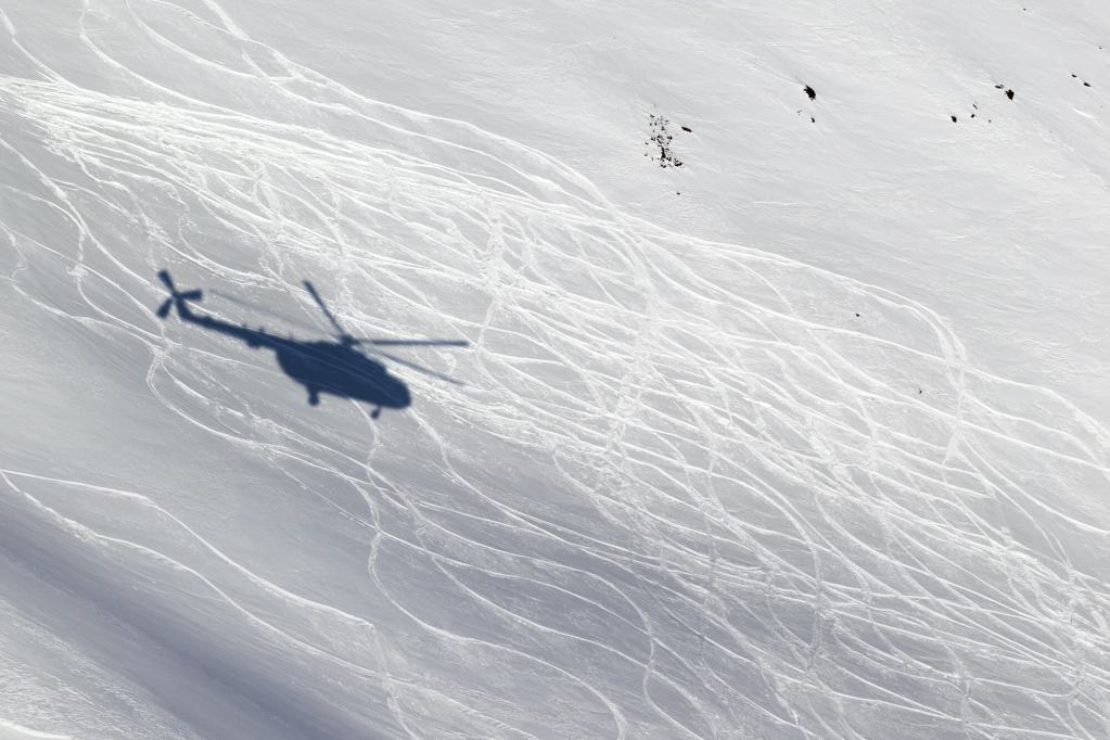
The next trip, though shorter in length than the other two at 4,679 miles, brought high-stakes adventure through the Alaskan wilderness and Canada’s Yukon territory. Over the course of six months, Skurka paddled alone down glacier-fed rivers, encountered grizzly bears, and skied over frozen swampland. At one point, Skurka traveled 615 miles without encountering another human.

The cover of Andrew Skurka's book The Ultimate Hikers Gear Guide.

“There was this constant uncertainty, where you wake up in the morning and you’re not actually convinced that you were going to have dinner that night.” Skurka said of his Alaska expedition. “That got old and it wore on me.“

Skurka recounts how he came out of that Alaska trip “still hustling and living on crumbs” but ready to try making a career out of his adventures. He started a robust blog on all things backpacking, wrote the Ultimate Hiker’s Gear Guide published by National Geographic, designed a handful of high routes, and started a guiding business.

Skurka reveals his super-simple method of teaching backcountry navigation to his clients, explaining how he uses both digital and paper maps and why he doesn’t teach triangulation in his courses. He also points out his favorite watch and compass and reveals what piece of gear that he’s been happy with for most of his hiking career. Skurka, though just shy of turning 40 years old, describes himself as firmly in the “old-timer camp,” reminding us that while he has been backpacking for almost 20 years it’s the miles that distill into experience and wisdom.

Tune in as he discusses the navigator’s story, what’s in his navigation kit, and the overall flavor of his guided trips.

Episode 3: Highlights with Andrew Skurka

3:25: Skurka’s first backpacking experience on the Appalachian Trail.
5:10: Why Skurka did not attack the normal Triple Crown progression but instead selected to embark on three never-before-hiked mega-adventures.
8:10: Skurka’s Alaska-Yukon adventure involved skiing, packrafting, and hiking.
9:10: The appeal of long-distance backpacking for Skurka is learning and expanding his skill set.
11:55: The Alaska trip made Skurka uncomfortable for 180 days, wondered if he would make it to dinner each day.
13:00: Skurka was living on crumbs, and that lifestyle reached an expiration date for him.
14:20: Skurka describes his guided trips, focusing on the education of backcountry skills.
16:00: Skurka says navigation is one of the most important backpacking skills, and definitely the most liberating.
17:25: The different grades of navigational competency.
18:20: Skurka describes the number one navigational mistake.
18:30: The navigational story is how Skurka teaches his clients to navigate in the backcountry.
21:40: Learn what’s inside Skurka’s backcountry navigation kit.
24:15: Reading the landscape in Alaska.
26:20: Paper maps versus digital maps, find out how Skurka uses both.
31:10: Skurka’s favorite compass and watch from Suunto, but not everyone needs an expensive one.
38:15: Skurka describes the high routes of the American west.
50:00 Skurka shines a light on that one piece of gear that’s been with him throughout almost his whole hiking career.

Next Episode: Long Distance Adventurer Daniel White, the Blackalachian

The next episode of the Out and Back podcast brings Blue Ridge Outdoors 2020 Hiker of the Year Daniel White. Known as the Blackalachian in the outdoor community, White tackled his first thru-hike in 2017 when he turned to the Appalachian Trail to get away from a bad break up and burn out at his job. Having never been hiking or camping before, White planned to walk for two months and return home to North Carolina. But when the time came to quit, White kept going and finished the 2,190-mile trail in six months.

After the AT, White has kept his roster full of unique adventures of more cultural import, including bike touring from Alabama to Canada on the Underground Railroad Trail, hiking across Scotland, and trekking the Camino Del Norte, a pilgrimage route along the Northern Coast of Spain.

Close -up of Daniel White known by his trail name the Blackalachian  giving the peace sign with green rolling hills in the background.
Long-distance hiker and biker Daniel White, widely-known in the outdoor community as the Blackalachian.

In this episode, the Blackalachian recounts the ups and downs of his AT completion, touching on his experience as one of the few Black hikers he saw on the trail that year. Experiencing both friendship and instances of racism, the Blackalachian discusses how he emerged from the AT wilderness in search of a more culturally infused adventure. To accomplish this goal, the Blackalachian took up bicycle touring and peddled from Alabama to Canada on the Underground Railroad Trail, retracing the secret route that led slaves to freedom in the early-to-mid 19th century.

Since then, the Blackalachian has continued to seek out stories of history in the wild, hiking the Camino del Norte and a route across Scotland, recalling that one of his favorites parts of the trip involved meeting all the townspeople. A true adventurer, a history buff, and a dedicated solo traveler, the Blackalachian shows us that the journey forward is made by the people met along the way. Tune in on June 24 to hear the full story.

Tap into the Blackalachian’s YouTube channel to learn more about his trips. Get exclusive content from the Blackalachian on Patreon. Follow the Blackalachian on Instagram and Facebook.

Last Episode: The Real Hiking Viking

The Real Hiking Viking standing on top of the Forester Pass trail sign on the Pacific Crest Trail with blue skies in the background.

Drop in on our last episode with Thomas Gathman, known on trail as the Real Hiking Viking. Known for his gnarly beard and fun-seeking attitude, Viking served two combat tours in Iraq and one of those as a Marine Scout Sniper before stumbling into full-time hiking on America’s long trails.

Out and Back’s Episode 2 dives into Viking’s journey from sniper to pro hiker. Viking also recounts his recent efforts, including a trip to the Middle East to thru-hike Jordan and recovery from a knee injury. Viking also lets us in on which of the three classic thru-hike trails taught him to love wilderness adventure and why he’s dying to get back out there.

Best of all, Viking, in usual gregarious and free-spirited style, reminds us in this episode why hiking is so much fun, and why there can never be too much trail time for all of us. Follow the Real Hiking Viking on Instagram. View all Out and Back episodes here.

Meet the Host of the Out and Back Podcast: Andrew “Shanty” Baldwin

Out and Back podcast host Andrew Baldwin with a frosty beard on the Appalachian Trail.

In 2019, host Andrew Baldwin completed a southbound thru-hike of the Appalachian Trail. After five months on the trail, Baldwin returned home to pursue a career in voice acting. A friend of the Gaia GPS company, Baldwin was a natural choice for hosting the Out and Back podcast.

In each Out and Back episode, Shanty strives to bring you conversations with people who spend an extraordinary amount of time outdoors. Listen in as Shanty taps into each backcountry expert’s superpower so that you can take their knowledge and experience with you on your next adventure.

June 11, 2020
0 FacebookTwitterLinkedinRedditEmail
The Real Hiking Viking Thomas Gathman standing on a trail sign, giving thumbs up signal. with Out and Back podcast logo on right side of frame
AdventuresFeaturedGaia GPSOut and Back PodcastUser Profiles

The Out and Back Podcast, Episode 2 with The Real Hiking Viking

by Mary Cochenour May 19, 2020
written by Mary Cochenour

How to listen: iTunes | Google Play | Spotify | Stitcher | Pocket Casts | RadioPublic | Breaker | Castbox

The Out and Back podcast drops its second episode today with thru-hiking legend the Real Hiking Viking. In this episode, meet free-spirited and fun-focused Thomas Gathman, who picked up the Viking trail name due to his Norse-like beard and his warrior status as a former Marine Scout Sniper. Viking served two combat tours in Iraq before coming home, selling all his possessions in 2013, and hiking more than 20,000 miles on America’s longest trails.

Tune in as host Andrew “Shanty” Baldwin goes beyond the iconic beard and unravels Viking’s often-overlooked journey from sniper to pro hiker. Viking shines a light on how he was first introduced to thru-hiking culture and what inspired him to step on the trail in 2013 and never look back.

Episode 2: the Real Hiking Viking on his Journey from Sniper to Pro Hiker

Fresh out of the Marine Corp in 2012, Thomas Gathman crossed paths with some Appalachian Trail thru-hikers. They completely blew his mind.

“This Appalachian Trail thing isn’t just this idea of a trail, there are people walking from Georgia to Maine every year in this big, mobile community .. my brain exploded at the idea of it,” Gathman said of his first realization of what the thru-hiking community had to offer. “I was talking to these thru-hikers and, yeah, they were gross, they were dirty, they were stinky and I was, like, enamored by it.”

Nine months later, without any real backpacking experience, Gathman set out on his own Appalachian Trail thru-hike. Returning home to Pennsylvania with a trail name and a new direction in life, Gathman sold all his belongings and left town. Since then, one trail has led to another, taking Gathman to completions of the AT, the Pacific Crest Trail, the Continental Divide Trail, and many more.

Thomas Gathman, also known as the Real Hiking Viking, with mountains in the background.
The Real Hiking Viking in his element.

In this Out and Back episode, Gathman brings an honest account of trail life, recounting both successes and failures, including failed attempts at the Pacific Crest Trail, two winter bail outs of the Long Trail, and a botched try at the Hayduke Trail. Gathman reveals his easy-going, free-spirited approach to hiking, bouncing from mountain range to mountain range in search of the best conditions and most beautiful scenery. When the trail doesn’t pan out, Viking quickly and easily changes course, sometimes ending up at Burning Man.

Viking reveals the long list of places he will go as soon as quarantine lifts, what luxury item he always put in his pack, and which Triple Crown trail he can’t wait to revisit. Gregarious, spontaneous, and untethered to conventional life’s responsibilities, Viking reminds us why hiking is so much fun.

Follow the Real Hiking Viking on Instagram or look him up on his website.

Episode 2 Highlights with the Real Hiking Viking

  • 2:00, Viking talks about his combat tours to Iraq, one as a Marine Scout Sniper
  • 2:30, Viking explains the meaning of his trail name the Real Hiking Viking
  • 5:30, Viking talks about his introduction to thru-hiking culture
  • 12:12, Viking talks about why he’s chomping at the bit to get back to the Continental Divide Trail
  • 14:45, Viking takes on the Appalachian Trail in winter, and how that trip was the pinnacle of danger for him
  • 27:15: Viking touches on the visiting the Jordan Trail in the Middle East in early 2019
  • 29:25: Learn why 2019 was a “train wreck” for Viking, felt like getting boxed by Mike Tyson
  • 41:11, As soon as quarantine ends, Viking is headed to a whole bunch of trails, listen to which ones are on top of his list
  • 46:60, Viking reveals the luxury item that he always takes with him
  • 47:15, Viking tells us what kind of music motivates him on the trail
  • 49:00, Find out the biggest town meal Viking ever ate
  • 52:15, Shanty asks about Viking’s cinnamon-colored beard

Next Episode: Adventurer Andrew Skurka Talks Backcountry Navigation

Andrew Skurka, backcountry navigation expert, with mountains in the background.
Mountain guide Andrew Skurka talks backcountry navigation in the next episode on Out and Back.

In Out and Back’s next episode, Shanty catches up with backcountry navigation expert Andrew Skurka. Widely known for
making up his own unique and burly long-distance hiking adventures, Skurka has more recently turned his attention to developing shorter-distance off-trail routes in the Wind River Range, the Sierra, and the Colorado Rockies.

Author of The Ultimate Hiker’s Gear Guide: Tools & Tips to Hit the Trail, published by National Geographic, and host to one of the most comprehensive websites for backpacking gear and tips, Skurka has become the definitive authority on ultralight, off-trail hiking. You won’t want to miss Episode 3, as Skurka passes along his insights on backcountry navigation, how not to get lost, and his favorite maps and navigation tools for hiking off the beaten path.

Last Episode: Record-Setting Thru-Hiker Heather “Anish” Anderson

Heather Anish Anderson looking at the camera with rocks in the background,

In case you missed it, go back and check out Out and Back’s debut episode, featuring record-setting thru-hiker Heather “Anish” Anderson.

Shanty dives deep with Anderson, who spells out the complex set of factors that drove her to accomplish speed records on the Pacific Crest Trail, the Appalachian Trail, and the Arizona Trail, as well as become one of a handful of athletes to nab all three of America’s long trails, some 7,500+ miles of hiking, in a single calendar year.

Listen in to find out what drove Anderson, a self-described overweight and unathletic kid, to subject herself to unimaginable sufferfests, ultimately becoming one of the backcountry’s most celebrated athletes.

Meet the Host of the Out and Back Podcast: Andrew “Shanty” Baldwin

Out and Back podcast host Andrew Baldwin covered in snow on the Appalachian Trail.
Andrew “Shanty” Baldwin finishing up his 2019 Appalachian Trail thru-hike.

In 2019, host Andrew Baldwin completed a southbound thru-hike of the Appalachian Trail. After five months on the trail, Baldwin returned home to pursue a career in voice acting. A friend of the Gaia GPS company, Baldwin was a natural choice for hosting the Out and Back podcast.

In each Out and Back episode, Baldwin strives to bring you conversations with people who spend an extraordinary amount of time outdoors. Listen in as Shanty taps into each backcountry expert’s superpower so that you can take their knowledge and experience with you on your next adventure.

May 19, 2020
0 FacebookTwitterLinkedinRedditEmail
Company NewsFeaturedGaia GPSOut and Back Podcast

The Out and Back Podcast Kicks Off with Record-Setting Thru-Hiker Heather Anderson

by Mary Cochenour May 5, 2020
written by Mary Cochenour

How to listen: iTunes | Google Play | Spotify | Stitcher | Pocket Casts | RadioPublic | Breaker | Castbox

The Out and Back podcast debuts today, bringing you conversations with people who spend an extraordinary amount of time outdoors. Listen in as host and Appalachian Trail thru-hiker Andrew “Shanty” Baldwin dives in deep with long-distance hikers, record-breaking athletes, and a family of offroad travelers who sold everything to live full-time on the dusty backroads.

The Out and Back podcast drops every other week, featuring guests who have mastered their craft, like backcountry navigation expert Andrew Skurka and pro hiker Thomas Gathman, known on the trail as the Real Hiking Viking. In every show, Shanty goes one-on-one, tapping into each backcountry expert’s superpower so you can take their experience and knowledge with you on your next adventure.

The series launches with Heather “Anish” Anderson who spells out the complex set of factors that drove her to accomplish speed records on the Pacific Crest Trail, the Appalachian Trail, and the Arizona Trail, as well as become one of a handful of athletes to nab all three of America’s long trails, some 7,500+ miles of hiking, in a single calendar year. In this episode, learn how Anderson faced her fear head-on to finally convince herself that she is indeed an athlete.

Episode 1: Heather “Anish” Anderson on Confronting Fear to Break the PCT and AT Speed Records

Growing up, Heather Anderson harbored a pipe dream to break an athletic record or compete in the Olympics. But as a self-described overweight and un-athletic kid who didn’t do sports, those dreams seemed completely out of reach.

“It was so audaciously outside of my capacity,” Anderson told Shanty in the Out and Back podcast. “It’s the perfect daydream — something I’ll never be able to achieve.”

Yet fueled by a powerful mix of self-doubt and something to prove, Anderson submitted herself to unimaginable sufferfests, handily smashing speed records on two of America’s iconic long trails. In 2013, Anderson completed the 2,660-mile Pacific Crest Trail in an impressive 60 days — outpacing the previous record-holder by four days. Two years later she set a new record on the Appalachian Trail, walking 2,189 miles in 54 days. Anderson’s success championed ordinary people everywhere by daring to transform herself from an academically inclined bookworm into an elite athlete, seemingly overnight.

Heather Anderson hiking in through a leaf covered forest.

And she didn’t stop there. After claiming the PCT and AT records, Anderson went on to set the speed record for the 800-mile Arizona Trail and continued to lay down a series of “firsts” in the thru-hiking arena. In 2018, Anderson became the first woman to complete the Triple Triple Crown, meaning she hiked the AT, PCT, and the Continental Divide Trail three times each. She also grabbed the title of the first woman to hike those trails in a single calendar year, earning the coveted Calendar Year Triple Crown, a feat previously accomplished by a handful of male athletes.

In Out and Back’s premiere episode, Anderson explains what inspired her in her journey from her first overnight backpack trip in 2001 to thru-hiking some 30,000 miles over the last 19 years. Anderson talks about the very real post-hike depression that she and other thru-hikers experience after re-entering society following months on the trail. She describes how journaling helped her process the grief that overcame her after claiming the fastest known time on the PCT, and how those journals formed the basis of her book Thirst: 2600 Miles to Home, (Mountaineers Books).

Anderson also spills the beans on the one luxury item she added to her backpack in recent years, the “sappy” thing that colored her Calendar Year Triple Crown hike, and her new book Mud, Rocks, Blazes: Letting Go on the Appalachian Trail (Mountaineers Books) about her fastest known time hike on the AT in 2015. Her new book is scheduled to print in 2021.

Check out Anderson’s website for an autographed copy of her book Thirst: 2600 Miles to Home, which chronicles her record-setting accomplishment on the PCT. Inspiring and authentic, the book highlights Anderson’s background as an un-coordinated kid with big athletic dreams, and how she immersed herself in nature to fill a void of self-doubt within her.

Find and follow Heather “Anish” Anderson on Instagram.
Get her gear lists for all of her famous trips here.

Episode 1 Highlights

  • 2:25: Anderson’s list of accomplishments
  • 7:35: Different categories of fastest known times
  • 9:35: Anderson discusses the writing process for her book Thirst: 2600 Miles to Home
  • 12:09: Anderson talks about post-hike depression and the COVID-19 lockdown
  • 18:10: Anderson reveals her offseason training routine and taking up a new sport
  • 24:40: Anderson talks about her route plan on the Calendar Year Triple Crown
  • 27:20: How Flyin’ Brian Robinson inspired her to do the Calendar Year Triple Crown 
  • 29:00: Anderson’s super sappy yet sweet story on the very first day of the Calendar Year Triple Crown trip
  • 32:20: The unique Barkley Marathons, and Anderson’s four attempts
  • 42:57: Don’t let fear stand in the way of following your dreams
  • 51:47: Anderson’s all-time favorite trail food
  • 52:46: The one luxury item that Anderson recently added to her pack

Next on Episode 2: From Sniper to Professional Hiker, the Real Hiking Viking, Thomas Gathman

Thomas Gathman, known on the trail as the Real Hiking Viking, is so much more than his iconic, long-flowing beard. Viking served two combat tours in Iraq, one as a Marine Scout Sniper, before inadvertently stumbling into full-time hiking on America’s long trails.

The Real Hiking Viking on top of the Forester Pass trail sign on the Pacific Crest Trail.


You won’t want to miss Out and Back’s Episode 2 as Viking talks about his transition from sniper to pro hiker. Viking also recounts his recent hiking efforts, including a trip to the Middle East to thru-hike Jordan, a bailout on Andrew Skurka’s burly Wind River High Route, and recovery from a recent knee injury.

Viking, in usual gregarious and fun-loving style, reminds us why hiking is so much fun, and why there can never be too much trail time for all of us.

Follow the Real Hiking Viking on Instagram.

May 5, 2020
2 FacebookTwitterLinkedinRedditEmail
A closed area sign at Big Sky ski resort in Montana.
Emergency ResponseGaia GPS

Search and Rescue Efforts Stressed During COVID-19 Pandemic

by Mary Cochenour April 9, 2020
written by Mary Cochenour

This week, we took an on-the-ground look through the eyes of search and rescue (SAR) personnel at how the COVID-19 pandemic is affecting some popular outdoor destinations. We spoke with first responder groups in the Colorado Rockies, Lake Tahoe Basin, and Joshua Tree National Park.

There have been a variety of state, local, and park/forest-level restrictions that have impacted how people get out there, but people have still sought the wild as a refuge from quarantine. SAR personnel we spoke to said people need a way to get outside, but a common theme we heard was urging people to stay closer to home and be safer. Because of the pandemic, rescue is complicated and outcomes can be worse due to the over-taxed medical and other facilities of the country.

Joshua Tree National Park: Now Closed

Just a three-hour drive from the greater Los Angeles area, Joshua Tree National Park is one of California’s most accessible outdoor playgrounds. When California instituted its stay-at-home order on March 19, the park and its tiny gateway towns instantly became an escape for city residents looking for fresh air and room to roam.

But the increasing crowds caused concerns about the spread of Coronavirus and Joshua Tree quickly responded by closing its entrance gates on March 21, while still allowing non-motorized access inside the park’s boundaries. The partial closure didn’t deter visitors, who continued hiking and biking on park roads and trails.

John Lauretig, Executive Director of Friends of Joshua Tree, the non-profit funding partner to the Joshua Tree National Park Search and Rescue Unit, said the limited access was causing a pile-up of cars — and people — at the park’s entrance gates.

Hundreds of vehicles parked along the road along the West entrance to Joshua Tree National Park. Video provided by John Lauretig, executive director of the Friends of Joshua Tree, the main funding partner and volunteer source for Joshua Tree National Park Search and Rescue team.

Springtime visitors to the park have kept Lauretig’s team on its toes. In March alone, Joshua Tree Search and Rescue, along with park service rangers and San Bernardino County medics, responded to four separate climbing rescues: one that required a helicopter transport and three others that resulted in ambulance rides to the local hospital.

On April 1, Joshua Tree National Park officially shut down all public access, which will hopefully quiet search and rescue calls for Lauretig’s crew.

“This is definitely not the time to be doing risky things and end up in the emergency room with a broken leg, using up valuable emergency medical resources,” Lauretig said.

An open hatchback on a sport utility vehicle showing ropes and rescue gear inside.
Emergency crews are ready for rescue in the Joshua Tree National Park area.
Photo courtesy of Friends of Joshua Tree

With the park completely shut down, Lauretig said he hopes visitor traffic in the park’s gateway towns of Twentynine Palms, Yucca Valley, and Joshua Tree dissipates. And so far it has. Lauretig said the days following the park’s total closure were quiet.

“We really want people to just stay at home now because we don’t want our small town to be affected by COVID-19,” Lauretig said, adding concern that an increased visitor population would strain local medical resources.

Lauretig said he understands the need to get outside but urges people to stick close to home, pick the less popular paths, and go outside at the least popular times of the day.

“Try getting outside in the hours right after dawn and just before dusk when there are less people out,” Lauretig said.

Colorado – Backcountry Skiers Out in Force

A similar situation has unfolded in Colorado, where skiers and snowboarders have been pouring into the state’s mountain zones ever since Colorado’s governor ordered all ski resorts to stop lift service on March 15.

Summit County’s high-elevation peaks, including several of Colorado’s most famous 14ers, are easy access to Denver’s population at only an hour or so drive from downtown. Consequently, trailheads in the area are packed and those crowds are keeping the Summit County Rescue Group, the area’s local search and rescue volunteer organization, at the ready.

Charles Pitman, Mission Coordinator of the Summit County Rescue Group in Colorado said his crew conducted an unofficial survey in late March at one of the busiest trailheads in the county — Quandary Peak. He discovered that half the cars parked at the trailhead were local, from Summit County, and the other half were from the front range, more than an hour’s drive away in the Denver area.

“There have been long discussions about whether this is an appropriate thing to be doing given the order to stay closer to home,” Pitman said. “People should be staying close to their homes, and if there’s no skiing nearby, then they should find something else to do.”

Pitman is also concerned about the lack of space at these crowded trailheads.

“There are 20 to 30 cars in the parking lot and everyone is standing around talking to each other,” he said. “The social distancing aspect is not there.”

A "area closed" sign at a ski resort with a big snow-covered mountain in background.
Ski resorts nationwide stopped lift service in mid-to-late March in an effort to help stop the spread of COVID-19. Here, Big Sky Resort in Montana closed on March 15.

Pitman said they’ve had to change response protocols to comply with social distancing practices to keep their team safe from exposure to the virus. Group briefings at the command center have been nixed and turned into individual briefings conducted outside in the parking lot. Situations in the past where the entire search and rescue team would have been called upon have now been pared down to teams of four-to-eight crew members.

These measures can slow response time, Pitman said.

Pitman said the fewer calls the better right now. Every time search and rescue gets called out, during the pandemic or not, the responders risk injury. Crews being called out during the pandemic now face the added risk of exposure to the Coronavirus. Pitman said he hopes people are willing to self-regulate their conduct and be less risky in the outdoors.

“I’d ask people to pick a more conservative line right now,” Pitman said. “There is no ski patrol out there — we’re the ski patrol.”

Come on folks. Let’s be smart. This is not social distancing. #MayorParker pic.twitter.com/on4ygQauRY

— Mayor Parker The Snow Dog (@officialsnowdog) March 21, 2020
This video is shared with permission by Mayor Parker The Snow Dog @officialsnowdog

Pitman added that in easy-access areas, like Loveland pass, he’s noticing a lot of novice backcountry users. On a recent weekend day, Pitman checked in with dozens of skiers and snowboards at the parking areas at Loveland Pass and discovered that only one was wearing an avalanche beacon.

“Maybe it’s better that people do a little introspection and recognize that these are different times right now, perhaps they need to hang up the snowshoes and the skis and do what the governor said to do, which is stay close to home and don’t get too close to other people,” Pitman said.

Lake Tahoe – Fewer Search and Rescue Volunteers

In some places, COVID-19 has put a strain on the number of volunteers available to respond to search and rescue missions. That has been the case in El Dorado County, California, where the Sheriff’s Office is tasked with responding to search and rescue missions from South Lake Tahoe, over the Sierra crest, and down to the gold rush towns surrounding Placerville, California.

Like most other search and rescue teams in the nation, El Dorado County relies on volunteers to carry out rescue missions. Some volunteer members have become unavailable for call out, El Dorado County Sheriff’s Sgt. Anthony Prencipe said.

“The reality is that there are so many people that are in self-quarantine and that’s affecting how many volunteers we have available,” Prencipe said. “We have less volunteers that are able to respond and go out to calls.“

A shadow of a helicopter on a snow field with ski tracks

Navigating the Line Between Access and Stay-at-Home Orders

When drafting its shelter-in-place orders, many states seem to recognize the benefit that the expanses of public lands bring to its residents.

For example, Colorado’s shelter-in-place order, which took effect on March 26, 2020, mandates that Coloradans take extreme measures to avoid COVID-19 and stay at home with the exception of essential activity, such as buying food or seeking medical care. In a separate document, Colorado’s governor clarified that outdoor activity would be permitted for the health and well being of Colorado residents, including “walking, hiking, nordic skiing, snowshoeing, biking or running” provided such activities adhered to social distance protocols.

Other states, like California and Washington, have signed similar shelter-in-place orders, permitting outdoor access close to home and with social distancing practices. Montana went a step further and permitted access to public lands provided that Montanans refrain from high-risk activities such as backcountry skiing “in a manner inconsistent with avalanche recommendations or in closed terrain.”

Hikers, bikers, climbers, and sightseers seem to face a conundrum as they attempt to navigate the line between complying with government orders and maintaining their physical and mental health by visiting the fresh air and expanses of public land.

All three search and rescue leaders advised that people should still seek to get outside, but they ask that people dial back risky behaviors to reduce the chances of needing rescue in the backcountry.

“No one ever plans to get injured or lost. They don’t expect it to happen, but then it does and we get called out,” Prencipe said. “Maybe now is a good time to avoid backcountry places with a higher danger element for now, and maybe stick to the walking trails by your house.”

April 9, 2020
5 FacebookTwitterLinkedinRedditEmail
AdventuresGaia GPSHow-ToNewsletter

Tips for Planning your Solo Backpacking Trip

by Mary Cochenour March 19, 2020
written by Mary Cochenour

Solo backpacking can be the ultimate meditation experience. You can travel at your own pace, view beautiful scenery in solitude, and really get the chance to tune into your environment with minimal distractions. But, for some, venturing out to the backcountry alone conjures up visions of long, wide-eyed nights in the sleeping bag, wondering what is making that noise outside the tent?

Whether you’re committed to conquering solo backpacking by choice or forced to go alone because your trail partners can’t get time away from work, this article offers some tips to help you make the transition from backpacking with others to backpacking alone with confidence and ease. If you’re already backpacking solo, review these tips for additional ideas for safety and comfort.

Master Backpacking with Others First

If you’re just starting out with backpacking, spend a whole season, or longer, backpacking with others before trying a solo trip. Get your kit dialed and become familiar with how everything works. Get comfortable with camping in the backcountry and develop basic navigation skills with other people around before trying a trip alone.

Three backpackers hiking on a trail along side a bubbling creek with a rocky mountain in background.

Tap into your backpacking friends and family to mentor you through the beginning stages. If that’s not possible, look to outdoor clubs, groups, and guided trips to introduce you to backpacking. After you’re comfortable with group backpacking, you’ll be more prepared, both physically and mentally, to try solo.

Plan and Prepare at Home

With all of its benefits, backpacking solo has become wildly popular. In fact, more than 60 percent of hikers surveyed last year started their thru-hikes of the Pacific Crest Trail, the Appalachian Trail, and the Continental Divide Trail alone. That’s thousands of people that hit the trail solo last year, and if they can do it, so can you.

The first steps to joining the solo ranks start at home. Use these tips to thoroughly research and plan your first solo backpack trip from the comfort of your couch. Knowing all you can about the area prepares you for your trip and eases any anxiety you might have about heading into the wild alone.

A woman backpacker holding and looking at a phone with a topographical map on the screen.

Select a Familiar Area

Choosing an area that you know well will boost your confidence when you’re hiking and camping alone. Start with an area that you’ve hiked many times before. If you’ve only hiked it with company, try a solo day trip before backpacking there by yourself. On your solo day hike, take note of all the major points of interest, such as creek crossings, trail junctions, potential campsites, and major landmarks like peaks and lakes. Track your hike using Gaia GPS and drop waypoints along the way for those notable points of interest. You can pull them up later when you head out on your solo backpack trip.

A desktop computer screen showing a topographical map on Gaia GPS website and a menu of waypoint options.

Choose a Well-Traveled Trail

If you’re feeling timid about being out in the backcountry alone, pick a high-use trail for your first time out. Seeing other hikers on the trail, hanging out at a lake, or camping nearby gives the sense that, although you are by yourself, you are not truly alone. If something goes wrong and you need assistance, you can bet another hiker will arrive shortly to give you a hand.

Another benefit of a busy trail is that you can and should wait for other hikers to come along before tackling any serious backcountry hazard. Crossing a swollen creek and traversing a steep snowfield are safer when you are with a buddy — even if they’re someone you just met a few minutes ago on the trail.

A man with an Osprey backpack facing away from the camera and looking at a mountain

Start Small

Starting out with a low-mileage trip will help you decide if you like solo travel without making a huge commitment. Plus, a manageable itinerary will set you up for success by increasing your chances of cooking dinner, setting up camp, and getting comfortable with the surroundings before the sun goes down.

Plan a route with daily mileage and elevation gains that are well within your reach and close enough to the trailhead that you could bail out in just a few hours if you decide to pull the plug on the adventure. And make sure you test out a series of one-night jaunts before taking on a multi-day hike. Ease into solo backpacking until you can be sure that you enjoy being alone outside.

Research the Terrain Online

Once you’ve selected an area that you’re comfortable with, go to gaiagps.com and pore over your favorite topo maps. Check out the surrounding landscape using satellite imagery. Get a good sense of the lay of the land, noting major landmarks, your planned campsite, trail junctions, and any side routes that you could use to bail out in case of an emergency. Create a waypoint for these important features and add notes to revisit later. Check for public tracks and, if you find one that matches your exact route, add it to your account. Finally, create a route of your planned hike and share that route with your friends and family so that people back home know your exact plan.

Next, look on blogs, Reddit groups, YouTube, and Vimeo for trip reports. Trip reports often contain images or videos that can give you a clue as to trail conditions, camping locations, and hazards like creek crossings or snowfields. Check in with relevant social media groups for current conditions. It’s amazing what you can find with a hashtag. Visit land agency websites for updates on conditions and permit requirements, call if you have questions.

Camp in a Designated Backcountry Campsite

If you want to be around other campers on your first night out alone, plan a trip to a national park that has designated backcountry campsites. Many parks — Glacier, Zion, and Mount Rainier, just to name a few — require backpackers to camp in designated sites and often these sites are clustered. These designated campgrounds are a good way to test out your solo camping game, but with the security of having other people within earshot.

Scope Out the Animals

Curb your fears about bears, mountain lions, and rattlesnakes by scoping out what animals live in the area you’ll be visiting. Search national park and forest service websites and call the ranger station for information about what animals you’d expect to see. For animals that concern you, find out what they look like, their tracks, the animal population numbers, their specific habitat, and any reports of human encounters. Also, find out what noises animals make in the area you are visiting. Owls, grouse, and elk in rut make significant noise in the backcountry and you’ll save a lot of worry inside the tent if you are familiar with their sounds.

Answering these questions will help you assess the risk of experiencing an animal encounter when you’re out on the trail alone. For example, you might learn that you will be traveling through bear habitat, but that the bear population is diminutive, mostly confined to the area’s lower elevation valleys, and there exists no prior history of human interaction. Knowledge can help you make decisions about where to camp in bear country and control your worry and vivid imagination.

A solo backpacker walking along a beach with cliffs in the background,

Pick the Perfect Time

The perfect time for solo backpacking is when the conditions are the most comfortable. Don’t plan to go in the rainy season, during peak bug levels, or in the late fall when there are minimal hours of daylight and cold temperatures. All of these situations will have you cooped up in your tent for long hours.

Instead, research the area and call the ranger station to find out if the bugs are on the decline. Look up weather patterns and pick the month with the least amount of average rainfall. Go when the days are long and bright if conditions permit.

Share Your Itinerary

Tell someone at home exactly where you plan to go. Give them all the details. Write down or send an email letting them know which trailhead you will start and finish from, where you plan to camp, and when you will notify them upon return to town, and when they should start to worry. Give them an exact date and time when they should call for help if you fail to contact them. Share your Gaia GPS recorded track with them. Have a plan and stick to it.

Learn the Skills to Stay Safe

Get First Aid Training

Take a wilderness first aid class before venturing out on your first solo backpack trip. Studies show that the top three backcountry injuries include soft tissue injuries, lacerations, and sprains while the top three illnesses include chest pain, dizziness, and diarrhea. Take a wilderness first aid class to prepare you to deal with a variety of medical emergencies should one arise. Knowing some first aid is beneficial to you and anyone you might come across in the wild who is sick or injured.

Take a Backcountry Navigation Course

Andrew Skurka teaching backcountry navigation at 11,000+ feet in Rocky Mountain National Park.

Solo hikers are more likely to get lost than hikers who are part of a group, according to one study conducted in Yosemite. Knowing how to read a map, use a compass, and understand electronic navigation will help you stay found in the backcountry. As a solo hiker, you’ll be making all the decisions on where to go and having the skills to navigate around the backcountry will boost your confidence outside even if you stick to a well-defined path.

Gear Considerations for Solo Backpacking

Go Lightweight

Backpacking solo requires the same gear as backpacking with friends. But without friends, there’s no chance of splitting up gear and your pack will be heavier when going solo. Those items you’re used to sharing, like a water filter, tent, first aid kit, and stove, you’ll be carrying on your own.

Adventure Alan camping with his 9-pound base weight.

Solo backpacking is a great opportunity to scrutinize your gear list and shave any unnecessary weight. Focus on dropping pounds with a lighter tent, sleep system, and backpack, and then move through the rest of your gear to determine if any ounces can be left behind. Ditch luxury items like a camp chair, heavy food items, and extra camera gear to keep your pack at a reasonable weight when soloing.

Get a Satellite Communicator

Invest in a good satellite communicator device. This device will allow you to send text messages outside of cell range. You can text your family at night to let them know your status. You can also press the SOS button and send a message for help if the need arises. The goal is to never have to use such a device, but having the capability to send for help in case of an accident is well worth the cost in both money and extra weight in your pack.

A woman hiker standing on a rock looking out into a foggy mountain valley.

Hike with Confidence

Many solo hikers are more concerned about encounters with people than run-ins with wild animals. Think through a plan on how you will act if you run into sketchy people in the backcountry. When approaching people you are concerned about, try sprinkling a little confidence in your step. Walk by them briskly, leaving no time for conversation.

If you get caught up in questions, be vague with your answers. Don’t tell strangers exactly where you plan to camp, how long you’ll be out on your trip, or that you are traveling alone. Have a fake story ready if someone who gives you the creeps starts asking too many questions. Be ready to tell them about your imaginary friends who are just a half-mile behind you, the made-up ranger who checked your permit 10 minutes ago, and make up a campsite location that is no less than 10 miles in the opposite direction from your planned stop.

Finally, don’t broadcast on social media where you will be spending your time alone in the backcountry.

An orange tent in a mountain valley with snowy peaks in the distance.

Camp with Purpose

Consider what makes you more comfortable: camping within earshot of other backpackers or finding an out-of-the-way spot where no one would stumble upon your campsite in the dark. If you like to be near people, choose popular destinations like lakes and river crossings for camps. However, listen to your gut instinct. If you feel uncomfortable camping around people, or you get to the high-traffic camping area and the people don’t seem like a crowd you can trust, load up on water and dry camp down the trail. Choose an isolated, elevated spot so that you can peer down on any person approaching your campsite.

A man sitting on a ledge looking out at a valley, a portion of his tent is in the foreground.

Get into camp well before dark so you have time to set up and watch the sun go down. Getting used to your surroundings in the fading light takes the mystery out of the darkness. Make a plan where you will go to the bathroom in the middle of the night. Finally, keep a clean camp so you don’t attract animals.

Conquer Solo Backpacking with a Friend

Finding a friend to practice solo backpacking seems counterintuitive, but it works. Plan your hikes together at home but stay separate on the trail by starting two hours apart. Camp on different ends of the lake and agree to refrain from contacting each other unless an emergency arises. Plan to meet at the car at a certain time at the end of your hike for a quick debriefing on how the trip went.

Another way to hike solo with a friend nearby is to thru-hike an area. You start at one end of the hike, and your friend starts at the other end. Your paths cross somewhere in the middle of the hike, where you exchange car keys. You’ll be miles away from your friend for most of the trip, but knowing that you will meet a familiar face along the way provides encouragement and incentive to keep going forward.

March 19, 2020
12 FacebookTwitterLinkedinRedditEmail
App UpdatesGaia GPSiOSNew Features

Gaia GPS and Apple CarPlay Bring Outdoor Maps to Your Dashboard

by Mary Cochenour February 24, 2020
written by Mary Cochenour

Gaia GPS now connects with Apple CarPlay, bringing the best outdoor maps directly to your vehicle’s dashboard navigation screen. View all of your favorite Gaia GPS maps, from USFS topo to National Geographic Trails Illustrated, with or without cell phone service, and get turn-by-turn directions on off-grid adventures for any drivable saved route.

Whether you’re headed out on a multi-day overland route or searching for that hard-to-find trailhead for your next backpacking trip, CarPlay connectivity assists you with hands-free navigation that will keep your eyes on the dusty road ahead.

Display Your Favorite Gaia GPS Map Source

Dashboard navigation screen displaying the Gaia Topo map.
Gaia Topo displayed on the CarPlay navigation screen.

Download the Gaia GPS app from the App Store and get access to hundreds of outdoor map sources on your vehicle’s dashboard touchscreen. When you open Gaia GPS from your CarPlay enabled display, the newly redesigned Gaia Topo map will appear and pinpoint your exact location on the map. Hand curated and beautiful to pore over, the new Gaia Topo is free to use.

Dashboard navigation screen displaying  a satellite imagery map.
Satellite imagery displayed on the CarPlay navigation screen.

To customize the map source, open Gaia GPS on your iPhone to choose from the hundreds of maps available with a premium membership. When in a national forest, try out the 2016 USFS map — a favorite with overlanders. Bring up National Geographic Trails Illustrated maps in most of America’s national parks for indispensable park information, or catch a birds-eye view of the terrain ahead with satellite imagery. Any available Gaia GPS map can be viewed on your dashboard screen … yes really.

Dashboard navigation screen displaying the National Geographic Trails illustrated map.
National Geographic Trails Illustrated displayed on the CarPlay navigation screen.

With your favorite map on display, use the touchscreen to zoom in and out on the map, pan or scroll the map in any direction, select and preview saved routes, and cancel navigation. Once you start driving, the map’s location marker pinpoints your progress as you blaze down a lonely dirt road or cruise a well-traveled scenic highway.

Turn-by-turn Directions on Saved Routes

Get turn-by-turn directions on your saved routes in the Gaia GPS app and let voice commands guide you to your destination, no matter how far off-grid you plan to go. Turn-by-turn directions work even when you’re out of cell range or operating on airplane mode to conserve phone battery, making it that much easier to leave the pavement behind.

A National Geographic map displayed on a vehicle dashboard screen, showing directions to Zion Scenic Drive.
Turn-by-turn directions are available for driveable, saved routes within the Gaia GPS app.

Turn-by-turn directions are optimal for front country adventures too. You can create and save a sightseeing tour on park roads using a National Park Service Visitor map. Plan to hit all the park’s main attractions and never miss the turnout to that obscure viewpoint again.

How to Connect Gaia GPS with Apple CarPlay

To connect Gaia GPS with CarPlay, you will need a Gaia GPS account, an iPhone (iPhone 5 or newer) with the Gaia GPS app installed, and an Apple CarPlay-supported vehicle. CarPlay is becoming more prevalent as more than 500 vehicle models are now CarPlay equipped.

Hop inside the vehicle and synch your iPhone to CarPlay. Select the Gaia GPS app from the dashboard screen and tap the “Go” button. It’s really that simple.

February 24, 2020
37 FacebookTwitterLinkedinRedditEmail
Tall orange and yellow flames sweep through a forest at night time.
Emergency ResponseGaia GPS

Eight Ways to Help Victims and Firefighters of the Australian Bushfires

by Mary Cochenour January 9, 2020
written by Mary Cochenour

Deadly bushfires continue to ravage southeastern Australia, leaving more than 15.6 million acres burned and well over 100 fires still blazing out of control. As scorching summer heat and high winds continue, firefighters see no relief in sight and officials expect the fire season to continue through the months ahead. 

With this long-lasting crisis, emergency responders say that financial donations are the best way to help both victims and fire crews battling the bushfires. Whether you’re down under or oceans away, consider donating to these eight Australian organizations. 

Flames burning grassy, open hillside with widely dispersed, low trees in the distance. There is a dark sky in the background and charred land in the foreground.

Donate to organizations that help victims

1. Australian Red Cross

In times of disaster, the Red Cross cares for the health and well-being of disaster-affected people, noting on its website that financial donations, rather than goods, help communities recover sooner. Currently, the Australian Red Cross is supporting thousands of people in 69 evacuation centers who have been displaced from their homes due to the bushfire emergency. 

Australian Red Cross volunteers are working to deliver basic needs like food and water, helping victims locate missing loved ones, and have started a cash grant program to help people meet immediate needs. Donations to Australian Red Cross help support these recovery programs and allow the organization to continue its one-on-one support to the thousands of victims who have been devastated by the fires.

2. Salvation Army Australia

Salvation Army Australia provides customized assistance for each individual or community in need, including financial assistance, housing support, mental health support, community building, and material assistance. Currently, Salvation Army Australia is supplying meals to both evacuees and wildfire responders involved in the Australian bushfire crisis. The organization is unable to accept donated goods at this time due to the lack of storage and the complex logistics involved in distributing goods in disaster-affected communities. 

According to Salvation Army Australia’s website, financial donations are the most effective way to help all residents in need by allowing fire victims the opportunity to decide how to best use the much-needed funds to support their local communities.

3. St. Vincent de Paul Society

Thousands of residents left their homes this week as bushfires crept into suburban areas, forcing evacuations all over southeast Australia. St. Vincent de Paul Society focuses on helping victims deal with the aftermath of the fire. Financial donations help the organization to continue to provide food and clothing to people who have lost everything in the fire, pay unexpected bills that accumulate during the recovery process, make referrals to other organizations that provide crisis accommodations, and foster emotional and practical support after homes are lost. 

4. Save the Children

More than 2,000 homes have been destroyed or damaged in Australia’s bushfires, leaving many families displaced and living in emergency shelters. Save the Children organization recognizes that kids become the most vulnerable victims in times of disaster. To help ease the traumatic effect of the fires, Save the Children is setting up “child-friendly spaces” across brushfire-affected areas. A donation of just $85 can help start a child-friendly space where youngsters can safely process their devastating experience by giving them a place to be children again.  

Large range and yellow flames rip through a silhouetted forest at night.

Donate to organizations that support firefighters

5. Country Fire Authority

Currently, more than 2,700 firefighters are battling blazes across southeastern Australia with more fire crews on the way. Australia’s Country Fire Authority is a volunteer and community-based fire and emergency services organization that helps to protect 3.3 million people living in the Victoria region of Australia, where fires have been burning out of control. A donation to this organization will help keep firefighters working the front lines around the clock. 

6. New South Wales Rural Fire Service

The bushfires have tragically claimed the lives of three New South Wales Rural Fire Service firefighters. Learn about the firefighters and donate to their families here to help them through this crisis. In addition, options exist here to make a donation to specific brigades or the organization as a whole, helping to keep the more than 2,100 rural fire brigades on the fire lines and protecting over 95 percent of New South Wales’ landmass.  

A baby koala catches a ride on an adult koala's back as the adult is walking across pavement.

Donate to organizations that help wildlife

7. Port Macquarie Koala Hospital

Australia’s bushfires are burning in the country’s prime koala habitat and an estimated 25,000 koalas have died with many more injured and in critical condition. Donations to the Port Macquarie Koala Hospital go directly to the rescue and treatment of sick, injured, and orphaned koalas, including helping them through their release back to natural habitat. In addition, the Koala Hospital also works on preservation and expansion of Koala habitat and the collection of information regarding habitat health, disease, and nutrition as well as education campaigns to increase public awareness of everything involving the koala. 

Follow the progress of koala burn victims at the hospital here.  

8. WIRES Wildlife Rescue

Wildlife experts estimate that 500 million animals have perished in the Australian fires and many more have been injured. WIRES rehabilitates and preserves Australian wildlife year-round but has been especially busy during the bushfire emergency. In December alone, WIRES took in more than 20,000 calls on its emergency hotline and rescued more than 3,300 sick, injured, and orphaned animals. Donations to WIRES help pay for the rescue and care of animals injured in the bushfires and uses donation money to train and support the more than 2,600 volunteers out in the field. 

Donate to the organization that suits you best

This list is not exhaustive – there are many other places you can donate. As you search, be on the lookout for scams. There have been 47 reported cases of scams surrounding donations to the Australian bushfires. To learn more about how to spot a scam, click here.

Gaia GPS for emergency responders and people affected by the fires

Gaia GPS offers free memberships to emergency responders. We’re also offering free memberships to anyone who was affected by these devastating bushfires. Email support@gaiagps.com to learn more.

January 9, 2020
0 FacebookTwitterLinkedinRedditEmail
Load More Posts

Categories

  • Adventures
  • Android
  • App Comparisons
  • App Updates
  • Backcountry Skiing
  • Boating
  • Company News
  • Emergency Response
  • Featured
  • Fishing
  • Gaia GPS
  • Gaia GPS Offroad Podcast
  • GaiaCloud
  • Hikes
  • How-To
  • Hunting
  • iOS
  • New Features
  • New Maps
  • Newsletter
  • Offroading
  • Out and Back Podcast
  • User Profiles

Recent Posts

  • The Hike Map That Broke Me: How Gaia GPS Turned an Overlander Into a Reluctant Hiker
  • A Fond Farewell to National Geographic Maps — And a Look at What’s Ahead
  • Introducing the Gaia Hike Map
  • Download the app and get a free 14-day trial of Gaia GPS Premium
    • Facebook
    • Twitter
    • Instagram
    • Youtube
    • RSS
    • Explore The Map
    • Get the App
    • Upgrade Today
    • Explore The Map Catalog
    • New Features
      • Gaia GPS

        The Hike Map That Broke Me: How Gaia…

        April 24, 2025

        Gaia GPS

        Introducing the Gaia Hike Map

        March 18, 2025

        Gaia GPS

        Unlock a New Level of Personalization in Gaia…

        December 12, 2024

        Gaia GPS

        Goodbye Clutter, Hello Streamlined Maps: Introducing Sync to…

        November 26, 2024

        Gaia GPS

        Discover Prime Stargazing Locations with Our New Light…

        August 15, 2024

        Gaia GPS

        2023 Mapped: Our Best New Features of the…

        December 27, 2023

        Gaia GPS

        Discover Adventure Easier Than Ever with New Map…

        July 27, 2023

      • New Maps
        • Gaia GPS

          Discover Prime Stargazing Locations with Our New Light…

          August 15, 2024

          Gaia GPS

          Find Prime Viewing for Total Solar Eclipse with…

          March 27, 2024

          Gaia GPS

          See the World More Clearly with New Gaia…

          May 18, 2023

          Gaia GPS

          Gaia Classic: The Only Map You’ll Ever Need?

          May 4, 2023

          Gaia GPS

          Why NatGeo Trails Illustrated are America’s Favorite Maps

          February 9, 2023

          Backcountry Skiing

          Find Backcountry Skiing in Gaia Winter Map

          January 11, 2023

          Gaia GPS

          Our Favorite New Maps and Features

          December 23, 2022

    • Activities
      • Backcountry Skiing
      • Boating
      • Emergency Response
      • Fishing
      • Offroading
    • Adventures
      • User Stories
    • Help

    @2024 - All Right Reserved. Gaia GPS


    Back To Top