Gaia GPS
  • Explore The Map
  • Get the App
  • Upgrade Today
  • Explore The Map Catalog
  • New Features
    • Gaia GPS

      The Hike Map That Broke Me: How Gaia…

      April 24, 2025

      Gaia GPS

      Introducing the Gaia Hike Map: Your Trail-Ready Adventure…

      March 18, 2025

      Gaia GPS

      Unlock a New Level of Personalization in Gaia…

      December 12, 2024

      Gaia GPS

      Goodbye Clutter, Hello Streamlined Maps: Introducing Sync to…

      November 26, 2024

      Gaia GPS

      Discover Prime Stargazing Locations with Our New Light…

      August 15, 2024

      Gaia GPS

      2023 Mapped: Our Best New Features of the…

      December 27, 2023

      Gaia GPS

      Discover Adventure Easier Than Ever with New Map…

      July 27, 2023

    • New Maps
      • Gaia GPS

        Discover Prime Stargazing Locations with Our New Light…

        August 15, 2024

        Gaia GPS

        Find Prime Viewing for Total Solar Eclipse with…

        March 27, 2024

        Gaia GPS

        See the World More Clearly with New Gaia…

        May 18, 2023

        Gaia GPS

        Gaia Classic: The Only Map You’ll Ever Need?

        May 4, 2023

        Gaia GPS

        Why NatGeo Trails Illustrated are America’s Favorite Maps

        February 9, 2023

        Backcountry Skiing

        Find Backcountry Skiing in Gaia Winter Map

        January 11, 2023

        Gaia GPS

        Our Favorite New Maps and Features

        December 23, 2022

  • Activities
    • Backcountry Skiing
    • Boating
    • Emergency Response
    • Fishing
    • Offroading
  • Adventures
    • User Stories
  • Help
Top Posts
The Hike Map That Broke Me: How Gaia...
A Fond Farewell to National Geographic Maps —...
Introducing the Gaia Hike Map: Your Trail-Ready Adventure...
Download the app and get a free 14-day...
Gaia GPS is Improving Satellite Imagery: Saying Goodbye...
How I Used Gaia GPS to Navigate Italy
Gaia GPS x Toyota: A New Way to...
Download Gaia GPS– iOS & Android App
Unlock a New Level of Personalization in Gaia...
Important Update: Changes to Esri World Imagery Offline...
Gaia GPS
  • Explore The Map
  • Get the App
  • Upgrade Today
  • Explore The Map Catalog
  • New Features
    • Gaia GPS

      The Hike Map That Broke Me: How Gaia…

      April 24, 2025

      Gaia GPS

      Introducing the Gaia Hike Map: Your Trail-Ready Adventure…

      March 18, 2025

      Gaia GPS

      Unlock a New Level of Personalization in Gaia…

      December 12, 2024

      Gaia GPS

      Goodbye Clutter, Hello Streamlined Maps: Introducing Sync to…

      November 26, 2024

      Gaia GPS

      Discover Prime Stargazing Locations with Our New Light…

      August 15, 2024

      Gaia GPS

      2023 Mapped: Our Best New Features of the…

      December 27, 2023

      Gaia GPS

      Discover Adventure Easier Than Ever with New Map…

      July 27, 2023

    • New Maps
      • Gaia GPS

        Discover Prime Stargazing Locations with Our New Light…

        August 15, 2024

        Gaia GPS

        Find Prime Viewing for Total Solar Eclipse with…

        March 27, 2024

        Gaia GPS

        See the World More Clearly with New Gaia…

        May 18, 2023

        Gaia GPS

        Gaia Classic: The Only Map You’ll Ever Need?

        May 4, 2023

        Gaia GPS

        Why NatGeo Trails Illustrated are America’s Favorite Maps

        February 9, 2023

        Backcountry Skiing

        Find Backcountry Skiing in Gaia Winter Map

        January 11, 2023

        Gaia GPS

        Our Favorite New Maps and Features

        December 23, 2022

  • Activities
    • Backcountry Skiing
    • Boating
    • Emergency Response
    • Fishing
    • Offroading
  • Adventures
    • User Stories
  • Help
Tag:

OpenStreetMap

Gaia GPSHow-To

How to Read OpenStreetMap Based Topo Maps

by Kate Dougherty December 19, 2015
written by Kate Dougherty

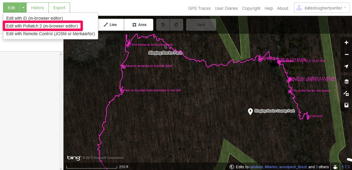
While we’ve covered how to read a topo map and U.S. Geological Survey (USGS) topographic maps in particular, OpenStreetMap-based topos are increasingly popular resources that merit their own post. In this post you will learn how to read OpenStreetMap-based topo map.

The OpenStreetMap (OSM) project leverages the knowledge of millions of people around the globe to crowdsource detailed world maps. As community involvement increases, OSM grows in detail and continues to improve—learn how you can help update OSM data in our recent blog post. Since OSM data is free to use, many apps and websites use it create custom maps for specific audiences.

OSM-based maps have higher resolutions than traditional USGS topos. They often provide more details than newer USGS topos, including additional feature types like cycle paths, bridleways, cable cars and chair lifts, brownfields, and better trail coverage to boot. Note that while USGS typically labels elevations on the 1:24,000 scale maps in feet, OSM-based maps label in meters.

OpenCycleMap

OpenCycleMap, one example of an OSM-based topo map service, emphasizes existing and proposed bike trails, bike lanes, and other amenities for cyclists. While it adds contours and hill shading to the standard OSM map, OpenCycleMap still generally offers less detail about the terrain, such as land cover types.

OpenCycleMap adopts elements of the OSM style, like purple/blue dashed lines for cycling paths and pink dashed lines for footpaths, though they appear more prominent than in OSM, “bolded” even. Non-cycling features have a lighter appearance, with footpaths left unlabeled.

This map source shows national and regional cycling routes, local cycling networks, and footpaths. It also displays bicycle shops, bike parking locations, restrooms, bars, pubs, and cafés near cycling routes.

how to read openstreetmap

OpenCycleMap display for the Manitou Springs, Colorado area. Credit: ThunderForest and OpenStreetMap contributors.

OpenCycleMap pulls the latest data from OSM every couple of days. A variety of apps and websites pull OpenCycleMap data, including Gaia GPS. Learn more about OpenCycleMap symbols through the key.

OpenLandscapeMap

OpenLandscapeMap by ThunderForest, another OSM-based service also found in Gaia GPS, focuses on terrain. Like OpenCycleMap, OpenLandscapeMap tones down non-naturally occurring features like roads, which all appear as light purple. Some other differences include:

  • less differentiation for trails
  • increased detail for land cover types ( like scrub, grassland, and farmland
  • darker and more prominently displayed water features
  • more labeled natural features like springs and geysers

OpenLandscapeMap also marks mountain peaks with a triangle, and labels their names and elevations, unlike the less specific USGS topos.

OpenHikingMap

OpenHikingMap styles OSM data to create a map geared toward hikers. We wrote about OpenHikingMap when it was first released in 2013. This map labels trail names and peak elevations. It also shows protected areas, restrooms, parking lots, and several different land cover surfaces.

Now that You Know How to Read an OpenStreetMap-Based Topo Map

You may want to try these sources out in Gaia GPS as you brainstorm your next foray into the great outdoors. Follow the iOS and Android links throughout this post to find out how to use them in the app.

If you have any questions about using topos in Gaia, just email us at support@gaiagps.com.

December 19, 2015
0 FacebookTwitterLinkedinRedditEmail
Gaia GPS

Use Your GPS Tracks to Update OpenStreetMap

by Kate Dougherty September 14, 2015
written by Kate Dougherty

In a recent blog post, we showed you how to join OpenStreetMap and help build an open map of the world, alongside millions of other map editors. That post focused on editing the map by comparing it to aerial imagery.

This new article covers how to use your GPS recordings (such as those you might make in Gaia GPS), to edit roads, landmarks, and other information into the map. Remember, OpenStreetMap doesn’t just mean roads – it includes trails and everything else of interest to hikers.

Record GPS Tracks and Waypoints

First, you need to go take a hike or something similar, and record tracks and waypoints. With Gaia GPS:

    • Download maps (iOS/Android) of the area you plan to explore ahead of time so they’ll be available without a strong internet connection. 
    • Start recording (iOS/Android) your track. 
    • It’s easy to add photos along your route (iOS/Android); the app will automatically geolocate or “attach” them at the proper locations. 
    • After you’ve finished recording your track, you’ll see a waypoint pin at the location where the photo was taken. Simply tap the pin to see your photo.
    • You can use your photos to contribute to OSM too, but we’ll leave that for another post.

        Completing Your GPS Track

        Once you’ve finished recording your track, you’ll have the option to customize its name (iOS/Android) and add it a folder (iOS/Android). If it’s one of several trails you plan to hike in Yosemite, for example, touch the folder icon to add the track to a new “Yosemite” folder.

        Gaia GPS will save your track and edits automatically, so there’s no save button on this screen. When finished, use your Android’s built-in back or undo button or tap done on an iOS device to exit the window and go back to your map.

          • Next, export the GPX file for your track. You can do this from within the app (iOS/Android), or by downloading the file from GaiaGPS.com. By default, your data will sync to gaiagps.com anytime you launch the app when connected to the internet.

        Uploading Your GPS Track to OpenStreetMap

        While OSM won’t automatically convert your track into a trace on the map, contributors can use it as a guide to add it manually. You can either trace over the path yourself, or make it public so other editors can access it.

          • Log into OpenStreetMap at http://www.openstreetmap.org.
            • Click GPS Traces at the top of the screen. You’ll see a list of the most recently uploaded traces.
              • Click Upload a trace at the top of the screen.

        Openstreetmap, gaia gpsClick on GPS Traces at the top of the screen to upload your file to OSM.

        openstreetmap, gaia gps

        You’ll see a list of the most recently added traces. Click Upload a trace to add yours.

          • On the next page, browse to select the location of the GPX file on your computer. You can also include a description, add tags, and set its visibility to Public. Click what does this mean? next to the visibility drop-down for more information on visibility types.
            • Click upload (the upload button is hidden by the dropdown in the screenshot below).

        openstreetmap, gaiagpsSelect and describe your file, then set its visibility.

        You’ll receive a confirmation of your submission, and a message saying that you’ll be notified by email once it’s been added to the OSM database. This usually happens within a few minutes. When you receive the email, click on the link to see the OSM page for your trace.

        openstreetmap, gaiagpsYour track’s page on OSM. Click edit to start editing the map at that location.

        Using Your Trace to Edit OpenStreetMap

          • Next, click edit to view your track superimposed over aerial imagery within the default editor. The track is so detailed that it may seem difficult to trace. But not to worry – OSM actually has three editors. One of them, Potlatch, will automatically smooth out and simplify the line.
            • To view and edit your trace in Potlatch, click the down arrow next to the Edit button at the top of the screen, then select Edit with Potlatch 2 (in-browser editor). You can also follow these steps to access Potlatch directly from your file’s OSM home page.

        openstreetmap, gaiagpsYour track is superimposed on top of imagery in the default OSM editor.

        While Potlatch looks different from the default editor, it works in much the same way. OSM displays basic instructions at the bottom of the screen.

        openstreetmap, gaiagps

        The trace is simplified in the Potlatch 2 editor.

        Simply click on a blank (unmapped) area of the map to start drawing a new way. Since your trace isn’t officially part of the map yet, OSM considers it a blank space.

          • Click on your track’s starting point to begin tracing over it, and click to add nodes where it begins to turn. The Potlatch editor makes this process much easier. Since Potlatch smoothes out your track, you’ll need fewer nods and less time to trace it.
        openstreetmap, gaiagps

        Follow your track to add it to the map as a new feature.

          • When you’re finished tracing, press enter on your keyboard (or double-click on the last node).
            • Next, you’ll need to add tags on the left. While the left panel may seem a bit crowded and complex when compared to the default editor, the idea is the same, except that Potlatch uses icons to offer a quicker, more visual way to tag features.
              • Set the feature type. Click Unknown, then choose Paths, then Footpath.
        openstreemap, gaiagps

        Tag the new feature.

        There are several tabs in the left pane; the first two are the most relevant to my path through Ringing Rocks Park.

          • After adding basic information on the first tab, click on the second tab and add a tag for the Surface field. In the example below, I’ve tagged the trail as an unpaved surface.
        openstreetmap, gaiagps
              • Feel free to explore the remaining tabs and add more information.
                • Click the Save button at the top of the screen to save your edits.
                  • You’ll be prompted to add a description of your edits for the community. For example, I wrote: “Added the trail/footpath that goes through Ringing Rocks Park.”
                    • Be sure to tweet or Facebook your edits to get your friends mapping too.

        Check back a bit later, and voila, your travels are now on the map for all to see!

        image (6)

        Your track is now mapped and visible to millions of users.

        Learn More about Uploading GPS Traces to OpenStreetMap

        Recording, uploading, and using your GPS tracks to contribute to OpenStreetMap is really quite simple and fun. You may just find yourself wanting to know more. Here are a few resources:

            • OpenStreetMap Wiki: Uploading GPS Traces
            • OpenStreetMap Wiki: Upload GPS Tracks
            • Potlatch 2 Primer: Creating Features

        We’re looking forward to seeing your traces on OpenStreetMap!


        September 14, 2015
        0 FacebookTwitterLinkedinRedditEmail
        Gaia GPS

        Map Your World with OpenStreetMap

        by Kate Dougherty August 24, 2015
        written by Kate Dougherty

        Map your favorite places, and join a global movement that makes data free and open to all people. This guide will teach you to edit OpenStreetMap (OSM).

        OpenStreetMap: More Than Roads

        Whether you’re hiking in the woods or driving in town, you can edit the map near you to make it accurate and more complete. OpenStreetMap uses the local expertise of contributors to crowdsource detailed maps of the world, and anyone can use the data, provided they credit OSM.

        Started in 2004, the number of OSM editors has grown from 1,000 on Christmas Day 2005, to more than two million today. The services now gains an average of 8,000 new users each month. OSM reached 20 million edits early last year, and its explosive growth shows no signs of slowing.

        Reasons to Edit the Map

        People contribute to OSM for all sorts of reasons:

        • Remote Forests and Trails – While U.S. government agencies like the U.S. Geological Survey provide topo maps to the public for free, the governments of other countries charge a fee for their maps. People have banded together to make free – and sometimes better – maps through OSM.
        • Local Maps – Some contributors want good local maps. For example, the OSM map of Berlin is probably better than any map in the world, because the Germans love OSM.
        • Crisis – In crisis, mappers pool their efforts to improve the OpenStreetMap so that first responders and emergency aid workers can navigate the affected areas.

        And from personal experience, you feel a bit like a better person when you edit the map.

        Getting started with OpenStreetMap.org

        In the following example, I’ll show you how I made some edits to my own neighborhood.

        The first step is to create an account with OSM at http://www.openstreetmap.org/. There are other tools you can use to edit the map, but this is the most common way.

        Explore an Area

        Enter an address, zip code, or city to search for the area you want to explore. Or, just click the Show My Location button (the arrow below the zoom controls on the right).

        Your search results will appear on the left.

        Openstreetmap

        The map will center on your chosen location on the right; the place’s tags (attributes, or descriptive information) are shown on the left.

        OpenStreetMap (OSM)

        You may not recognize many of the tags, but don’t worry… editing is simple.

        Editing OSM

        Now, you’ll need to find something that needs to be added or changed. When I first registered with OSM, I didn’t know where to start, but after poking around for a few moments, I found plenty to do.

        The basic steps are:

        • Click the Edit button at the top of the screen to enter edit mode. Microsoft Bing aerial imagery will load in the right pane, with existing OSM features superimposed on top.
        • Trace over the imagery to add roads, buildings, and other missing features.

        I recommend you go ahead and do the built-in walkthrough on openstreetmap.org. Then jump in and improve the map near you.

        Editing From the Field

        We’re focusing here on using aerial imagery to help improve the map. But another way (and some say the pure way) to improve OSM is to collect data directly from the field.

        Here are ways you can collect data to help edit OSM:

        • Go find out the name of a feature on the map. While tracing from imagery is helpful, tagging new features adds a whole other dimension to the data.
        • The next time you’re out on a trail, record what you can do there (hiking, biking, horseback riding, etc.)
        • Mark the exact coordinates of features in the field, using an app like Gaia GPS
        • Record hikes and drives of unknown roads and trails with GPS apps

        Since aerial imagery can be years old, your tracks and waypoints will provide the most up-to-date information for OpenStreetMap. See the end of this article for a list of resources and tools to help you edit the map.

        Editing from Imagery

        Look at minor roads in off-the-beaten path areas. Parks are another good place to start, since many of them lack information for restrooms, foot paths, playgrounds, and other features. You’ll get a kick out of this, and spend more time than you think fixing your local haunts.

        I started by homing in on a local ball park, and found neither the baseball diamond, nor the park road featured on the map.

        OpenStreetMap (OSM)

        Adding New Features

        To add a new feature, you’ll use the tools at the top of the right pane.

        • The Point tool drops a map marker at a point of interest.
        • The Line tool traces roads, rail lines, trails, bike paths, footpaths, and other linear features.
        • The Area tool lets you add detailed footprints of buildings, schools, businesses, lakes, swimming pools, and more.

        No matter which tool you choose, you’ll want to zoom in far enough to be able to mark features accurately.

        OpenStreetMap (OSM)

        Line features, as they appear in OSM.

        Adding a Road or Path

        In this example, I’ll add the minor road with the Line tool, and the ballpark with the Area tool.

        To begin adding a road or path (what OSM calls a “way”):

        • Select the Line tool at the top of the right pane. Bear in mind that a line should run down the center of the surface. If you’re adding a road, your line should connect to another road that’s already mapped in OSM.
        • Click on the point where the center of the new road connects with an existing road. This will create the first node, or point that helps define ways and shapes.
        • Follow the course of the road; where it begins to turn, click to anchor a new node that will allow you to swivel and follow its shape.
        • Press the enter key (or double-click on the final node) to complete your line. You’ll have a burgeoning sense of accomplishment, but you won’t be finished quite yet.

        OpenStreetMap (OSM)

        For this example, I connected the new road where it begins at Karakung Drive, and traced it to its dead end at a parking lot. Your sketch doesn’t have to be perfect, but if you make a mistake, use the undo arrow at the top of the screen. You’ll be an expert at tracing features in no time.

        Next, you’ll be prompted to add a feature type for the new road.

        • Set the Feature Type to “Road,” then select a subtype (Residential Road, Motorway, Primary Road, etc.). Click the information icon (i) for a description of each type.
        • If you’re not sure what to choose, set the type to Unknown Road. (If you’re adding a path, choose Path as the feature type, then select the appropriate subtype.)

        Then, name and tag the road:

        • Add the name of the road or path. Since the road that goes through the ballpark is unnamed, I left that field empty.
        • By default, roads are assumed to be two-way. If your road is one-way, change the value in the One Way field. Add the speed limit, if known.
        • You can indicate which types of traffic are permitted in the Access section. If you’re not sure, leave this section empty.
        • You can also note the type of surface in the Surface section. Most roads are tagged as paved, which means the surface is sealed with asphalt, paving stone, metal, or other material. If you know the surface is asphalt, you can specify that here. If you’re not sure, tagging more generally as paved or unpaved is fine.
        • If you like, you can include additional fields, such as address, phone, and website with the Add field drop-down menu.
        • Finally, be sure to save your edits with the button at the top right.

        Afterwards, OSM will prompt you to write a short summary of your changes in the left pane. For example, you could write something like “Added a minor road and speed limit.”

        OpenStreetMap (OSM)

        Adding a Park or Building

        I added the baseball diamond outline. You may want to add a body of water, grove of trees, your place of work, or a favorite restaurant.

        • Select the Area tool at the top right.
        • Click on a corner or edge of the feature to place the first node.
        • Continue tracing around the feature; you’ll see a polygon taking shape as you go.
        • When you’re finished, press enter to complete the shape.

        OpenStreetMap (OSM)

        OSM offers tools to help you smooth out your tracings. While they won’t help you if you’re tracing a ballpark, they can make outlining buildings and other features a lot easier.

        If your square, rectangular, or circular sketch is an “approximate” one that could use a bit of help, complete the drawing, then click on it. A menu of tools will appear on top of your sketch. Click the square-shaped tool (Square Corners) to fix up square and rectangular shapes, or the circle-shaped tool (Make Circular) for circular ones.

        Add tags for the new feature in the left pane.

        • I searched for “baseball” in the search box at the top left, then set the feature type for the ballpark to Baseball Diamond.
        • I entered Reilly Field as its name.
        • Since I didn’t know if the park is lit or not (probably not, and I don’t see light poles on the imagery), I kept the value in that field as “unknown.”
        • I also added the address and the website for Haverford Township Little League.
        • Don’t forget to Save your edits, and then summarize them in the left pane.
        • Also, make sure to Tweet or Facebook your changes, and get your friends mapping too.

        OpenStreetMap (OSM)

        Your Edits Reach Millions

        It may take a few minutes (or hours in some cases) before your edits appear on OpenStreetMap.org, and start to percolate out to other maps and services that use OSM data. When you edit the map, your changes will start being pulled by all of these apps and maps used for so many things, used for fun and for research and for work.

        Hundreds of millions of people use OpenStreetMap each day. OpenStreetMap data powers some of the best websites and apps out there, including our own Gaia GPS. Here are a few others:

        • Craigslist
        • MapQuest
        • FourSquare
        • Bike Citizens
        • City Maps 2Go
        OpenStreetMap (OSM)

        The newly added features, as they appear to OSM users.

        Become an OSM Expert

        There are several resources to help you get started with OSM. Learn more at these sites, and happy mapping!

        • Video Tutorials
        • Beginner’s Guide – A community-maintained guide for beginners.
        • OpenStreetMap Wiki – Need help with tags? Get detailed keys, descriptions, and documentation here.
        • OpenStreetMap Help – post a question; get an answer.
        • FieldPapers.org – This tool makes collecting data from the field and updating OSM easy. Print off atlas pages in advance, sketch and annotate what you see, then upload the photos of your notes. Open your updated Field Papers file in OSM to start editing, based on your firsthand experience.
        • Track-Making Apps – a list of iOS track-recording apps that can be used to update OSM.
        • Recording GPS Tracks – OSM’s instructions on how to edit the map by uploading GPS traces.
        August 24, 2015
        0 FacebookTwitterLinkedinRedditEmail
        Load More Posts

        Categories

        • Adventures
        • Android
        • App Comparisons
        • App Updates
        • Backcountry Skiing
        • Boating
        • Company News
        • Emergency Response
        • Featured
        • Fishing
        • Gaia GPS
        • Gaia GPS Offroad Podcast
        • GaiaCloud
        • Hikes
        • How-To
        • Hunting
        • iOS
        • New Features
        • New Maps
        • Newsletter
        • Offroading
        • Out and Back Podcast
        • User Profiles

        Recent Posts

        • The Hike Map That Broke Me: How Gaia GPS Turned an Overlander Into a Reluctant Hiker
        • A Fond Farewell to National Geographic Maps — And a Look at What’s Ahead
        • Introducing the Gaia Hike Map: Your Trail-Ready Adventure Buddy
        • Download the app and get a free 14-day trial of Gaia GPS Premium
          • Facebook
          • Twitter
          • Instagram
          • Youtube
          • RSS
          • Explore The Map
          • Get the App
          • Upgrade Today
          • Explore The Map Catalog
          • New Features
            • Gaia GPS

              The Hike Map That Broke Me: How Gaia…

              April 24, 2025

              Gaia GPS

              Introducing the Gaia Hike Map: Your Trail-Ready Adventure…

              March 18, 2025

              Gaia GPS

              Unlock a New Level of Personalization in Gaia…

              December 12, 2024

              Gaia GPS

              Goodbye Clutter, Hello Streamlined Maps: Introducing Sync to…

              November 26, 2024

              Gaia GPS

              Discover Prime Stargazing Locations with Our New Light…

              August 15, 2024

              Gaia GPS

              2023 Mapped: Our Best New Features of the…

              December 27, 2023

              Gaia GPS

              Discover Adventure Easier Than Ever with New Map…

              July 27, 2023

            • New Maps
              • Gaia GPS

                Discover Prime Stargazing Locations with Our New Light…

                August 15, 2024

                Gaia GPS

                Find Prime Viewing for Total Solar Eclipse with…

                March 27, 2024

                Gaia GPS

                See the World More Clearly with New Gaia…

                May 18, 2023

                Gaia GPS

                Gaia Classic: The Only Map You’ll Ever Need?

                May 4, 2023

                Gaia GPS

                Why NatGeo Trails Illustrated are America’s Favorite Maps

                February 9, 2023

                Backcountry Skiing

                Find Backcountry Skiing in Gaia Winter Map

                January 11, 2023

                Gaia GPS

                Our Favorite New Maps and Features

                December 23, 2022

          • Activities
            • Backcountry Skiing
            • Boating
            • Emergency Response
            • Fishing
            • Offroading
          • Adventures
            • User Stories
          • Help

          @2024 - All Right Reserved. Gaia GPS


          Back To Top