Boulder and Steamboat Springs are steeped in the cycling culture and lore. So why not strap some bags to your bike and ride over some high alpine passes, linking them together in one mega route? This 354-mile route (intended to be ridden counter-clockwise) with lots of elevation gain will test your full adventure skillset. Still, despite its numerous challenges, you’ll be rewarded with breathtaking views and countless opportunities for fantastic campsites and side quests along the way. Follow along as I give you a look into the route and what to expect along the way. Refer to the last paragraph for bike setup recommendations and other helpful tips for the route.
Leaving Boulder, there are numerous bike-friendly ways to get to Estes Park. For my selection, I recommend taking the North Sky Trail to Joder Ranch, Lefthand Canyon, and then up through Jamestown to reach the Peak to Peak Highway. It is an excellent mix of dirt and pavement that feels efficient and somewhat direct. You’ll feel like you’re making progress, and the scenery changes quickly. Other options exist, so check the map and find what works for your setup and riding style. I like balancing interesting dirt options, but nothing too slow or tedious, as this is a big loop! You have places to be!
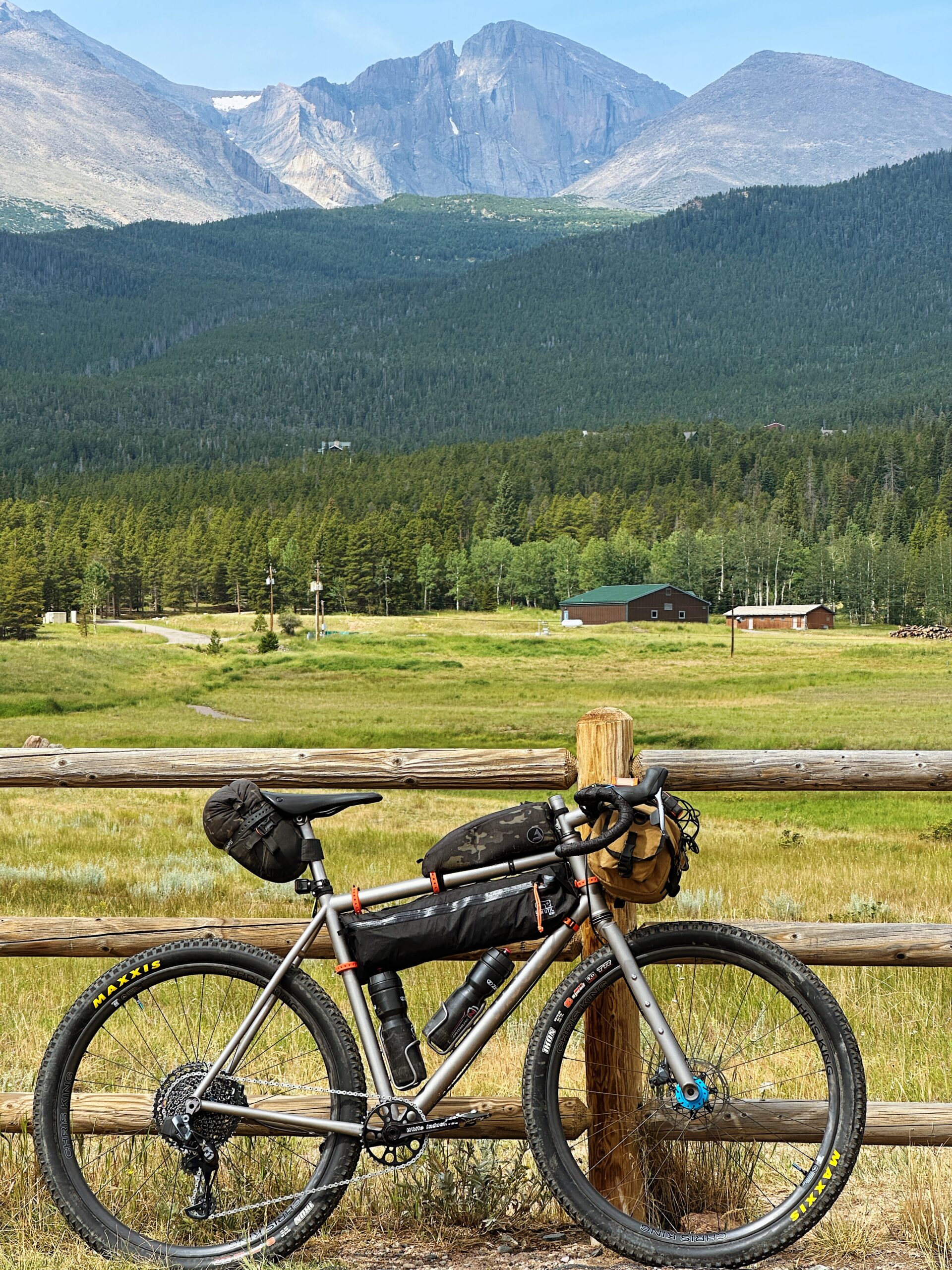
Once you arrive at the Peak-to-Peak Highway, you’ll be smooth sailing on a wide shoulder and excellent tarmac all the way to Estes Park. The P2P is a Boulder County classic, so don’t forget to take in the views of the Indian Peaks and the infamous Longs Peak as you pedal by. In Estes, stock up on supplies and grab some food. Numerous options exist, and you’ll have no problem finding something to eat.
Now onto the first big climb of the trip: Old Fall River Road. Once you pay the park entry fee and enter RMNP, the fun stuff begins. Enjoy this magnificent dirt climb up to 11,796ft. The grade is perfect and the views are stunning. Heads up, this is a one-way road, so make sure to keep an ear out for cars wanting to pass from behind. Also, it’s not uncommon to find elk on the road, so another point of caution.
Once atop the pass, buckle in for one of the craziest road descents you’ll ever do. It’s smooth sailing all the way down to Grand Lake. Camping options are available along the way, so be sure to call ahead and book a reservation in advance. Lodging options are available on HWY 34 through Grand Lake and Granby, so research ahead of time if that’s something you’re looking to do. Resupply in Grand Lake or hit the Gas Station in Granby before Willow Creek. You’ll be on pavement for a long stretch without services. Turn on that rear blinky light. There is a comfortable shoulder the whole way, and I never felt like it was sketchy. That being said, it’s a busier road, so proceed with caution and be alert.
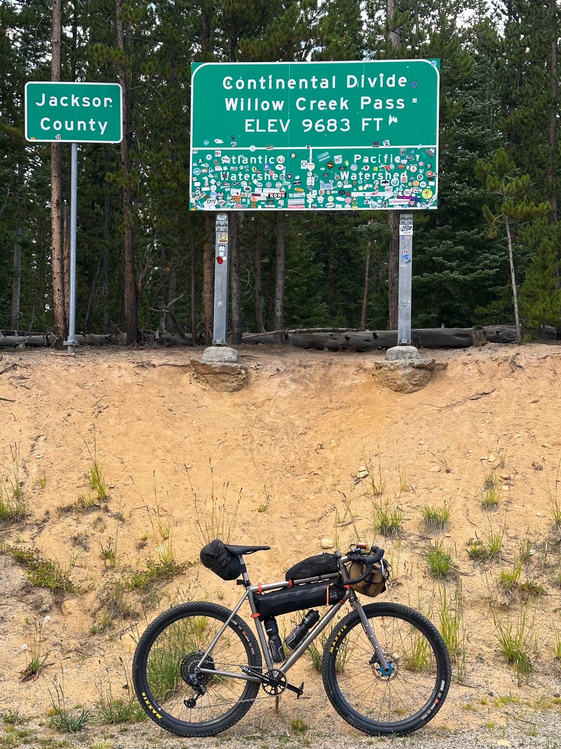
I’ll repeat it, you’ll be on pavement without services for a long time (almost 90 miles!), so stock up in Granby. Your next resupply is Steamboat Springs. The next stretch is remote and beautiful, and will be worth the solitude. If you’re looking to ride more dirt, check out Illinois/Stillwater Pass. It was closed when I rode this route, so please check online before committing to it.
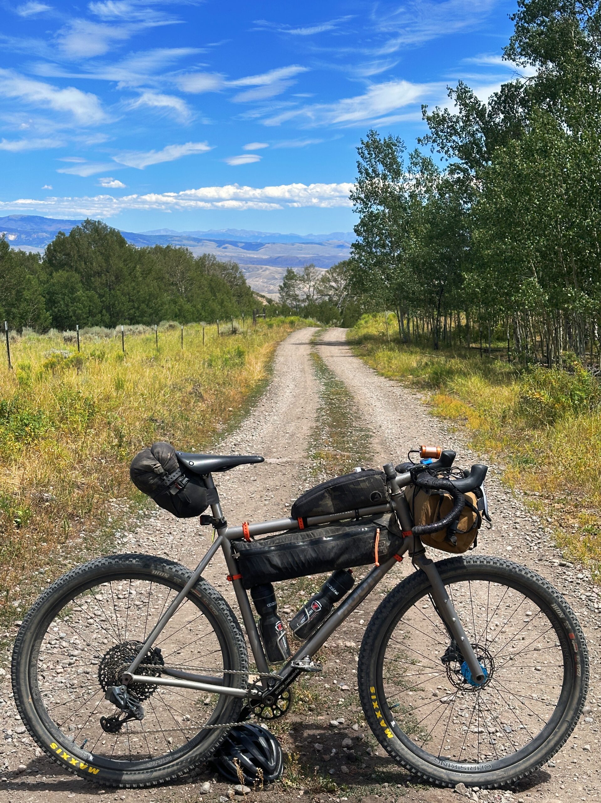
After Willow Creek Pass, you’ll enjoy wide open spaces and sagebrush. As you cruise through North Park, you’ll have a mix of fast pavement and dirt roads. Make the long push over to the base of Buffalo Pass, your final obstacle before charging down into Steamboat. From the east, Buffalo Pass is a gentle, smooth climb. Down the west, it’s chunky and steep! You’ll be screaming down to Steamboat Springs soon enough. Want to hit some singletrack? Cruise down Flash of Gold and get a taste of the iconic trails that made this place famous.
In Steamboat, you’ll find everything you need to recover and get motivated for the ride back to Boulder. You’ll be hopping on the iconic Great Divide Mountain Bike Route and feel where many legends have ridden before you. Soak it in—This is one of the premier stretches of the route. You’ll find camping and places to filter water near the top of Lynx Pass before leaving the GDMBR for Gore Pass. Don’t miss the cutoff turn, as this skips pavement and extra miles down to Kremmling. On the second half of the route, resupplies become more frequent. You’ll rejoin the GDMBR through Williams Fork, then head up Keyser Creek to Church Park. Excellent views and dispersed camping are easily accessible on this climb, as well as at the summit.

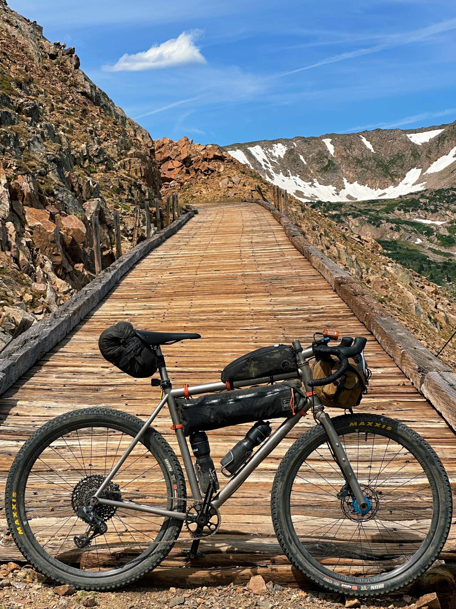
Only a few obstacles stand in your way from Boulder. Ride down to Fraser and the Winter Park valley and get ready for the crux of the ride. Rollins Pass. It’s easy cruising up from the West, but the real challenge lies in the descent. Ride over the historic trestles and do your only real hike-a-bike of the trip. It’s worth it for the views! The descent is rocky, enough said. Stay with it and don’t get frustrated. It’s the last real challenge of the route, and you got this. Once you hit Tolland Road. It’s fast dirt back down to Rollinsville. Stop by Melt for a coffee or beer, and get psyched for the final stretch of the trip. It’s the famous Magnolia Road. Rolling dirt miles will bring you to a screaming fast paved descent down to Boulder Canyon. Hop onto the creek path at Chapman Drive and coast down into Boulder. The loop is complete!
Bring your widest tires! 2” minimum. You’ll want the wide tires for Buffalo and Rollins Pass. You’ll also want to have plenty of water and food storage. There are some long stretches (Granby to Steamboat, specifically) with almost no resupply. This route holds snow until midsummer. The best time to ride is from July through the end of September. It’s a short window, given the high-elevation mountain passes. Lights! Bring your front and taillights for visibility along busier stretches of road. Have more questions? Send me a DM on Instagram @kylerichardson. Enjoy!