
After a long time in development and testing, we have finished Gaia GPS for Android, v2.0. This is a big release because it adds tracking to the app and includes a totally reworked UI.
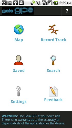
We used code from Google’s MyTracks open source app to add tracking, stats, and graphs to the app, so hat tip to Google for providing yet another good programming toolkit. Besides tracking, the most striking change is the new home menu:
This release has been in beta for several months now, so if you are an Android Gaia user, check it out. If you haven’t bought the app, you can download the free, ad-supported version.
With these additions, our Android app is much closer in functionality of the iPhone version of Gaia. Up next, we’re working on POI search and GPX exports. Please let us know your suggestions at android@gaiagps.com.

