Top Posts
Introducing Adventure Modes: The Right Map for Every...
Trip Report: A Rider’s Guide to Bikepacking in...
How to Hike a Colorado 14er: A Step-by-Step...
Trip Report: A Rider’s Guide to link Boulder...
Trip Report: A Rider’s Guide to the South...
Battling the Wind: Setting Your Shocks to Firm...
The Hike Map That Broke Me: How Gaia...
A Fond Farewell to National Geographic Maps —...
Introducing the Gaia Hike Map: Plan Your Hike,...
Download the app and get a free 14-day...
Gaia GPS
  • Explore The Map
  • Get the App
  • Upgrade Today
  • Explore The Map Catalog
  • New Features
  • Activities
    • Backcountry Skiing
    • Boating
    • Emergency Response
    • Fishing
    • Offroading
  • Adventures
    • User Stories
  • Help

Gaia GPS

A closed area sign at Big Sky ski resort in Montana.
Emergency ResponseGaia GPS

Search and Rescue Efforts Stressed During COVID-19 Pandemic

by Mary Cochenour April 9, 2020
written by Mary Cochenour

This week, we took an on-the-ground look through the eyes of search and rescue (SAR) personnel at how the COVID-19 pandemic is affecting some popular outdoor destinations. We spoke with first responder groups in the Colorado Rockies, Lake Tahoe Basin, and Joshua Tree National Park.

There have been a variety of state, local, and park/forest-level restrictions that have impacted how people get out there, but people have still sought the wild as a refuge from quarantine. SAR personnel we spoke to said people need a way to get outside, but a common theme we heard was urging people to stay closer to home and be safer. Because of the pandemic, rescue is complicated and outcomes can be worse due to the over-taxed medical and other facilities of the country.

Joshua Tree National Park: Now Closed

Just a three-hour drive from the greater Los Angeles area, Joshua Tree National Park is one of California’s most accessible outdoor playgrounds. When California instituted its stay-at-home order on March 19, the park and its tiny gateway towns instantly became an escape for city residents looking for fresh air and room to roam.

But the increasing crowds caused concerns about the spread of Coronavirus and Joshua Tree quickly responded by closing its entrance gates on March 21, while still allowing non-motorized access inside the park’s boundaries. The partial closure didn’t deter visitors, who continued hiking and biking on park roads and trails.

John Lauretig, Executive Director of Friends of Joshua Tree, the non-profit funding partner to the Joshua Tree National Park Search and Rescue Unit, said the limited access was causing a pile-up of cars — and people — at the park’s entrance gates.

Hundreds of vehicles parked along the road along the West entrance to Joshua Tree National Park. Video provided by John Lauretig, executive director of the Friends of Joshua Tree, the main funding partner and volunteer source for Joshua Tree National Park Search and Rescue team.

Springtime visitors to the park have kept Lauretig’s team on its toes. In March alone, Joshua Tree Search and Rescue, along with park service rangers and San Bernardino County medics, responded to four separate climbing rescues: one that required a helicopter transport and three others that resulted in ambulance rides to the local hospital.

On April 1, Joshua Tree National Park officially shut down all public access, which will hopefully quiet search and rescue calls for Lauretig’s crew.

“This is definitely not the time to be doing risky things and end up in the emergency room with a broken leg, using up valuable emergency medical resources,” Lauretig said.

An open hatchback on a sport utility vehicle showing ropes and rescue gear inside.
Emergency crews are ready for rescue in the Joshua Tree National Park area.
Photo courtesy of Friends of Joshua Tree

With the park completely shut down, Lauretig said he hopes visitor traffic in the park’s gateway towns of Twentynine Palms, Yucca Valley, and Joshua Tree dissipates. And so far it has. Lauretig said the days following the park’s total closure were quiet.

“We really want people to just stay at home now because we don’t want our small town to be affected by COVID-19,” Lauretig said, adding concern that an increased visitor population would strain local medical resources.

Lauretig said he understands the need to get outside but urges people to stick close to home, pick the less popular paths, and go outside at the least popular times of the day.

“Try getting outside in the hours right after dawn and just before dusk when there are less people out,” Lauretig said.

Colorado – Backcountry Skiers Out in Force

A similar situation has unfolded in Colorado, where skiers and snowboarders have been pouring into the state’s mountain zones ever since Colorado’s governor ordered all ski resorts to stop lift service on March 15.

Summit County’s high-elevation peaks, including several of Colorado’s most famous 14ers, are easy access to Denver’s population at only an hour or so drive from downtown. Consequently, trailheads in the area are packed and those crowds are keeping the Summit County Rescue Group, the area’s local search and rescue volunteer organization, at the ready.

Charles Pitman, Mission Coordinator of the Summit County Rescue Group in Colorado said his crew conducted an unofficial survey in late March at one of the busiest trailheads in the county — Quandary Peak. He discovered that half the cars parked at the trailhead were local, from Summit County, and the other half were from the front range, more than an hour’s drive away in the Denver area.

“There have been long discussions about whether this is an appropriate thing to be doing given the order to stay closer to home,” Pitman said. “People should be staying close to their homes, and if there’s no skiing nearby, then they should find something else to do.”

Pitman is also concerned about the lack of space at these crowded trailheads.

“There are 20 to 30 cars in the parking lot and everyone is standing around talking to each other,” he said. “The social distancing aspect is not there.”

A "area closed" sign at a ski resort with a big snow-covered mountain in background.
Ski resorts nationwide stopped lift service in mid-to-late March in an effort to help stop the spread of COVID-19. Here, Big Sky Resort in Montana closed on March 15.

Pitman said they’ve had to change response protocols to comply with social distancing practices to keep their team safe from exposure to the virus. Group briefings at the command center have been nixed and turned into individual briefings conducted outside in the parking lot. Situations in the past where the entire search and rescue team would have been called upon have now been pared down to teams of four-to-eight crew members.

These measures can slow response time, Pitman said.

Pitman said the fewer calls the better right now. Every time search and rescue gets called out, during the pandemic or not, the responders risk injury. Crews being called out during the pandemic now face the added risk of exposure to the Coronavirus. Pitman said he hopes people are willing to self-regulate their conduct and be less risky in the outdoors.

“I’d ask people to pick a more conservative line right now,” Pitman said. “There is no ski patrol out there — we’re the ski patrol.”

Come on folks. Let’s be smart. This is not social distancing. #MayorParker pic.twitter.com/on4ygQauRY

— Mayor Parker The Snow Dog (@officialsnowdog) March 21, 2020
This video is shared with permission by Mayor Parker The Snow Dog @officialsnowdog

Pitman added that in easy-access areas, like Loveland pass, he’s noticing a lot of novice backcountry users. On a recent weekend day, Pitman checked in with dozens of skiers and snowboards at the parking areas at Loveland Pass and discovered that only one was wearing an avalanche beacon.

“Maybe it’s better that people do a little introspection and recognize that these are different times right now, perhaps they need to hang up the snowshoes and the skis and do what the governor said to do, which is stay close to home and don’t get too close to other people,” Pitman said.

Lake Tahoe – Fewer Search and Rescue Volunteers

In some places, COVID-19 has put a strain on the number of volunteers available to respond to search and rescue missions. That has been the case in El Dorado County, California, where the Sheriff’s Office is tasked with responding to search and rescue missions from South Lake Tahoe, over the Sierra crest, and down to the gold rush towns surrounding Placerville, California.

Like most other search and rescue teams in the nation, El Dorado County relies on volunteers to carry out rescue missions. Some volunteer members have become unavailable for call out, El Dorado County Sheriff’s Sgt. Anthony Prencipe said.

“The reality is that there are so many people that are in self-quarantine and that’s affecting how many volunteers we have available,” Prencipe said. “We have less volunteers that are able to respond and go out to calls.“

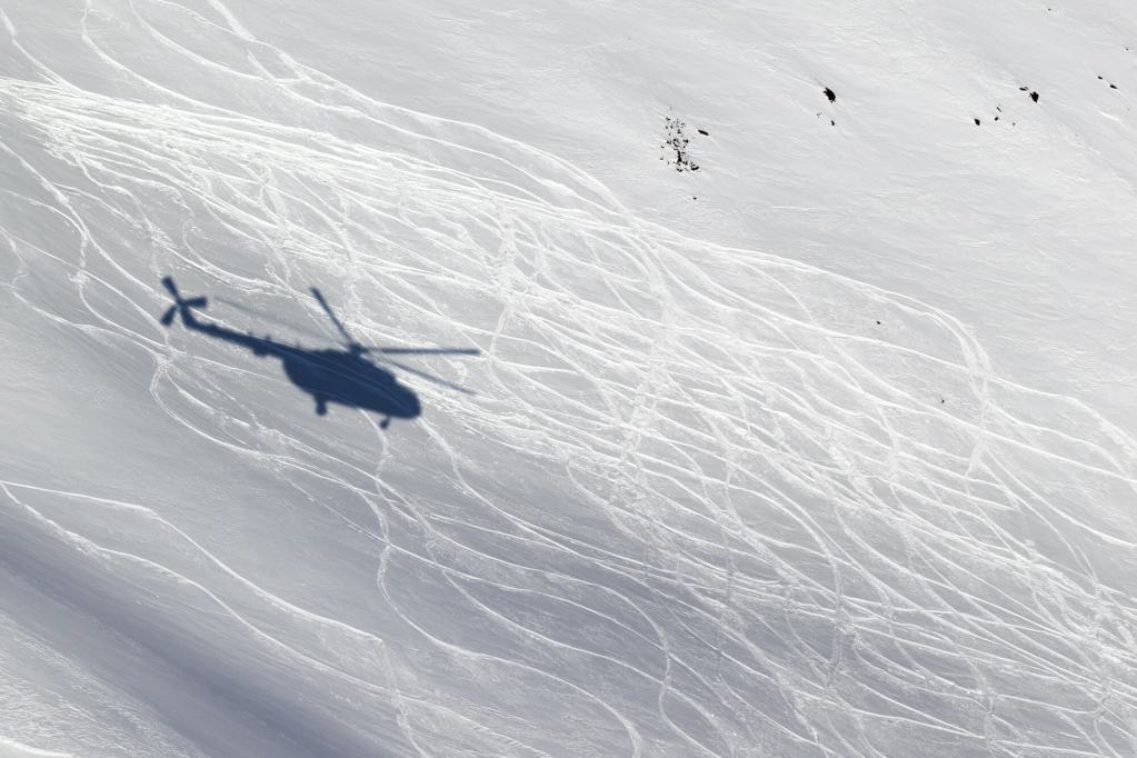
A shadow of a helicopter on a snow field with ski tracks

Navigating the Line Between Access and Stay-at-Home Orders

When drafting its shelter-in-place orders, many states seem to recognize the benefit that the expanses of public lands bring to its residents.

For example, Colorado’s shelter-in-place order, which took effect on March 26, 2020, mandates that Coloradans take extreme measures to avoid COVID-19 and stay at home with the exception of essential activity, such as buying food or seeking medical care. In a separate document, Colorado’s governor clarified that outdoor activity would be permitted for the health and well being of Colorado residents, including “walking, hiking, nordic skiing, snowshoeing, biking or running” provided such activities adhered to social distance protocols.

Other states, like California and Washington, have signed similar shelter-in-place orders, permitting outdoor access close to home and with social distancing practices. Montana went a step further and permitted access to public lands provided that Montanans refrain from high-risk activities such as backcountry skiing “in a manner inconsistent with avalanche recommendations or in closed terrain.”

Hikers, bikers, climbers, and sightseers seem to face a conundrum as they attempt to navigate the line between complying with government orders and maintaining their physical and mental health by visiting the fresh air and expanses of public land.

All three search and rescue leaders advised that people should still seek to get outside, but they ask that people dial back risky behaviors to reduce the chances of needing rescue in the backcountry.

“No one ever plans to get injured or lost. They don’t expect it to happen, but then it does and we get called out,” Prencipe said. “Maybe now is a good time to avoid backcountry places with a higher danger element for now, and maybe stick to the walking trails by your house.”

April 9, 2020
5 FacebookTwitterLinkedinRedditEmail
Professional endurance athlete Anton Krupicka trains on his gravel bike along a dirt road.
AdventuresFeaturedGaia GPS

How Six Professional Mountain Athletes are Navigating the COVID-19 Pandemic

by Abby Levene April 9, 2020
written by Abby Levene

Professional mountain athletes and guides are facing canceled races, maybe even entire race seasons, guiding trips, and speaking tours. Some of these outdoor experts are tapping into their resiliency in the mountains to survive sheltering at home during the COVID-19 Pandemic.

Gaia GPS checked in with endurance athlete Anton Krupicka, ultra runner Clare Gallagher, mountain guide and backpacker Andrew Skurka, rock climber Hazel Findlay, mountain-trail-ultra runner Sage Canaday, and mountain runner Hillary Gerardi to learn how they are navigating this uncertain time. Whether locked down in France or avoiding crowded trails in Colorado, these professional athletes share a productive outlook on how they can work on their weaknesses and recharge for future goals.

Anton Krupicka

Professional mountain athlete Anton Krupicka rose to ultra running prominence by winning the iconic Leadville 100. The 100-mile ultramarathon crosses the rugged trails and dirt roads of Leadville, Colorado, in the thin air of the Rocky Mountains. Krupicka ascended through the fledgling sport by running insanely high mileage in a minimalist style: mostly shirtless, sometimes barefoot, and always sporting his flowing hair and beard. While injuries have thwarted his racing goals for the past several years, the mystique of Anton Krupicka has only grown.

Running finally started to click for him this spring. Injuries abated and Krupicka had his eyes set on qualifying for the iconic Western States Endurance Run. The 100-mile running race traverses California’s Sierra Nevada trails and attracts many of the best ultra-marathoners in the world. Krupicka aimed to qualify for Western States at one of the “golden ticket” races later this spring, where the top two racers receive automatic entries to the big dance. But the pandemic led to the cancellation of all the qualifying races, including the Western States itself. Krupicka had also planned on racing a slew of endurance off-road cycling races, which suffered the same fate.

Despite the derailment of his racing season, Krupicka is making the most of what circumstance and health allow. His endurance bike adventures and climbing, scrambling, and biking-to-run linkups prove just as ambitious as his running style. The pandemic simply presents another challenge for creativity and controlling what he can.

“The main thing I’ve done is forgotten about doing any more skiing this year,” Krupicka says. “I have also quit climbing, unfortunately.”

He rationalizes that these activities present too much risk of injury and hence potentially stressing the healthcare system further. When he trains outside, Krupicka shies away from trailhead bathrooms and tries to frequent less traveled trails.

“I think there’s a lot of people — myself included — feeling quite out of control,” Krupicka says. “So we all just try to hyper-control those things that we think we have power over, whether it’s rational or not.”

For Krupicka, that entails still getting outside in the ways that he can. He dialed his running training back a bit; “no more 25-to-35-mile long runs.” Instead, Krupicka re-focused on biking and mountaineering with hopes of tackling some long bikepacking routes this summer and high alpine traverses on foot.

As an introvert and advocate for exploring your backyard, Krupicka’s relatively hermit-like, simplistic lifestyle offers some wisdom for staying at home.

“Read a good book,” Krupicka recommends. He is currently enjoying Empire Falls. “Go outside for christ’s sake. Exercise is good. Don’t unnecessarily self-martyr. Be responsible. Exercise from your doorstep.”

Follow Anton Krupicka on Instagram.

Ultrarunner Clare Gallagher standing in a large meadow with mountains in the background.

Clare Gallagher

Professional ultra runner and Patagonia climate activist Clare Gallagher trains on the trails, dirt roads, and mountains surrounding her hometown of Boulder, Colorado. Or at least that’s the case when she’s home. Gallagher usually spends most of her springs and summers traveling around America and Europe for speaking engagements and races.

The pandemic led to the cancellation of Gallagher’s spring international speaking tour and goal race for the year: defending her title at Western States. Last year, Gallagher hammered the last five miles of the 100-mile trail race to hold off Brittany Peterson for the win. She recorded the third-fastest time — including men — for that last 5-mile segment. But the pandemic hit her harder on a more intrinsic level than canceled events.

“I wanted to quit running,” Gallagher says. “Running just didn’t seem important compared to everything else going on.”

Gallagher tried going on a run. The trails were crowded. She was exhausted. Her back hurt. Gallagher accepted those signals as sirens. She walked home and didn’t run for the rest of the week. Her attention turned to planting a garden and reading One Breath, a book about the sport of freediving. Gallagher signed up for a freediving course this winter to rekindle her love for the water. With the freediving course now canceled, Gallagher started practicing breath control at home.

“It is deeply meditative and relaxing,” Gallagher says of holding her breath for minutes at a time. “And challenging.”

A week into sheltering in place, Gallagher decided that quitting running wasn’t the solution after all. As time at home passed, she felt less tired and more motivated. She started to run again, albeit at a slower pace. She takes the time to read plaques alongside the trial that she has run by hundreds of times before.

“I’m trying to be present, grateful, and to stop and smell the tulips,” Gallagher says.

Gallagher also remains cognizant of social distancing etiquette and doing her part to make people feel safe on the trails.

“When I see someone walking up towards me on the trail, I shout I’m going to hold my breath!” she says, before sprinting around them with a large berth.

Gallagher believes this year probably won’t include any racing, and she’s okay with that. In fact, her face lit up at the prospect of tackling some big mountain days close to home, including running from Boulder to her family’s cabin in Montezuma, Colorado — some 70 miles away and across the continental divide.

“There’s some pristine wilderness back there that is relatively unexplored,” she says.

Follow Clare Gallagher on Instagram.

Backpacker Andrew Skurka running on a road with mountains in the background.

Andrew Skurka

Professional backpacker, runner, and mountain guide Andrew Skurka has welcomed hardships in non-pandemic life. Diving into long-distance thru-hiking in his 20s, Skurka helped pioneer the concept of light and fast backpacking. National Geographic and Outside named him “Adventurer of the Year” in 2007 and 2011, respectively. Since then, Skurka has developed a thriving guiding business. He takes clients on trips to Alaska, the Sierra, Utah, the Appalachians, and the Rockies with a focus on ultralight backpacking and backcountry navigation. But the pandemic took its toll.

“When the pandemic hit, I was deflated,” Skurka says. “This was going to be a banner year for my guided trip program — by the middle of February, 28 out of my 29 scheduled trips were sold out. It’s not looking like that anymore. At this time point, I’m just trying to be constructive and salvage what I can.”

While the guiding business slows down for now, Skurka devotes more attention to running. The 2:28 marathoner had been training for the Colorado Marathon in early May, which has been postponed and potentially canceled. He pivoted.

“I extended the training cycle for another five weeks, hoping that the REVEL Marathon in early June happens,” Skurka says. “My racing goals are modest this year. I’d simply like to get a strong Boston qualifier for the 2021 race — when I’ll be 40.”

Skurka hopes that his guided trips still happen later in the year. He moved his April and May trips to the fall. And he’s mentally prepared for his June and July trips to get canceled.

“This will pass eventually,” Skurka says. “But for now, follow the doctor’s orders, and play your part. The more buy-in now, the quicker we get through this and with the least disruption.”

Follow Andrew Skurka on Instagram.

Climber Hazel Findlay doing a pull up in a door way.

Hazel Findlay

For the past 24 years, rock climbing has played a central role in professional climber Hazel Findlay‘s life. She quickly established herself as a competition climber, winning the British junior championships six times before turning her attention to rock. Findlay’s specialty lies in extremely challenging traditional climbing. She has numerous first ascents around the world, including the first female ascent of Once Upon a Time in the South West (E9 6c/5.13b R/X), Devonshire, South Wales and first ascent of Tainted Love (5.13d/8b R trad), Squamish, Canada.

But now, for the first time since age six, Findlay’s life does not revolve around climbing.

“I had to cancel all the coaching and speaking events I was working towards, which was a real shame,” Findlay says. “And of course when [the United Kingdom government] said we shouldn’t go climbing that was pretty sad.”

“My life right now is like a rainy day.”

Findlay had a lot of “adventure” climbing trips planned for this year. Instead, she currently weathers the pandemic at home in Pembrokeshire, North Wales.

She spends the morning training on a hangboard in her loft and at her computer working. In the afternoons, Findlay continues to work, train, and tackle various home projects like gardening, cooking, cleaning, and decorating her new house. Ironically, the darker moments set in when the sun comes out.

“With my coaching business, podcast, professional climbing and all the things I still want to learn, I have a never-ending list of jobs to do,” Findlay says. “When it gets sunny it feels very weird not to be going climbing.”

While Findlay worries for the health of family members and her coaching business, she focuses on what she can control:

“I’m trying to be kind to myself and not ask too much of myself.”

Follow Hazel Findlay on Instagram.

Ultra runner Sage Canaday running on a trail with mountains in the background.
Photo Credit: Sandi Nypaver

Sage Canaday

Professional mountain runner and coach Sage Canaday felt excited and optimistic about his ambitious international racing plans for 2020.

“Suddenly, my running and racing season seem quite a bit less important,” Canaday says. “I’ve always viewed a lot of endurance sports as being pretty selfish endeavors. That’s magnified now.”

When his hometown of Boulder enacted a shelter in place ordinance, Canaday effectively shut down his training. He hardly left his 420-square-foot apartment.

“With my goal races for the year all up in flux I totally lost motivation to train hard,” Canaday says. “But it was more than that. I’ve burned a lot of energy worrying about the fate of society and the long-term ramifications of this event.”

Stress is stress. Whether it’s from intense training or getting into “pointless” debates with those who believe the pandemic is a hoax, it takes a physical toll on the body. Canaday slowly upped his activity.

“But my main goal is just to stay as healthy as possible and to not gain a beer gut!” Canaday says.

He aims to run a moderate-to-low amount while focusing on things he previously ignored: working weaknesses like hip mobility and glute strength with indoor exercises. While it might seem like this is a good time to go to the wilderness to find yourself, Canaday presents a more responsible alternative.

“Perhaps now is more of a time to focus on looking within and inside oneself and grounding oneself physically and mentally,” he says.

Canaday rose to distance running prominence at only age 21, when he qualified for the 2008 Olympic Marathon Trials. For the first time in 13 years, he’s had the chance to take a step back and remember why he runs in the first place.

“As a professional athlete, you view running as a job,” Canaday says. “You throw out race performances and it gets back to why you really like and want to run, why you find meaning in running, or what it means in the context of your ever-changing life.”

He has also doubled-down on content creation for his popular Youtube channel. Recent videos range from the importance of ankle flexion for a longer running stride to covering iconic songs in his one-man-band.

When he’s feeling down, Canaday remembers the upside of this freeze on regular life: it’s good for the environment.

“I had become addicted to the luxury of international travel,” Canaday says. “And now I’m actually forced to reduce my carbon footprint. Finally!”

Follow Sage Canaday on Instagram.

Mountain athlete Hillary Gerardi riding a stationary bike in her backyard in France.

Hillary Gerardi

American born and French bred, professional mountain athlete Hillary Gerardi calls the Alps surrounding Chamonix, France her training ground. The 2018 “Skyrunner Extra World Series” world champion planned to return to the Sky Running race circuit this summer in addition to other prominent mountain races around the world. When she’s not running, climbing, and skiing in the Alps, Gerardi works at the Crea Mont-Blanc, the research centre for alpine ecosystems, with her husband, Brad.

But on March 16, French President Emmanuel Macron imposed a national lockdown to help flatten the Coronavirus curve and to minimize accidents necessitating hospitalization. Residents may go outside once a day for one hour of exercise, and they must remain within a kilometer of their homes. In Gerardi’s village outside of Chamonix, regulations further limit citizens to only ascending 100 vertical meters. The heart of the trail running race season typically extends from April to November. This year, the pandemic forced race directors to cancel early season races, and the rest of the season remains up in the air.

Canceled races and quarantine restrictions have not stopped Gerardi from training. In fact, she has responded to the uncertainty and limitations with creative exuberance. Instead of long training runs, ski mountaineering, and climbing in the mountains, Gerardi bikes for an hour on her trainer set up on the deck. She then runs for an hour in “flower-petal-shaped” loops on the five roads around her house before hopping back on the trainer for another hour.

“I need more TV shows,” Gerardi laughs, citing the monotony of spinning in place.

Her work at Crea Mont-Blanc has shifted to home. Nonetheless, she swears by sticking to a routine. Now in the third week of lockdown, Gerardi wakes up, eats breakfast, gets dressed for the home office, and works for the first half of the day. She trains and rests in the afternoon.

“I find myself getting sad when I don’t give myself something to do,” Gerardi says.

No time in the mountains means more time to focus on neglected aspects of training: rest and strength work.

“I’ve wondered how good I could be if I truly rested like a professional athlete rather than ‘resting’ while working at my desk,” Gerardi says.

Capitalizing on this opportunity, she relaxes on the couch in the afternoons without her phone. To compliment her downtime, she grew diligent about strength work and physical therapy.

“My physical therapist is cognizant of what this time away from the trails will do to my balance and tendon strength,” Gerardi says. “So he’s having me jump rope and do balance drills so my body is ready for mountain adventures once the lockdown is lifted.”

While Gerardi can’t explore the Alps around her, she makes the best of her newfound free time by “armchair mountaineering” with her husband and mountain guide, Brad. Planning and dreaming give her motivation to ride the trainer while gazing at the Mont Blanc massif peering through the clouds.

“We’ve been pouring over maps, devising new link-ups, and pushing the limits of how fast we think we can tackle routes,” she says.

While she’s a bit disappointed about race cancellations, Gerardi also views the shutdown as a blessing in disguise.

“The last couple of years have been too focused on racing,” Gerardi says. “I was feeling a bit oppressed by the race schedule. Hopefully this summer I can finally focus on some personal running and climbing objectives in the mountains.”

Follow Hillary Gerardi on Instagram.

April 9, 2020
4 FacebookTwitterLinkedinRedditEmail
Gaia GPSNew Features

Find Your Saved Items on the Map with a New Sidebar

by Julien Friedland April 8, 2020
written by Julien Friedland

A new tool on gaiagps.com allows you to jump to any of your saved items on the map. Similar to the Gaia GPS mobile apps, all of your saved tracks, routes, waypoints, and areas now live in an organized sidebar. Additionally, you can now hide any saved item on your map and find it in the sidebar as well.

Search, Filter, and Sort Saved Items

Now you can skip zooming and scrolling across the map to find a route or waypoint. Click the “folder” icon located along the left edge of the screen, find your item in the sidebar, and click to jump right to the item’s location. There are a few ways you can find your item by using the search, filter, and sort tools.

The search bar allows you to type in keywords to pull up a saved item instantly.

If you’d rather browse a list of saved items, use the filter and sort tools.

The filter tool allows you to control what items are shown in the sidebar by type (route, track, waypoint, or area) and visibility (shown or hidden on the map). Only want to see your tracks in the sidebar? Simply hide all other items by unchecking their boxes in the dropdown list.

Computer screen displaying saved items toolbar with filter tool open

Change the order of your items using the sort tool. This allows you to reorder your list of saved items based on time created, time updated, or title in either ascending or descending order.

Computer screen displaying saved items toolbar with sort tool open

Hide Waypoints, Tracks, and Routes on the Map

With the new saved items folder, you can also hide items on the map for cleaner map viewing. Preparing for an upcoming trip, printing a map, or have a plethora of waypoints dotting your screen? Use this to declutter your map or organize your data however you like.

To hide an item, first select it on the map and click the “more” button, and click “hide item”. Then, use the filter tool to show all of your “Hidden” items in the saved items sidebar or search for a specific hidden item by name.

You can also control item visibility from the sidebar using the eye icon. Hover over an item in the saved items sidebar and click the eye icon to toggle visibility.

Access the Saved Items Sidebar

Access the Saved Items sidebar by visiting the main map on gaiagps.com and selecting the “folder” icon on the left side of the screen. From here you can use all of the features mentioned in this article to search, filter, sort and hide your saved items.

April 8, 2020
1 FacebookTwitterLinkedinRedditEmail
Gaia GPSNew Features

Avoid Bug Bites with All-New Bloodsucker Security

by Abby Levene March 30, 2020
written by Abby Levene

Buds, blossoms, baby animals—spring means rebirth. But rebirth also means the rebirth of the most physically and psychologically tormenting time of the year: bug season.

Whether it’s black flies swarming around your head, mosquitoes stabbing your elbows, or horse flies chasing you down the trail, biting flies come in all forms, they are vicious, and they can ruin your adventure. 

If you’ve been itching for a solution, we’ve got you covered.

Introducing our brand new, proprietary Bloodsucker Security™. Complete with a Mosquito Forecast map layer, live bug conditions tracking, auto-escape route technology, and a bite prevention alert system, Bloodsucker Security™ is your one-stop shop for making bug season suck a lot less.

Stay Out of Bug Bite Territory with the Mosquito Forecast Map

The easiest way to avoid getting bitten is simply to avoid regions with biting insects. That’s why we created the Mosquito Forecast map overlay. This map taps into data from the Centers for Disease Control and Prevention and the European Centre for Disease Prevention and Control to provide projected mosquito densities across the world.

Just add the Mosquito Forecast overlay to your favorite basemap such as Gaia Topo or Gaia Overland to get a sense of where mosquitos lie in wait of your juicy flesh. Darker pink shows where mosquito density is highest, while purple shows where mosquitoes are less prevalent. No color on the map means you’re quite literally in the clear.

Whether you’re planning a backpacking trip, an overlanding expedition, or a family trip to a national park, refer to the Mosquito Forecast map to save you, your family, and your friends from the psychological and physical trauma associated with sitting at your campsite getting eaten alive through your sweatpants. 

Outrun Blood Suckers with Live Conditions Tracking

Sometimes entering bloodsucker territory is unavoidable. But don’t despair. Use our live conditions tracking to see real-time mosquito density. Based on your speed, wind, time of day, and bug density, our smart algorithm will tell you exactly how fast you have to move to avoid getting eaten alive.

Hiking with a heavy pack and/or small children and can’t move fast enough? Don’t ditch them on the trail. Just hit “Find an Escape Route” and we will re-route you to safer ground.

Flee Flies with Auto-Escape Route Technology

If that swarm of mosquitos proves too dense and too hungry to outrun, find an escape route with our patented Auto-Escape Route Technology (AERT). Our live conditions tracking system automatically senses when you’re moving too slowly to avoid getting bitten. Then our smart planning tools systematically scour nearby trails to reroute you to safer ground, as fast as possible.

Adventure Smarter and Safer with the Bite Prevention System

Sick of climbing out of your tent in the morning for breakfast only to realize that you are the breakfast? We’ve got a solution that lets you say goodbye to sacrificing one for the team.

If you’re camping in bug territory or overlanding through a particularly bug-infested swap, never fear. Our Bite Prevention System will send you alerts telling you when to pull out the bug nets and bug spray and when it’s safe to come outside.

It’s BS!

Say goodbye to itchy nights with our brand-new BS technology, available with your Gaia GPS Premium membership. Premium also gives you access to the perfect map for every adventure. And stay found with offline access around the globe.

March 30, 2020
0 FacebookTwitterLinkedinRedditEmail
AdventuresGaia GPSHow-ToNewsletter

Tips for Planning your Solo Backpacking Trip

by Mary Cochenour March 19, 2020
written by Mary Cochenour

Solo backpacking can be the ultimate meditation experience. You can travel at your own pace, view beautiful scenery in solitude, and really get the chance to tune into your environment with minimal distractions. But, for some, venturing out to the backcountry alone conjures up visions of long, wide-eyed nights in the sleeping bag, wondering what is making that noise outside the tent?

Whether you’re committed to conquering solo backpacking by choice or forced to go alone because your trail partners can’t get time away from work, this article offers some tips to help you make the transition from backpacking with others to backpacking alone with confidence and ease. If you’re already backpacking solo, review these tips for additional ideas for safety and comfort.

Master Backpacking with Others First

If you’re just starting out with backpacking, spend a whole season, or longer, backpacking with others before trying a solo trip. Get your kit dialed and become familiar with how everything works. Get comfortable with camping in the backcountry and develop basic navigation skills with other people around before trying a trip alone.

Three backpackers hiking on a trail along side a bubbling creek with a rocky mountain in background.

Tap into your backpacking friends and family to mentor you through the beginning stages. If that’s not possible, look to outdoor clubs, groups, and guided trips to introduce you to backpacking. After you’re comfortable with group backpacking, you’ll be more prepared, both physically and mentally, to try solo.

Plan and Prepare at Home

With all of its benefits, backpacking solo has become wildly popular. In fact, more than 60 percent of hikers surveyed last year started their thru-hikes of the Pacific Crest Trail, the Appalachian Trail, and the Continental Divide Trail alone. That’s thousands of people that hit the trail solo last year, and if they can do it, so can you.

The first steps to joining the solo ranks start at home. Use these tips to thoroughly research and plan your first solo backpack trip from the comfort of your couch. Knowing all you can about the area prepares you for your trip and eases any anxiety you might have about heading into the wild alone.

A woman backpacker holding and looking at a phone with a topographical map on the screen.

Select a Familiar Area

Choosing an area that you know well will boost your confidence when you’re hiking and camping alone. Start with an area that you’ve hiked many times before. If you’ve only hiked it with company, try a solo day trip before backpacking there by yourself. On your solo day hike, take note of all the major points of interest, such as creek crossings, trail junctions, potential campsites, and major landmarks like peaks and lakes. Track your hike using Gaia GPS and drop waypoints along the way for those notable points of interest. You can pull them up later when you head out on your solo backpack trip.

A desktop computer screen showing a topographical map on Gaia GPS website and a menu of waypoint options.

Choose a Well-Traveled Trail

If you’re feeling timid about being out in the backcountry alone, pick a high-use trail for your first time out. Seeing other hikers on the trail, hanging out at a lake, or camping nearby gives the sense that, although you are by yourself, you are not truly alone. If something goes wrong and you need assistance, you can bet another hiker will arrive shortly to give you a hand.

Another benefit of a busy trail is that you can and should wait for other hikers to come along before tackling any serious backcountry hazard. Crossing a swollen creek and traversing a steep snowfield are safer when you are with a buddy — even if they’re someone you just met a few minutes ago on the trail.

A man with an Osprey backpack facing away from the camera and looking at a mountain

Start Small

Starting out with a low-mileage trip will help you decide if you like solo travel without making a huge commitment. Plus, a manageable itinerary will set you up for success by increasing your chances of cooking dinner, setting up camp, and getting comfortable with the surroundings before the sun goes down.

Plan a route with daily mileage and elevation gains that are well within your reach and close enough to the trailhead that you could bail out in just a few hours if you decide to pull the plug on the adventure. And make sure you test out a series of one-night jaunts before taking on a multi-day hike. Ease into solo backpacking until you can be sure that you enjoy being alone outside.

Research the Terrain Online

Once you’ve selected an area that you’re comfortable with, go to gaiagps.com and pore over your favorite topo maps. Check out the surrounding landscape using satellite imagery. Get a good sense of the lay of the land, noting major landmarks, your planned campsite, trail junctions, and any side routes that you could use to bail out in case of an emergency. Create a waypoint for these important features and add notes to revisit later. Check for public tracks and, if you find one that matches your exact route, add it to your account. Finally, create a route of your planned hike and share that route with your friends and family so that people back home know your exact plan.

Next, look on blogs, Reddit groups, YouTube, and Vimeo for trip reports. Trip reports often contain images or videos that can give you a clue as to trail conditions, camping locations, and hazards like creek crossings or snowfields. Check in with relevant social media groups for current conditions. It’s amazing what you can find with a hashtag. Visit land agency websites for updates on conditions and permit requirements, call if you have questions.

Camp in a Designated Backcountry Campsite

If you want to be around other campers on your first night out alone, plan a trip to a national park that has designated backcountry campsites. Many parks — Glacier, Zion, and Mount Rainier, just to name a few — require backpackers to camp in designated sites and often these sites are clustered. These designated campgrounds are a good way to test out your solo camping game, but with the security of having other people within earshot.

Scope Out the Animals

Curb your fears about bears, mountain lions, and rattlesnakes by scoping out what animals live in the area you’ll be visiting. Search national park and forest service websites and call the ranger station for information about what animals you’d expect to see. For animals that concern you, find out what they look like, their tracks, the animal population numbers, their specific habitat, and any reports of human encounters. Also, find out what noises animals make in the area you are visiting. Owls, grouse, and elk in rut make significant noise in the backcountry and you’ll save a lot of worry inside the tent if you are familiar with their sounds.

Answering these questions will help you assess the risk of experiencing an animal encounter when you’re out on the trail alone. For example, you might learn that you will be traveling through bear habitat, but that the bear population is diminutive, mostly confined to the area’s lower elevation valleys, and there exists no prior history of human interaction. Knowledge can help you make decisions about where to camp in bear country and control your worry and vivid imagination.

A solo backpacker walking along a beach with cliffs in the background,

Pick the Perfect Time

The perfect time for solo backpacking is when the conditions are the most comfortable. Don’t plan to go in the rainy season, during peak bug levels, or in the late fall when there are minimal hours of daylight and cold temperatures. All of these situations will have you cooped up in your tent for long hours.

Instead, research the area and call the ranger station to find out if the bugs are on the decline. Look up weather patterns and pick the month with the least amount of average rainfall. Go when the days are long and bright if conditions permit.

Share Your Itinerary

Tell someone at home exactly where you plan to go. Give them all the details. Write down or send an email letting them know which trailhead you will start and finish from, where you plan to camp, and when you will notify them upon return to town, and when they should start to worry. Give them an exact date and time when they should call for help if you fail to contact them. Share your Gaia GPS recorded track with them. Have a plan and stick to it.

Learn the Skills to Stay Safe

Get First Aid Training

Take a wilderness first aid class before venturing out on your first solo backpack trip. Studies show that the top three backcountry injuries include soft tissue injuries, lacerations, and sprains while the top three illnesses include chest pain, dizziness, and diarrhea. Take a wilderness first aid class to prepare you to deal with a variety of medical emergencies should one arise. Knowing some first aid is beneficial to you and anyone you might come across in the wild who is sick or injured.

Take a Backcountry Navigation Course

Andrew Skurka teaching backcountry navigation at 11,000+ feet in Rocky Mountain National Park.

Solo hikers are more likely to get lost than hikers who are part of a group, according to one study conducted in Yosemite. Knowing how to read a map, use a compass, and understand electronic navigation will help you stay found in the backcountry. As a solo hiker, you’ll be making all the decisions on where to go and having the skills to navigate around the backcountry will boost your confidence outside even if you stick to a well-defined path.

Gear Considerations for Solo Backpacking

Go Lightweight

Backpacking solo requires the same gear as backpacking with friends. But without friends, there’s no chance of splitting up gear and your pack will be heavier when going solo. Those items you’re used to sharing, like a water filter, tent, first aid kit, and stove, you’ll be carrying on your own.

Adventure Alan camping with his 9-pound base weight.

Solo backpacking is a great opportunity to scrutinize your gear list and shave any unnecessary weight. Focus on dropping pounds with a lighter tent, sleep system, and backpack, and then move through the rest of your gear to determine if any ounces can be left behind. Ditch luxury items like a camp chair, heavy food items, and extra camera gear to keep your pack at a reasonable weight when soloing.

Get a Satellite Communicator

Invest in a good satellite communicator device. This device will allow you to send text messages outside of cell range. You can text your family at night to let them know your status. You can also press the SOS button and send a message for help if the need arises. The goal is to never have to use such a device, but having the capability to send for help in case of an accident is well worth the cost in both money and extra weight in your pack.

A woman hiker standing on a rock looking out into a foggy mountain valley.

Hike with Confidence

Many solo hikers are more concerned about encounters with people than run-ins with wild animals. Think through a plan on how you will act if you run into sketchy people in the backcountry. When approaching people you are concerned about, try sprinkling a little confidence in your step. Walk by them briskly, leaving no time for conversation.

If you get caught up in questions, be vague with your answers. Don’t tell strangers exactly where you plan to camp, how long you’ll be out on your trip, or that you are traveling alone. Have a fake story ready if someone who gives you the creeps starts asking too many questions. Be ready to tell them about your imaginary friends who are just a half-mile behind you, the made-up ranger who checked your permit 10 minutes ago, and make up a campsite location that is no less than 10 miles in the opposite direction from your planned stop.

Finally, don’t broadcast on social media where you will be spending your time alone in the backcountry.

An orange tent in a mountain valley with snowy peaks in the distance.

Camp with Purpose

Consider what makes you more comfortable: camping within earshot of other backpackers or finding an out-of-the-way spot where no one would stumble upon your campsite in the dark. If you like to be near people, choose popular destinations like lakes and river crossings for camps. However, listen to your gut instinct. If you feel uncomfortable camping around people, or you get to the high-traffic camping area and the people don’t seem like a crowd you can trust, load up on water and dry camp down the trail. Choose an isolated, elevated spot so that you can peer down on any person approaching your campsite.

A man sitting on a ledge looking out at a valley, a portion of his tent is in the foreground.

Get into camp well before dark so you have time to set up and watch the sun go down. Getting used to your surroundings in the fading light takes the mystery out of the darkness. Make a plan where you will go to the bathroom in the middle of the night. Finally, keep a clean camp so you don’t attract animals.

Conquer Solo Backpacking with a Friend

Finding a friend to practice solo backpacking seems counterintuitive, but it works. Plan your hikes together at home but stay separate on the trail by starting two hours apart. Camp on different ends of the lake and agree to refrain from contacting each other unless an emergency arises. Plan to meet at the car at a certain time at the end of your hike for a quick debriefing on how the trip went.

Another way to hike solo with a friend nearby is to thru-hike an area. You start at one end of the hike, and your friend starts at the other end. Your paths cross somewhere in the middle of the hike, where you exchange car keys. You’ll be miles away from your friend for most of the trip, but knowing that you will meet a familiar face along the way provides encouragement and incentive to keep going forward.

March 19, 2020
12 FacebookTwitterLinkedinRedditEmail
BoatingFishingGaia GPSNew Maps

Plan Where to Fish with USGS Streamflow and Gaia Fishing Maps

by Ashli Baldwin March 16, 2020
written by Ashli Baldwin

Find a new favorite fishing spot or plan the perfect trip with two all-new interactive map layers. Get up-to-date streamflow and water temperature information from the new USGS Streamflow map. And, be one of the first to test the brand new Gaia Fishing Map with boat access information and known fish species for select waterways in Montana and Oklahoma.

The USGS Streamflow and Gaia Fishing maps supplement an expanding catalog of fishing-specific map sources that includes National Geographic fishing maps for Colorado.

USGS Streamflow

This layer allows you to overlay Stream Gage status icons on any map source and offers complete coverage of the U.S., including Alaska and Hawaii.

Gage icons indicate current river flow status — above normal, normal, below normal, and unknown. Tap the icons to get information such as Gage ID, flow rate in cubic feet per second, water temperature, gage height, and river status based on historical averages when available.

Gage information comes directly from the USGS and gets updated every 6 hours. View the USGS Streamflow overlay when connected to the internet.

USGS Streamflow Map Overview
USGS Streamflow Gage Details

Gaia Fishing

The new Gaia Fishing overlay offers data sourced by Gaia GPS team members from their local states. Coverage is currently available in Montana and Oklahoma. Similar to the USGS Streamflow map, this layer is interactive, and you can tap icons to get more information.

The map also features:

  • Fishing access points, boat ramps, marinas
  • Known fish species where available
  • Fish habitat/brush pile locations
  • Bathymetric lines where available
  • Labels for lakes, rivers, streams, and small bodies of water
  • Montana fishing license dealer locations

You can layer both USGS Streamflow and Gaia Fishing on top of any map source – and take advantage of iOS Dark Mode by layering with the new Gaia Topo.

Gaia Fishing Map Overview
Gaia Fishing Area Details

How to Use These Maps

These new layers come with a Premium Membership. To add these layers to your maps, open the Gaia GPS app or website, tap the layers icon, and select “Add map layers.” Go to “Nautical/Aviation” and select the new map source. Also, make sure you’ve enabled the new Gaia Topo to utilize these maps.

March 16, 2020
2 FacebookTwitterLinkedinRedditEmail
Gaia GPSNew Maps

Navigate Through Town with the New Gaia Streets Map

by Julien Friedland March 7, 2020
written by Julien Friedland

Get your bearings in cities, towns, and on the road with the new Gaia Streets map. The new map features more points of interest and amenity labels with less clutter, making it easy to pinpoint the places you want to go on the road. Use this map as a go-to for navigation and wayfinding through city downtowns, national park centers, and anywhere else the road takes you.

Find Restaurants, Shops, and Places Near You

With clearer labeling, fewer topo lines, and a softer color palette, the new Gaia Streets map helps you reach places more conveniently in your vehicle. Points of interest appear first when you zoom in and out on the map, highlighting the most critical information first. This makes planning national park visits easier, placing more emphasis on visitors centers, restrooms, and trailheads.

Orient yourself after spending multiple days on the trail by finding laundry, a hot meal, beers, or whatever else you’re craving on the map. New labels include restaurants, pubs, breweries, shops, grocery stores, transportation terminals, gear shops, parks, banks, and more.

While visiting a new city, explore the neighborhood parks, bike paths, and local trails or locate the train and bus terminals for upcoming travel. Additionally, plug Gaia GPS into CarPlay to discover surrounding businesses and points of interest right on the touchscreen of your dashboard.

Roadway Labeling

New designations appear over roadways, clearly identifying interstates, exit numbers, and road names. For example, quickly locate exits or frontage roads to avoid road closures or traffic along your route. Identify road types with color-coding: interstates in red, major roads in yellow, and streets in white.

How to Get Gaia Streets Map

Gaia Streets map is available to all Gaia GPS users. Download the Gaia Streets map by visiting the layers menu > Road Maps > Gaia Streets.

March 7, 2020
1 FacebookTwitterLinkedinRedditEmail
Gaia GPSNew Features

Measure Areas on the Web

by Robyn Martin March 4, 2020
written by Robyn Martin

Measuring land just got easier with Gaia GPS’s area/polygon measurement tool now available on gaiagps.com. Start using your desktop computer for your land measurement needs.

Often used by land managers, search and rescue groups, and private property owners, this tool allows you to create a polygon to cover irregular land boundaries and measure the perimeter and acreage or km2 for a piece of land.

Click the area icon on the left-hand side of the map to get started.

Land measurement of river highlighted in purple.

Creating an area on gaiagps.com allows you to adjust each edge and side of the polygon so you can conform the shape to cover land features. Drag and drop the corners to new locations. Add an adjustable point by clicking the distance markers between each point.

Saved areas will appear as shaded polygons on the map. Select the shaded area on the map to change the name and color. Or make an adjustment by clicking ‘More’ and ‘Edit Area.’

Web map land measurement highlighted in purple with "Lake Thomas" label over the area

For step by step instructions on measuring an area, visit the help center here.

March 4, 2020
2 FacebookTwitterLinkedinRedditEmail
App UpdatesGaia GPSiOSNew Features

Gaia GPS and Apple CarPlay Bring Outdoor Maps to Your Dashboard

by Mary Cochenour February 24, 2020
written by Mary Cochenour

Gaia GPS now connects with Apple CarPlay, bringing the best outdoor maps directly to your vehicle’s dashboard navigation screen. View all of your favorite Gaia GPS maps, from USFS topo to National Geographic Trails Illustrated, with or without cell phone service, and get turn-by-turn directions on off-grid adventures for any drivable saved route.

Whether you’re headed out on a multi-day overland route or searching for that hard-to-find trailhead for your next backpacking trip, CarPlay connectivity assists you with hands-free navigation that will keep your eyes on the dusty road ahead.

Display Your Favorite Gaia GPS Map Source

Dashboard navigation screen displaying the Gaia Topo map.
Gaia Topo displayed on the CarPlay navigation screen.

Download the Gaia GPS app from the App Store and get access to hundreds of outdoor map sources on your vehicle’s dashboard touchscreen. When you open Gaia GPS from your CarPlay enabled display, the newly redesigned Gaia Topo map will appear and pinpoint your exact location on the map. Hand curated and beautiful to pore over, the new Gaia Topo is free to use.

Dashboard navigation screen displaying  a satellite imagery map.
Satellite imagery displayed on the CarPlay navigation screen.

To customize the map source, open Gaia GPS on your iPhone to choose from the hundreds of maps available with a premium membership. When in a national forest, try out the 2016 USFS map — a favorite with overlanders. Bring up National Geographic Trails Illustrated maps in most of America’s national parks for indispensable park information, or catch a birds-eye view of the terrain ahead with satellite imagery. Any available Gaia GPS map can be viewed on your dashboard screen … yes really.

Dashboard navigation screen displaying the National Geographic Trails illustrated map.
National Geographic Trails Illustrated displayed on the CarPlay navigation screen.

With your favorite map on display, use the touchscreen to zoom in and out on the map, pan or scroll the map in any direction, select and preview saved routes, and cancel navigation. Once you start driving, the map’s location marker pinpoints your progress as you blaze down a lonely dirt road or cruise a well-traveled scenic highway.

Turn-by-turn Directions on Saved Routes

Get turn-by-turn directions on your saved routes in the Gaia GPS app and let voice commands guide you to your destination, no matter how far off-grid you plan to go. Turn-by-turn directions work even when you’re out of cell range or operating on airplane mode to conserve phone battery, making it that much easier to leave the pavement behind.

A National Geographic map displayed on a vehicle dashboard screen, showing directions to Zion Scenic Drive.
Turn-by-turn directions are available for driveable, saved routes within the Gaia GPS app.

Turn-by-turn directions are optimal for front country adventures too. You can create and save a sightseeing tour on park roads using a National Park Service Visitor map. Plan to hit all the park’s main attractions and never miss the turnout to that obscure viewpoint again.

How to Connect Gaia GPS with Apple CarPlay

To connect Gaia GPS with CarPlay, you will need a Gaia GPS account, an iPhone (iPhone 5 or newer) with the Gaia GPS app installed, and an Apple CarPlay-supported vehicle. CarPlay is becoming more prevalent as more than 500 vehicle models are now CarPlay equipped.

Hop inside the vehicle and synch your iPhone to CarPlay. Select the Gaia GPS app from the dashboard screen and tap the “Go” button. It’s really that simple.

February 24, 2020
37 FacebookTwitterLinkedinRedditEmail
Cellphone screen operating in Dark Mode with dark colored topographical map and white writing, set against a colorful sunset in backdrop
Gaia GPSHow-ToNewsletter

Navigate at Night with Dark Mode

by Corey Buhay February 5, 2020
written by Corey Buhay

Use Dark Mode in Gaia GPS to plan routes, research hikes, and navigate after sundown without straining your eyes or wasting device battery. Dark Mode inverts the traditional iOS color scheme, showing you light-colored text and icons on a dark background. The result is a beautiful new aesthetic that produces less ambient light.

For an even better viewing experience, enable the Dark Mode responsive Gaia Topo map and your eyes will thank you.

A tablet screen operating in dark mode with topographical maps shown in dark colors and writing shown in light colors.  The tablet screen is set against a dark night sky with stars.

When to Use Dark Mode

Optimal for low-light environments, Dark Mode is easier on your eyes and won’t disturb people around you. It’s perfect for nighttime navigation, reviewing route stats during the ride home, or even just double-checking the weather for your morning hike or run while you wait for the sun to come up. And if you’ve got a dream trip keeping you up at night, you can nerd out over the details without disturbing your sleeping significant other.

Dark Mode also has the potential to extend the battery life of your device since the display requires less light.

A cell phone with the screen displayng a topographical map in Dark Mode, with a dark colored map and light colored writing.  The phone is set against a colorful sunset backdrop.

How to use Dark Mode in Gaia GPS

Dark Mode is a feature available with iOS 13. To turn it on, go to Settings > Display & Brightness > Appearance. Then, tap “Dark” to set the display to Dark Mode. Gaia GPS will automatically adjust its own display settings to match.

To ensure that your screen settings are always suited to your environment, tap “Automatic” under “Display & Brightness” to sync up Dark Mode with sunset and sunrise. You can also set it to adjust according to a schedule of your own choosing.

February 5, 2020
3 FacebookTwitterLinkedinRedditEmail
Load More Posts

Categories

  • Adventures
  • Android
  • App Comparisons
  • App Updates
  • Backcountry Skiing
  • Boating
  • Company News
  • Emergency Response
  • Featured
  • Fishing
  • Gaia GPS
  • Gaia GPS Offroad Podcast
  • GaiaCloud
  • Hikes
  • How-To
  • Hunting
  • iOS
  • New Features
  • New Maps
  • Newsletter
  • Offroading
  • Out and Back Podcast
  • Overlanding
  • User Profiles

Recent Posts

  • Introducing Adventure Modes: The Right Map for Every Adventure in One Tap
  • Trip Report: A Rider’s Guide to Bikepacking in Bears Ears National Monument
  • How to Hike a Colorado 14er: A Step-by-Step Guide with Gaia GPS
  • Trip Report: A Rider’s Guide to link Boulder and Steamboat Springs
    • Facebook
    • Twitter
    • Instagram
    • Youtube
    • Rss
    • Explore The Map
    • Get the App
    • Upgrade Today
    • Explore The Map Catalog
    • New Features
    • Activities
      • Backcountry Skiing
      • Boating
      • Emergency Response
      • Fishing
      • Offroading
    • Adventures
      • User Stories
    • Help

    @2024 - All Right Reserved. Gaia GPS


    Back To Top
    Gaia GPS
    • Explore The Map
    • Get the App
    • Upgrade Today
    • Explore The Map Catalog
    • New Features
    • Activities
      • Backcountry Skiing
      • Boating
      • Emergency Response
      • Fishing
      • Offroading
    • Adventures
      • User Stories
    • Help